Circular from the Monastery of Montserrat to Sant Jeroni and the Albarda Castellana
Pyrenees and mountains 📩
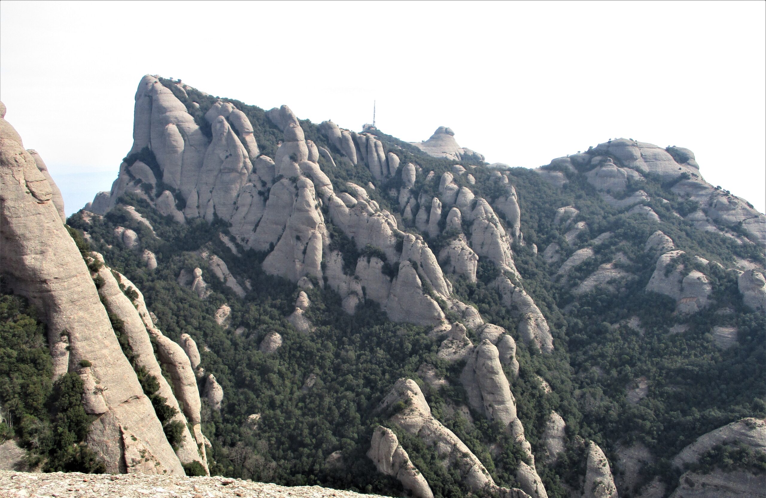
Here 🔥If you want to know the Montserrat mountain and start with an impressive route, this would be the recommended one. From the famous monastery we will go up to Sant Jeroni (1,236m), the summit of this imposing massif. We will pass by five hermitages, including the photogenic Sant Onofre and underneath the emblematic needle of the "Cavall Bernat". For the more adventurous, there will be the option to climb the Albarda CastellanaThe route is a small rocky pass, with its two sections equipped with ropes and its fabulous views.
Summary:
From the monastery and along a track marked with PR marks, we will pass by the hermitages of Sant Miquel, Sant Joan and Sant Onofre. Once on the "vell de Sant Jeroni" path, you have the option of going to the Albarda Castellana and back. Shortly after, we will crown Sant Jeroni, the roof of Montserrat. Now we will have to undo a part of the path and turn off along the Santa Marta stream to descend to the monastery along a stepped section.
Map:
Downloadable:
How to get there?
The starting point of this tour is the Montserrat Monastery (see in Google Maps), which can be accessed in different ways:
- By car by road from Monistrol (9 kms) or from El Bruc (14km). In total, 60 km from Barcelona. The car park, which runs parallel to the BP - 1121 access road to the monastery, fills up very easily on public holidays. Price: 6,50€/day.
- In the "aeri"This "aeri" is an aerial cabin or basket that takes five minutes and costs €8.6 one way and €13 return (adult). There are two ways to get there, by car or by FGC, and get off at the "Aeri de Montserrat" stop. See in Google Maps.
- On the rack railway (See in Google Maps): This train takes 15 minutes. Price: €8.1 one way and €13.50 return (adult). The rack railway stop can be reached by the FGC, at the stop at Monistrol de Montserrat (See in Google Maps) or by car, leaving it in the car park. free of charge next to the rack railway.
Technical specifications:
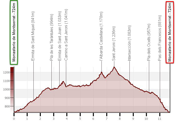
Distance: 11.7 km.
Cumulative difference in altitude: +/-760m.
Timetable: about 4 and a half hours. Walking time without stops: 3h30min.
Water: in the bars and shops on the monastery grounds.
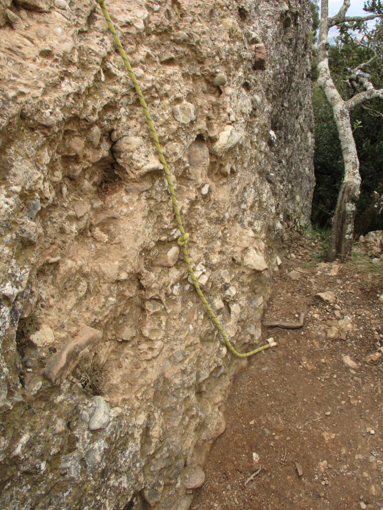
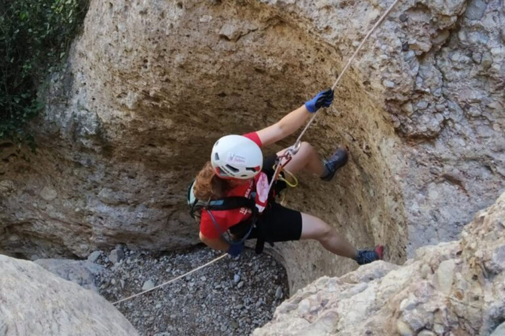
Difficulty: marked and well signposted paths. The slope can be an extra effort in some sections. The ascent to the Albarda Castellana consists of a steep section with a support rope, a rocky section that is climbed with the help of another rope of about two metres and a rocky slope that has to be negotiated from the side. The ascent is neither aerial nor exposed.
Recommended equipment for the summer: comfortable clothing, water and some food, sun protection and a baton for the climbs.
Itinerary:
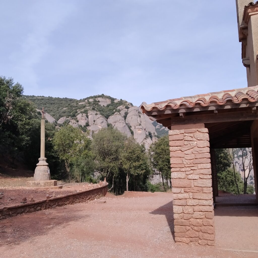
(0h00min; 0,0km) Monastery of Montserrat (724 m). If you arrive by car, you will have to climb a little up the road. If you arrive by plane, you will also have to climb a few metres, while the rack railway will leave you a little higher up. We go up towards the Plaça Abad Oliba, where we find the entrance to the monastery grounds, several shops and a large yew tree in the middle.
The Montserrat Monastery It was founded in 1025 and houses a community of Benedictine monks and a choir of choirboys. Inside, we find the original carving of the ".Moreneta"The legend says that some shepherds found it in the "Santa Cova" in the 9th century. There is a museum, restaurants, cafés, hotels...
Here we take an uphill cobbled path between some cedar and holm oak trees. On our right we will see the Santa Cova Funicular stop and a little later the path to the Miranda de Fra Garí. In Montserrat, we find many "mirandas", these names refer to high peaks where we can contemplate extensive views. In Latin it would mean "worthy of being admired". We pass the camping area on your left, while you enjoy views of the neighbouring pre-coastal mountain range of Sant Llorenç del Munt. You pass the Sant Miquel barrier, which is unusual, but park vehicles drive through here, and shortly after, the turn-off to the Creu de Sant Miquel (0h20min; 1.2km; 815m).
(0h25min; 1,4km) Hermitage of Sant Miquel (841 m).
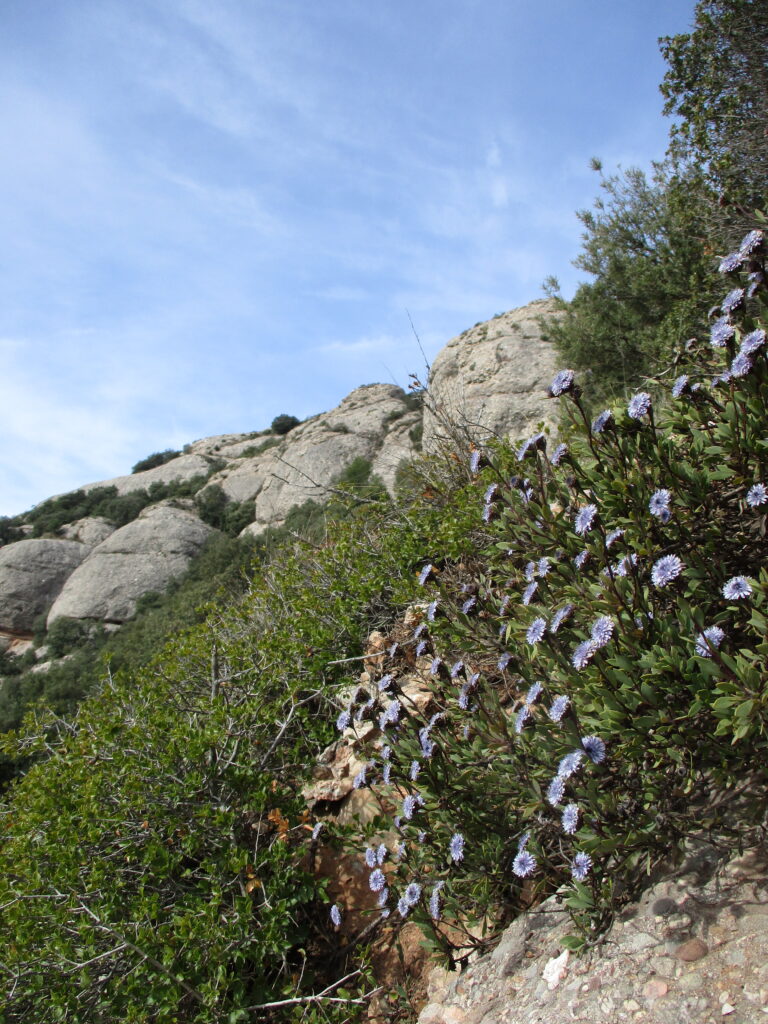
We continue uphill, pass a pond and reach the turn-off for the "Camí vell del Monasteri a Collbató". (0h30min; 1,5km; 867 m) that allows you to descend to this village. Continue climbing through a young holm oak forest, surrounded by the characteristic blue flowers of the "foixarda" (foixarda in Catalan) and aromatic plants such as thyme and rosemary.
(0h55 min; 2,8km) Pla de les Taràntules (994 m). In this flat area, located in the so-called Tebes region, the Sant Joan funicular railway that comes from the monastery ends. A little further on we pass a flight of steps on the right.
(1h05 min; 3,4km) Sant Joan Hermitage (1033 m). This hermitage is from the 19th century and has a bell tower. We go up a little further and turn right. On the left you will find the path that will allow you to go down to Collbató. We entered the Sant OnofreA hermitage built taking advantage of a natural cave that was formerly accessed by a wooden bridge and 60 steps dug into the rock. We see the remains of the wall that allowed for several rooms, which we will walk through on our route, we pass by a water cistern excavated in the rock and we reach a flight of stairs. We climb them and reach a path. A little later we will find the turning to the hermitage and the Miranda de Santa Magdalena. We continue downhill along a path and later along a very steep flight of stairs, the so called Jacob's laddersuntil you reach a wider road.
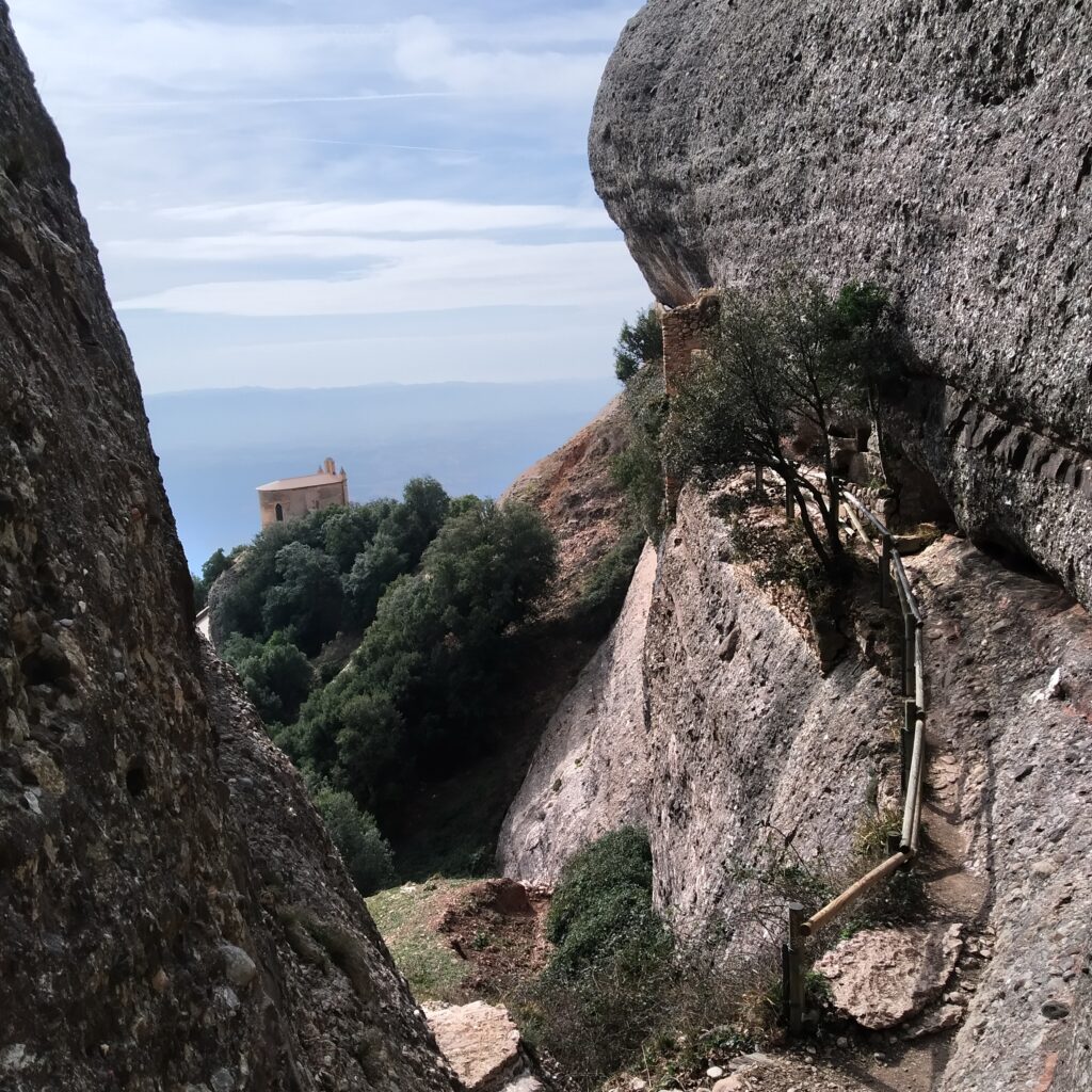
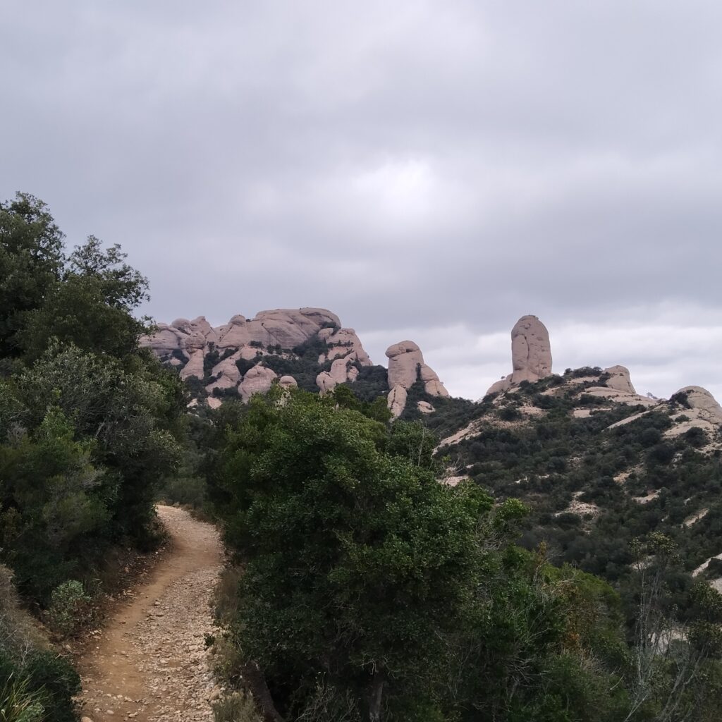
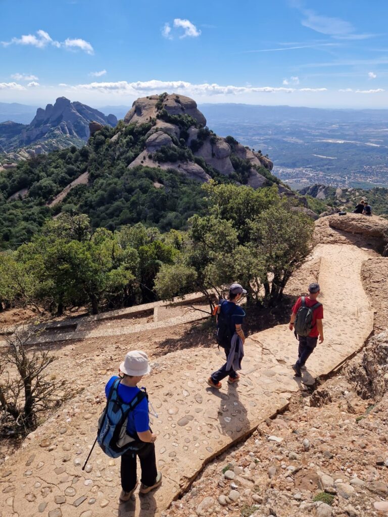
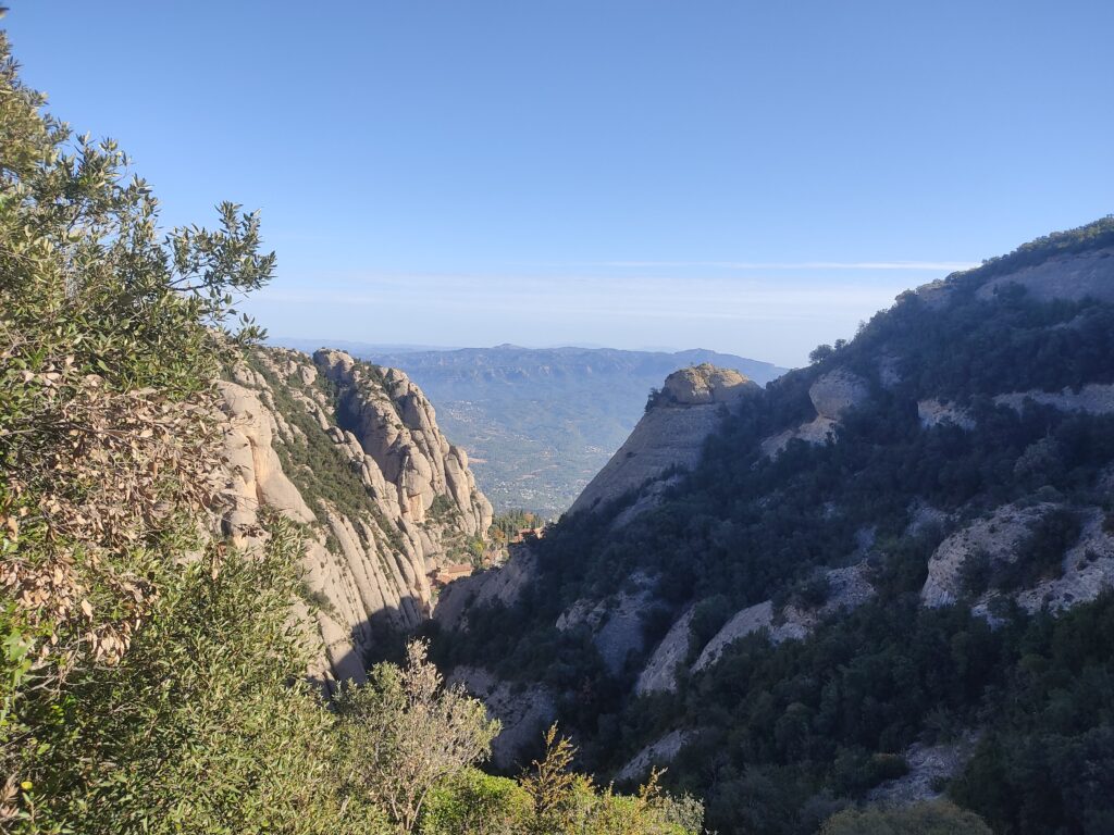
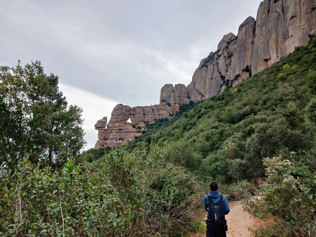
(1h20min; 3,9km) Way to Sant Jeroni ( 1.041 m). If you go left through the holm oak forest, in spring you can see some flowering rockrose. You pass a viewpoint on your left and come to a junction, the path to "Coll de Pollegons" (1h30min; 4,7km; 1.031m), where you can descend to the parking place of Vinya Nova or to Collbató. On your right you see the emblematic rock monolith "Cavall Bernat" and the "Cap de Mort", which depending on the angle of view looks like a human skull.
Soon after that you leave the Camí del Pont on your left (1h37min; 5,2km; 1.046m) and the Camí Vell de Sant Jeroni (1h45min; 5,8km; 1.069m), where you return to the monastery. You pass through a stepped section, where you see an accumulation of water in the torrent. This water point serves as a watering place for birds and forest mammals and as a breeding ground for the amphibians of the area, such as the salamander. A little later, take the path to the left that will take you to the first peak of the route.
(2h00min; 6,4km) Detour l'Albarda Castellana ( 1.130 m). First we climb up to "les Pinasses" and here we go to the left following some blue marks that will take us around a small rocky promontory. Then two ropes will help us to climb a path the first one and a rocky promontory the second one.
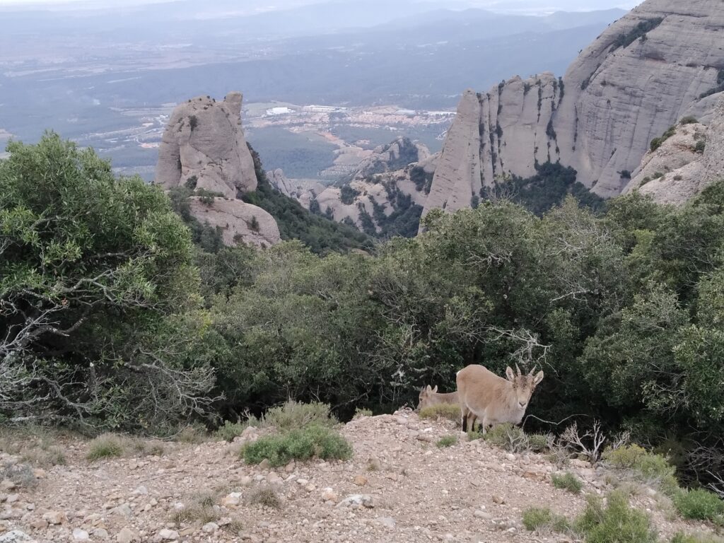
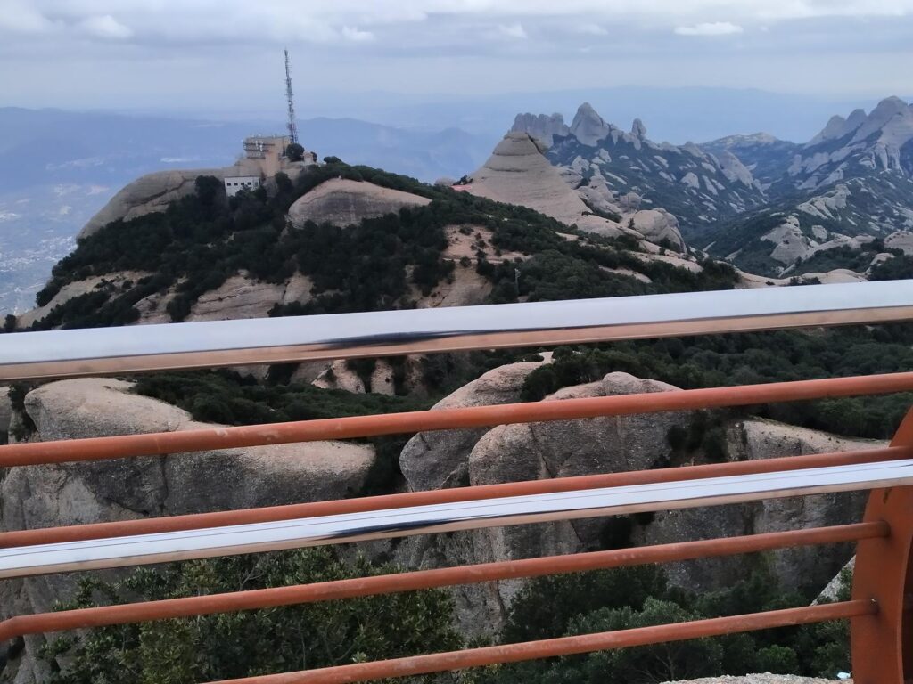
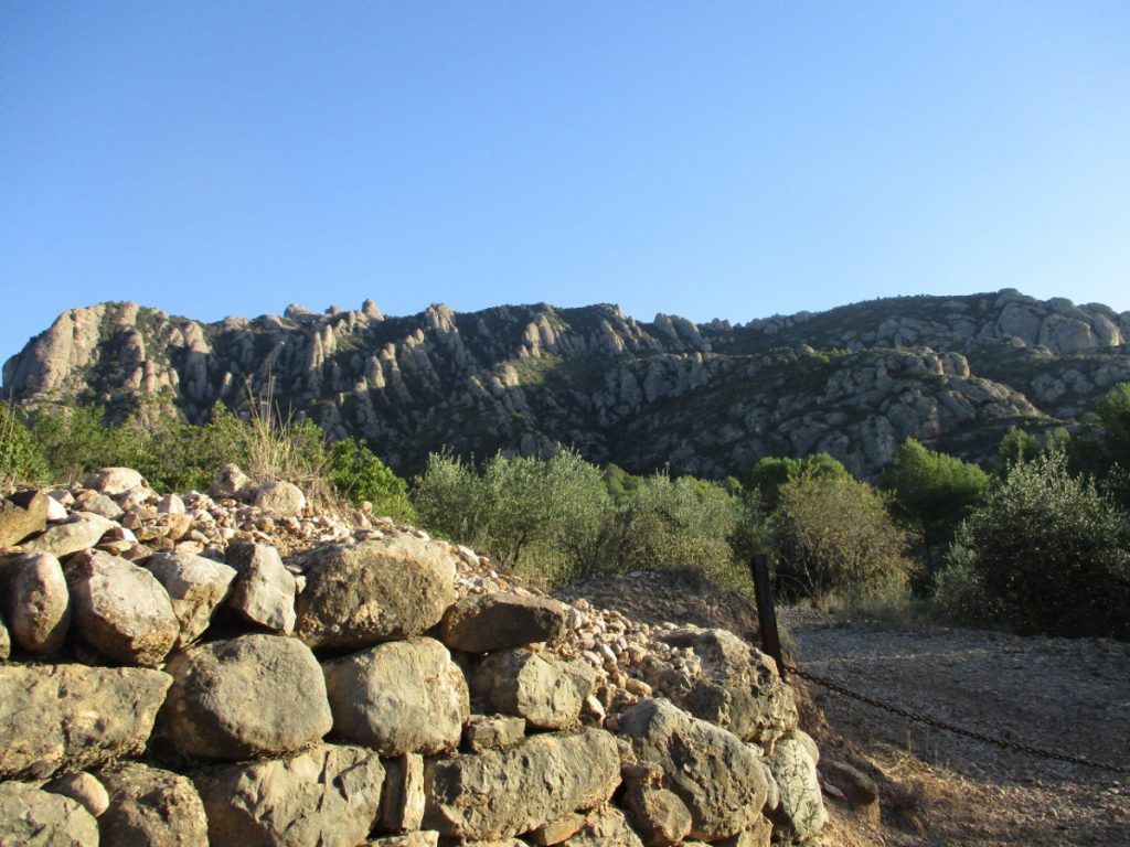
(2h08min. 6,6km) l'Albarda Castellana (1.178 m). We are at the top of the Baix Llobregat region, and one of the 100 summits ("100 cims"), we can contemplate views of the Mirador del Moro with its antenna and the neighbouring Sant Jeroni. We go back to the way we came before
(2h15min; 6,8km) Detour l'Albarda Castellana ( 1.130 m) and we continued in the direction we were going.
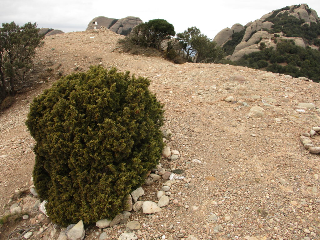
On the top of the Albarda Castellana survives the frequent wind, this small juniper bush.
(2h18min. 7,1km) Sant Jeroni Hermitage (1.162 m).
The Sant Jeroni Chapelmentioned in the 16th century, has been destroyed and rebuilt several times. The current one dates from the 19th century and is surrounded by holm oaks, cypresses and the occasional yew tree. A little further up was the old hermitage, near which there was a "nevero" to supply the monastery with ice. In the 20th century a restaurant was built and it could be reached by cable car, where you could hire shotguns to check the echoes of the area.
We continue to climb a little further up the cobbled and stepped terrain.
(2h26 min. 7,5km) Miranda o cima de Sant Jeroni (1.236 m) Located in a small structure with a central wind rose and protected by a railing. You can enjoy breathtaking 360º views of the pre-coastal mountain ranges, the coastline, flat cultivated areas with their villages and, on clear days, the outline of Mallorca. After resting for a while, you go back to the hermitage of Sant Jeroni (2h35min; 8,0km; 1.161m) and the fork to l'Albarda Castellana (2h37min; 8,2km; 1.130m) until you reach a junction at the torrent of Santa Marta.
(2h43min; 8,7km) Intersection (1,083 m). We descend the Santa Marta torrent through a wooded environment dominated by holm oaks, boxwood, butcher's broom, blackthorn and the occasional relict maple.
"Legend of Pla dels escurçons"(esplanade of the vipers). On the Santa Marta torrent we pass through this spot, where there is a curious legend in the book "Llegendes i tradicions de Montserrat" (Tales and traditions of Montserrat) by Joan Amades. In it he explains that all the snakes in Catalonia went to this place in Montserrat to breed. As all these snakes were born here, they always looked to Montserrat, wherever they were. The snake hunters, in order to catch the "viborera stone" (which they had in their heads with curative properties), could extract it without fear if they caught them on the side facing the sacred mountain. The abundance of these reptiles was such that there were more vipers than rocks, and if a viper touched a grass, it took on healing properties. These vipers only bite if they are touched and the remedies, according to tradition, could be of two types: burn the wounded part with embers or take the viper and crush it to make a poultice to put on the wound. In this way, the flesh of the reptile would trap its own venom. As the saying goes: "Picada d'escurçó, no hi hi és a temps l'extremunció". We could translate it as: if you are bitten by a viper, you are not in time for extreme unction. All over the Montserrat area you can find the snake snake, with a small protuberance on its head (which is possibly where the term "viborera stone" comes from). They are small snakes, with a dangerous venom, but they tend to flee easily. Obviously, avoid disturbing them if you see one.
You may be interested in: Poisonous snakes in Spain.
In the torrent we can see stone banks joined with cement to prevent the frequent floods of the Mediterranean climate.
(3h05 min; 10,2km) Pla dels Ocells ( 957 m). Knot of roads. The name refers to a fragment of the psalm that can be found engraved on a monolith and which reads: "...".Benedicite omnes volucres coeli Domino"translated as: "Bless, Lord, all the birds". We go to the left along a stepped path that will join the PR C-19, which we will do on the same hand. On the right we will see the ruins of the hermitage of Santa Anna. Follow the GR markings.
(3h15 min; 11.0km) Pas dels Francesos (881 m). This is a steep section with a railing between two rocks. Tradition has it that the French army passed through here to invade Montserrat in 1812. We go down a little further and cross two wooden bridges.
(3h30min; 11,7km) Montserrat Monastery (724 m). We finish our tour at the starting point.
Nearby you may be interested in:
Can Maçana - Collet de Can Guirló - Roca Foradada - Coll de Port/Porc - Refugi Vicenç Barbé - Collet de Can Guirló - Can Maçana. [3h20min; 7,5km; +/-470m].
Dry canyon - Medium level - Total time: 5-6 h. Approach: 60′ approx. Descent: 2-3 h. Return: 40′.
Route through Montserrat from Collbató, on the southern slope of the massif [5h30min; 14,6km; +/-1.269m].
Fastpacking is not about going faster. It's about going lighter.
If you come from classic trekking, this is the next step: learning to move with less weight,
more fluid and enjoying every kilometre more.
Join the Outsiders Newsletter and start discovering what lightness feels like.