Urkulu, Txangoa, Astobizkar, Ortzanzurieta and more, from the Orbaizeta Arms Factory.

Pyrenees and mountains 📩
Here 🔥SUMMARY:
The route we propose, apart from being a good way of getting to know the mountains located between Roncesvalles and the Irati Forestis a route with an important historical and natural attraction. From the starting point, at the Royal Ammunition Factory of Orbaizetathrough the Roman trophy tower of Urkuluthe Lepoeder col (a highlight of the Camino Real Francés and of legends surrounding Charlemagne and his knight Roland), the Etzangio peat bog (curious carnivorous plant habitat), Ortzanzurieta (the highest peak in the area, unsurpassed by any other as far as the Cantabrian Sea), various traces of trenches of the Convention War or the numerous mugarris (muga or boundary stone) that delimit the border.
The proposed route climbs all the peaks that delimit the Txangoa ravine, which means that, as well as being a long route, it has a significant difference in altitude (+1500m). From the Orbaitzeta Arms Factory we will head for the GRT-8 to the Azpegui sheepfolds, to continue along the GR12 as far as the Soraluze pass. On clear terrain, with practically no path, you reach the summit of Urkulu (1.423m). From here we will follow the ridge that separates the Cantabrian-Mediterranean divide, optionally climbing, in some cases, all the peaks: Bentarte (1.384m), Leitzarateka (1414m), Txangoa (1.471m), Menditxipi (1.377m), Astobizkar (1.499m), Burregieta (1.441m), Mendimotx (1.492m), Ortzanzurieta (1.565m) and Murukoa (1.223m). The descent is practically without a path, through the beech forest, following the ridge until it connects with a path that will take us back to the Fábrica de Armas.
DOWNLOADABLE
> Download Track
> Download pdf (mobile version)
HOW TO GET THERE:
Once in Aribe (which can be reached by following the road to Aoiz and then the Oroz-Betelu road if coming from Pamplona), take the turn-off on the NA-2030 signposted to: Orbara and Orbaizeta / Fábrica de Armas / Selva de Irati. Following the road signs, you will have no problem reaching the Fábrica de Armas (11kms from Aribe; 70kms from Pamplona).
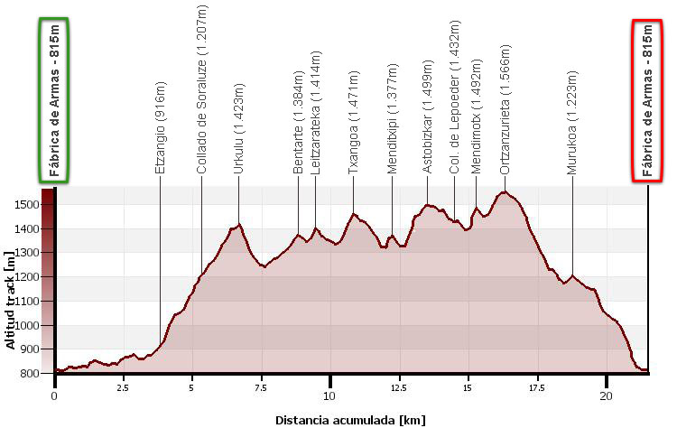
Distance: 21,5kms.
Cumulative difference in altitude: +1.535m / -1.535m.
Timetable: about 8 hours. Running time non-stop: 6h00min.
Water: There are no fountains along the route, except for a basin without a spout on the Arnegui pass and a fountain at the end of the route.
Difficulty: high due to the elevation gain and distance. It is possible to reduce the cumulative height gain considerably by avoiding some peaks. The upper part can be confusing in foggy weather, as there are no paths or markings in many sections.
Avoid peaks: The best way to avoid some of the peaks between the Soraluze pass and the Lepoeder pass is to follow the GR12. This way you can avoid Urkulu, Bentarte, Leitzarateka, Txangoa, Menditxipi and Astobizkar. From Lepoeder we can follow the road to Ortzanzurieta without passing through Burregieta and Mendimotx.
Itinerary:
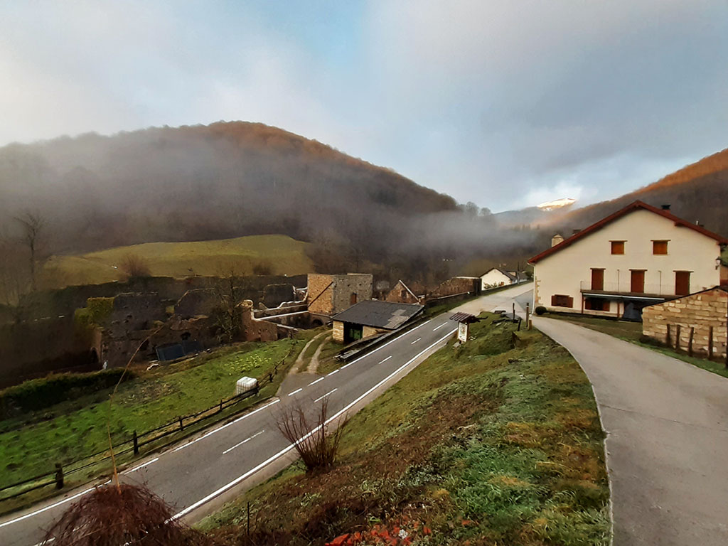
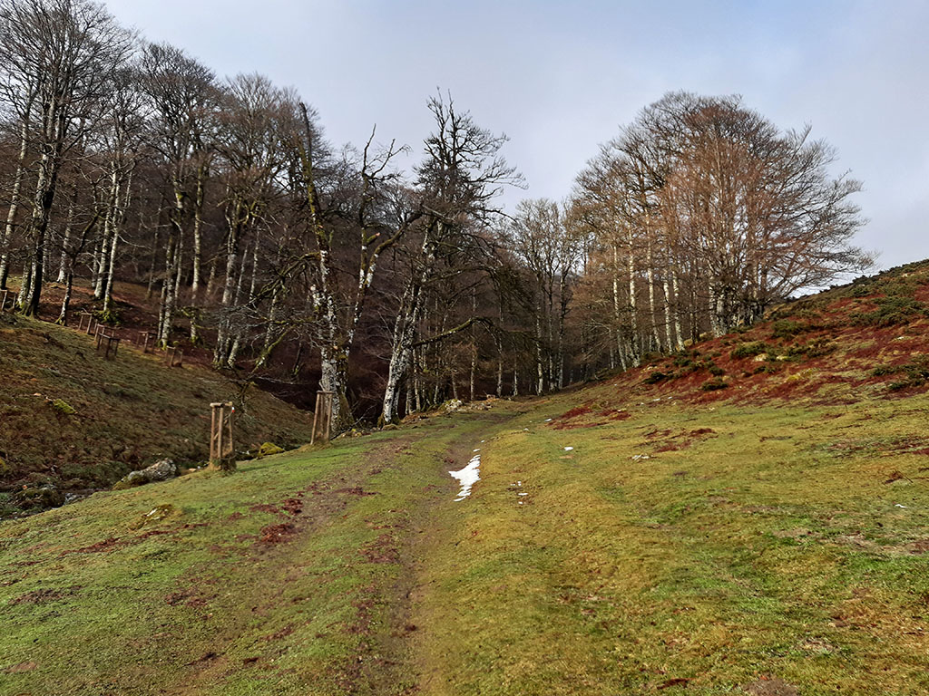
(0h00min; 0,0kms) Fábrica de Armas de Orbaizeta (815m). At the entrance to the Fábrica de Armas neighbourhood there is a concrete track along which we start walking.
In just 3 minutes we take a path on the left-hand side signposted GRT-8, which we follow in the direction of Majadas de Azpegui. The path connects a little further up with a wide path that comes from some houses and that we follow to the left (N) through the beech forest, through comfortable terrain. The path turns into a path when you reach a hut built with concrete blocks (0h15min), and then gains width before it comes out to a track in the Azpegui sheepfolds.
(0h50min; 3,8kms) Azpegui / Etzangio road (916m). Cross to the other side of the road to continue along the meadow, bordering the upper part of an enclosure for the protection of plant species and fauna (Etzangio peat bog). We follow the tracks of the off-road vehicles in a westerly direction until we join the GR12 a little further up, which we will follow until we reach the...
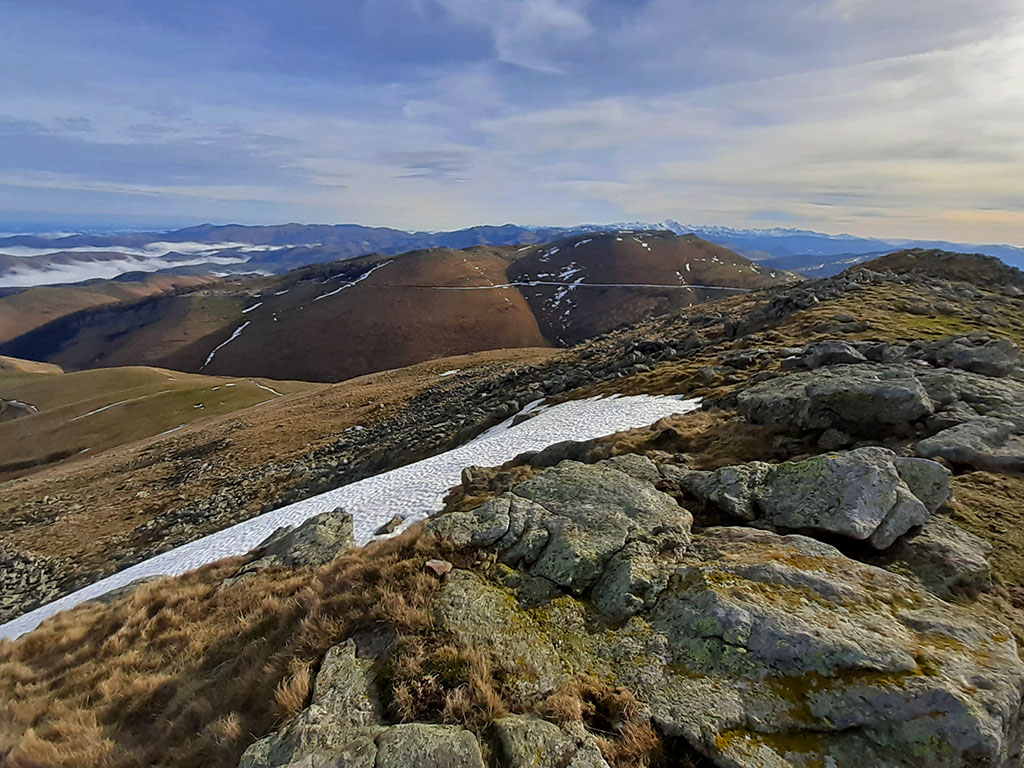
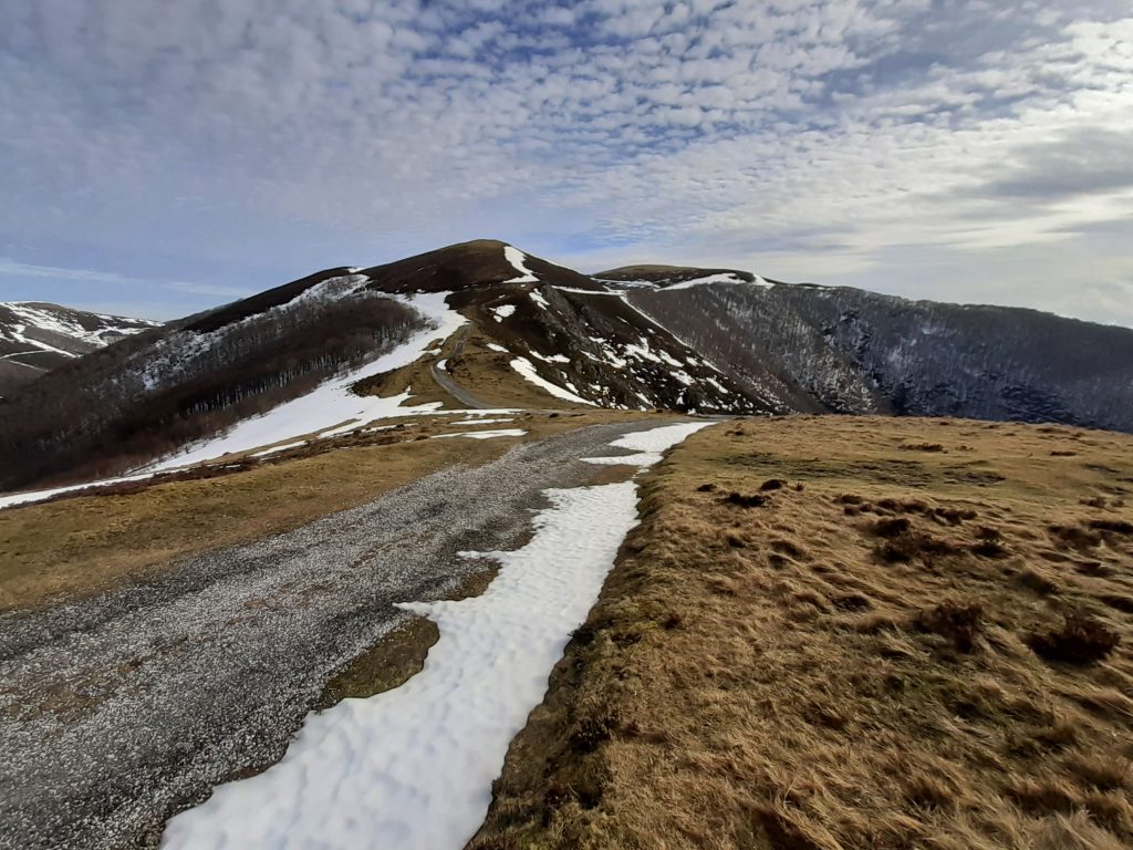
(1h15min; 5,3kms) Soraluze pass (1.207m). At this point we leave the red and white GR markings to continue without a clear path through the fields in a northerly direction (yellow paint). At the point where the limestone begins to emerge, the path turns left towards the west until it reaches the top and then north-west to gain the top of the hill.
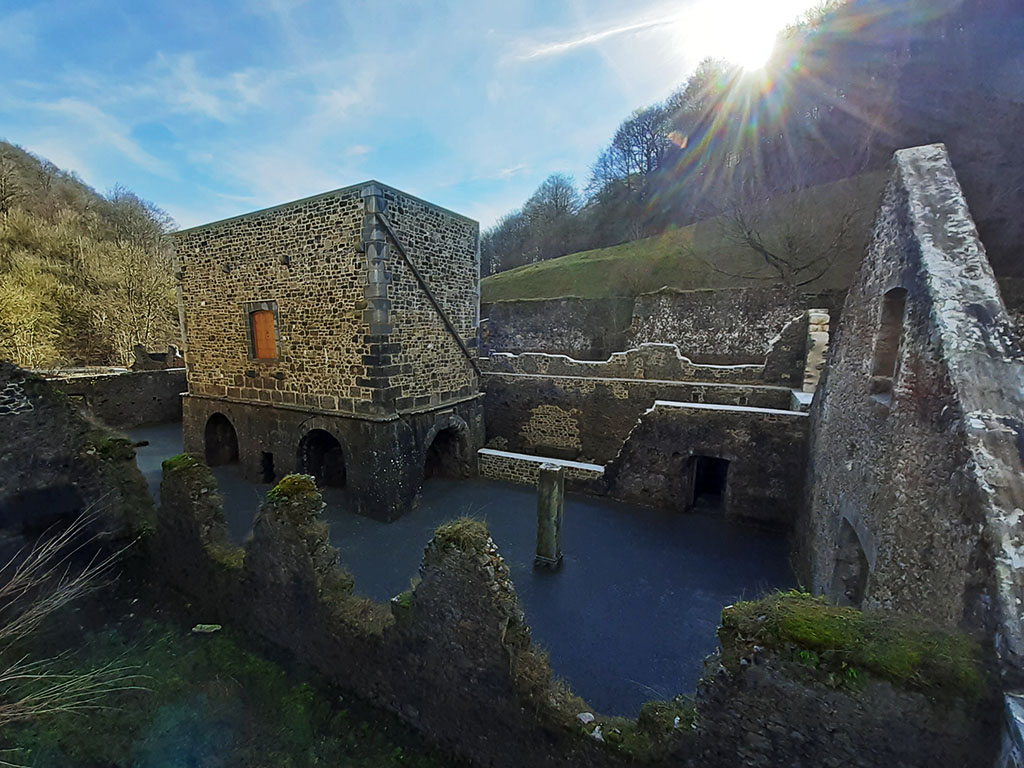
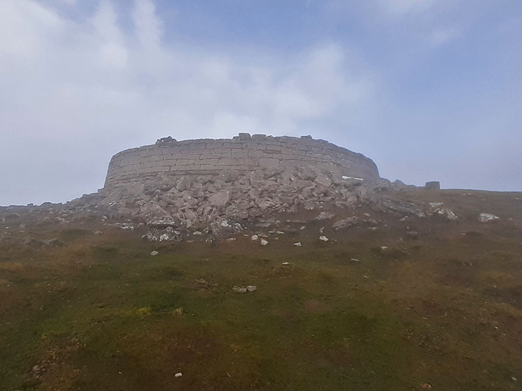
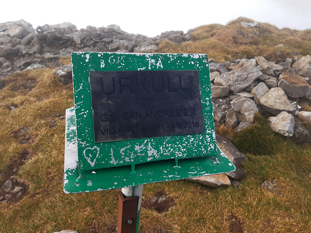
(1h40min; 6,6kms) Urkulu (1.423m). On the summit of Urkulu are the remains of a large tower, 20 metres in diameter and 3 metres high, on top of which is the mountain mailbox.
Urkulu trophy tower
In 1976 the French archaeologist Jean-Luc Tobie identified it as a Roman tower-trophy, erected in the 1st century BC to commemorate the recent conquest of Aquitaine; the construction was used to mark the southern boundary of the newly conquered territories. A consecration altar was found during the 1990 archaeological campaign, confirming this interpretation of the monument. The tower overlooks the border crossing of col d'Amoustegui, through which the Roman road Ab Asturica Burdigalam (from Astorga to Bordeaux), which passed through Pamplona and Dax, used to pass in ancient times. (Source: Wikipedia).
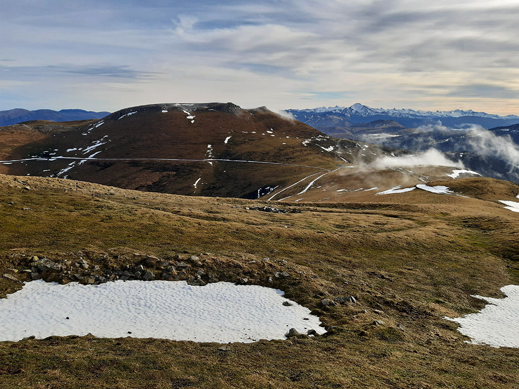
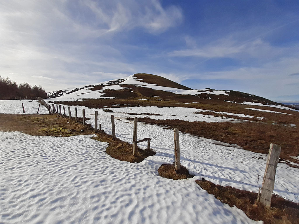
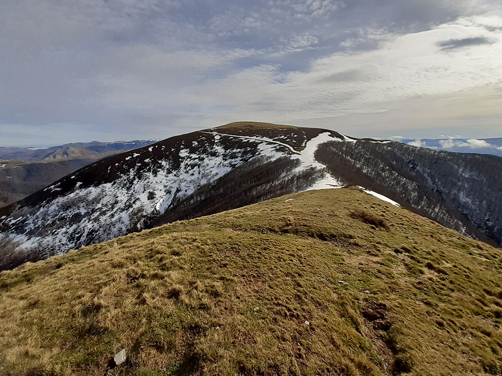
For the descent, head west following the yellow waymarks. A signpost indicates "Retour Col Arnosteguy". The descent is direct and in a moment we are at the pass, just a few metres from an old grazing road that climbs up from the French side. At the pass of Arnostegui (1,239m) we will see a water trough with water that looks like drinking water, but the tap is covered with a metal plate. We continue climbing along a dirt track until we reach the hill that emerges from Bentarte, which can be climbed by following some tracks in the grass.
(2h15min; 8,7kms) Bentarte (1.384m). Below the summit there is a kind of circular plain where there must have been a building and the remains of a moat that circles the entire summit. Probably a trench from the Convention War between Spain and France (1793).
Those who want to add another peak to their curriculum can go down to the col to the north and climb the...
(2h25min; 9,4kms) Leitzarateka Peak (1.414m).
On the way back to the pass, we go round the Bentartea peak that we climbed earlier, until we reach the Bentartea pass, crossed by the GR12 (red and white). We cross a wire fence and, through obvious terrain, we climb up to the...
(2h50min; 10,8kms) Txangoa (1.471m), topped with a letterbox.
We continue over the grassy hill that finally ends up falling over a marked pass (1,302m) that separates it from Menditxipi and which, optionally, we can climb steeply uphill.
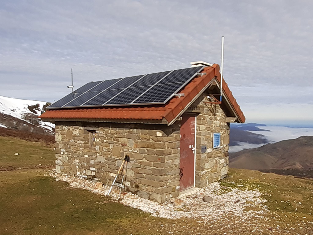
(3h10min; 12,2kms) Menditxipi (1.377). We descend to the Izandorre pass (1,322m), crossed by the Camino de Santiago and the GR12, where there is a small refuge for emergencies.
We continue on our way, climbing straight ahead on a path to the next peak of the range.
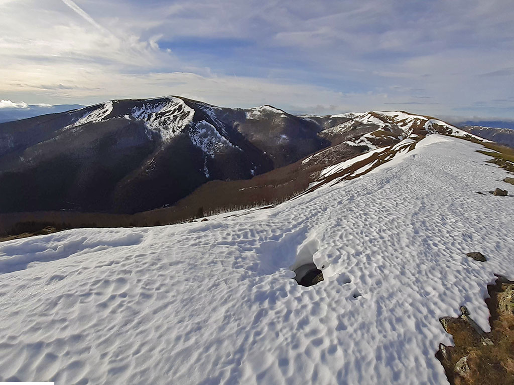
(3h35min; 13,4kms) Astobizkar (1.499m), where another letterbox marks the high point.

It is worth taking a short detour to look out over the Valcarlos valley. From the summit of Astobizkar, the path continues along the high part, going around a peak on the right and then tending to the left to descend to the...
(3h50min; 14,4kms) Col of Lepoeder (1.432m). A historic port on the French Way (Camino de Santiago), as it is the key pass through the Pyrenees and because of the legends about the army of Charlemagne and his knight Roland. For many historians, this may have been one of the places where the Battle of Roncesvalles was fought between Charlemagne's army and the Basques. If we do the route in summer, it is quite likely that at this point we will meet some pilgrims, but not in winter, as since 2015 this route has been restricted after several rescues.
Continuing with our route, if we want to avoid the road that leads to Ortzanzurieta, we can choose to follow the ridge that passes through Burregieta (1,441m) and then descend to the track. Further on, we will take a shortcut that crosses the road further up, and we will continue along it until we reach the...
(4h05min; 15,3kms) Mendimotx (1.492m). Walking over the grassy hill, we descend back to the road. We avoid it again by shortcuts to reach the top of the...
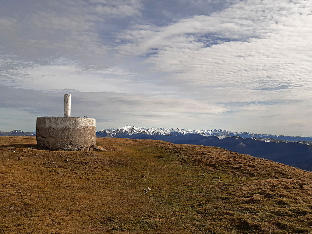
(4h25min; 16,2kms) Ortzanzurieta (1.565m), the highest peak in the area and where a large geodesic vertex is located.
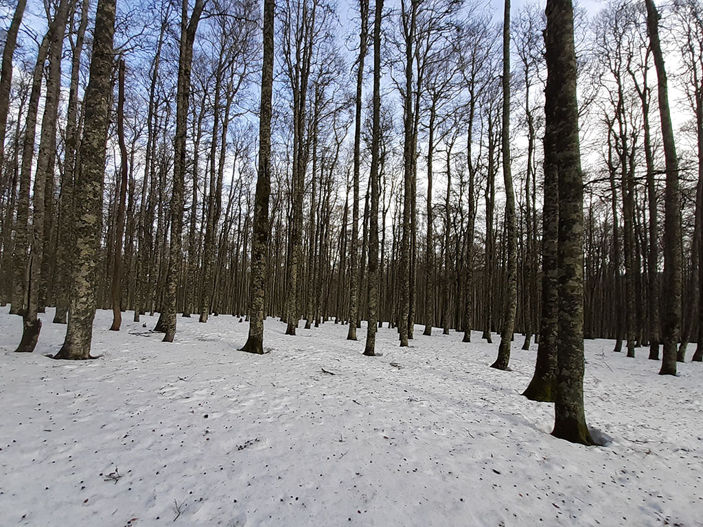
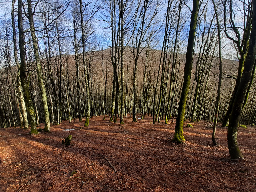
From here you can see the Orbaitzeta Arms Factory. We start the descent following the upper part of the path until we reach the forest line. At the time of the route there was a lot of snow when we entered the forest and, if there is a path, it was impossible to follow. In any case, it is a very clean forest with no vegetation and you can walk anywhere without any problem.
Descend in a westerly direction through the highest area and then to the left, so as not to leave the crest of the ridge and end up descending to the southern slope, to the Itolatz ravine. In this way, we reach the Murukoa pass (1,177m), to which a wide path climbs up from the southern slope. We will continue as before along the high part, gaining the flattened and imperceptible summit of...
(5h10min; 18,8kms) Murukoa (1.223m). We continue without a path on horizontal terrain, through dense forest, parallel to a wire fence. The mountain range begins to lose height and some rocky areas appear, which we avoid on the northern slope. We descend steeply and without a path, until we connect with a path that we follow to the right halfway down the slope.
The path ends next to a fountain, on the track that comes from Roncesvalles through the Usateguieta pass. We pass a farm, cross the Itolatz stream and arrive at the...

(6h00min; 21,5kms) Barrio de la Fábrica de Armas (815m), where we finish this long route.