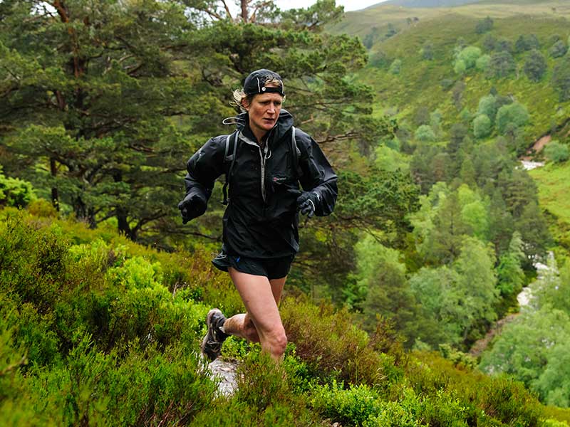
Trail running in the Benasque Valley
Pyrenees and mountains 📩
Here 🔥Short routes in the Benasque Valley
1. The Three Ravines and La Saleta
This route goes all the way around Benasque, linking the Ruta de Los Tres Barrancos and the path of La Saleta.
- Length: 7.2 km.
- Altitude: 353 m
- Difficulty: low
- Recommended season: Almost all year round (except during heavy snowfalls).
- Water points (3):
- Esquirisueles Fountain: Km 1
- Sobarriba Fountain: Km 2.3
- Cemetery Fountain: km 4.3
This is one of those routes that I often do because it starts "from the door of the house", so you don't have to travel anywhere. If you have about an hour, this is a good option to see the village of Benasque from different perspectives.
The route of the 3 ravines is a simple and enjoyable circular route that can be done on foot, even with the whole family. To do it you have to cross the river Ésera over one of the bridges and follow the signs, as it is perfectly signposted.
In this case, the track starts next to the swimming pools, just after crossing the stone bridge in the main square of Benasque. As it is a circular route, we can walk it in both directions, but here it starts downstream following the course of the Ésera.
Once we reach the end of the village, next to one of the municipal car parks, we head up the steep slope that leads to the Mountain School and pass it until we take the Puyegarbes path that will take us along the route.
We will gently gain altitude, passing the Esquirisueles spring and obtaining good panoramic views.
At an altitude of approximately 1400 m, the path flattens out and we will pass the 3 ravines: Molinasos, Sobarriba and Rallá.
A few metres after crossing the last of the ravines, a comfortable but direct zigzagging descent begins that will end up leaving us at the opposite end of the village from where we started the route. Cross the bridge over the Ésera on your left and go down the road towards the village to take the path to La Saleta, which starts next to the cemetery. This is up a small slope that, starting from the road, goes up behind the health centre.
The Saleta path is a pleasant walk that runs along the opposite slope to the one we have already walked. It has very little gradient and, except for a couple of small slopes, it will take us comfortably between trees and ravines. If we wish, at the highest part we can take a detour a few more metres to the Mirador del Pichirillo viewpoint, from where we will have a privileged view of the Benasque valley.
The path ends in a track that will take us to the village of Benasque behind the Gran Hotel, from where we can go back to the starting point.
2. Campalets and Conques Forest
From Benasque to Eriste along the Campalets Way, houses of Conques and Anciles (Circular route)
- Length: 10 km.
- Slope: 345 m
- Difficulty: low
- Recommended season: Almost all year round (except during heavy snowfalls).
- Water points (3):
- Terretes Fountain: Km 1.3
- Fountain on track: Km 3.7
- Fountain of Gardeta: km 5.8
The Campalets path connects the villages of Benasque and Eriste along the east-facing slope of the valley. This part of the route will receive the sun's rays from dawn to midday all year round. It is a pleasant, perfectly marked and preserved walk where it is impossible to get lost.
The route starts next to the Benasque swimming pools, just after crossing the medieval bridge in the Plaza Mayor.
We head in a southerly direction, downstream of the river Ésera to go up the slope that leads to the Mountain School. The path starts next to the school and quickly turns into a path that passes through fields and pastures where we can find livestock.
Little by little we leave the fields behind us and enter a forest, gaining altitude on the hillside. We pass the Terretes spring and the Predicadera viewpoint, from where we can see part of Benasque and the Linsoles reservoir.
Shortly afterwards we will start to descend again through a leafy forest and we will reach the asphalted track that climbs up to the Espigantosa waterfall, the starting point for the Ángel Orús or Forcau refuge.
After a short descent along the track and in front of a fountain, take the path that will take you to the village of Eriste. Once here, we pass under the road through the tunnel, as is done on the Gran Trail Aneto-Posets, to go along the edge of the Linsoles reservoir. Next to the house on its shore, take the track on the left that goes up towards the houses of Conques.
The forest of Anciles (Ansils), Conques and Eriste (Grist) is a luxuriant grove of mixed forest that sits on the darkest slope of the valley. This will not be the last route along its labyrinthine paths of great beauty.
Once you reach Conques, take the track on the right that goes up next to the fountain and keep an eye out for the small path that enters the forest and goes off to the left around a bend. In this part, the route is clearly marked as the Eriste-Anciles Benasque circular route.
This is the most spectacular section of the route. We will cross ravines with abundant water meandering through the trees on a pleasant route that will take us to the village of Anciles. Once there, we reach the main street and head towards Benasque, returning along the path that runs between the river and the road that we must take next to a park at the exit of the village. We can also take the road between Benasque and Anciles, a very beautiful walk all year round (although it is asphalted). There are numerous walkers on either of these two routes.
Finally we will return to the starting point completing a spectacular 10k mountain run.
Average routes in the Benasque Valley
1. Ibonet de Batisielles and Estós Refuge
From the Estós car park to the Estós Refuge via the Ibonet de Batisielles:
- Length: 17.6 km.
- Altitude: 721 m
- Difficulty: Medium
- Recommended season: May to November
- Water points (3):
- Fuente de Coronas (uphill): km.4,5
- Estós Hut: Km 9
- Fuente de Coronas (downhill): Km 13.5
The route starts at the Estós car park. To get there, take the road from Benasque in the direction of Llanos del Hospital and after approximately 4 km you will find the turn-off.
The Estós valley belongs to the Posets-Maladeta Natural Park and its lower part is dominated by a lush forest of deciduous and coniferous trees (as the altitude increases).
The first few kilometres run along a track in good condition. At first it is made of cement as it passes next to the Estós dam, but it soon turns into a dirt track. We pass by the Cabaña de Santa Ana (old shepherds' hut) and the Fuente de Coronas fountain until we reach the turning indicating "Ibonet de Batisielles" (approx. km 5) on the left, which we should take. Here a path starts zigzagging up through the trees and after about 2 km it takes us to the Ibonet de Batisielles.
Once here and next to the wooden hut, take the path that leads to the Refugio de Estós. This is where the only slightly technical section of the route begins. On the approximately 3 km up and down that takes us to the refuge, there is the occasional descent between roots and stones.
From the highest point we descend to the Estós river and cross it over a metal footbridge, shortly before ascending to reach the refuge. Once there, we start a very fast descent along the track we took at the beginning (and which on this occasion we will do in its entirety). We will pass by the well-known "Cabaña del Tormo" (not del Turmo) and we can take a detour to the viewpoints of Las Gorgas Galantes, beautiful waterfalls. Following the track we will arrive back at the starting point.
2. Eriste, Eresué and La Tuasa
From Eriste to Eresué bordering the Linsoles reservoir, ascent to Labert and descent via La Tuasa:
- Length: 14.4 km.
- Elevation gain: 509 m
- Difficulty: Medium
- Recommended season: Almost all year round (except during heavy snowfalls).
- Water points (0):
- * Possibility of water diverting slightly to the Sanctuary of Guayente and the village of Eresué.
The route starts in the picturesque village of Eriste, specifically over the bridge where the Linsoles reservoir ends, and will take us to the villages of Sahún and Eresué, giving us good views of, among others, the Posets and the Turbón.
Once here, we must head towards Sahún, that is to say, we will go along the edge of the reservoir along the track, which is in very good condition and has no gradient.
When we reach the dam itself, the path starts to descend along a stretch of concrete. We must be very careful to take the path that will take us parallel to the river Ésera without crossing it.
This short stretch of path is spectacular and will leave us on a track in the vicinity of the village of Sahún. Once here, we must turn almost 180º to start gaining altitude along the track. This part of the route is marked with posts signposted as "Ruta Circular Villanova-Sahún-Sesué".
Once on the track, we will enjoy beautiful views of the Sanctuary of Guayente and the Sierra de Chía.
The track will lead to the road between Sahún and Eresué, and we must follow it in the direction of the latter for approximately 1.600 km. Once here, just before reaching the village, we take the track that starts on our left in the direction of Labert.
We will follow this one in an ascending direction and pass by the village of Eresué. On this section of the route we can enjoy views of the Cotiella peaks and even the Posets, weather permitting.
There will come a moment when the track starts to flatten out. To our left, a new downhill path will start, which we must follow. This is the prelude to La Tuasa, a spectacular descent, a real slalom through one of the countless labyrinthine paths in the Conques and Anciles forests. After a very fast descent of about 2 km, the track turns into a path. At this point we must be very attentive to the white and yellow marks of the PR and the cairns that are strategically placed. Even so, having a GPS at hand with the track will be of great help because the snow or leaves can confuse us between the thick vegetation and the different detours.
Finally, the path ends on a track that gradually descends in altitude and ends very close to the starting point.
3. Return to the Ventamillo Narrow Pass
- Length: 18.5 km
- Altitude: 705 m
- Difficulty: medium
- Recommended season: Almost all year round (except during heavy snowfalls).
- Water points (3):
- Ermita de Piedad :: Km 9.9
- Fountain of Escarnells: : Km 14.2
- Fuente de El Run: km 18 * Possibility of water also in the village of Seira (km. 8.7)
The Congosto de Ventamillo is a work of art of Nature sculpted over millions of years. In its day it was the mouth of the glaciers from the Posets and Maladetas peaks that eroded the limestone rock until it became one of the typical vertical wall gorges that abound in other mountain ranges such as the Alps, the Rockies, ...
As this is a circular route, it can be started from the towns of El Run and Seira and can be walked in both directions. In this case, the track starts in El Run, next to the bridge over the river Ésera. We will start the beautiful path marked as PR-HU50 that will take us flat for approximately one kilometre until we start to gain altitude. In this section we will reach about 1000 metres and we will enjoy impressive views of the Congosto and the Circo de Armeña.
From the highest point and in the vicinity of the turn-off that leads to the village of Gabás, take the GR-15 and descend towards Seira. The path ends in a track that finally leads to the road to the village of Abi. Go down this road until you reach the new village of Seira.
At this point, we cross the Ésera again over the bridge that leads to the old village, which we cross to the highest part of the river from where different paths start, including the one that will take us back to El Run.
This return slope is much sunnier than the one on the way back, with much more vegetation, meadows and a beautiful oak forest. We will reach 1300 metres first on a path that finally turns into a fast track next to the turn-off to Plan.
We must continue in the direction of Chía until the path that descends to El Run appears on our right, a descent to be enjoyed, comfortable and "cushioned" by the leaves of the dense forest. The path quickly crosses several cliffs and ends at a track in the vicinity of the Ermita de Gracia, which will take us back to El Run.
4. The meadows of Ñara
From the village of Chía to the meadows of Ñara by the pass of Resuali
- Length: 17.71 km.
- Elevation: 617 m
- Difficulty: medium
- Recommended season: Almost all year round (except during heavy snowfalls).
- Water points (0)
On this occasion we travel to the town of Chía, located at an altitude of 1172 metres, to visit its Sierra. It is imposing and never goes unnoticed, as it can be seen from many points throughout the valley.
The proposed route is the result of the combination of routes 17 and 21 of the Benasque Valley Mountain Bike Centre and its website http://www.bttpuropirineo.com/, running along the southern slopes of the Sierra de Chía. It is possible to obtain the Puro Pirineo MTB guide in paper format in many collaborating establishments. For the modest price of 1 € you will get a great deal of information.
We will start the route in the town square of Chía, from where several mountain bike routes start and where there is a bicycle service station with tools for repairs.
We set off along the steep streets of the village looking for the highest part of the village and following the common route of routes 17 and 21, which coincide with the track that joins the villages of Chía and Plan via the Sahún pass, separated by about 25 km.
Shortly after leaving the village we reach the Chía viewpoint, a privileged vantage point from which it is possible to contemplate a large part of the valley, the Cerler ski resort and the beginning of the Congosto del Ventamillo.
The first few kilometres are easy and without gaining much altitude along a pretty track through the trees towards the Sahún pass.
As soon as we pass some cattle troughs we take the path that goes off to our left towards the Los Reyes Magos paragliding take-off runway, now only following route 17. This track is in worse condition than the previous one and we will be steadily gaining height on it, although not particularly hard, in the direction of the Resuali pass.
As the altitude rises, the forest will be populated by conifers and firs typical of these locations, leaving the deciduous trees behind.
Shortly after 1800 m you will reach the highest point of the route, the col of Resuali, where the landscape is typically alpine, similar to the meadows of Switzerland, and where you will find beautiful meadows where there are often cattle.
The effort made on the ascent will have been worth it because at this point a vertiginous descent begins, first along a track that will take us to the meadows of Ñara from where, weather permitting, we can contemplate the Circo de Armeña and the Congosto del Ventamillo.
Shortly afterwards, at a bend in the track, a spectacular path begins, which, halfway up the slope, gently descends in altitude at the beginning and more steeply at the end.
The path ends up on a good track where we will join up again with MTB route 21. To return to the village of Chía, we will follow this route, as route 17 descends along the path to El Run, to return to Chía along the road.
After 2 km we reach Chía again, completing a circular route that can be travelled almost all year round due to its special orientation.
5. A Selba d'Ansils-Conques-Grist
Route through the Anciles-Conques-Eriste Forest. From Benasque to Cerler via La Mosquera, Pllanadona, Kulunguele and La Tuasa to Eriste. Return via the San José path.
- Length: 18.68 km.
- Altitude: 747 m
- Difficulty: low
- Recommended season: May to October
- Water points (0).
- *There are numerous ravines and streams along the route.
"The Selba de Grist/Conques/Ansils is an immense grove that occupies a large part of the shady slopes of the valley, extending its domain over the lands of Anciles, Eriste and Cerler. The proposed excursion covers almost the entire area, choosing some of the most beautiful paths. However, it is worth remembering that the possibilities here are numerous. Dozens of paths and tracks link this mountain...".
The aim of this route is to cover part of La Selva de Anciles Conques-Eriste, crossing three of its most emblematic paths: the Pllanadona, the Kulunguele and La Tuasa.
We will start the excursion at the Benasque roundabout, heading towards Anciles, from where the La Mosquera path starts, one of the paths that connects Benasque with Cerler.
Through the streets of the village, we will go along the back of the Gran Hotel along a track until we reach, between orchards, the signs that indicate the path towards Cerler.
This is the start of a beautiful path, paved at times, which will allow us to quickly gain altitude. In just over 3 km we will cross the approximately 400 metres of height difference between the towns of Benasque and Cerler.
From various points along the route we can enjoy beautiful panoramic views of Cerler, La Selva and part of the Benasque valley.
There will come a moment when the path divides towards Cerler village or towards El Molino, in the ski resort. We must take the latter turning and shortly afterwards we will reach the car park. Once here, head towards the ski lifts to cross the Remáscaro river over the bridge and start the descent to Anciles, which is perfectly signposted.
Shortly after starting the descent we cross the Puymestre ravine over a wooden footbridge and then come to a crossroads, which points to Cerler and/or Anciles. The path we should take is the one that comes out between the previous ones and it is the one that will take us to the Pllanadona path, which descends from the Labert track and the Pllanadona meadow. We will know that we are on it because we will see a sign indicating Selva 2 towards the direction we came from.
We have now fully entered "A Selba" and we will not leave it until we reach the Linsoles dam in Eriste. This is the moment to enjoy the spectacular Pyrenean mixed forest, where you can easily spot all kinds of fauna: roe deer, squirrels, foxes...
After an initial flat stretch, we start a steep descent that will take us to the fork where the Kulunguele (although this is not its real name) and Pllanadona paths meet in the shape of a Y, well known to mountain bikers in the area, with the descent towards the village of Anciles. This point is marked with a stone milestone. We must take the path that ascends (the Kulunguele) which in a comfortable but not insignificant ascent will take us to the Labert track.
On this stretch of good track we can push the pace for about 3 km, until we reach a meadow. As soon as we pass it, we must be careful to take the hidden path that goes off to the right.
This is the start of another delightful stretch of trail. We wind through the forest, crossing small open meadows, streams, ravines and a lush forest of great beauty. The path ends up joining the La Tuasa path, which descends from the pass of the same name towards the Linsoles dam.
Once at the lower part of the La Tuasa path, pay special attention to a fork and take the path to the right, in the direction of the Linsoles dam. The speed of the descent and the thickness of the forest can make us take the path to the left (more obvious) which will take us to the vicinity of Sahún. The detour is marked with a stone milestone.
The end of our path is also marked with a stone milestone, which becomes a fast track that will take us to the dam.
Once we reach the dam, we will walk along it until we reach the bridge over the Ésera. On this occasion we choose to return to Benasque by taking the San José path, the old road that linked the towns of Eriste and Benasque. Part of the path was hidden under the new road, but it is still possible to walk along a section of it, which starts opposite the turn-off to the Linsoles housing development. To get here, cross the bridge and walk between the houses and the riverbed. When you reach the access to Linsoles, cross the road and take the San José path, a pleasant walk between stone walls and trees that will take you back to the starting point of your route.
On this final flat stretch we pass by the hermitage of San José. Shortly after, the path ends at the Peguera housing estate, at the entrance to Benasque.
Long routes in the Benasque Valley
1. Trail of the 3 Refuges
The Route of the Three Refuges in the Posets-Maladet massifa: a spectacular circular route that will take you to discover the spectacular Posets massif. Joining the refuges of Estós, Biados and Angel Orús, you will go round this great colossus of the Pyrenees.
2. Route of the Hospitals
3. Aneto X-Treme
Trail Running events and trials in the Benasque Valley.
Have the pleasure of discovering the Gran Trail Trangoworld Aneto-Posets and Trail 2 Heaven, both at the foot of the Aneto.
Trangoworld Great Trail Aneto-Posets
This event is held in July and consists of a semi-self-sufficiency race whose registration is reserved for those over 18 years of age who can prove that they have ever participated in one of the many mountain races that exceed 58km and more than 3700 metres of total elevation gain. This is due to the monumental 109km of this race.
There are five main races that make up the event:
- The Gran Trail Trangoworld: as we have said, it consists of 109km and more than 7,000 metres of positive difference in altitude. Only 300 people can participate and its route is one of the most beautiful, passing, obviously, by the Aneto (3404 metres) and the Posets peak (3371 metres).
- Vuelta al Aneto: 58 km and 3700 metres of net positive altitude gain. 800 people will be able to enjoy the route, which passes through many of the high peaks of the Pyrenees, including, of course, the Aneto. The Salenques pass, at almost 2,800 metres, is the highest point that participants will have to climb.
- Maratón de las Tucas: It consists of the standard 42km of a marathon, and two and a half kilometres of elevation gain. Up to a thousand people can take part, and it passes through the most emblematic peaks of the Pyrenees, such as the Posets Peak. The col de la forqueta is the highest point of the whole route, at 2840 metres above sea level.
- Cerler Peak Tour: With a 22.5km route and 1200 metres of elevation gain, 500 runners will be able to run along a path that links the towns of Benasque, Anciles and Cerler, not forgetting the ski resort of the latter.
- Vuelta al Molino de Cerler: It is only 9km long and has almost half a kilometre of elevation gain. Only 250 runners can participate, and it is perfect for beginners under 18 years old. The route is made up of trails between Benasque and Anciles and Cerler.
Trail 2 Heaven
This opportunity to discover trail running takes place in the surroundings of the beautiful Posets-Maladeta Natural Park, in the only place in the Benasque Valley, always watched over by the Aneto.
You will be able to enjoy events such as Snow running, passing through the vertical kilometre, to finish with the Pyrenees Series at the very foot of the Aneto thanks to the T2H-25km and possibly the most emblematic event: the Trail 2 Heaven with a 48 km route and more than 5,500 metres of accumulated height difference joining France and Spain in a single race.
Both races have the Aneto as their main route. In fact, the highest point of the 25km trail is the Aneto viewpoint itself, which is at 2,385m and offers the best views of almost the entire region.
Whether you are from the Benasque Valley, from abroad or even from other countries such as Argentina, Mexico or even Finland, you cannot miss this event.
Fastpacking is not about going faster. It's about going lighter.
If you come from classic trekking, this is the next step: learning to move with less weight,
more fluid and enjoying every kilometre more.
Join the Outsiders Newsletter and start discovering what lightness feels like.