Acherito from Linza
Pyrenees and mountains 📩
Here 🔥(6h; 12.7 kms; 1070m)
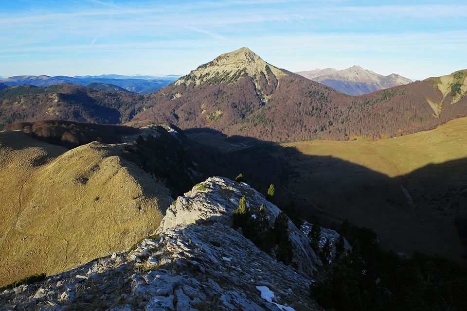
The Mallo de Acherito (2374m), in the Pyrenees of Huesca, is one of the most beautiful summits in the Western Valleys. Its pyramid-shaped summit makes it easily distinguishable from anywhere and attracts the gaze of mountaineers.
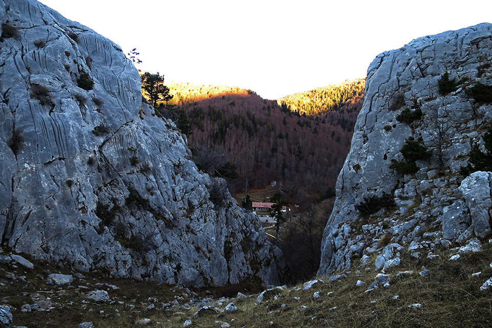
Among the valleys of Ansó and Hecho and peering into the circus of LescunThere are several starting points to climb this mountain, such as Linza, Guarrinza or the Masousa bridge. Perhaps the "normal route" is the one we have chosen, the one that starts from Linza and allows a circular route. You can reach Linza (refuge) by road from Zuriza and park there in a large car park.
Route:
The route we are following (circular), ascends from Linza by the Paso del Caballothe Bear Passthe Plana de Diego and the Huerto de Acherito pass and down the Foyas del Ingeniero and the Petrechema ravine. In total 6h and a positive difference in altitude of 1000m.
From Linza (1340m) we head for the gap (Horse Pass (1427m)) visible from the car park heading south. To do this, cross the stream and climb a steep path that shares the same route as the Camille Trail (green and yellow waymarks).
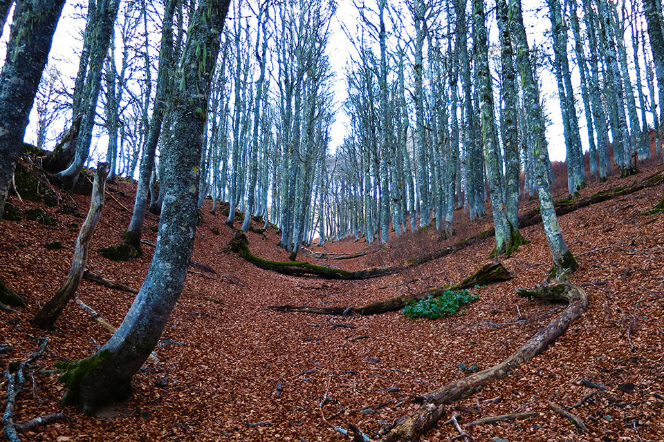
Shortly after reaching the top of the pass, we leave the Senda Camille that descends towards the Gamueta forest. We follow to the left (a sign indicates Chinebral and Plana de Diego) below the rocky outcrop a path that climbs towards the Bear Pass (1637m). The path runs through a small valley covered with beech trees and ends shortly before reaching the pass.
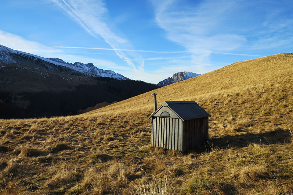
In the Bear Pass There is a two-seater mini hut made of sheet metal that can be used for lunch or shelter from bad weather.
It has an earth floor, a fireplace and a bench.
At this point the path splits. We opt for the one on the left that ascends to the pass and then turns to the right to ascend the pala-cresta.
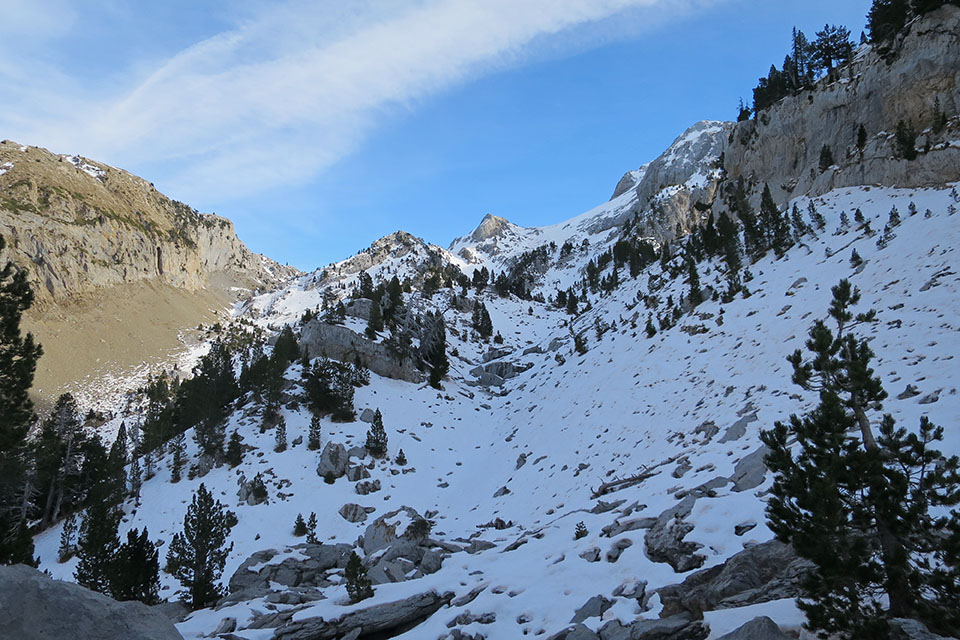
At approximately 1840m, the trail heads towards the northern slope of the Chinebral de Gamueta to make a horizontal traverse that we find with icy snow, which forces us to put on our crampons. Here it is better not to slip.
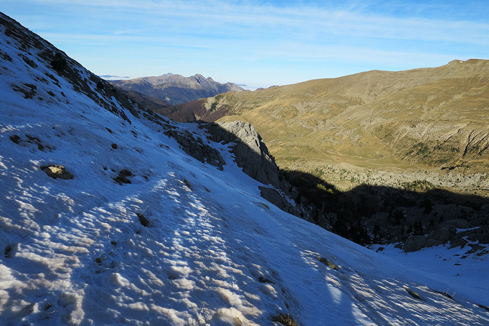
We arrived at the Plana de Diego (1900m)Here the snow is soft and we sink all the time.
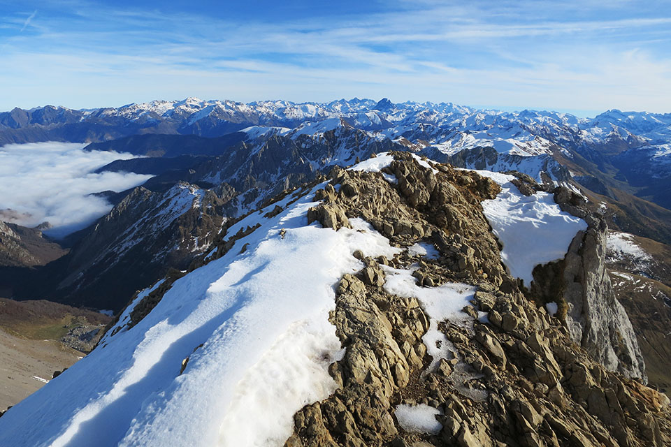
We cross the Plana de Diegoin the background we will see the Acherito (2374m)We climb without losing altitude towards the hill on the right, the pass of Huerto de Acherito(2169m). The pass to the other valley is not here, it is the next one further south, here the pass has a 100m drop.
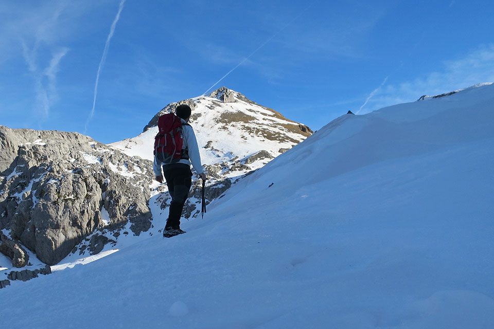
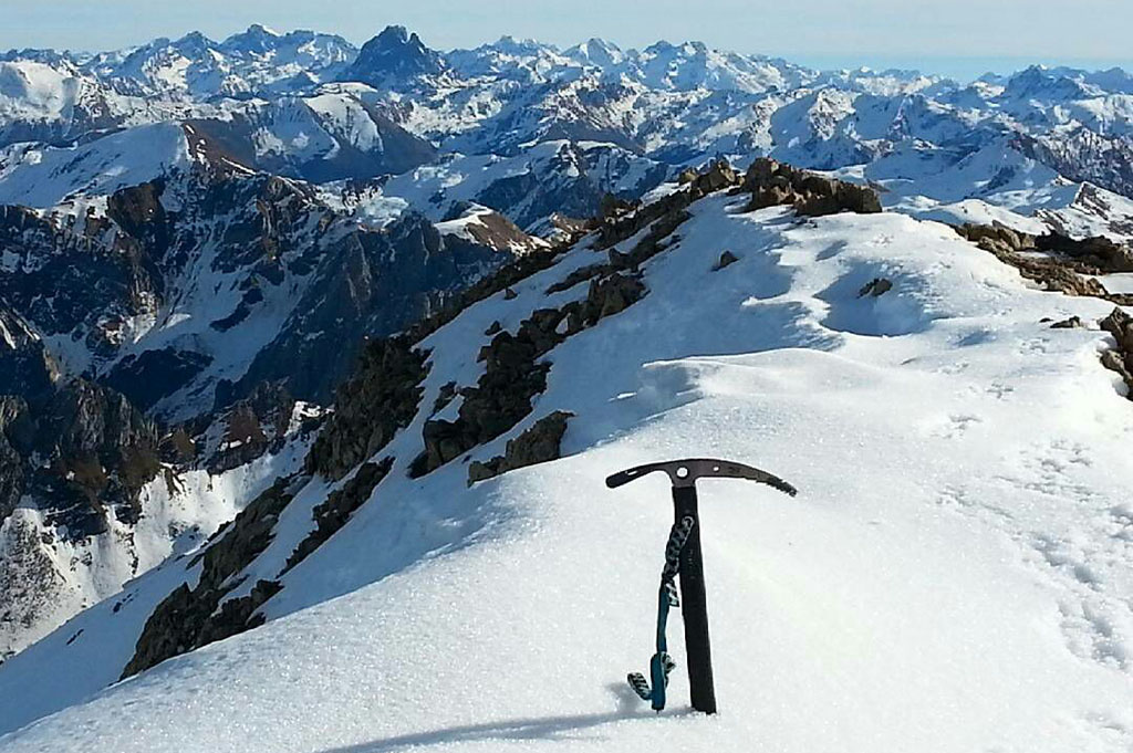
Only the final part is missing, we face it straight ahead and then to the left to join some tracks that go up from the valley shortly before reaching the ridge. We turn right, in some shady areas the snow is frozen and the slope exceeds 35º. With a bit of care we reach the narrow summit of the Mallo de Acherito (2374m). The views are breathtaking in all directions.
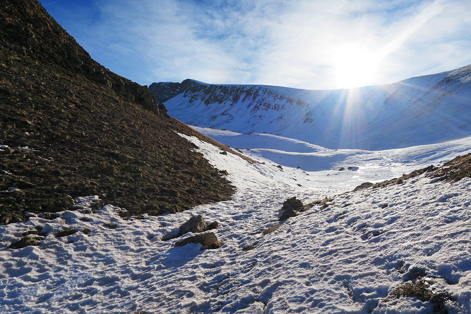
We go down where we climbed up to the ridge, but now, instead of going towards the col, we go down towards the valley on the right, towards the Foyas del Ingeniero.
The path goes down the Petrechema ravineThe valley is quite shady and the snow is very hard up to an altitude of 1600m, so we have to wear crampons all the time.
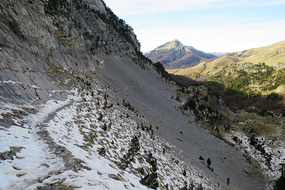
At an altitude of 1420m we reach a flat area at the bottom of the valley, a meadow to which there is a path that can be climbed by off-road vehicles. Follow these tracks for half a kilometre until you come to a path on the right that takes you to Linza. On the way down we pass an area of picnic areas where there is a path adapted for wheelchairs. In total we spent about 6 hours on this circular route.
Fastpacking is not about going faster. It's about going lighter.
If you come from classic trekking, this is the next step: learning to move with less weight,
more fluid and enjoying every kilometre more.
Join the Outsiders Newsletter and start discovering what lightness feels like.