Secús (2,341m) from the Gabardito refuge.

Pyrenees and mountains 📩
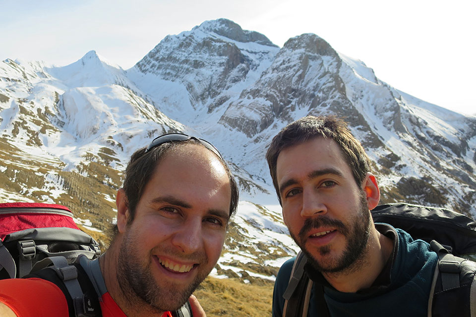
Here 🔥The Secús Peak (2341m) is one of those solitary peaks, isolated, like a watchtower. From its summit, the view stretches from the westernmost mountain ranges of Navarre to the central Pyrenees, making it the best viewpoint of the imposing north faces of the peaks of the Pyrenees and the Pyrenees. Agüerri y Bisaurín.
Located in the Echo Valley/Hechowithin the Western Valleys Natural Parkthe quickest way to reach the top is from the Gabardito Refuge. The itinerary is largely in common with its larger neighbour, the Agüerri PeakIt is somewhat more complicated than Secús, especially when the north face is icy. Other options to reach the Secús are from the Guarrinza and Aguas Tuertas track, where you can do a nice circular route, or from the Selva de Oza along the route to the Acher Castle.
Route:
The route we follow is linear, going back and forth along the same route. In total there are 15 kms (outward/return) with an elevation gain of 1050m positive. Starting from the refuge of Gabardito the route ascends following the GR11The Agüerri ravinecontinues in the Taxera ravine to the Paul de Secús and from there ascends northwards in search of the Secús Peak.
[osm_map_v3 map_center="42.796,-0.684″ zoom="14″ width="100%" height="450″ type="cyclemap" control="fullscreen,scaleline" file_list="../wp-content/uploads/tracks/secus.gpx" file_color_list="#ab192d" post_markers="1″]
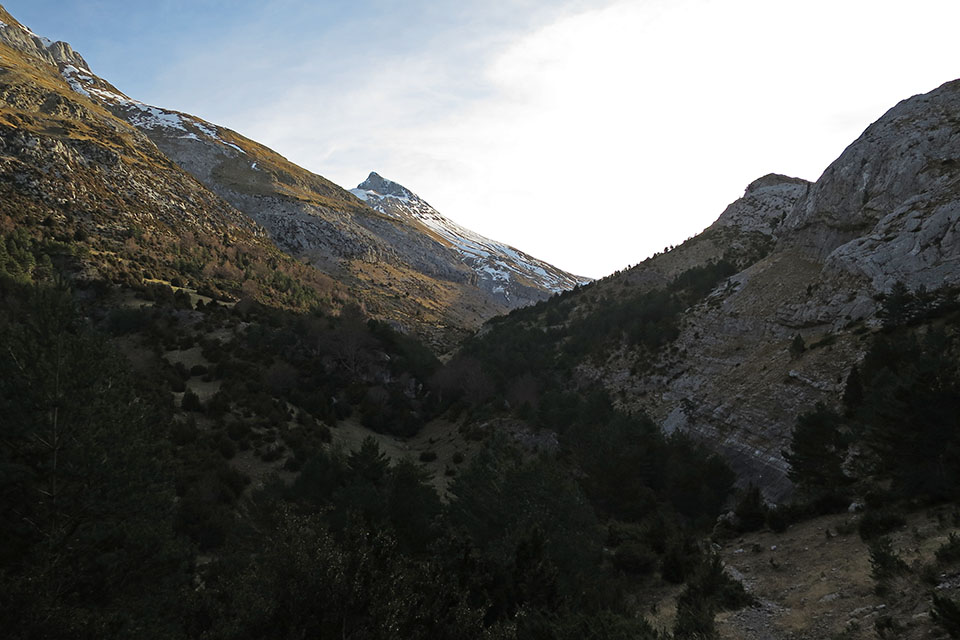
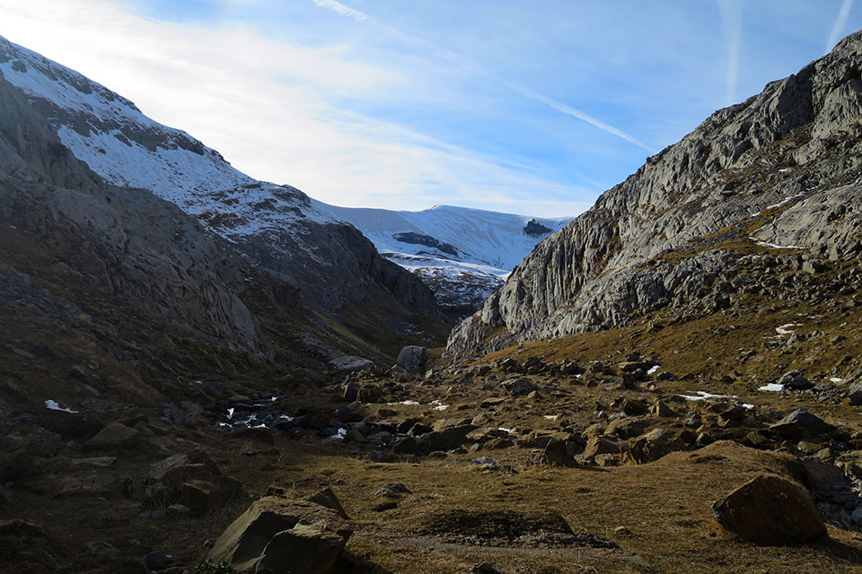
We parked the car at the refuge of Gabardito (1370m), which can be reached by car from the road leading to the Oza Forest. The start of the route follows the red and white markers of the GR11We can get water as soon as we leave at a fountain on the right hand side. Half an hour after starting to walk, we leave the GR11 to take a crossroads on the left indicating Agüerri and Taxera. The path descends to Agüerri ravinecrosses the river and continues along the other bank (right bank), almost horizontally.
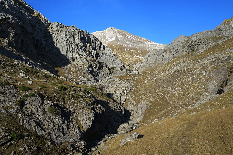
A kilometre further on the path will change banks, although we do not see it and continue on this side (it is better to change banks). We enter the Taxeras ravineThe path has practically disappeared and when the ravine becomes narrower, we are forced to descend to the river and cross it in order to continue along the path we see on the other side. On the way back we return along the left bank.
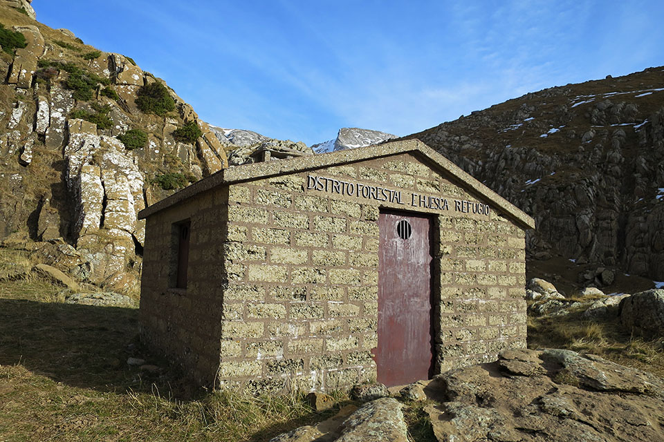
We continue up the ravine, heading north. Almost at the end (1840m) we find on the left the Secús shelter (fireplace, sleeps 4-5, good condition, clean, no luxuries).
We continue climbing and reach the Paul de SecúsThe path then divides in all directions in search of the main peaks. The path divides in all directions in search of the main peaks.
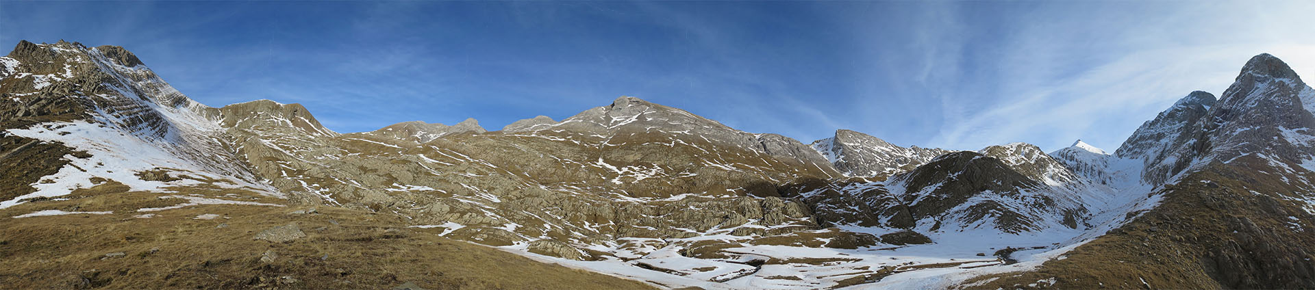
The Secús Peak is the one directly in front of us as we climb up the Taxeras ravine. We head in the direction of the small pass between Secús and La Rueda - not the Taxera pass - directly, off the path. Although several paths appear on the maps, they are more like scattered milestones that are difficult to follow and some green and yellow paint that we find quite high up.
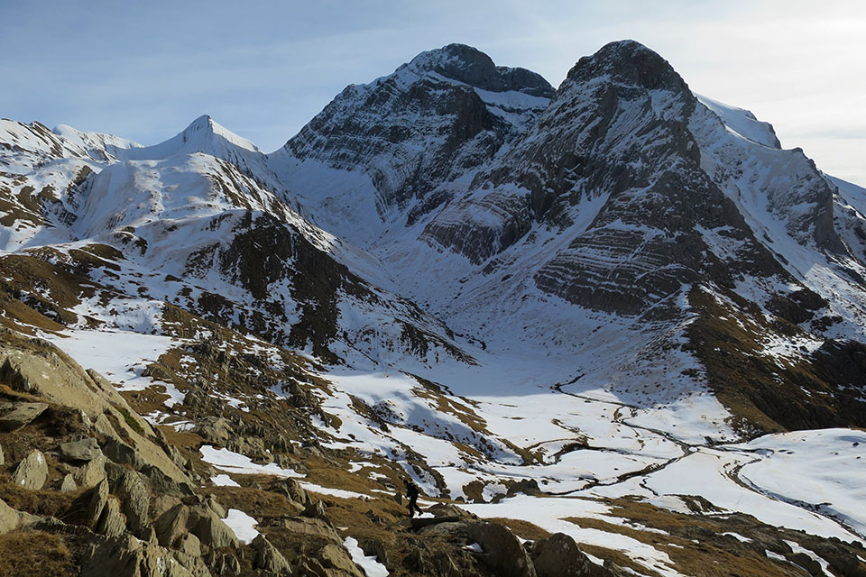
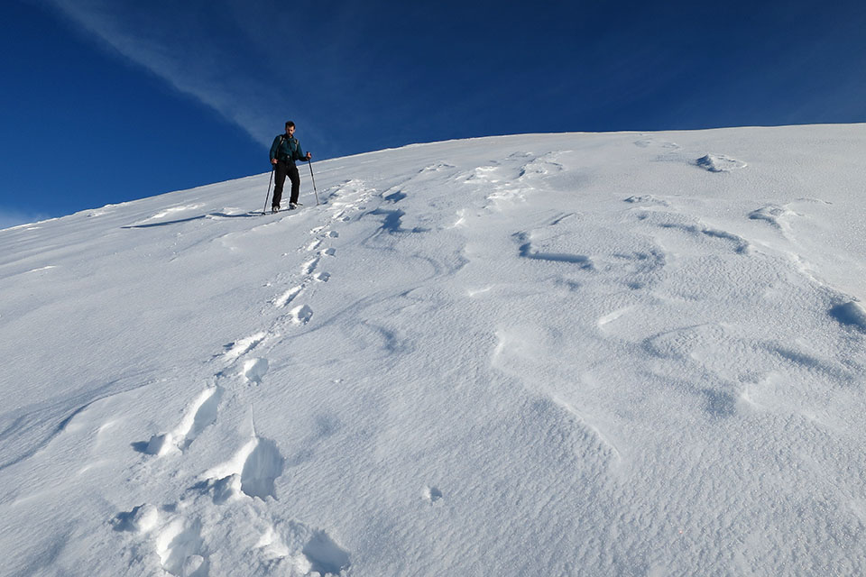
Shortly before reaching the pass we decided to go in search of the summit, which we reached without difficulty via a snow slope and a short route along the long summit.
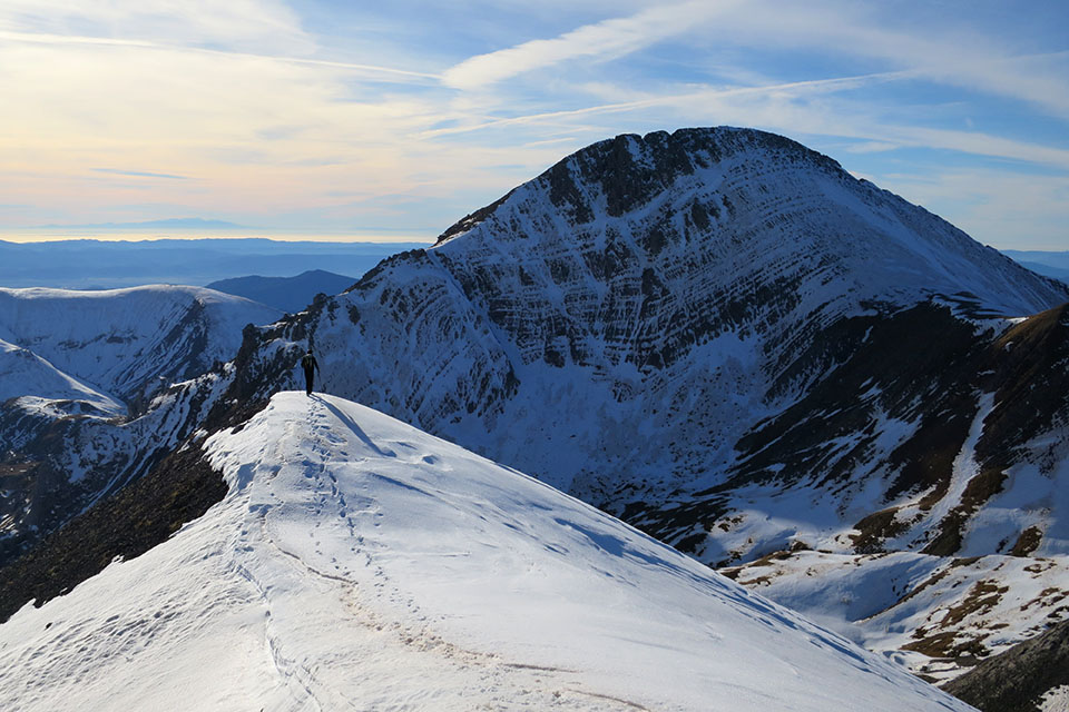
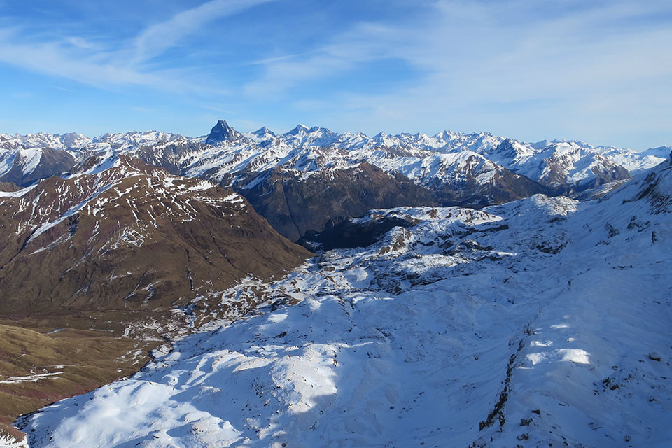
From the summit the views are exceptional towards the nearby north faces of Agüerri and Bisaurín, Achert Castle and the Central Pyrenees.
The downhill route is the same as the uphill one with some small variations. To do so, we descend to the pass and then decide to go down as straight as possible, taking advantage of a snow-covered channel along which we advance very quickly. We pass Paúl de Secús and enter the ravine again, starting on the slope on the right, then the path crosses and this time we go down the left bank to the Barranco de Agüerri ravine. The itinerary is the same, you just have to pay attention to the path that after crossing the river climbs upwards in search of the GR11. Once on the GR11/Pyrenean Path a signpost indicates: 30minutes; 1.7kms to Gabardito.
We hope you like it, here are some more pictures during the descent.