Carros de foc: a high altitude trekking in Aigüestortes i Estany de Sant Maurici National Park
![Carros de foc: a high altitude trekking in Aigüestortes i Estany de Sant Maurici National Park / Cotarelo75 [CC-BY-SA] Wikimedia Commons](https://travesiapirenaica.b-cdn.net/wp-content/uploads/2018/05/Refugio_de_J.M.Blanc_en_el_Parque_Nacional_d'Aigüestortes_-_Lérida_España_By-Cotarelo75-CC-BY-SA-3.0-httpscreativecommons.orglicensesby-sa3_760x500.jpg)
Pyrenees and mountains 📩
Here 🔥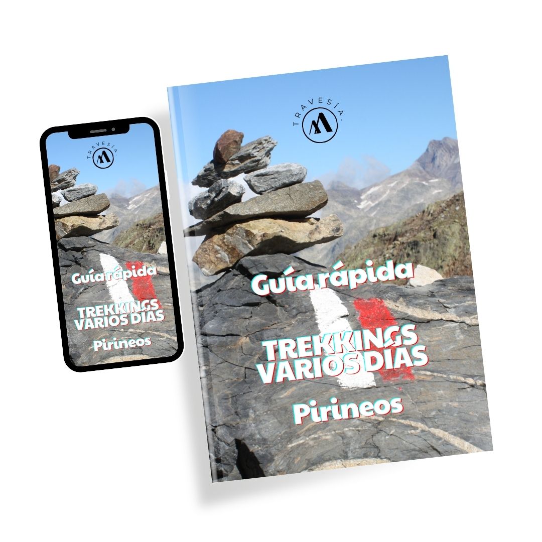
Quick guide TREKKING SEVERAL DAYS in the Pyrenees
with everything you need to know before undertaking a multi-stage circular route.
Carros de Foc is a high mountain trekking, a circular route through the shelters in the Aigüestortes and Estany de Sant Maurici National Parkin the north-west of Catalonia in the Pyrenees of LleidaHere we bring you a guide to the essential things you need to know about this journey:

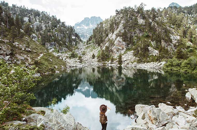
Aigüestortes i Estany de Sant Maurici National Park
This is one of the oldest national parks on the Iberian Peninsula, located in the central region of the Pyrenees, where you can enjoy some of its most spectacular scenery. It combines high mountain peaks with lakes and deciduous forests. This national park is among the 10 most visited in Spain.
The Chariots of Foc
Since the end of the 80's the first routes started to be done, it is a circuit that goes through 9-10 shelters in high mountain areas, so it is not a simple trail, but it is an attractive challenge for those who like this type of alpine terrain.
For some time it was even carried out as a race, as it is possible to do the 55 km complete route in one day; however, to best enjoy the whole journey, it is recommended to do the circuit in a range of 4 to 7 days. A cumulative difference in altitude of 9,200 m. Here we tell you a little about its different stages.
The Carros de Foc stages
There are 9 to 10 refuges along the Carros de Foc route, and you can start your route from any point you want, although the Espot area is the furthest away and in this case you would have to collect your ski pass in the village and not in the refuges.
For this example, we propose to start the route from the western area, which is the easiest to access to begin with, and the distribution of the refuges is optional, although we recommend that you check beforehand which ones are available, in order to design a route that does not end a day in a closed refuge or one that has no places.
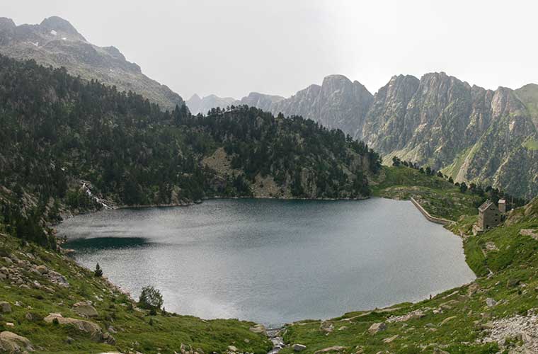
Stage 1 from Ventosa i Calvell to Estany Llong
![Estany Llong / Photo: Aimaras [CC-BY-SA] Wikimedia Commons](https://travesiapirenaica.b-cdn.net/wp-content/uploads/2018/05/Estany_Llong_By-Aimaras-CC-BY-SA-3.0-httpscreativecommons.jpg_760x500.jpg)
Starting with this route, you will begin to understand why this is an alpine experience, not recommended for beginners. You will have to cross peaks such as the Coll de ContraixAt 2745 m it is the highest point of the route. The terrain is steep and rocky, so good mountain equipment is essential.
It normally takes 4 to 6 hours of continuous walking to reach Estany Llong, depending on the pace and stops. It should be noted that these areas are snow-covered more than 100 days a year, so it is also important to consider the season and weather conditions in order to carry the appropriate equipment.
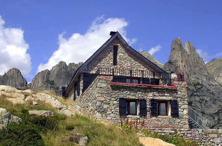
Stage 2. From Estany Llong to J.M. Blanc
The mountain terrain continues with attractive spots such as the Coll de Dellui (2700m) and its spectacular views. It is important to bring a map or location equipment.
On this day we went through the Colomina ShelterThe southernmost of the route, it is one of the most beautiful, with beautiful rivers flowing over huge boulders on the shores of a beautiful lake.
Continuing with this journey you will pass through the Saburó Hillwhich is one of the highest and most imposing on the way to J.M. Blanc.
Stage 3. From J.M. Blanc to Amitges
On this route you will start the day with important challenges such as the Collado de Monestero, which, as happens on a 60% of the route, does not have telephone coverage -this is something to bear in mind in case of unforeseen events-.
You will then arrive at the Ernest MallafréThis is where the path opens up with two options, as you can extend the route eastwards, towards Pla de La Font, which is the extra stage of the route "...".Foc Plus Trolleys".or you can go westwards around the beautiful Saint-Maurice Lake en route to the refuge of Amitges. On the plus route you also end up at Amitges, but the route is longer and more complicated.
We took the direct route to Amitges, as the views and routes through areas of the Amitges mountains and the forest with rivers and waterfalls are a magnificent experience, as well as magnificent views of the Els EncantatsThe park's imposing pair of peaks rising to the south of Lake St. Maurice is another of the park's distinctive features, as well as that of this hiking route.
Stage 4. From Amitges to Collomers
For this 4th day we leave the forest again to climb in mountainous -and sometimes snowy- terrain, crowning beautiful mountain spots like the Port of Caldes.
Stage 5. From Collomers to Cavelers
On this route you have the option to pass or not to pass through RestancaThe route is the starting point for many, and you will pass beautiful lakes in mountainous areas that will be far from easy.
By doing the journey this way you will pass through The BesiberrisThe route is one of the highest points of the whole journey, and one of the most challenging, but certainly a worthwhile challenge.
What you need to know
Access to the park is free and there are mountain refuges to spend the night at altitude, although due to the cold, we recommend the refuges, although it is essential that you stay in them. book in advance. At altitude you can bivouac.
Some specially designed activities are also available for childrenThey can also do the whole route if they are in good enough condition and have sufficient training. A ski pass has been prepared for the little ones to stamp.
READ ALSO:
Fastpacking is not about going faster. It's about going lighter.
If you come from classic trekking, this is the next step: learning to move with less weight,
more fluid and enjoying every kilometre more.
Join the Outsiders Newsletter and start discovering what lightness feels like.