The magic of Forau d'Aigualluts

Pyrenees and mountains 📩
Here 🔥In the Benasque valleyAt the foot of the Pyrenean monarch, we have the opportunity to see how the waters of the river Ésera mysteriously disappear, coming from the glaciers of the Aneto, Tempestades and Barrancs; and its tributary, the Escaleta. It is the magic of the Forau d'Aigualluts.
The forau d'Aigualluts is a karstic sinkhole through which the water seeps from this place, to reappear some 4 kilometres away on the other side of the divide, in Artiga de Lin (Aran Valley), in an upwelling known as Uelhs deth Joèu, which means "The Devil's or Jupiter's Eyes".
Thus, the waters that, due to the natural orography of the terrain, should end up in the Mediterranean, finally end up in the Atlantic, in the city of Bordeaux, at the mouth of the Garonne river.
Next to the Forau d'Aigualluts, you can also visit the waterfall and the plan of the same name. Three highly recommended places that can be easily seen following a route of less than 5 kilometres (round trip) from La Besurta. Those who want something more can follow this circular route up to the La Renclusa refuge and the pass of the same name, from where there are beautiful views of the Plan d'Aigualluts and the surrounding mountains.
How to get to La Besurta
To get to the starting point of this excursion we will take the town of Benasque as a reference point. From here we follow the main road (A139) up the valley towards Llanos del Hospital. Depending on the time of year, we can go as far as the Besurta, or as far as the car park at Llanos del Hospital (in high season). In this case, we have two options: we can take the bus that regularly goes up from Benaque to La Besurta and stops at the car park, or we can extend our excursion by 8 kilometres (4 outward and 4 return) following the geomorphological path or the rickety road.
Route to the Forau d'Aigualluts
Once in La Besurta (small car park, bar and toilets), we start the walk by crossing a small wooden bridge that crosses a stream that descends from the Villamorta lakes. After approximately 12 minutes, we will reach the crossroads where we will go straight ahead to the Forau d'Aigualluts (short route) and to the right, to the Renclusa refuge and the pass of the same name (long route).
If we go straight on, in no more than 40 minutes from La Besurta, we reach the Forau d'Aigualluts viewpoint. A large hollow 80 metres in diameter, with walls 35 metres high and a sandy bottom reminiscent of a beach, where the waters of the Ésera mysteriously disappear.
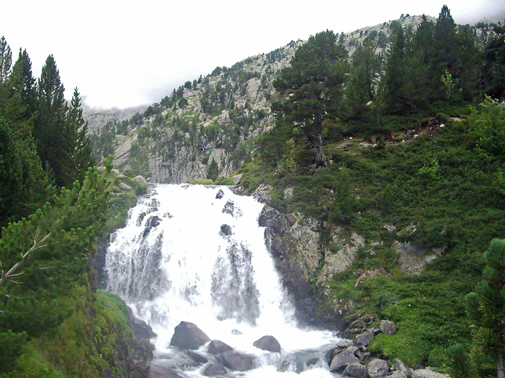
A little further on, visible from the lookout point, we will see the Aigualluts waterfall. What gives us one of the most beautiful snapshots of the Pyrenees. A close-up of the waterfall with the Aneto peak and its glacier as a backdrop.
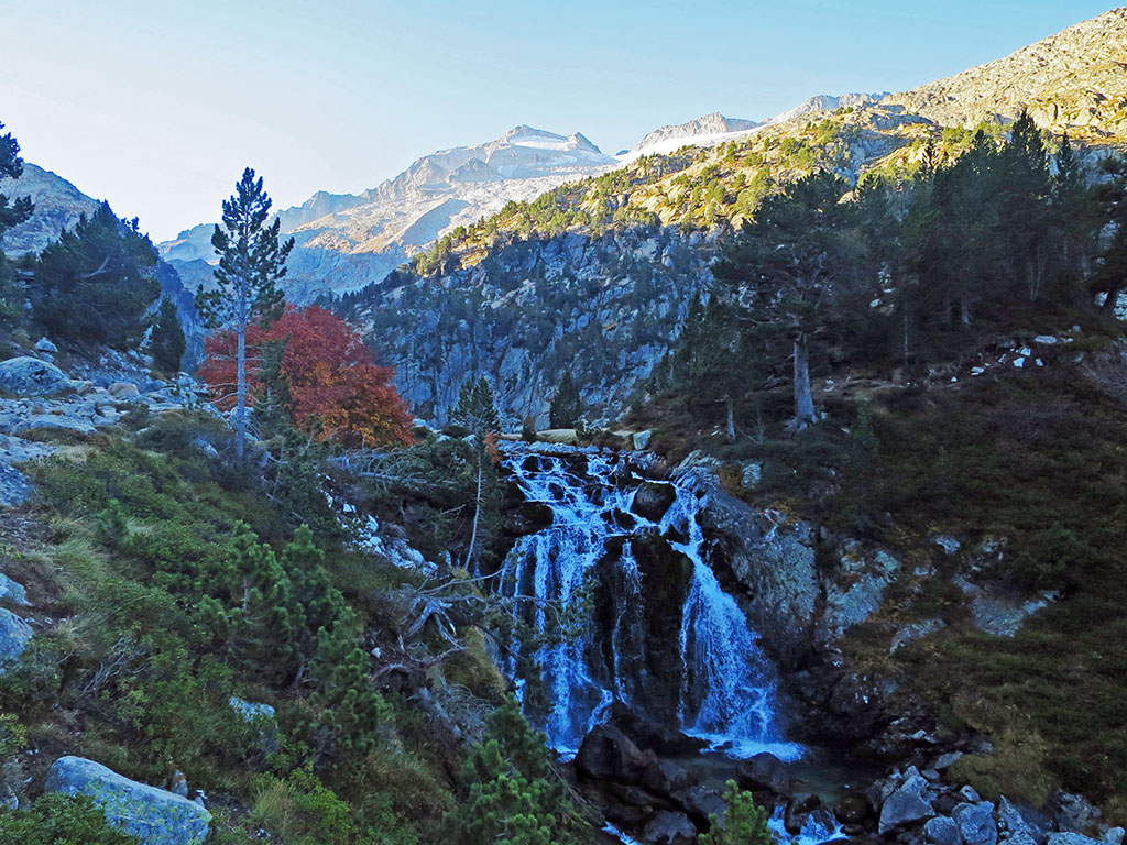
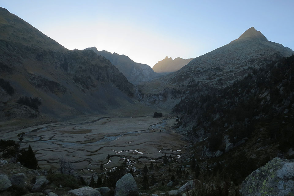
After passing this waterfall there is still one more surprise in store, the Plan d'Aigulluts. An extensive green meadow through which several streams meander in perfect harmony, coming from the glaciers of Aneto and Barranco de la Escaleta.
If the chosen route has been the long one, passing first through the La Renclusa mountain hutyou will visit these three places in reverse. This route adds a couple of kilometres and 250 metres of elevation gain, but in exchange it offers unbeatable views to the north during the climb to the refuge over the valley and the peaks of Salvaguardia and La Mina; and to the south, of the ridge to the west of La Maladeta, from Cordier peak (3,263m) to Pico de Alba (3,118m), as well as Tuca Blanca and Pico de Paderna. During the descent from the Renclusa pass to the Plan d'Aigualluts, we will enjoy beautiful views towards this esplanade and we will be able to see the Forcanada in the background and, closer to it, the Tuca d'Aigaulluts or l'Escaleta.
READ ALSO:
Fastpacking is not about going faster. It's about going lighter.
If you come from classic trekking, this is the next step: learning to move with less weight,
more fluid and enjoying every kilometre more.
Join the Outsiders Newsletter and start discovering what lightness feels like.