

Signs in mountain hiking: learn the meaning of the markings
Pyrenees and mountains 📩
Here 🔥Today, most hikers head out into the mountains with a track loaded onto their mobile phone or GPS device. Even so, trail markers remain essential. Batteries die, signals are lost, and on difficult terrain, a painted mark on a rock can be more reliable than any app. Knowing the marking code isn't an outdated skill: it's the layer of safety that complements technology.
Learn how to interpret the trail sign code
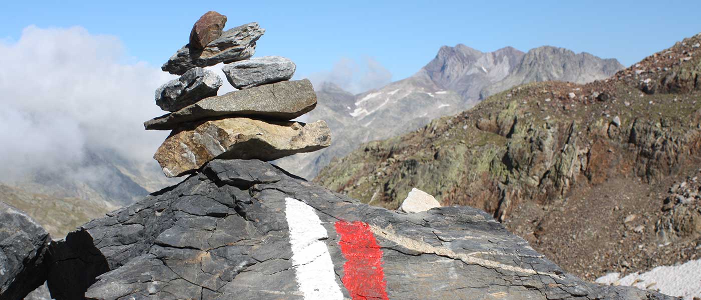
Signs on footpaths are made up of symbols consisting of a white stripe and one or two stripes that can be of three different colours depending on the type of footpath. These signs are either horizontal (e.g. painted on a stone) or vertical (wooden signs). For safety reasons, the signs should be visible in both directions of the trail, and in places where they can be easily seen.
Colours and shapes, an easy-to-memorise code
- The red colour is used to mark long-distance (GR) trails. In this case, the trail is longer than 50 km or takes more than one day to complete, and usually crosses several regions or even countries. In this case, the sign will have a European number added indicating that it crosses several countries. An example of a GR trail in the Pyrenees is the Pyrenean Path or GR 11which runs through the Spanish part of the Pyrenees from West to East.
- The yellow colour is used to indicate a short distance footpath (PR). These are trails of between 10 and 30 km. They are the most common due to their length, and their route lasts around one or two days.
- The green colour indicates local trails (SL). These are trails of less than 10 km. They are very often circular trails, and can be based on a theme, for example the nature of the terrain, such as botanical species.
- In addition, sometimes along the route you may come across special blue signs. These signs are used to guide the routes on horseback or by bicycle. mountain. There may be countless brands, but in no case will these be approved for hiking.
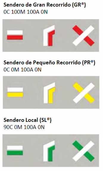
The shapes are geometric figures that are easy to differentiate and memorise:
- Continuity signs consist of two rectangles 10 to 20 cm long and about 3 cm high, approximately 1 cm apart. The upper rectangle shall always be white, while the lower rectangle shall be red, yellow or green.
- A continuity signal that deviates at an angle to the left or right, or an angle looking left or right indicates an abrupt change of direction or a deviation. Depending on which way the angle faces, it corresponds to the direction of deviation.
- We can also find a sign made up of a cross-shaped cross formed by two lines of about 15 cm. long and 3 cm. wide. This indicates a wrong direction. The upper line will always be white, and the lower one coloured.
Occasionally, two different signs may coincide on the path. In this case, a hierarchical order will be followed, and the one with the longest route will have priority over the others. For example, a GR sign will have priority over a PR sign. In any case, you will find posts informing you of this circumstance.
As you can see, the signalling code is simple and easy to remember. Use it as a backup to your track, when everything is working, it's a confirmation. When something goes wrong, it's what gets you out of trouble.


