Discover this hidden gem of the Benasque Valley: Route to Ibonet de Batisielles
Pyrenees and mountains 📩
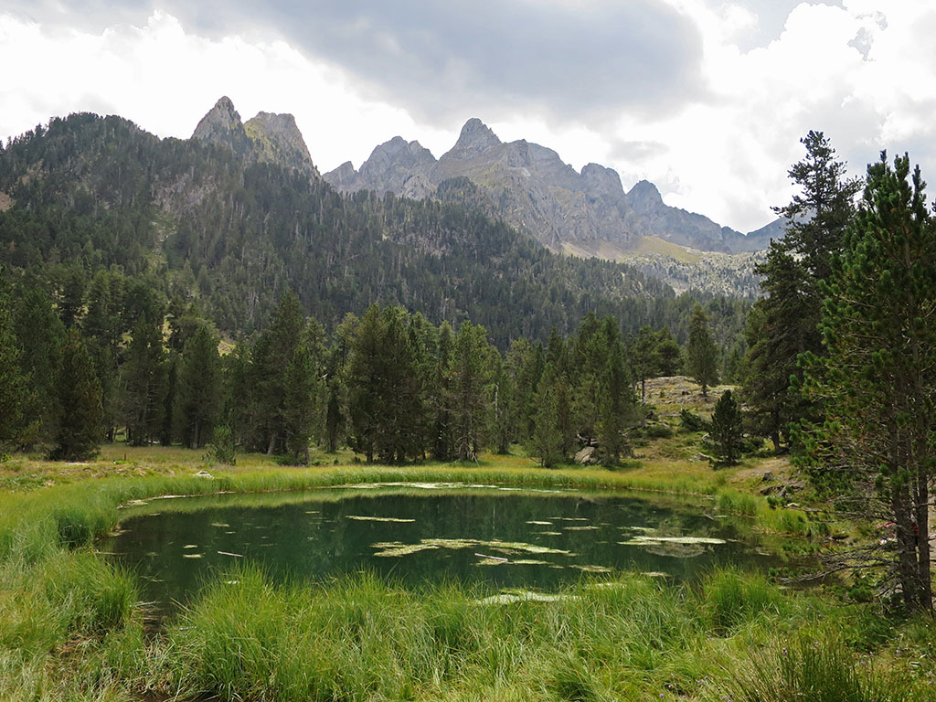
Here 🔥The excursion to the ibonet de Batisielles following the footpath S3 is one of the most common routes of the Benasque valley. The walk we propose ends here, at the ibonet de Batisielles, but the path is signposted to the ibón de Escarpinosa, forty minutes further up.
Camino de Santiago 101
A Quick Guide in English to Preparing Your First Camino de Santiago: Which Route to Choose, How Many Days You Need, How to Pack Your Rucksack, and How to Go from “Someday” to Having a Real Plan.
🟡 Camino 101 for beginners
Practical tips for choosing a route, dates, and backpack
📍 Free community guided by a local on the French Way
💬 Questions and answers within Skool
Technical specifications:
Distance: 10 km.
Cumulative difference in altitude: +/- 555 m.
Timetable: about 5 hours (round trip). Walking time non-stop3h15min (1h50min uphill and 1h25min downhill).
Water: halfway, past the refuge of Santa Ana, we find the fountain of Las Coronas (0h50min).
Difficulty: outside the winter, without snow, it is not a difficult route, but you do need to be a bit fit for the climb from the track to the ibonet.
Recommended equipment for the summer: light boots or trekking shoes, walking sticks, GPS (optional), canteensome food, sun protection, sunglasses...
Suggestions: at the end of the article we indicate several proposals such as: visit the Gorgas de Calantes, follow the S3 path to the ibón de Escarpinosa, continue along the GR11.2 (stage 21v) to the ibón Grande de Batiselles, make a loop through the ibón de Perramó and the ibón Grande de Batisielles or continue along the GR11.2 to the refuge of Estós and return by the main route.
When to go: This route can be done at any time of year, although the difficulty will not be the same in winter, when there is snow, as in the rest of the year.


ITINERARY:
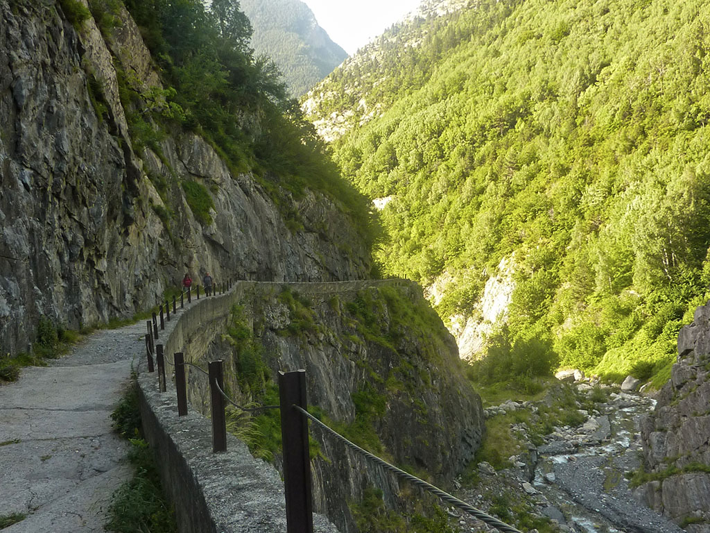
(0h00min; 0,0kms) Estós valley car park (1.336m). Once we are in the car park at the top, we take a path that links up with the Estós valley track, along which we arrived by car. The route is marked as path S3 and shares the same route with the GR11 during the first hour of the route. The route follows the track that soon leaves the Estós reservoir to the left and later changes banks at Palanca de Aiguacari (0h25min; 1,3kms). The valley becomes even narrower and in some stretches there is hardly room for the track.
(0h40min; 2,0kms) Santa Ana hut (1.490m). In good condition.
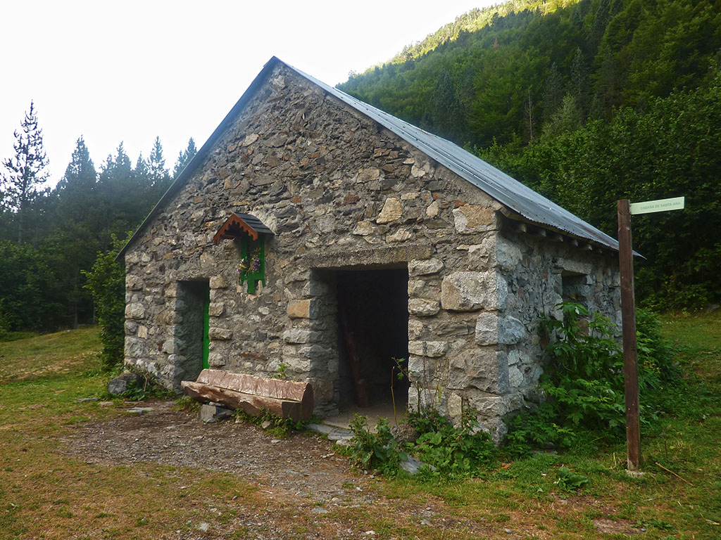
We continue ahead, in 10 minutes we pass the Coronas fountain and 5 minutes later we reach a turning on the left hand side where we leave the track and the GR11.
(0h55min; 3,1kms) S3 trail fork (1.578m). The path steepens as you enter the beech forest and continues like this for the next 25 minutes. Then the slope becomes gentler, when the path continues halfway up the slope in search of the Palanca de los Carboneros (1h30min; 4,3kms), where you cross the ravine of Aigüeta. The path becomes steeper again in the final stretch of this excursion to the Aigüeta....
(1h50min; 5kms) Ibonet de Batisielles (1890m). The descent follows the same route.
(3h15min; 10kms) Estós valley car park (1,336m).
Possible alternatives to this excursion:
If, halfway through the excursion, instead of taking the S3 path up to the ibonet de Batisielles, we continue along the track in the direction of the Estós refuge, we will be able to visit the Calantes Gorgesa kind of pots excavated by the Estós river.
As discussed above, the S3 path is signposted to the lake of Escarpinosa40 minutes further up from the ibonet de Batisielles. Once at the ibón de Escarpinosa, if you want to extend this route, we have two options The first is a fairly elegant route that allows us to make a loop and return to the ibonet de Batisielles. The first consists of going to link up with the GR11.2above the ibón Grande de Batiselles. The second, longer one, consists of climbing up to the Perramó lakeand then go halfway up the slope to link up with the previous route of the ibón Grande de Batisielles.
Another option without going up to the ibón de Escarpinosa is to go from the ibonet de Batisielles to the Estós refuge (1h15min) following the GR11.2 and from there, return to the car park via the GR11 (2h15min from Estós).