Kayak applications
Pyrenees and mountains 📩
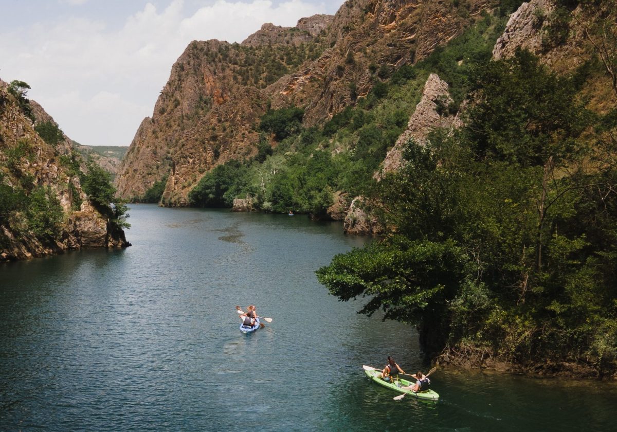
Here 🔥Kayaking is one of the most popular outdoor activities in recent times. If you are interested in keeping detailed track of your speed, distance or strokes while on the water, the following can be very helpful kayak applications.
Which kayak applications are recommended?
Below, you will find the best applications that can help you with the kayaking.
Strava
One of the kayak applications most popular on the market is Strava, which has millions of downloads. The app has a free and a paid version of the app. The paid version offers more metrics and allows for deeper analysis.
Strava can track your distance and also tracks your time on the water very well. With the use of this app you will be able to know the pace of your movements and it helps you with increasing and maintaining the same pace when you are paddling.
In addition, you can fully record your training summaries. It makes it possible to save and review your journey, which you can share with your friends in the wider community.
Go paddle
Go paddle it is a free kayak application which works for both iOS and Android devices. This application shows precise information about each site suitable for this activity.
It is possible to observe the characteristics of each place and people have the possibility to add details of each location for other users to see. The application continuously improves its service and progresses through updates.
It has approximately 25,000 locations that are stored in the app to allow you to find the best place to take your kayak. It is very easy to set up, so it will not be useful for detailed maps and information.
Although if you are looking for places to start and launch your boat, this can be a great tool. Users have the possibility to add descriptions of paddling locations and launching points in order to share more detailed information.
Polaris GPS
Polaris GPS is a kayak application which you can download for free, although it is currently only available for Android. It makes it easy to track your route and is also useful for planning. This app makes use of the GPS signal on your device, and most functions can be used offline.
The app can access marine charts and allows users to estimate water depth. In addition, through the app, users can download detailed maps for offline use.
Polaris GPS has functions including a compass, trail navigation capabilities, latitude and longitude readings, an altimeter and more. It's an all-in-one tool that helps you stay on course while paddling.
RiverApp
RiverApp is one of the kayak applications which will keep you up to date with the latest water levels. The app also offers map displays of various routes, the navigability of those routes, water temperature, among other data.
Depending on your interests, there is a free version and a premium version. It can be used in several different countries, so you can take your experience everywhere. RiverApp is an ideal kayaking application to check the water conditions before you start your trip.
Navionics
Navionics is a kayaking application and for fishing. The app includes detailed marine nautical charts and advanced features. The app can be used free of charge for two weeks.
After that, you have to choose a Premium payment option, the prices of which vary according to the functions you are interested in using. The app can be found on both iOS and Android and offers information related to tides, weather, currents, among others.
CrewNerd
CrewNerd is a kayak application available for iOS and Android. It is excellent for training and is currently one of the best rowing apps available on the market.
Through CrewNerd you can track various aspects such as stroke rate, speed, distance and helps you monitor your heart rate along the way. This is an ideal app for kayaking, canoeing, rowing and more.
An important feature is that you can create your own training plan or use a pre-programmed workout. The actual display presents all the metrics in real time, the way you want them to be displayed. It is a very intuitive and easy to use application.
SafeTRX Maritime Rescue
A 50 % of the emergencies that the Maritime Rescue and Safety Company The services it provides in Spain are related to pleasure craft.
The free application SafeTRX allows recreational boaters that Maritime Rescue can monitor your journeys and issue alerts in cases where the navigation plan is not adhered to.
SafeTRX is an application for mobile devices, which you can find on Google Play and Apple Store, is useful for keeping track of your vessel's voyages, informing the user's chosen contacts when there are delays in the planned voyage and has a web page so that Maritime Rescue can quickly check what has happened to the vessel and can take the appropriate action.
KayakLog
KayakLog is a application designed exclusively for kayaking. Allows you to record your average speed, trip distance and route, wind speed and temperature.
It also has a weather forecast function that will alert you in the event of high winds or severe weather. An extra safety feature is that it has the ability to set up emergency contacts that can track your location should you fail to arrive at your planned destination on time.
You can add notes and photos to your trip that can also be shared with your friends. This application is available for iPhone.
The app is paid, but you will have the opportunity to download a free version and use it to track five different trips before you start paying for the service. In this way, it will be possible for you to test the app and decide whether you will make the paid investment.
River Data
River Data is a kayak application which, as the name suggests, provides data on rivers. It accurately includes data from more than 14,000 sites. In this application, it is possible to see how fast a river is flowing, how much oxygen is in the water and many other characteristics. The information is updated from time to time and allows you to track changes in conditions.
The app also has a navigation function that helps you find your way around each location. The problem with this app is that it is only available for iPhone users.
Relive
The application Relive was created for running, cycling and walking, but it has also become a favourite among kayaking enthusiasts. It works with your mobile, and with multiple tracking platforms. One of its main features is that it has the ability to generate 3D maps of your route, showing you a video that you can then share with others at the end of your trip.
Routie
Routie is a utility application for Apple devices and is compatible with some BlueTooth 4.0 heart rate monitors. It has the most common stats, such as distance and duration, but it also has interactive graphs where you can see speed and altitude. It is possible to view your activity stats over three different time spans: the previous month, the past year or all time.
AEMET weather
This easy-to-use application puts the official forecasts and announcements of the State Meteorological Agency (AEMET). You can use it to find out where it will rain, how strong the winds will be or whether adverse weather conditions are expected in your municipality.
As long as you have geolocation activated, the application automatically identifies the location of the device making the query and presents the weather forecast for that municipality. In addition, you can also obtain forecasts for any other municipality in Spain using its search engine.
The information provided is accurate, detailed and constantly updated in a simple and user-friendly format.
Windy
Windy is a free mobile application through which you will be able to have all the weather information in an interactive, simple, real time and with great prediction. The data provided includes forecasts and gusts of wind, waves, rain and humidity for the next 10 days after the date of consultation.
The application uses four forecast data models that can be obtained at the same time in order to ensure greater accuracy in the query. The models used are GFS, MEMS, ICON-EU or ECMWF, the latter being the default one.
Access to Windy is carried out via the web or by downloading the app, which you can find on Google Play and Apple Store, to your mobile phone. It is very intuitive to use as it graphically displays wind, waves, currents and other data layers, making visualisation easy and interactive.
Conclusion
You have seen that there are currently several kayak applications. In order to choose the most suitable one, you should review all its features and functionalities. This way you will be able to select the one that best suits your interests.
Fastpacking is not about going faster. It's about going lighter.
If you come from classic trekking, this is the next step: learning to move with less weight,
more fluid and enjoying every kilometre more.
Join the Outsiders Newsletter and start discovering what lightness feels like.