Cuchillejo (934m), provincial ceiling of Valladolid
Pyrenees and mountains 📩
Here 🔥The Cuchillejo (934m) would hardly be a mountaineering objective of any kind, were it not for the fact that it is the provincial ceiling of Valladolid, and for that strange hobby that many of us have of collecting mountains and completing lists: the highest peak in each province, the 217 pyrenean three-thousandersThe 100 most prominent mountains in the Iberian Peninsula, the "100 cims" of Catalonia, etc. All of them, an excuse to get to know nearby places that we would probably not go to otherwise.
Mountains, gastronomy, wine and culture
There are few excuses to visit this part of the province of Valladolid: good food, better wine and the nearby town of Peñafiel, famous for its castle on the top of a hill and for its centre, declared a Historic-Artistic Site in 1999.
Choosing the moment
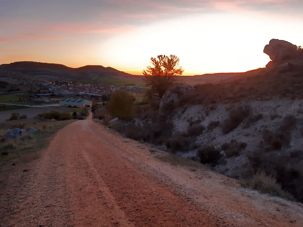
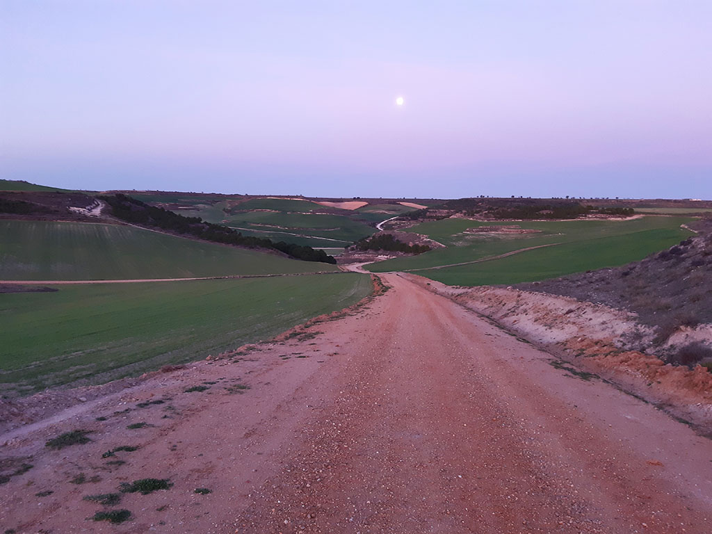
The climb to Cuchillejo has its charm and if you choose the right moment, it is quite pleasant along the route described here. The best time is at dawn, with the first light of dawn. Enjoy the sunrise, the barking of the roe deer - very abundant and easy to see in this area - and of course, avoid the hottest hours, as there is not a single shadow in this moorland to take shelter in.
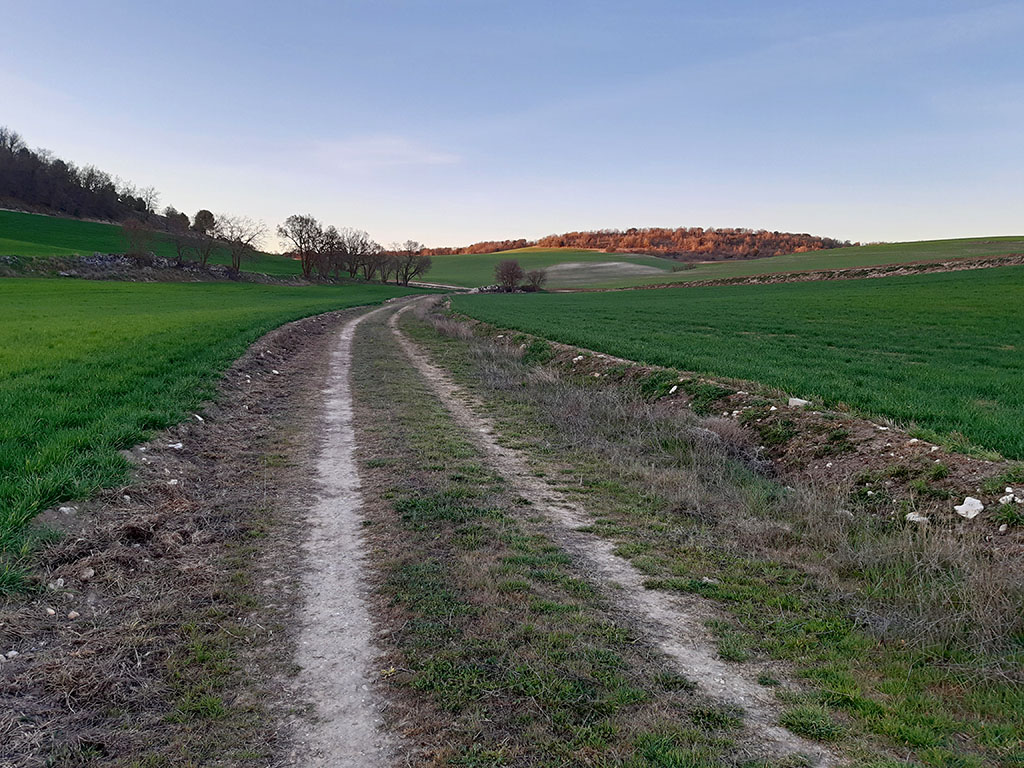
The climb, if done in the direction of travel described above, is very flat and, except for the first ramp, is ideal for running.
How to get there:
See in Google Maps.
The starting point for this excursion is Castrillo de Duero, a town located 10 kilometres east of Peñafiel. To get there from Peñafiel, take the road (VP-2307) that goes around the castle on the northern side and passes next to the Protos winery. After one kilometre, this road joins the VP-2006, along which we continue without getting lost, passing through Mélida (4 km) and Olmos de Peñafiel (7 km).
Technical specifications:
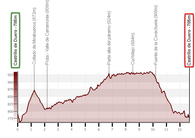
Distance: 12.7 kms.
Cumulative difference in altitude: +285m/-285m.
Timetable: about 4 hours. Walking time non-stop: 3 hours 5 minutes.
Water: At the beginning of the descent we will find the Covachuela fountain.
Difficulty: none. The same route can be done by bicycle or even by car.
Recommended equipment: boots or slippers, walking sticks, canteen, GPS useful.
Itinerary:
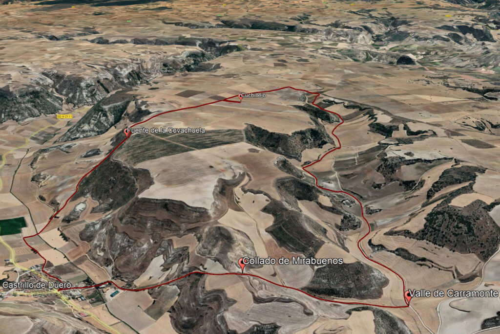
(0h00min; 0km) Castrillo de Duero (785m). Starting from the mural at the roadside, a good place to park, take Cantaranas street downwards (S) to leave the village. Continue along a track that crosses the Botijas stream and, on reaching the foot of a hillside perforated by the traditional wineries typical of this area, forks off.
We will take the right branch to flatten out for a moment and then face the only steep climb of the whole route.
(0h20min; 1,2km) Collado de Mirabuenos (872m). The track now descends towards the valley of Carramonte.
We go down to the bottom, passing a couple of crossroads on the left that could also be used to go to Cuchillejo.
(0h30min; 2,2km) Track - Carramonte Valley (808m). Once down, our track joins the one coming from Olmos de Peñafiel, which we will follow on the left as we gently ascend. Just before a steep slope, if we prefer to avoid the track, we leave it to continue to the left along a path that runs along the bottom of the valley.
It won't be long before we join the track again, which we will follow until we reach the...
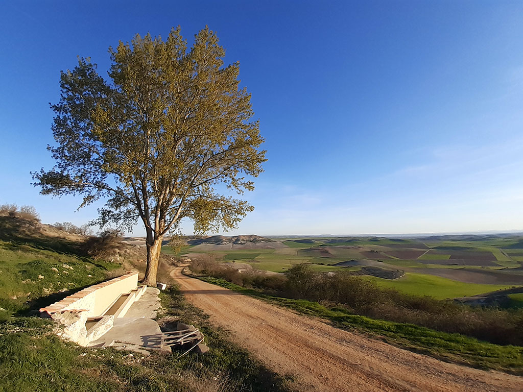
(1h35min; 6,7km) high part of the moor (924m), where it forks and ends. Take the left branch, which descends slightly to cross the head of the Carramonte valley and climbs back up to Campo Cuchillejo. On the left there is a path that we can take. We have taken the next one, known as the Covachuela path, which runs along the provincial boundary between Valladolid and Segovia. In the distance we can already make out the geodesic vertex where, supposedly, the provincial ceiling of Valladolid is located. We will reach it by turning off the track for a moment when we reach its height.

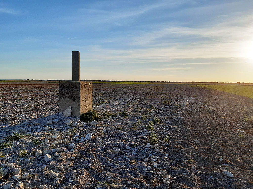
(2h10min; 8,5km) Cuchillejo (934m).
The truth is that it is a plain with hardly any unevenness in which, if it were not for this sign, it would be difficult to locate the highest point. In fact, to the east it seems that there could be a higher point, but that would be in the province of Segovia. Once again on the Covachuela track, we continue along it in a northerly direction until we reach the edge of the moorland, from where we can see the Botijas stream. The track splits, and we take the right branch to descend. As soon as we start to descend, we will pass by the...
(2h35min; 10,2km) fountain of la Covachuela (908m)A good place to stop before tackling the last kilometres.
We only have to take a crossroads on the left shortly before reaching the road if we want to complete this route to the provincial roof of Valladolid.
(3h05min; 12,7km) Castrillo de Duero (785m).