Cerro Rongiero or Montón de Trigo (1,622m) from Ladrillar (Cáceres)

Pyrenees and mountains 📩
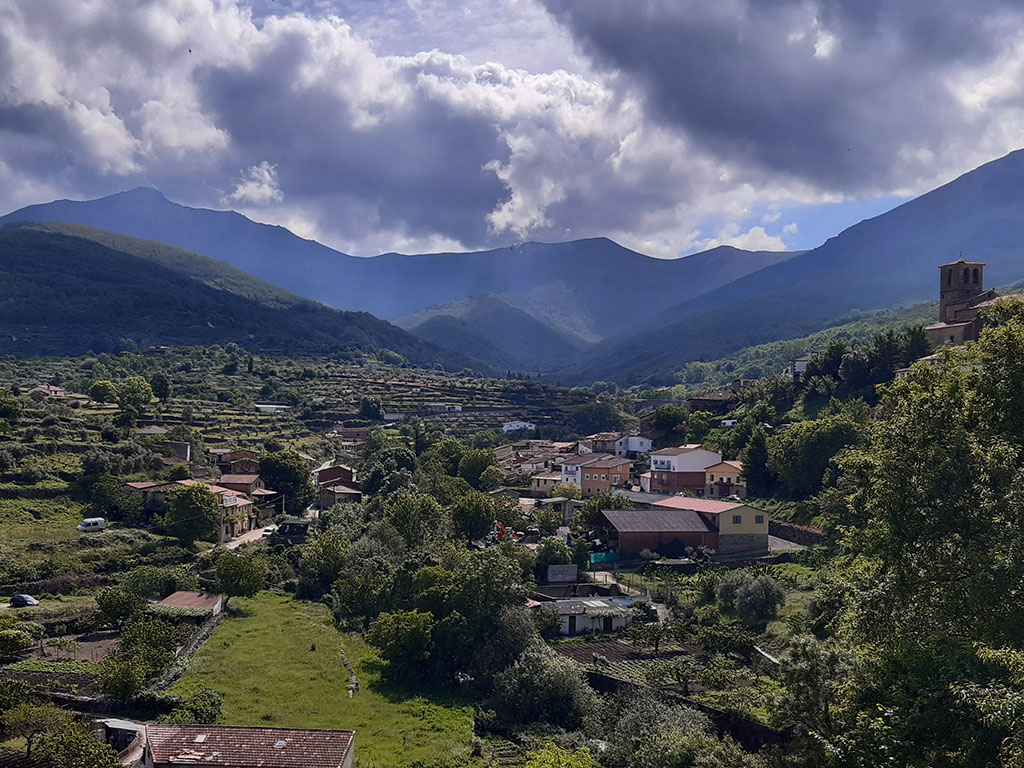
Here 🔥This week we travel to the Central Systemto the historic district of The HurdesThe highest point is the Cerro Rongiero, Mingorro or Montón de Trigo (1,622m), which can be climbed from Ladrillar.
The Hurdes is a mountainous territory located in the north of Cáceres which is bordered to the north by the province of SalamancaThe Batuecas Natural Park and the Sierra de Francia Mountains. Together with the Sierra de Gata, the Ambroz Valley, the Jerte and La Vera, The Hurdes is one of the 5 regions (although it is not an administrative region) in Extremadura that occupy the southern slopes of the Central System.
Curiously, contrary to what we might think in a country where most of the storms enter from the north and northeast, the southern slopes of the Central System is the one that receives the greatest accumulation of rainfall. Thus, we find ourselves in a territory of the so-called rainy Spain, with a Mediterranean climate and Atlantic influence. A territory populated by large extensions of pine trees that every summer prays to be kept safe from the devastating fires that threaten the region.
Although, as we have already mentioned, the Rongiero, Mingorro or Montón de Trigo is the highest peak of The Hurdesis not the highest in the area. This honour is held by La Hastiala (1,735m), in the Sierra de Francia (province of Salamanca), just 4 kilometres away as the crow flies. In fact, Rongiero is part of the Peña de Francia mountain range, more specifically, of the La Granjera or Canchera mountain range.
The route we propose was done in October 2019, a year in which the summer drought lasted until the middle or end of October.
SUMMARY:
Circular route from Ladrillar to Cerro Rongiero, Mingorro or Montón de Trigo. From Ladrillar, first along paths and then along a well-marked trail, you climb up to the Portilla del Samoral. From here, following the ridge to the east, you reach Cerro Rongiero. The descent is more difficult, following the rope in a SE direction, passing the Collado de las Fuentes pass, the Piquito del Moro and the Col de Valleverde pass, where the descent proper begins until it joins the Alfonso XIII route. Following this short distance path (PR-CC-212) we return to Ladrillar.
MAP:
DOWNLOADABLE:
> Download Track
HOW TO GET THERE:
See in Google Maps.
Technical specifications:
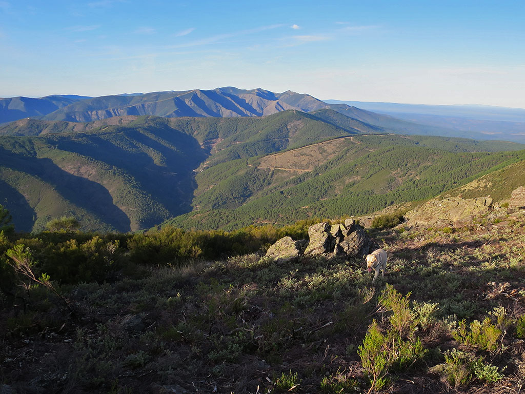
Distance: 15,7kms.
Unevenness: 1.100m.
Timetable: about 7 to 7.5 hours. Walking time without stops: 5h55min.
Water: On the way up there is a spring (La Mesenguen) to which you have to turn off 200-300m. At the top and on the way down, up to where it joins the Alfonso XIII route, there is no water. On the way to Ladrillar, 20 and 30 minutes away, we pass two ravines with water in the middle of a drought, as well as a spring next to the second one which is dry.
Difficulty: The ascent is on a well-marked path, where it is easy to accumulate metres of elevation gain. The descent is worse, longer and over stony and unstable terrain. When the main descent is over, you still have to climb and continue walking for quite a while until you reach Ladrillar.
ITINERARY:
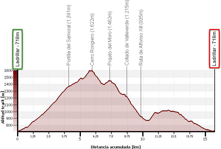
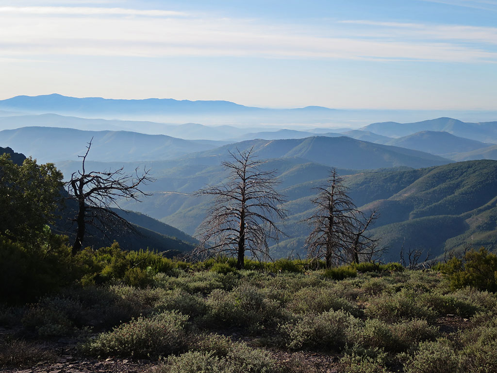
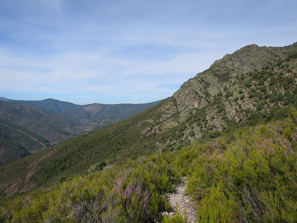
(0h00min; 0,0kms) Ladrillar (718m). Cross Ladrillar heading west until almost the end of the village. By a small house with rubbish containers you see a slope on your right hand side, which leads past a house with a vine-covered facade. Behind the house you find an ascending path that leads to a track (0h10min; 0,5kms) that you follow to the left. Soon the track ends at the bottom of a valley in an olive grove. Now, following a marked path between olive trees, you cross an area of scrubland and continue over another olive grove. The path comes to a wide path that ascends steeply to a track (0h25min; 1,2kms). Follow it to the right and turn left at the next junction. A few meters later you meet the ascending path (0h30min; 1,4kms). The path zigzags uphill through an impenetrable field of broom myrtle, rockrose and other bushes. It is best not to leave the path. The views towards the region of The Hurdes are spectacular.
Some time later you pass a fork to a fountain (1h10min; 3,1kms), which you find some 200 metres further on. The junction is signposted with a pile of stones. Continue uphill ignoring soon after that a junction on your right hand side, which you could also go uphill.
The path closes a little but progress is good.
(1h35min; 4,1kms) Portilla del Samoral (1.391m). A small esplanade with no vegetation, closed off from the northern slope by a pine forest. Cross it in an easterly direction, looking for a wide path that climbs up the other slope and ends there. We then continue along a more or less clear path until we reach the crest and then, with a bit of intuition, along the clearest path.
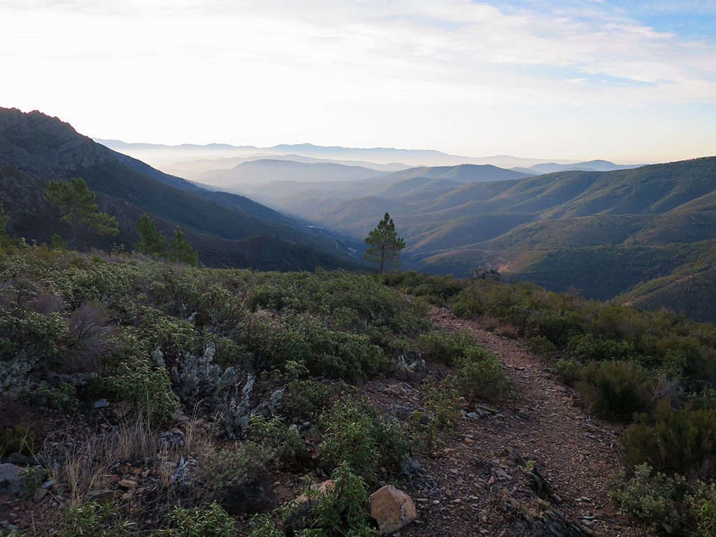
In 10 minutes we reach a curious passage between two stones in the form of a tunnel. The route continues along the edge of the sierra, enjoying the views, until we reach the top of a small peak (1,509m) that precedes a small pass.
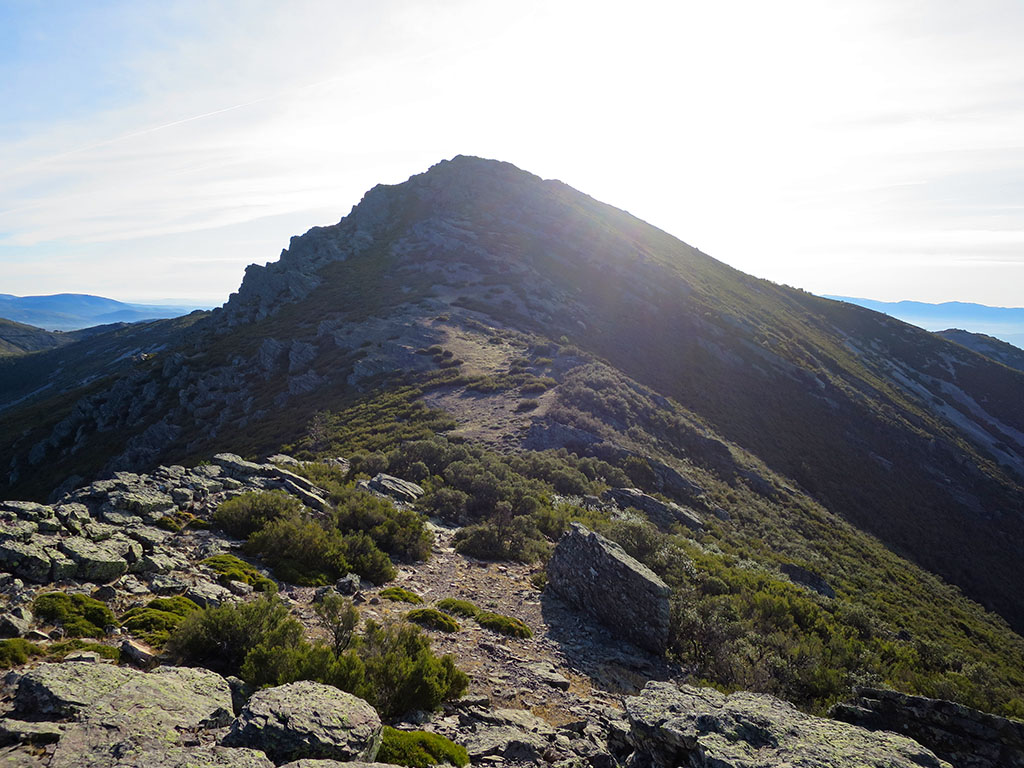
We follow the path along the high part until we reach a rock barrier that we flank to the left, until we find the weak point. It is also possible to avoid it in other places. Shortly afterwards we gain a height from where we can see the nearby...
(2h20min; 5,9kms) Cerro Rongiero (1.622m).

At the top we find an old mailbox on a promontory of piled stones.
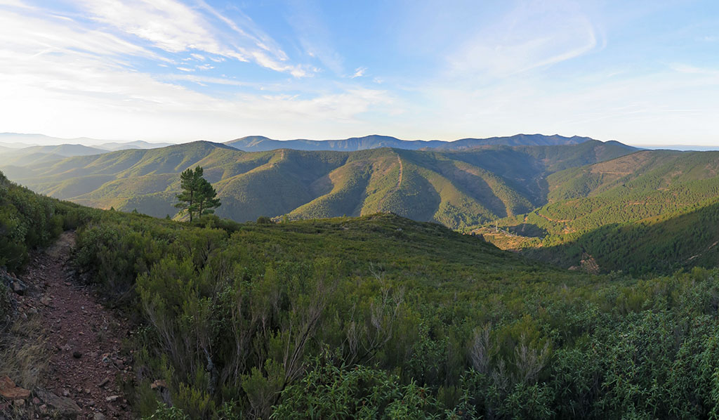
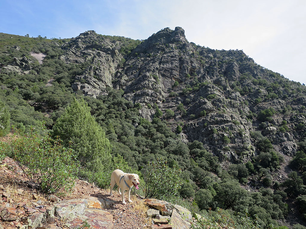
The views are splendid in all directions. Close by is the Peña de Francia (1,727m), on top of which sits a monastery and a telecommunications repeater. The descent on the other path is more difficult. It is noticeable that there are fewer people here and the path is not as well marked as on the way up. We descend from the summit heading south on rocky terrain.
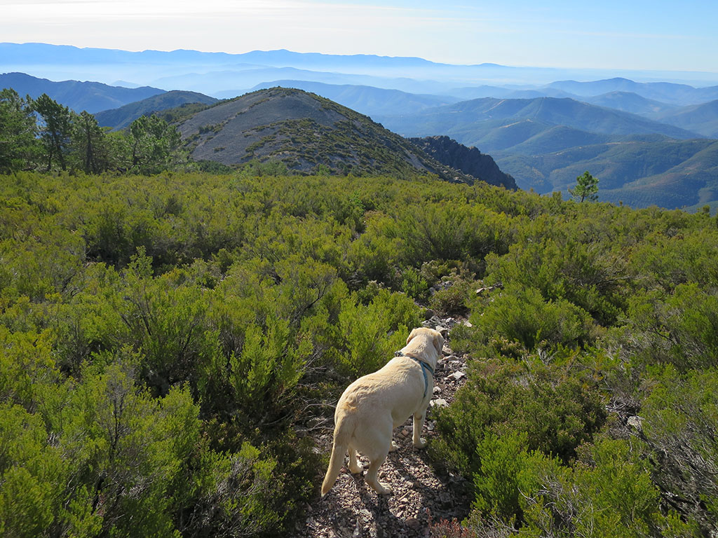
The path winds its way through the heather following the highest line of the ridge to the pass of Las Fuentes (2h45min; 6,9kms), whose northern slope is occupied by pinewoods. A short ascent between boulders and you reach the...
(3h00min; 7,3kms) Piquito del Moro (1.462m).
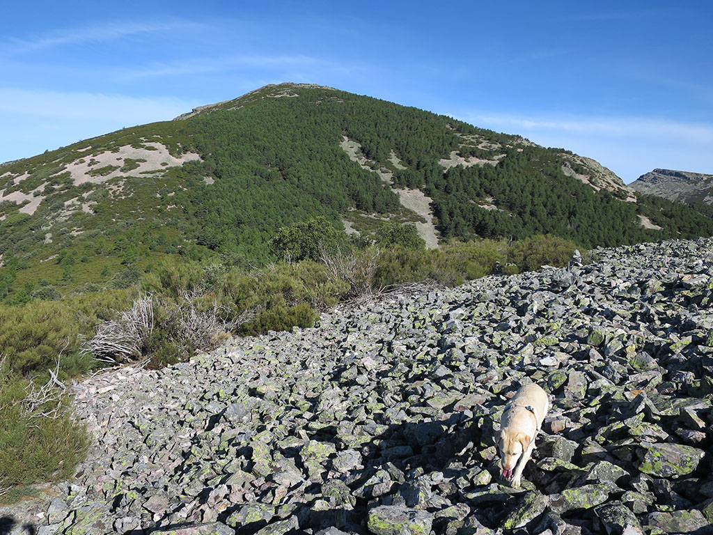
We pass the Montón de Trigo, a shoulder of this one that appears as such on the IGN maps, and begin a downhill stretch, taking care not to lose the path. We will pass a sort of pass and a peak before reaching the...
(3h40min; 8,7kms) Col of Valleverde (1.215m). Here we leave the ridge to descend steadily down a path on the southern slope. Scrubland, some trees and rocky areas alternate until you join the route of...
(4h05min; 9,8kms) Route of Alfonso XIII (935m), next to a picnic area with wooden benches. The path is now much more comfortable and well signposted. However, it is not all downhill all the way to Ladrillar, with a 100-metre slope in between.
From the picnic area we follow the PR path heading west, downhill. You pass a stretch of road in the middle of a large cliff and enter a wooded area, one of the few on this route. The path starts to climb (4h15min; 10,5kms) in zigzag, between large holm oaks covered with moss. We cross a dry ravine and leave the forest, where the hard part of this climb ends (4h35min; 11kms).
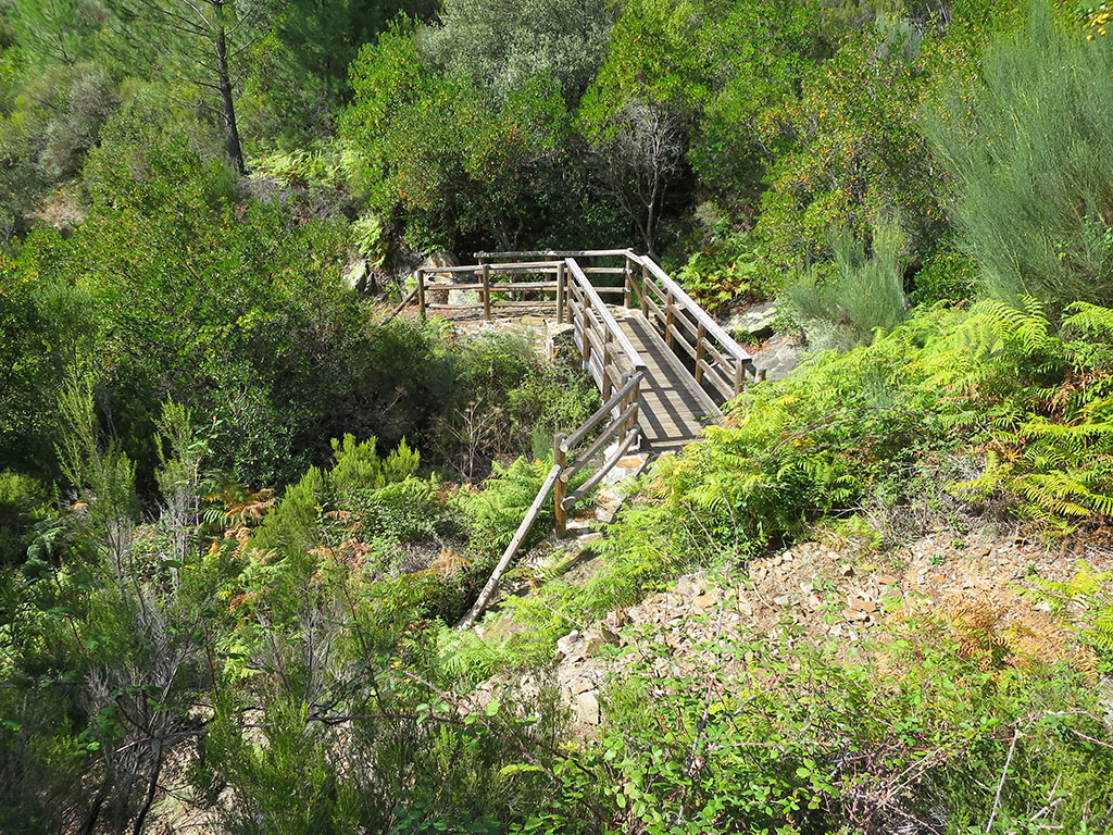
The route continues flanking the sierra at medium altitude, under the crags of El Espigón. We pass two dry streams before we reach the main watercourse of the ravine of Labradillos (5h00min; 12,5kms), with water in spite of the drought. We flank a spur (Pico de la Cotorra) and come to a second gorge (5h20min; 13,6kms) with more water than the previous one (a bridge and a dry spring).
The descent to Ladrillar is almost done, on the way we will pass another viewpoint-merendero and a track.
(5h55min; 15,7kms) Ladrillar (718m).
NEARBY YOU MAY BE INTERESTED IN:
The Pinajarro is a mountain that enjoys a certain prestige among the mountains of Extremadura. Its position overlooking the valley of the Ambroz...
18.6kms; +/-1,460m; 8-9 hours
Fastpacking is not about going faster. It's about going lighter.
If you come from classic trekking, this is the next step: learning to move with less weight,
more fluid and enjoying every kilometre more.
Join the Outsiders Newsletter and start discovering what lightness feels like.