Las mejores rutas de 3 días por la costa catalana
Pirineos y montaña 📩
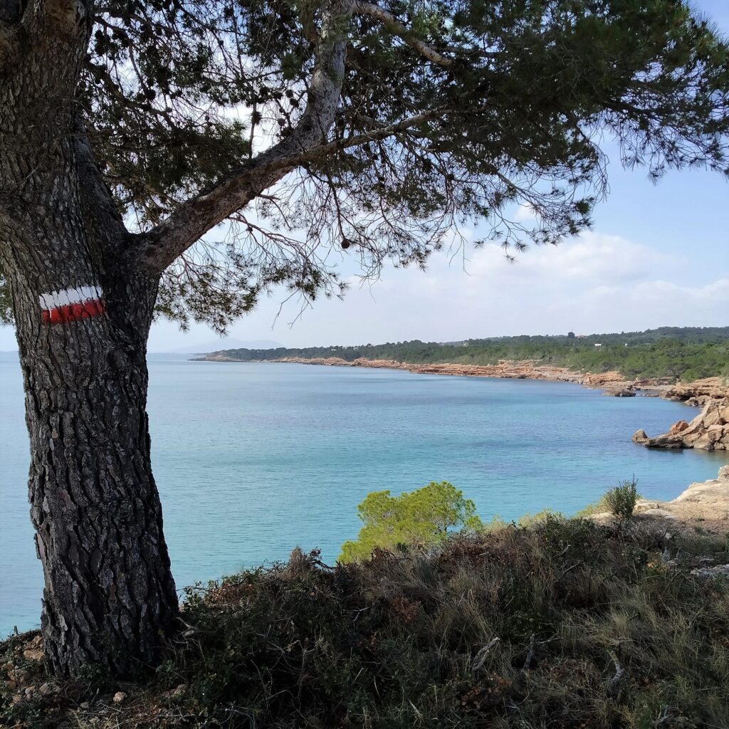
Aquí 🔥Desde tiempos inmemoriales, la costa ha estado surcada por caminos usados para la comunicación entre poblaciones costeras o como vías de escape de naufragios. Sembrados de torres de vigilancia ante los posibles ataques de la piratería, o recorridos como el emblemático camino de ronda, día y noche, por la guardia civil y los contrabandistas.
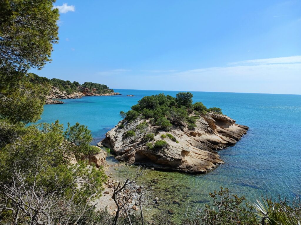
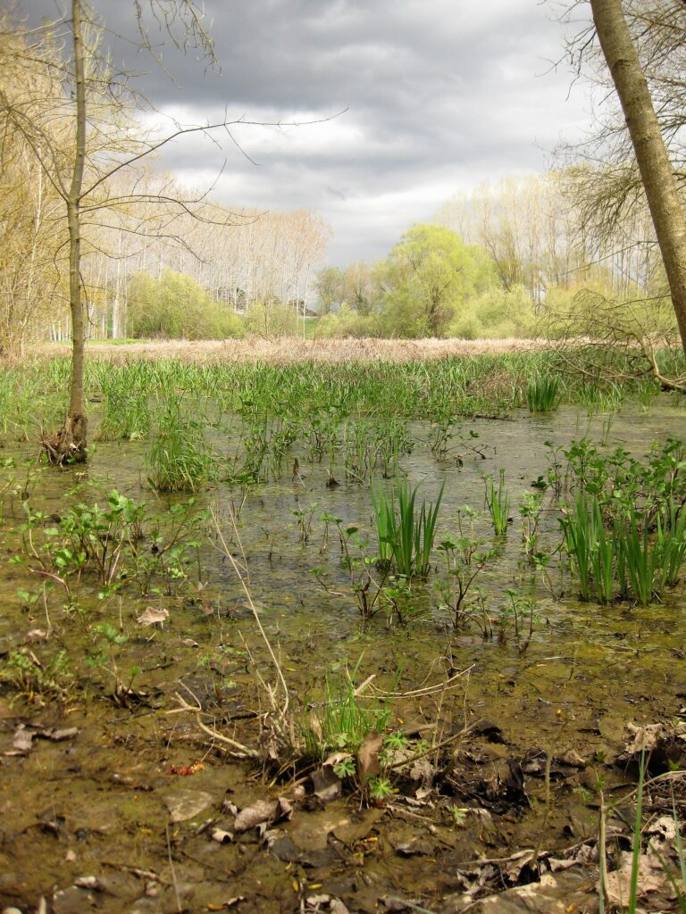
Tal vez pienses que la costa catalana está muy masificada o es muy turística, nada más lejos de la realidad. En sus 580 km de longitud, desde el Cabo de Creus al delta del Ebro, nos podemos encontrar tramos abruptos y rocosos con pequeñas calas intercaladas entre los acantilados, como en la conocida Costa Brava; campos de dunas con lagunas deltaicas, como en la desembocadura del Ter; costas bajas formadas por el aporte sedimentario de los ríos, como el fantástico delta del Ebro; o la costa del Maresme, entre otros muchos atractivos.
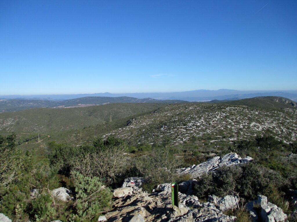
Eso, sin contar la franja de montañas que acompaña a la costa: los macizos calcáreos del Montgrí y el Garraf, los tupidos bosques de alcornocales del Montnegre y Corredor, les Gavarres y el macizo de Ardenya, las vistas deltaicas de la sierra del Montsià y los espacios naturales de Marina, Collserola y el Ordal, a tocar de la mediática Barcelona.
En este artículo, te sugerimos cinco propuestas por la historia y la naturaleza de estos caminos.

5 propuestas de trekking de 3 días por la costa catalana.
Propuesta 1: GR92 y la Costa Dorada tarragonina.
Tipo de recorrido: lineal.
Inicio: L’Hospitalet de l’Infant.
Final: Ampolla de Mar (lo Goleró).
– Etapa 1: De L’Hospitalet de l’Infant a la Ametlla de Mar.
– Etapa 2: De la Ametlla de Mar a la Ampolla de Mar.
– Etapa 3: De Ampolla de Mar hasta «lo Goleró» (ida y vuelta).
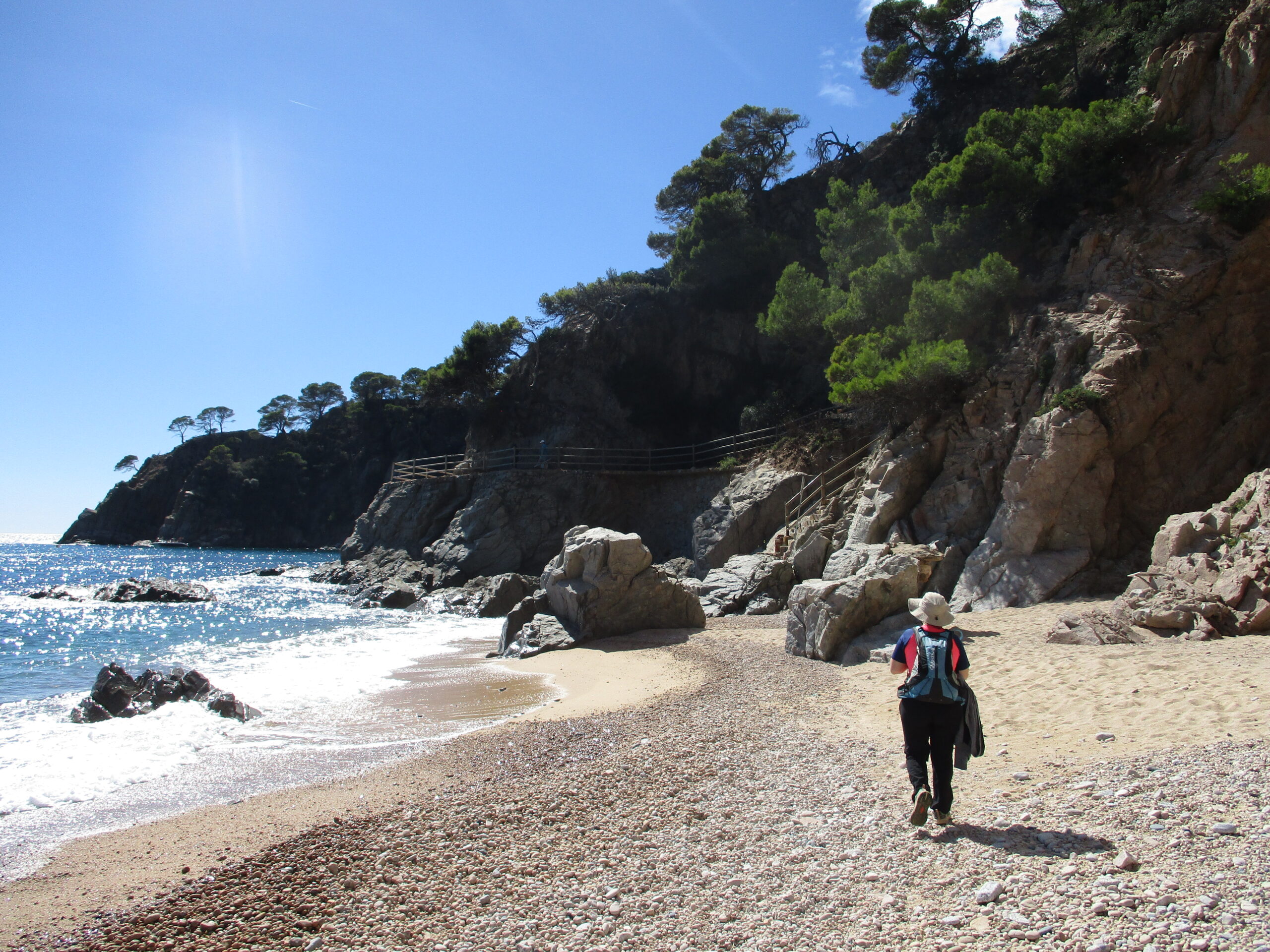
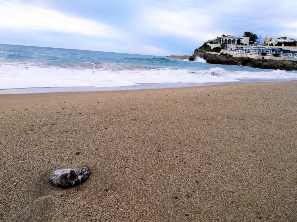
Este recorrido pegado al mar Mediterráneo, transcurre por acantilados de poca altitud y playas de grava en su mayor parte, protegidas por conglomerados marronosos o grisaceos. A lo largo del recorrido iremos acompañados de una vegetación arbustiva y algún pino en la parte terrestre y una vegetación submarina dominada por la posidonia, que podremos observar en las muchas calas que salpican nuestro recorrido.
Etapa 1: De L’Hospitalet de l’Infant a la Ametlla de Mar.
Recorrido entre dos paradas de tren de la línea R16 (web rodalies de Catalunya). Coincide con la etapa 28 del GR 92. En poco más de 23 km recorreremos un tramo fantástico de costa, con el único accidente geográfico remarcable de la Punta de les Rojales, pequeña colina al principio de la ruta.
Etapa 2: De la Ametlla de Mar a la Ampolla de Mar.
Etapa 29 del GR 92 que recorre un tramo de costa, la mayor parte no urbanizada, también entre dos paradas de tren. Poco más de 17 km con subidas y bajadas constantes, que nos llevaran a ver restos de la guerra civil, lagunas litorales, miradores y rocas fotogénicas.
Etapa 3: De Ampolla de Mar hasta «lo Goleró» (ida y vuelta).
Pequeña incursión en la parte norte del delta del Ebro. Recorremos un paisaje litoral mucho más plano que en las dos etapas anteriores por la playa del Arenal. Rodearemos la «Bassa de les Olles» donde podremos observar diversas especies de aves.
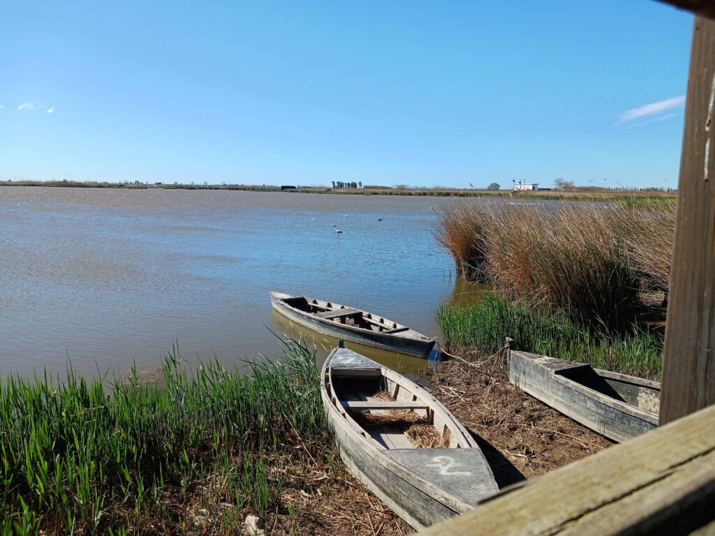
Propuesta 2: El delta del Ebro y la sierra del Montsià.
Tipo de recorrido: rutas independientes.
– Ruta 1: Ascensión a la «Foradada» del Montsià.
– Ruta 2: Recorriendo la punta del Fangar hasta el faro.
– Ruta 3: La desembocadura del Ebro y el faro del Garxal.
El delta del Ebro es producto de los sedimentos que ha ido arrastrando el río en su día a día, formando una estructura plana con su característica forma de flecha. Salpicada de poblaciones, lagunas, campos de arroz, canales de riego… Te proponemos tres recorridos en coche como toma de contacto con este espacio natural que no te dejará indiferente.
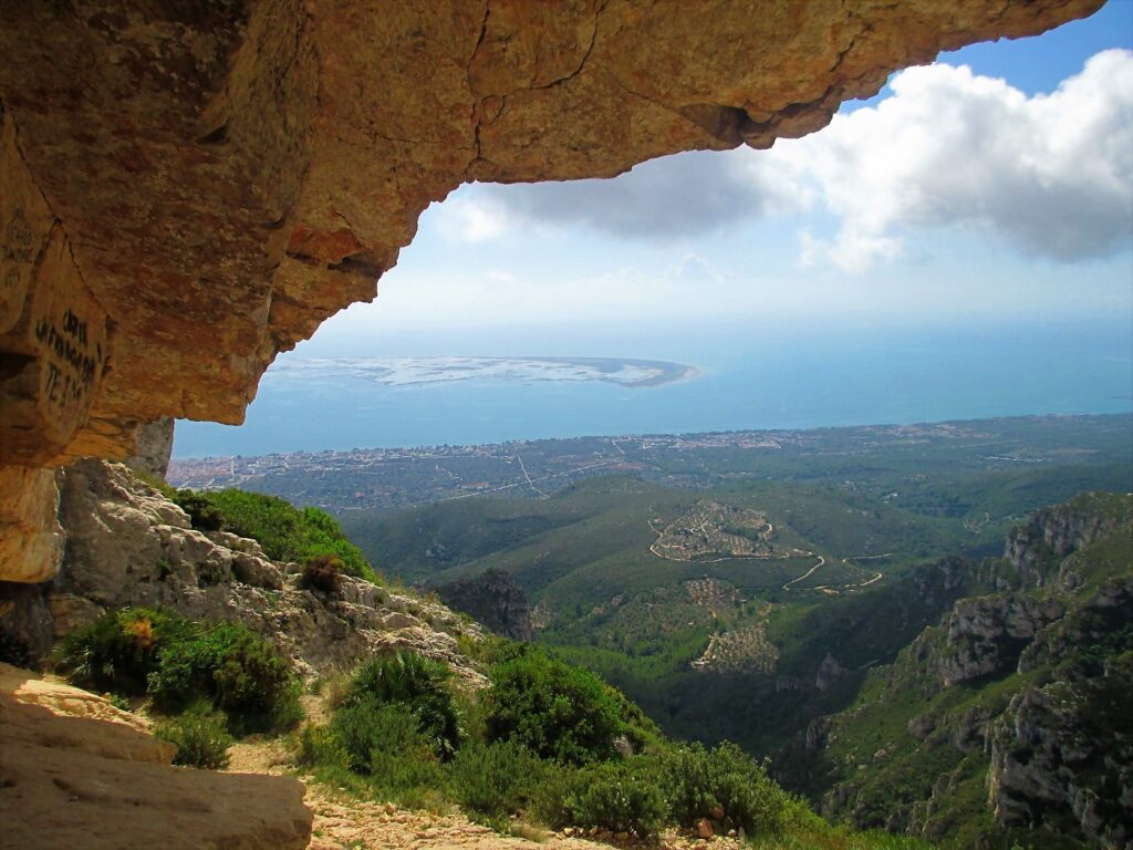
Ruta 1. Ascensión a la «Foradada» del Montsià.
Recorrido circular de unos 10 km que parte del «Área de lleure de la Mundana». Lo espectacular de la ruta es la subida por un tramo rocoso que nos permite contemplar todo el delta, hasta alcanzar «la Foradada». Por dentro de este agujero rocoso podremos contemplar gran parte del delta. La bajada nos sorprenderá con un encinar muy umbrío y la curiosa fuente del Burgar.
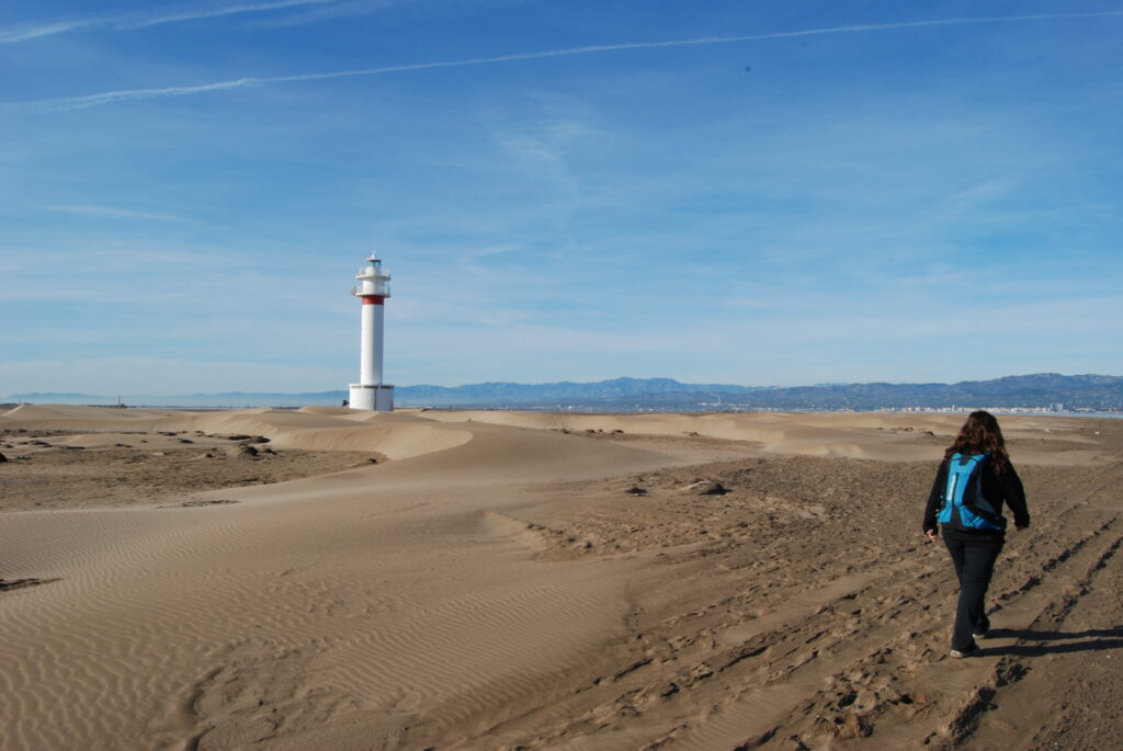
Ruta 2. Recorriendo la punta del Fangar hasta el faro.
Nuestra ruta comienza en el «Mas dels Bascos«(restaurante situado en la playa de la Marquesa, al final de la ctra. TV- 3451). Son unos 4 km por la punta del Fangar que nos permite llegar al fotogénico faro del mismo nombre. Tendremos que regresar por el mismo camino.
Ruta 3. La desembocadura del Ebro y el faro del Garxal.
Partimos de la urbanización de Riumar, desde donde iremos por zona de dunas siguiendo el GR 99 hasta el mirador Zigurat o faro del Garxal, situado en la desembocadura del Ebro con vistas a las islas de Buda y Sant Antoni. Para completar los poco más de 7 km que tiene la ruta, iremos a buscar el camino que nos llevará al «estany les Illes» y al punto de partida.

Propuesta 3: Costa central y sierras litorales barcelonesas.
Tipo de recorrido: lineal.
Inicio: Sitges.
Final: L’Hospitalet de Llobregat (Parada metro hospital de Bellvitge).
– Etapa 1: GR 92 entre Sitges y Garraf.
– Etapa 2: de Garraf a Gavà, por la Morella.
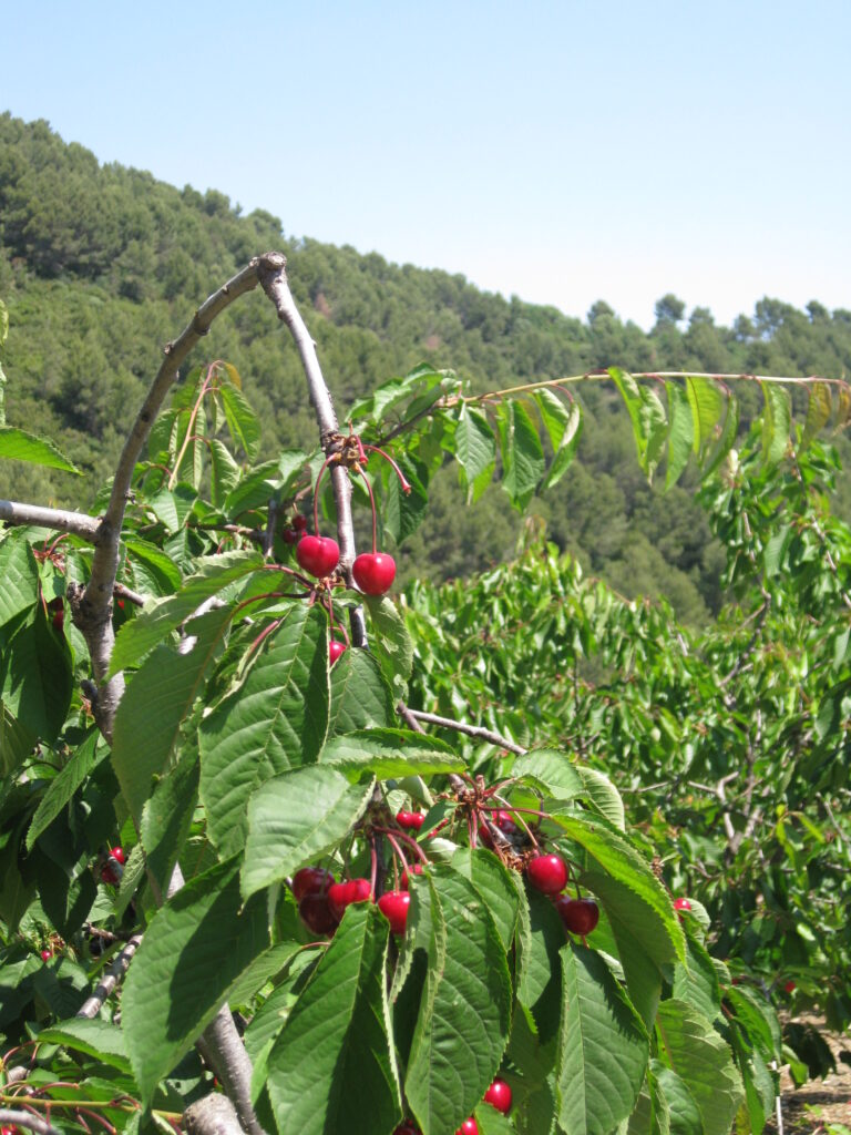
– Etapa 3: de Gavà al río Llobregat, por los cerezos del Ordal.
Con estas tres etapas por territorio barcelonés, tendrás un poco de todo. Una primera parte dominada por subidas exigentes, soledad y los paisajes abiertos del Garraf, sin olvidar miradores, calas y restos de la historia que ha dejado huella en este macizo calcáreo. La segunda parte por las montañas de Ordal es más suave, con sus cerezos, almendros, pinares y alguna población. Y ya la tercera parte, por la zona agrícola y un recorrido amable junto al río Llobregat.
Etapa 1: GR 92 entre Sitges y Garraf.
Este trozo, de casi 15 km de la etapa 22 del GR92, nos permitirá conocer la curiosa ermita blanca de la Trinitat y el pequeño núcleo de casas de Campdàsens, testigos del pasado agrícola de la zona. Caminaremos por el macizo calcáreo entre pinos, palmitos, viñas, coscojas, higueras… que nos conducirán al pequeño pueblo del Garraf con su característica cala.
Etapa 2: de Garraf a Gavà, por la Morella.
Recorrido exigente de 24 km por terreno calcáreo que partiendo del nivel del mar, nos permitirá recorrer el encajonado «fondo de Vallgrassa«, ascender al techo del macizo con sus casi 600 metros y descender por un paisaje mosaico formado por cultivos y bosque, hasta la población de Gavà.
Etapa 3: de Gavà al río Llobregat, por los cerezos del Ordal.
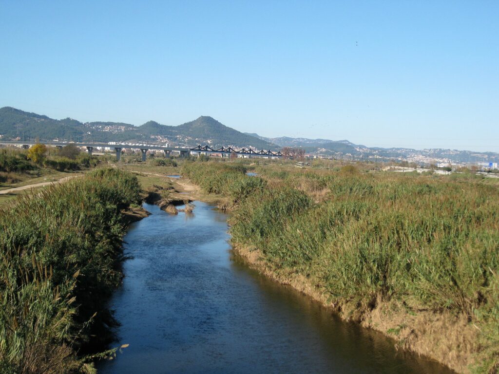
Este recorrido, de poco más de 23 km, nos llevará siguiendo las marcas del GR 92 en su primer tramo, por bosques y cultivos de cerezos de las montañas de Ordal. La segunda parte transcurre entre cultivos de alcachofas y sigue la desembocadura del río Llobregat hasta la parada de metro de Hospital de Bellvitge.
Propuesta 4: La costa central del Maresme.
Tipo de recorrido: lineal.
Inicio: Sant Pol.
Final: Tordera.
– Etapa 1: de Sant Pol a Pineda de Mar.
– Etapa 2: de Pineda de Mar a Santa Susanna, por el Montpalau.
– Etapa 3: de Santa Susanna a Tordera, por la sierra d’en Burgada.
La comarca del Maresme está formada por sierras litorales modestas, pero con pendientes acusadas que van a dar a la planicie litoral. El material geológico dominante es el granito, que se descompone en una grava especial, el «sauló», que forma las playas de la zona. Los valles, las rieras, los bosques, las cimas o las zonas agrícolas, junto a las poblaciones que aún guardan su esencia, hacen de esta, una zona con mucho encanto y belleza. Las tres rutas que os proponemos han sido extraídas del libro: «Maresme. 17 excursions a peu» y son accesibles por la línea R1 de Rodalies.

Etapa 1: de Sant Pol a Pineda de Mar.
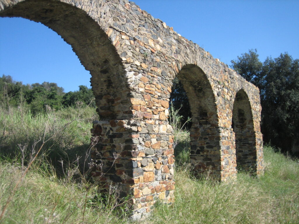
Recorrido de unos 15 km entre dos poblaciones costeras en el que podremos contemplar valles agrícolas, rieras con restos de molinos hidráulicos, hornos de cal y restos de un acueducto romano.
Etapa 2: De Pineda de Mar a Santa Susanna, por el Montpalau.
Subiremos a dos cimas, la primera, el Montpalau, dentro de la sierra del Montnegre, con restos íberos y medievales. Y la segunda, la Guàrdia, con unas vistas inmejorables. Alternaremos bosques de alcornoques, encinas y pinares, con terreno agrícola. Alguna fuente y algún resto histórico nos acompañará en los poco más de 13 km de esta ruta.

Etapa 3: de Santa Susanna a Tordera, por la sierra d’en Burgada.
Este recorrido tiene tres partes bien diferenciadas: la riera de Santa Susanna, la pequeña sierra d’en Burgada, que tendremos que franquear, y la riera de Vallmanyà, que forma un valle agrícola con el lago de Can Torrent, muy interesante para la observación de fauna. Los casi 17 km de esta etapa, los completaremos recorriendo la población de Tordera y el río del mismo nombre para ir a buscar la parada de tren.
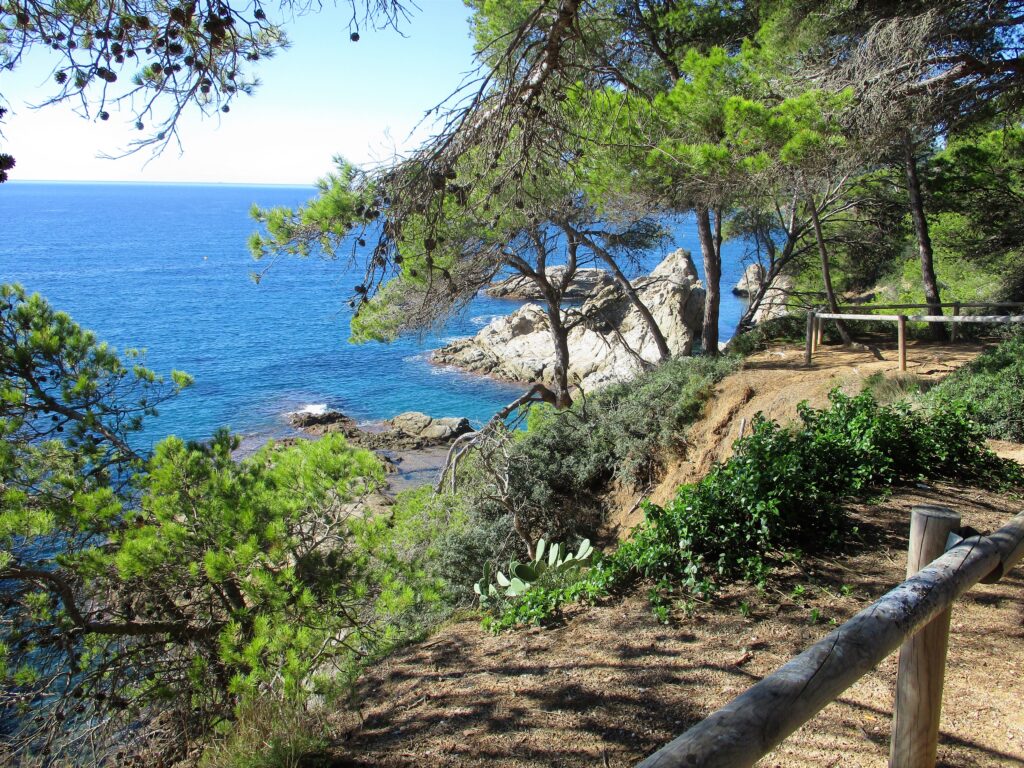
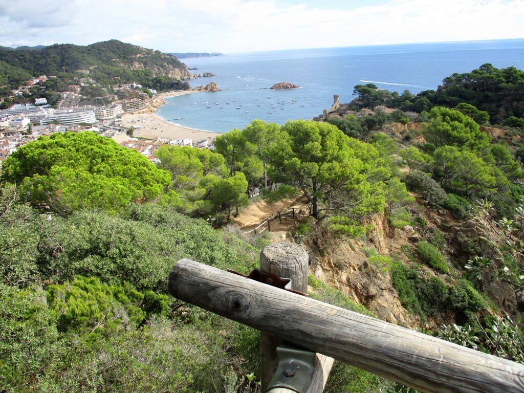
Propuesta 5: La Costa Brava, por el GR92 y el «camí de ronda».
Tipo de recorrido: lineal.
Inicio: Sant Feliu de Guíxols.
Final: Blanes.
– Etapa 1: de Sant Feliu de Guíxols a Tossa de Mar.
– Etapa 2: de Tossa de Mar a Lloret de Mar.
– Etapa 3: de Lloret de Mar a Blanes.
Y llegamos a la conocida como Costa Brava gironina. Acantilados rocosos rodeados de pinos que nos harán bajar y subir senderos cortados en las rocas, algunos empedrados y otros más expuestos. Algunos acompañados por cuerdas o estructuras metálicas para facilitar el ascenso y que seguramente nos dejarán embelesados contemplando el azul del Mediterráneo. Para esta propuesta te puedes desplazar al punto de inicio desde Barcelona con el bus de la compañía Moventis (web) y la vuelta la puedes hacer con la línea R1 de Rodalies (web).
Etapa 1: de Sant Feliu de Guíxols a Tossa de Mar.
Este primer recorrido coincide con la etapa 10 del GR92. En poco más de 20 km, recorreremos el macizo de Ardenya, subiremos al mirador del Puig Cadiretes y recorreremos pistas forestales acompañados del alcornocal, bosque dominante en este espacio natural.
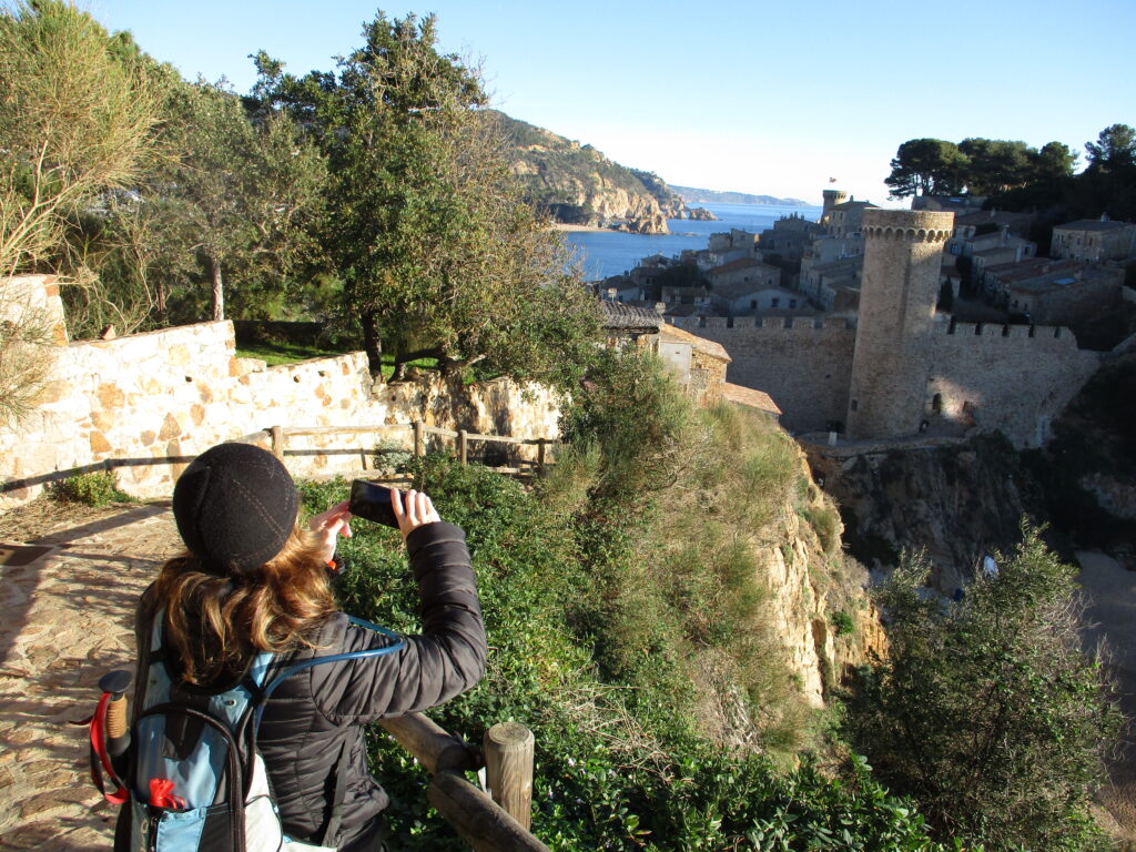
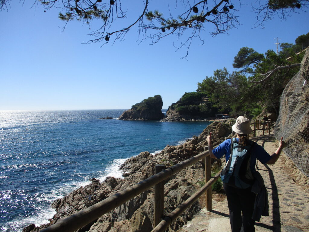
Etapa 2: de Tossa de Mar a Lloret de Mar.
A partir del casco histórico de Tossa recorreremos el camino de ronda, alternándolo con el GR 92 en un continuo sube y baja. Pasaremos por calas, caminos empedrados y miradores espectaculares. El Mediterráneo será nuestro telón de fondo en estos casi 16 km de recorrido.
Etapa 3: de Lloret de Mar a Blanes.
Calas, ermitas, jardines botánicos, miradores… nos acompañarán en este camino litoral marcado como GR 92 en su primera parte. El último tramo nos hará recorrer el casco urbano de Blanes hasta llegar a la parada de tren.