Easy" three-thousanders in the Pyrenees
Pyrenees and mountains 📩
Here 🔥The Pyrenees currently has 217 tresmiles divided into 11 sectors (125 main summits and 92 secondary summits). Of these, up to 72 are graded easy (F) and another 54 are graded (F+). In other words, in the Pyrenees there are 126 "easy" three-thousanderswhich means that more than half are affordable (in summer) for someone in good physical shape and with some previous experience in this type of terrain.
9 "Easy" three-thousanders of the Pyrenees
As we said, of those 126 three-thousanders classified as easyIn this short article, we have opted for nine well-known peaksone of those that cannot be missing in the Pyrenean curriculum.
We would like to stress that although we talk about "easy three-thousanders", they are not routes to do with children far from it. We say they are "easy" because they do not require climbing (maximum climbing grade F-F+), but you must be in good physical shape to walk uphill for many hours, know how to find your way around, overcome steep slopes or cross chaotic terrain without a path.
And remember that, even if they are "easy" three-thousanders, planning the route well before setting off, checking the weather forecast, knowing the conditions of the mountain and the snow and carrying the right equipment is obligatory.
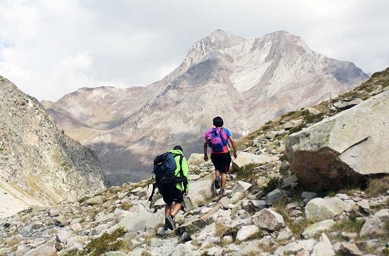
Let's get down to business, this is our selection of 9 easy three-thousanders in the Pyrenees, ideal for beginners..
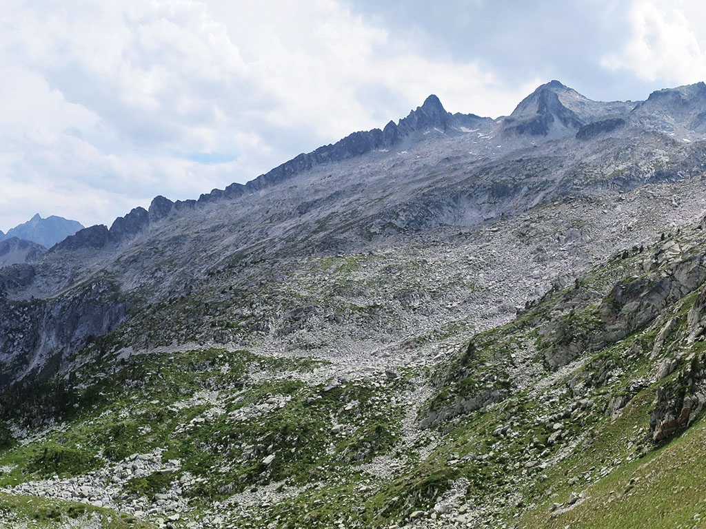
Black Garmo (3,051m)
Altitude: 3.051m
Distance: 11,2km (outward/return)
Unevenness: +/- 1.400m
Start / End: Panticosa Spa
Difficulty: no difficulty except that, having to overcome 1,400 metres of height difference in just 6 kilometres.
Recommended equipment for the summer: trekking boots or shoes, 2 sticks, GPS (optional), canteensome food, sun protection, sunglasses...
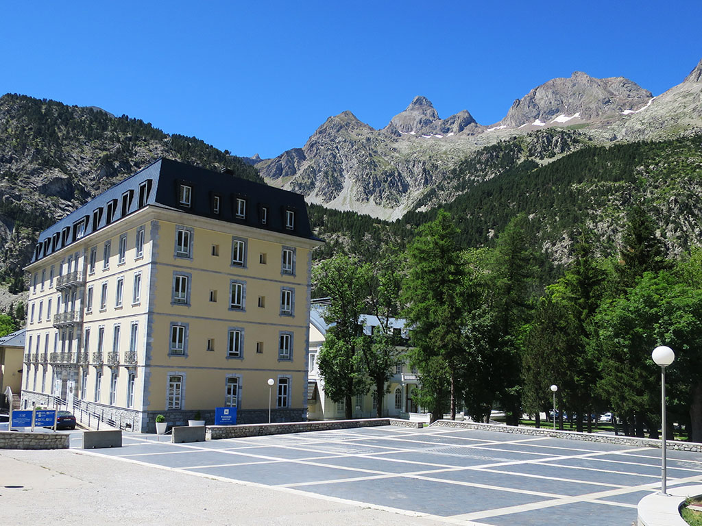
The Black Garmo (3,051m)is the highest peak of those that dominate the Panticosa Spa y one of the most accessible three-thousanders in the Pyrenees. It can be climbed during the day and due to its proximity, it is usually chosen by people from Navarre, the Basque Country or La Rioja, to be baptised with a three-thousander.
The starting point is the Panticosa Spawhere you can spend the night in the Casa de Piedra shelter. The uphill route, with a positive difference in altitude of about 1,400m, follows a marked path along which dozens of people climb every day in July and August with the same intention, to get their first locker.
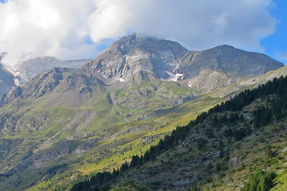
Great Tapou (3.150m) and Middle Peak (3.130m)
Altitude: 3,150m and 3,130m respectively.
Distance: 13km (outward/return)
Unevenness: +/- 1.400m
Approximate time: 7 hours
Start / End: Ossoue reservoir.
Difficulty: easy climbing
Recommended equipment in summer: Ice axe and crampons at the beginning of the season, boots, 2 poles, useful GPS.
A good option in the Vignemale massif to climb three easy three-thousanders during the day are the Gran Tapou and the Pic du Milieu (Middle Peak). They are situated at the south-eastern end of the crown of peaks that form the massif, dropping sharply down into the Ara river valley to the south. The route that starts on the Spanish side from Bujaruelo is very long and ends up joining up with the route that climbs up the Ossoue valley, the quickest way up and a good option for getting to know this valley, as we prefer the route that climbs up the Gaube valley to visit the spectacular north face of the Vignemale.
Starting under the dam of the Ossoue reservoir (1,840m), you climb up through the Lourdes hut, the Montferrat lakes, the Tapou Gap and the upper pass (3,111m), which separates the Gran Tapou (3,150m) from the Pico del Medio (3,130m) to the right. From the summit the views are impressive in any direction, however, what is most striking is the enormous marble slab of the Labaza slabs located below the Montferrat.
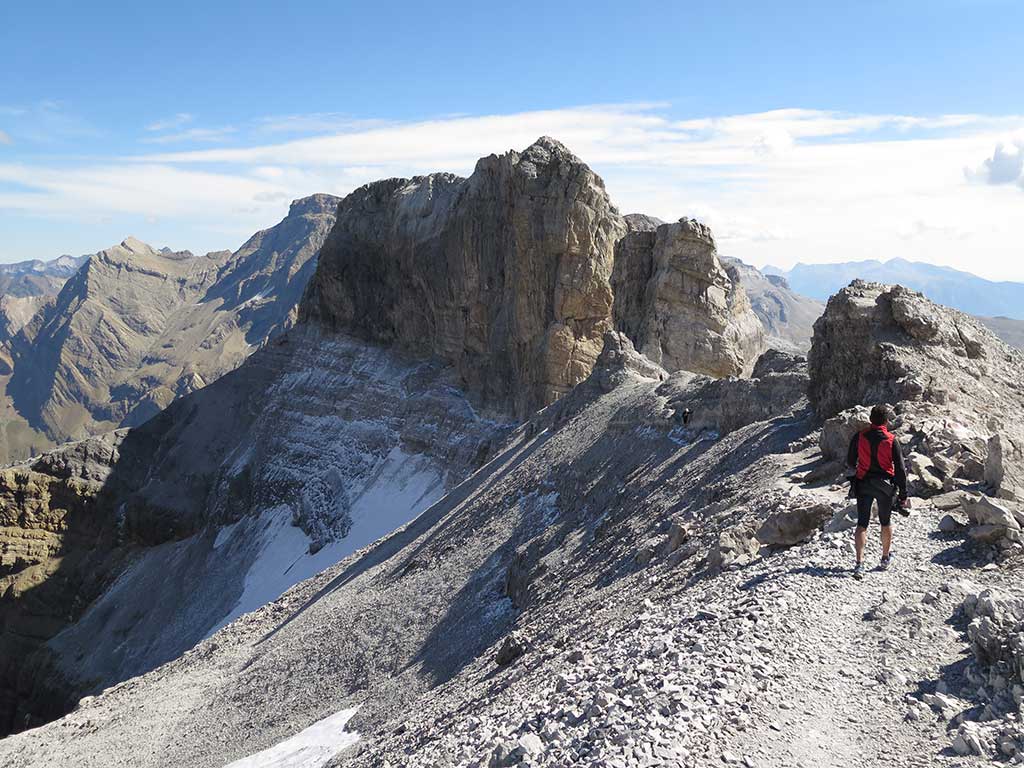
Taillon or Punda Negra (3.144m)
Altitude: 3.144m
Distance: 23km (outward/return)
Unevenness: +/- 1.870m
Start / End: Bujaruelo hut/camping.
Difficulty: from Bujaruelo is a long route. The glacier of the gap towards the French side is not very steep and from July-August onwards it is not usual to use hard material (ice axe and crampons).
Recommended equipment in summer: Ice axe and crampons needed at the beginning of the season, boots, 2 poles, useful GPS.
From Bujaruelo it is a long climb with quite a steep slope, but bearable. It is usually done in one or two days depending on the group. From Bujaruelo we climb up to the Bujaruelo pass along a comfortable path, where we join the marabout coming from the Col de Tentes car park on the French side. The path is fairly flat along this stretch and enjoys good views of the Gabietos and its meagre glacier, and of the Taillón and its no less meagre glacier. The path steepens to reach the Sarradets refuge and continues in the same vein on the way to the gap, which we cross to skirt the south side of the Bazillac peak. The final stretch along the ridge is very beautiful.
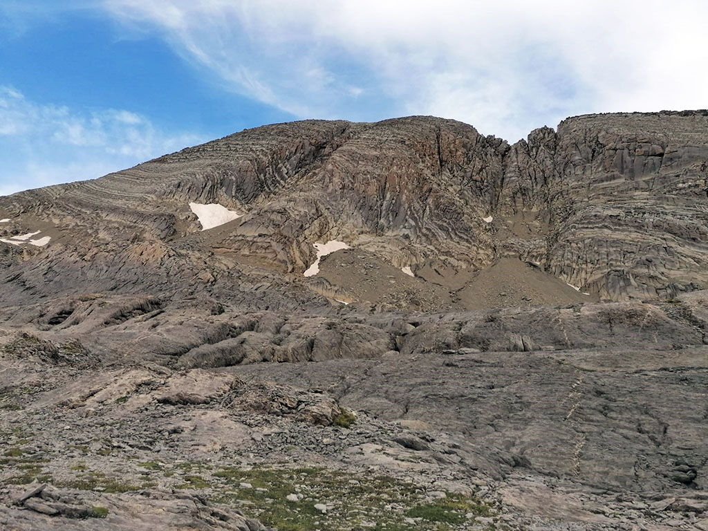
Monte Perdido (3.348m)
Altitude: 3.348m
Distance: 33km (outward/return)
Unevenness: +/- 2.200m
Start / End: Ordesa meadow.
Difficulty: When there is snow or ice, the cuspidor is a dangerous place where many accidents occur every year. In recent years, from August onwards, the snow disappears completely and the only difficulty is the gradient and the distance of the route itself.
Recommended equipment in summer: Ice axe and crampons are essential in case of snow on the spit, boots, 2 poles, useful GPS.
Monte Perdido is, together with Aneto and Vignemale, one of the three great Pyrenean peaks. So much fame has its negative side and every year thousands of people try to reach its summit. The most common ascent is via the Ordesa valley, spending the night in the Góriz refuge. The fittest can do it during the day and it is common to see people in trail shoes going up and down from Torla. For the vast majority, the route starts in the Ordesa meadow, continues through the Ordesa valley, the Góriz refuge and the frozen lake. Other normal ascents, much less travelled, are via the Vía de las Escaleras (from Góriz) and via the glacier on the north face, from the Pineta valley and Marboré lake.
Great Astazu (3.071m)
Altitude: 3.071m
Distance: 22km (outward/return)
Unevenness: +/- 1.900m
Start / End: Pineta valley car park.
Difficulty: the final stretch can be impressive for the most novice climbers. The summit is gained by a series of stepped terraces where it is necessary to use your hands (F). Apart from that, the difference in altitude is significant and to climb it during the day you need to be in good physical condition. Spending the night at the Ibón de Marboré can be an option.
Recommended equipment in summer: Ice axe and crampons needed at the beginning of the season, boots, 2 poles, useful GPS.
The Great Astazu or East Astazu has a very different perspective to the north. Towards that side it looks like twin peaks plunging into the valley with a 500-metre wall interrupted only by the famous Swan corridor.
Towards the Ibón de Marboré it shows a much friendlier side, although to get there we will first have to overcome the 1,000 metres of height difference from the bottom of the valley to the Balcón de Pineta. The path flattens out to go around the lake, a common bivouac area, and continues with our sights set on the Swan pass, which separates Pequeño Astazu (3,013m) from Gran Astazu (3,071m). To climb the Gran Astazu we will have to pass through the first one, to climb the Pequeño Astazu we turn off to the left before reaching it.
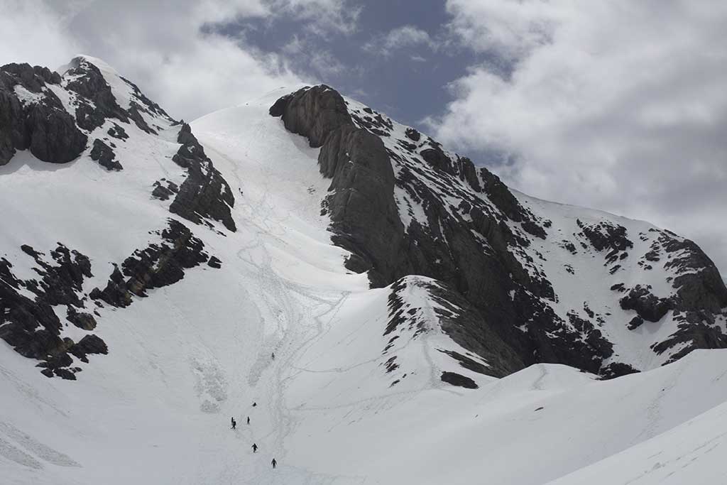
Pic de Néouvielle or d'Aubert (3,091m)
Altitude: 3.091m
Distance: 10km (outward/return)
Unevenness: +/- 1.000m
Start / End: Lake Aubert.
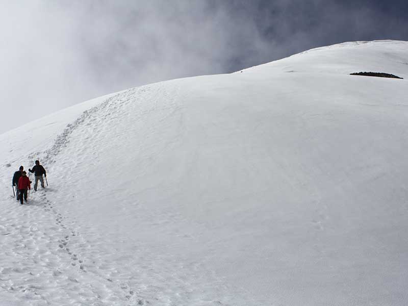
Difficulty: This is one of the most accessible three-thousanders, the reason being an approach by car to the Lac d'Aubert (2,150m) and the absence of committed climbing steps. In any case, don't attempt this ascent, it is a three-thousander. You will have to know how to find your way around, move over a terrain of boulders that is very difficult to move over, overcome a snowy ramp that may require ice axe and crampons at the beginning of the season and overcome some rocky sections where you will have to use your hands.
Recommended equipment in summer: Ice axe and crampons needed at the beginning of the season, boots, 2 poles, useful GPS.
The normal route, very popular in summer, climbs from the Lac d'Aubert to the Barris ridge and over the Barris gap. After this, the route passes through boulder-strewn terrain before revealing the large corridor that once housed the Néouvielle glacier. Now there is a long snowfield interrupted from time to time by a few rocky strips and which does not usually require the use of crampons in July and August. A passage with our hands takes us to the other side of the ridge, which is impressive and airy but simple. With a little care we make a short traverse to reach the channel that ends at the summit of the Néouvielle peak (3,091m).
Posets or Llardana (3.369m)

Altitude: 3.369m
Distance: 13km (round trip) from the refuge. 20 km (return trip) from the car park.
Unevenness: +/- 1.850m (650m to the hut and 1200m to the summit)
Start / End: Espigantosa car park.
Difficulty: ice axes and crampons may be necessary on the Fonda channel well into the summer and when the snow is hard early in the morning. Accidents due to slippers on this section are common.
Recommended equipment for the summer: boots, 2 sticksice axe, crampons, GPS (optional), canteensome food, sun protection, sunglasses...
The second summit of the Pyrenees is one of the most accessible three-thousanders and, of course, one of the most climbed.
Around the mass of the Posets or LlardanaThe Posets, whose meaning in the local language is "burnt", due to its unique ochre tones, has three strategically located refuges that allow you to go around the col in three stages, known as the Vuelta al Posets or Ruta de los Tres Refugios (Route of the Three Refuges). From any of them, Viadós, Estós and Ángel Orús or Forcau, it is possible to climb without excessive difficulty, although it is from the latter that most mountaineers climb.
The route that passes by the Angel Orús refuge and ascends the Canal Fonda starts at the Espigantosa car park (1,500m), accessible by car from Eriste, in the Benasque valley. From here, a footpath marked in white and yellow (PR-36) leads along the Eriste valley, in an hour and a half or two hours, 4 km and 650 metres of height difference, to the refuge, where it is usual to spend the night. From the refuge we follow the red and white markings of the GR11.2 path towards Viadós to leave it at an altitude of 2,550 metres, 20 minutes before reaching the Llardaneta lake. The path enters the Fonda channel, covered in snow all year round, where ice axes and crampons may be necessary until mid-summer and in the early hours of the morning, when the snow is frozen. Once the gap (3,017m) below the Diente de Llardana is gained, along a stony slope and a stretch of easy ridge the summit is reached.
Punta Alta de Comalesbienes (3.014m)
Altitude: 3.014m
Distance: 13,5km (outward/return)
Unevenness: +/- 1650m (the circular route through the Colieto valley)
Start / End: Cavallers reservoir, in the Boí valley
Difficulty: easy climbing
Recommended equipment in summer (no snow): Boots, 2 poles, useful GPS.
The Punta Alta de Comalesbienes is the highest point of the nucleus of summits to the east of the Cavallers reservoir. The usual starting point is the car park below the Cavallers reservoir dam. The start, after a few comfortable metres on a track, is quite steep until the Pas de l'Oso. Then the slope decreases and the valley opens out into the lake basin in which the Estanys de Comalesbienes. The climb becomes serious again from Estany Gelat. The milestones are divided, to the left they will lead us along the ridge to the Pic de Comalesbienes, separated from the Punta Alta by an airy but easy gap that we will have to climb; to the right, the milestones will lead us to the small pass that opens up between the two peaks. The final ridge to the Punta Alta presents no significant difficulties.
The quickest way down is by the same route. If you want to put the finishing touch to this route, which is highly recommended, you can go down towards the Colieto Valley and continue to the Ventosa and Calvell shelter. The descent to this side is steep and we must pay attention to the milestones so as not to embark unnecessarily. The slope decreases as we lose altitude. The Estany de la Roca is a good place to rest. Afterwards, once at the bottom of the Colieto valley, we continue up and down to the refuge. Joan Ventosa i Calvell. From here the descent into the Cavallers reservoir is self-evident and without difficulty.
Pica d'Estats (3.143m)
Altitude: 3.143m
Distance: 18km from the Vallferrera ref. (round trip)
Unevenness: +/- 1680m
Start / End: VAllferrera shelter
Difficulty: There are no climbing steps. The main difficulty is, as always, the distance and the difference in altitude.
Recommended equipment in summer (no snow): Boots, 2 poles, useful GPS.
La Pica d'Estats is the roof of Catalonia and that is reason enough to want to reach its summit. Of all the Pyrenean massifs where the three peaks are concentrated, this is the most easterly and also the most remote. The ascent to the Pica d'Estats is usually done mainly by the following routes two routes; from the south via the Vallferrera and from the north via the Etang du Pinet refuge.
On the southern slopethe reference point is the Vallferrera refugeThe access is by an 11 km track from Àreu and a 15 minute walk.
From the refuge, the itinerary flanks the slopes of the Pic d'Areste to the left and enters into the Sotllo ravine. The road ascends on the left side, halfway up the slope, to the Plans de Sotllo. Next, another step on the left side (right bank of the ravine) is climbed to reach the Sotllo Lake and subsequently the Estany d'Estats. The slope steepens considerably from here onwards to gain the Port de SotlloThis is the hardest section of the entire route. To reach the summit, the normal route descends a hundred metres down the northern slope and then ascends eastwards towards Montcalm and then turns southwards towards Pic Verdaguer and the Pica d'Estats.
From the northern slope the climb starts at just 1,200m, at L'Artigue. On the first day of the route, which is usually divided into two days, you climb up to the refuge of the Etang du Pinet (2.250m). The next day we climb the Cometa d'Estats ravine until Etang d'Estats and is followed to the left (E) to the Etang de Montcalm. From here it turns south again up the slope to the Col de la CoumetteThe route links up with the Port de Sotllo route at an altitude of 2,900 metres, very close to the Pica d'Estats (3,143m).
Recommended books:

You may be interested in:
If you are thinking of achieving your first 3,000m in winter, these 9 ascents are perfect for beginners: Garmo Negro, Aneto, Perdiguero,...
Fastpacking is not about going faster. It's about going lighter.
If you come from classic trekking, this is the next step: learning to move with less weight,
more fluid and enjoying every kilometre more.
Join the Outsiders Newsletter and start discovering what lightness feels like.
There are a few more peaks that could be considered "easy" that are not on this list.
For example the Campbieil and the Estaragne, which are in the Cap de Long area, in the Pyrenees (near the Bielsa tunnel). I know they are easy because they are the first ones I climbed. There are no difficulties except that it is long (about 7-8 hours).
Here is a link to that upload I found:
http://www.pirineos3000.com/servlet/DescripcionAscension/MONTANA–Campbieil–IDASCENSION–11003–VOLVER–H–PESTANA–1–PESTA–home–ITERACION–1.html