Trekking y ascensión al Toubkal en Marruecos

Pirineos y montaña 📩
Aquí 🔥El Jbel Toubkal (4.167m), en Marruecos, es la montaña más alta del Atlas y de todo el norte de África. En el macizo del Toubkal se concentran la mayoría de cuatromiles del Atlas, 11 de 14, los otros 3 se encuentran en el del M’Goun.
Marruecos y la cordillera del Atlas siguen siendo un lugar por descubrir, a un paso de casa y en el que podremos vivir algunos de los mejores trekkings y ascensiones de África.
Camino de Santiago 101
Una guía rápida en inglés para preparar tu primer Camino de Santiago: qué ruta elegir, cuántos días necesitas, cómo organizar la mochila y cómo pasar de “algún día” a tener un plan real.
🟡 Camino 101 para principiantes
🥾 Consejos prácticos para elegir ruta, fechas y mochila
📍 Comunidad gratuita guiada por un local del Camino Francés
💬 Preguntas y respuestas dentro de Skool
La Cordillera del Atlas
El Atlas es una gran cordillera de 2400kms que recorre el noroeste africano, desde Túnez hasta Marruecos atravesando Argelia. Los mayores picos se concentran en el Atlas marroquí. En este país la cordillera se divide en tres: Atlas Medio, Alto Atlas y Anti Atlas. El macizo del Toubkal se encuentra en la parte occidental del Alto Atlas.
El Jbel Toubkal
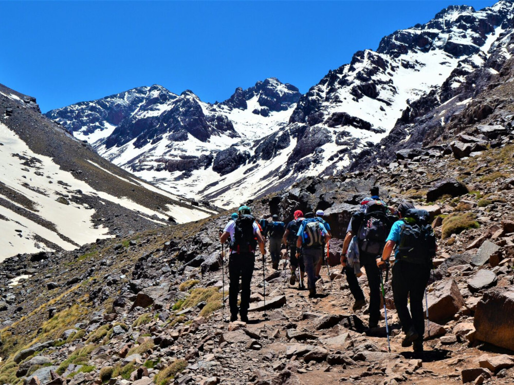
La ascensión al Jbel Toubkal (4167m) ofrece, más allá de la satisfacción de superar la barrera de los 4.000 metros, recorrer un territorio salvaje, con profundos valles habitados por pueblos bereberes y montañas de afiladas crestas en las que la nieve permanece durante gran parte del año.
Aunque habitualmente se suele hacer la subida al Jbel Toubkal como un recorrido de ida y vuelta desde Imlil, el macizo tiene muchas posibilidades para hacer travesías y subir otros cuatromiles fáciles como el Ras (4083m), el Timesguida (4089m), el Afella (4043m) o el Akioud (4030m).
La subida al Jbel Toubkal desde Imlil no es una ruta técnicamente difícil y está al alcance de cualquiera que se encuentre en una forma aceptable y escoja una época favorable para su ascensión. La falta de aclimatación a la altura no suele suponer un problema, ya que el tiempo que se está a 4.000m es bastante corto. Aún así, no conviene subestimar esta circustancia.
Rutas de ascensión al Toubkal:
Desde Imlil:
La ruta más transitada es la que sube desde la vertiente norte, y que comienza en el pueblo de Imlil (1740m). Desde aquí la ruta asciende siguiendo el valle del Oued Rheraya hasta el refugio Toubkal / Les Mouflons (3.200m), en unas 4 o 5 horas de caminata. En Imlil es práctica habitual contratar una mula y arrieros para subir las mochilas. Nada más llegar os la ofrecerán. Tened en cuenta que para muchos de ellos es la única forma de salir adelante en un lugar como este.
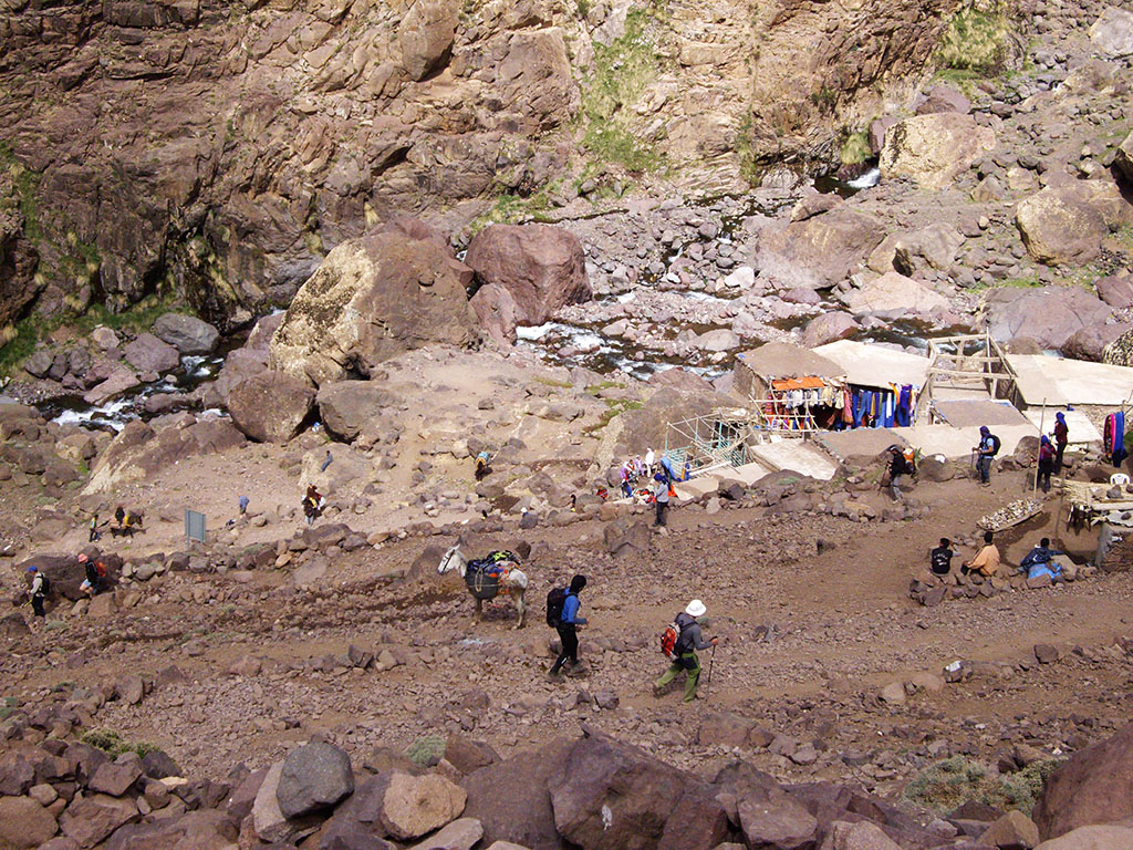
Dependiendo de la época del año podréis encontrar nieve, excesiva en invierno, nada en verano. La Semana Santa es una de las épocas más concurridas por los turistas españoles. Aún no hace calor para hacer algo de turismo por la zona, los días son bastante largos y el Toubkal tiene un manto blanco que le da un ambiente más alpino.
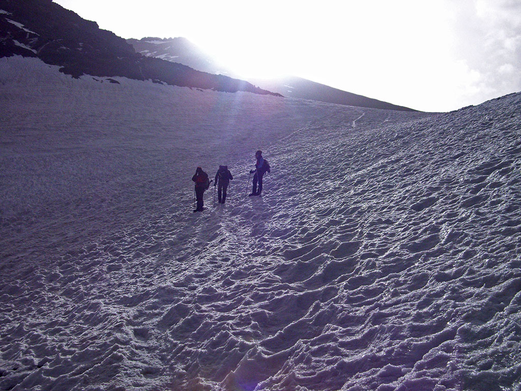
Si váis en una época en la que haya nieve, a partir del refugio Toubkal probablemente harán falta los crampones. La subida no tiene ninguna dificultad técnica pero la pendiente es bastante mantenida y a esta altura el aire comienza a notarse enrarecido.
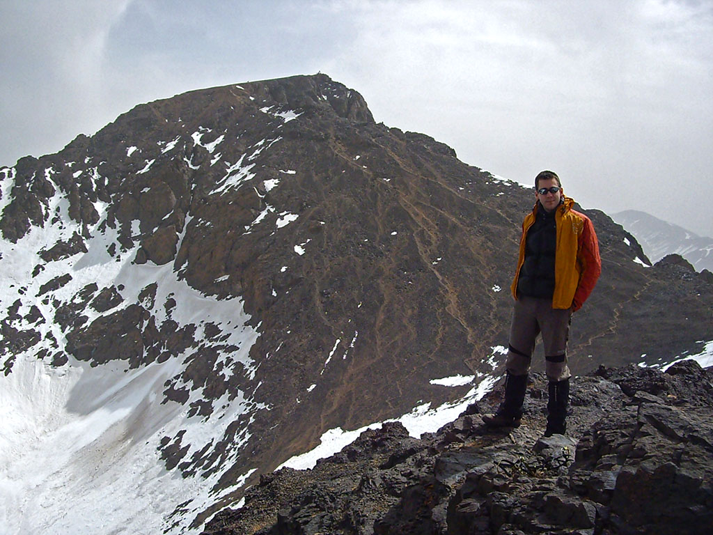
Los coleccionistas de cuatromiles pueden desviarse a la derecha, a unos 3850m de altura y coronar el Toubkal Oeste (4.030m) antes de alcanzar el Jbel Toubkal (4.167m). Para el descenso, una opción para hacer un recorrido circular hasta el refugio es, bajar hacia el Pico Imouzzer (PD; 4.010m) y después girar a la izquierda en dirección al refugio del Toubkal. Esta ruta pasa por los restos de un avión accidentado.
Desde Imlil por el Refugio Lepiney:
Una ruta para conocer más a fondo el macizo y recorrer el valle que discurre paralelo al de Oued Rheraya es subir al refugio Lepiney. Este recorrido añade un día más a la ascensión al Toubkal, pero permite realizar un recorrido circular y conocer otros valles. Esta ruta se une a la ruta anterior desde Imlil en el refugio del Toubkal (3.207m), aunque para llegar allí habrá que superar la barrera montañosa que separa ambos valles. La ruta más frecuentada hace un rodeo por el norte, a través del collado del Aguelzim (3500m). La ruta más directa asciente al Tizi n’Tadat (3800m) y presenta una ocasión inmejorable para ascender al Biiguinnoussene (4002m), si bien, la bajada al refugio del Toubkal / Les Mouflons presenta un corredor de 40º de inclinación que deberemos tener presente.
Por el Lago d’Ifni:
Ruta mucho menos transitada pero muy interesante para conocer la vertiente sur del macizo. En este caso, el punto de partida es la aldea de Imhilene, en el valle de Imenane. Desde este lugar comienza un ascenso bastante duro hasta el lago d´Ifni (2.319m), donde se acampa, para continuar al día siguiente por el Toubkal Oeste hasta el Jbel Toubkal.
Datos prácticos
Cómo llegar a Imlil
Para llegar a Imlil (a 67 kilómetros de Marrakech y una hora y media de coche), la manera más barata es tomar un autobús en Marrakech. El autobús llega hasta la población de Asni y desde allí se toma un taxi u otro vehículo hasta Imlil (10kms). Otras formas de llegar son tomando un taxi particular o tipo combi colectivo, o alquilar un coche.

Mejor época:
La temporada ideal va de primavera a otoño. Las vacaciones de Semana Santa son temporada alta de españoles y un buen momento para viajar a este lugar. En esta época la nieve aguanta por encima de los 2600m-2800m y le da un cierto carácter alpino a estas montañas. En verano la nieve deja paso a la roca y hace demasiado calor para hacer turismo por Marruecos, aunque no precisamente en el Toubkal. El invierno no es la opción recomendable por la enorme cantidad de nieve y hielo, salvo que sea precisamente eso lo que estemos buscando.
Otras recomendaciones e información importante:
Es obligatorio llevar un guía local oficial para ascender al Toubkal por la ruta clásica desde Imlil desde 2019, una normativa impuesta tras incidentes trágicos, con controles de la Gendarmería Real, aunque la ruta no es técnicamente difícil, la seguridad y la logística
Además de todo esto, hay que prestar especial atención al equipo necesario (piolet y crampones según la época), contratar un seguro básico de viaje/montaña y reservar en los refugios.
Bibliografía recomendada:


TE PUEDE INTERESAR:
Los mejores trekkings y ascensiones de África »
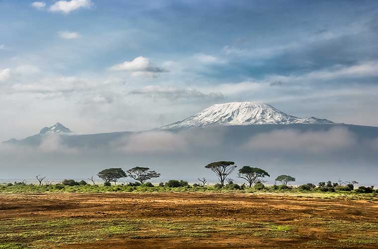
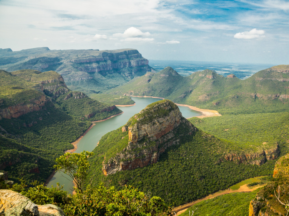
Otros lugares para hacer trekking en África: Marruecos | Sudáfrica | Tanzania |