9 winter ascents in the Pyrenees to "easy three-thousanders".
Pyrenees and mountains 📩
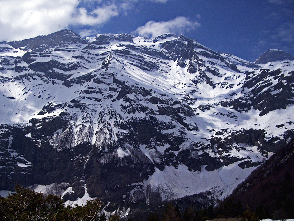
Here 🔥From Orhi to Canigó, from the end of autumn to the beginning of summer, the Pyrenees offers 300 kilometres of uninterrupted snow-capped peaks. The number of routes that can be climbed is inexhaustible and the temptation to determine the 9 best winter ascents is simply a chimera. However, these 9 proposals that we bring you, we can say that they are among the best ones. easy" winter ascents of three-thousanders in the Pyrenees for beginners in the high mountains. And among them, the most renowned summits could not be missing: Aneto, Monte Perdido, Vignemale, Punta Alta or Perdigueroamong others.
The routes described follow roughly the "normal" routes of ascent in summer. These routes sometimes have the most exposed sections on the approach itself, in places that may go unnoticed during the summer, such as a sloping hillside. Sometimes it is preferable to abandon the route in summer and start the ascent in places that are less exposed to avalanches.
Highlighted by the editor

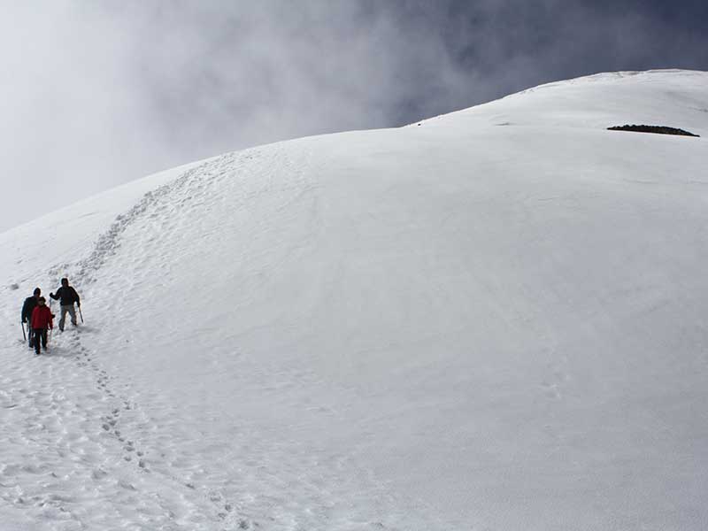
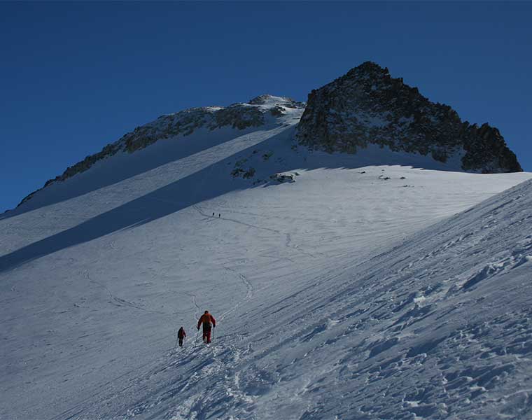
Remember that although technically they are not the most complicated, they do require a high physical level and a lot of experience in winter mountaineeringand in the use of the ice axe, crampons and rope in some cases. At this time of year the mountain shows its wildest side and even the easiest routes can become an exciting and dangerous adventure.
Do not start any of these routes without knowing the recommendations for safe winter mountaineering. Train yourself in mountain techniques, hire a guide if necessary, practise the self-detention techniques and learns what to do in the event of an avalanche.
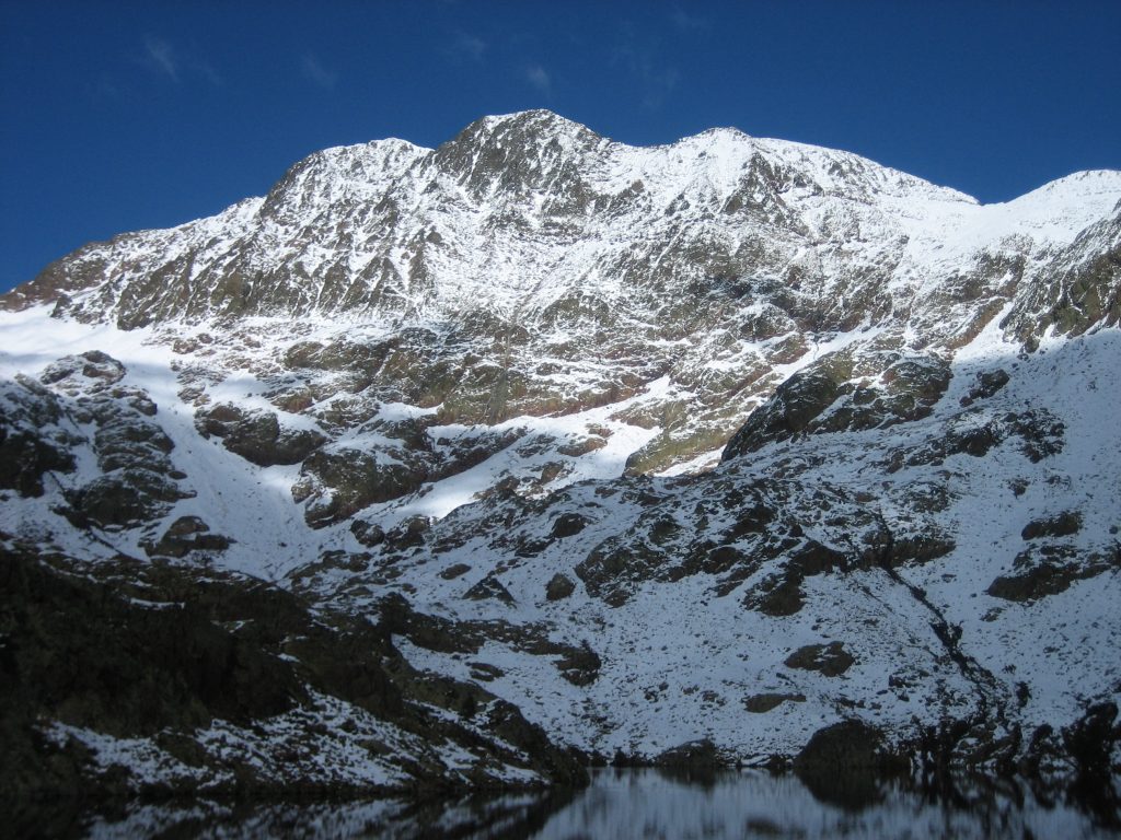
1. Black Garmo (3,051m)
The Black Garmo (3,051m)is the highest peak of those that dominate the Panticosa Spa y one of the most accessible three-thousanders in the Pyrenees. It can be climbed in a day and can be perfect for beginners to winter mountaineering, if you have already climbed others at lower altitudes.
The starting point is the Panticosa Spawhere you can spend the night in the Casa de Piedra shelter. The ascent route, with a positive difference in altitude of about 1,500m, roughly follows the usual route used by hundreds of people in summer, which is not technically difficult at that time of year. In winter, with hard snow, it will be necessary to use the use of ice axes and cramponsas on any route at this altitude. The maximum gradient ranges from 35º and 40º..
2. Vignemale (3.298m)
The Gran Vignemale or Pique Lonque, at 3,298 metres, is the highest peak in the French Pyrenees. It is an incomparable massif within the Pyrenees, despite its small size. The north face looks like something out of the Alps and its eastern slope has the only glacier with a tongue in the Pyrenees. The ascent can be made from Spain or from France.
The routes through the Spanish side are technically and physically challenging and require preparation and experience of winter climbs. These routes are beyond the scope of this article. and to be undertaken only by experienced mountaineers. The starting point is San Nicolas de Bujaruelo and two days are needed for the ascent-descent. The first option is by the Moskowa Corridor (AD-). On this route we will find slopes of 50º and grade III climbs. The corridor ends at the Lady Lyster col, to the east of Cerbillona peak and to reach Pique Lonque, we still have to cross the glacier and tackle the last few metres of mixed (I+). The second option via the Cerbillona corridor (PD+) It is not easy either. It is a very wide corridor, with a 1,000m difference in altitude, which ends to the north of the Cerbillona peak.
The climb from the French side is not so technical, although it is not without difficulty. It also requires at least two days. The route from the Ossoue reservoirThe shortest route in summer is affected by the road closure.
From Pont d'Espagnethe route climbs first to the refuge Oulettes de Gaube and then by the Hourquette d'Ossoue to the shelter of Baysellancewhere you can spend the night. The route continues to the base of the glacier, where it joins the Barrage d'Ossoue route, after crossing a steep and exposed slope. When approaching from one side or the other, extreme precautions should be taken due to the possible risk of avalanches, and the walk should not be started if this is recommended. The ascent through the glacier is easy and only in the final part will we encounter difficulties that will depend on the state of the snow. Slopes of 45º and mixed (I+).
A alternative to the Gran Vignemale is the Petit Vignemale (3.032m)It is much more accessible than its big brother. It is the first peak of those that make up the impressive wall of the north face. It can be climbed without particular difficulty from the Hourquette d'Ossoue (2,734m), between the Oulettes de Gaube hut and the Baysellance hut.
Another alternative accessible from the Ossoue valley are the Grand Tapou (3,150m) and the Pic du Milieu / du Milieu (3,130m).
3. Taillon (3,144m)

The winter ascent to the Taillon (3,144 metres) from San Nicolás de Bujaruelo is long, more than 20 kilometres in total, but with a relatively low technical difficulty. If you are physically well prepared, but have no experience in high mountains, this is a good option to get started. Always in the company of someone more experienced and having previously done other peaks of lesser importance. Once the Puerto de Bujaruelo pass has been climbed, the route passes through beneath the imposing north face of the Taillon to the refuge of la Brèche de Roland / Les SerradetsA good place to spend the night and divide the climb into two days.
From the refuge you can see the famous Rolando GapWe head up a steep slope but without excessive risk of falling. Once we have passed the gap, the path flanks the southern slope of the great wall of Bazillac Point, until we reach the false dichotomy. This steep traverse is the most difficult part of this route. Access to the summit is wide and uncomplicated, except in winter.
4. Monte Perdido
The Monte Perdido (3.355m)in the Ordesa y Monte Perdido National ParkThe winter climb, following the normal route along the normal route, needs no introduction. The winter ascent, following the normal route on the Ordesa valley and the Góriz refugeIt is not very difficult until the end. The last stretch of the ascent by The Spittoon is technically difficult, and is one of the black spots in the Pyrenees.. The slope is around 45º and usually remains frozen until the beginning of summer. The name comes from the fact that in the event of a fall it spits you out into a cut. If you add to this the fact that it is one of the most visited summits, in many cases by people with little experience, the cocktail is explosive.
At winter conditionsThe most common way to start the journey is at the Ordesa Car Park / Ordesa Meadow. The first day's approach to the Góriz refuge can be relatively pleasant if the snow allows it. The route goes through the Ordesa valley passing by some spectacular places such as the viewpoint over the Ordesa mountain. Arripas waterfallTheascadas de la Cueva y el Estrecho (Cave and Strait of Gibraltar)the Gradas de Soaso, la Horsetail and the Soaso pegsthat in winter it is preferable to avoid, extending the arrival at the refuge by half an hour.
The summit is tackled the following day, and although the difference in altitude is just over 1,100m, it requires physical preparation, especially if you want to return to the car the same day. On the last stretch of the ascent is the famous cuspidor (45º), which we have already mentioned, and which is the key point of the ascent.
The route from the Pineta valley is not recommended in winter because of the enormous risk of avalanches on the Pineta balcony.
5. Perdiguero peak (3.222m)
This important peak of 3,222 metres is located in the Posets-Maladeta Natural Park. Although the technical difficulty of the terrain is not high, it is necessary to know how to use the ice axe and crampons, essential safety elements for this type of ascent. The route from the Benasque valley begins in the Lliterola bridge (1.600m). The beginning of the route runs along a path through forest that soon disappears. The route continues into the Lliterola valley, under the watchful eye of Perdigueret Peak, always on the right-hand slope, facing south. It is important not to go up the other side, as at the end there are some cliffs that close off the path. Once you reach the Lliterola lakeThe easiest way is to climb up the left-hand slope until you reach the top ridge.
6. Aneto (3,404m)
The roof of the Pyreneeswith its 3,404 metresIt is undoubtedly one of the most visited and most prestigious summits in the whole Pyrenean chain. It is located within the Posets-Maladeta Natural Parkin the heart of the Cursed Mountains. Its endless granite ridges, where the highest concentration of three-thousanders can be found, the glaciers that are still preserved and the weight of history, make it a place where the supreme summit of the Pyrenees.
The easiest and most travelled route runs along the northern slope, through the Portillón Superior.It is the same as the one used in summer. However, ski touring enthusiasts will prefer to use the downhill route on the Barrancs valleywhich has become a ski mountaineering classic with its 1,400m descent to the Plan d'Aigualluts, which is usually skiable until June.
From the La Renclusa mountain hut it climbs in a southerly direction to the Topside Doorto descend to the Aneto glacierwhich is crossed without major difficulties until it is under the peak of Aneto. On the last stretch to the top, the slope increases without posing any serious problems if you are well equipped. Once there, there are only a few more metres to go before you reach the top, in the middle of which is the Mohammed Bridge (F). In summer, it is a horizontal passage over blocks of about 15 metres, with very good grips, but which can be impressive due to the drop on both sides. In winter it is the same but with cold, gloves, crampons and covered in snow and ice.
7. Tuc de Molières (3,009m)
![Pic de Mulleres / Photo: Andreube [CC0]](https://travesiapirenaica.b-cdn.net/wp-content/uploads/2018/11/PicdeMulleres_by-Andreube-Public-domain-o-CC0-via-la-Wikimedia-Commons_800x600.jpg)
The Tuc de Molières (3,009m)The Huesca-Terrassa tunnel, on the border between Huesca and Lleida, is a perfect option to get started in this type of ascents and achieve our first three-thousandth winter ascent. The two main access routes run from the Besurta and from the Hospital de Vielha, next to the southern mouth of the tunnel.
The easiest way to reach the summit is from the western slope, from the Besurta.. Russel, after his conquest in 1879, claimed that it was possible to reach the summit on a donkey. In winter, carry ice axes and crampons..
From the Besurtathe route goes to the Plan d'Aigualluts and continues along the Escaleta valley and the la Escaleta lakes (2,330m) along an obvious route. It continues in a southerly direction passing the Mulleres lakes and continues towards the pass between the Tuca de Ixalenques and the Tuc de Molières. Long before reaching the pass, we turn off to the left to reach the top by easy slopes.
The route from the Vielha tunnel is more complicated, as it goes through a fairly steep slope up to the col of Mulleres and overcomes a air ridge of blocks (PD as a whole).
8. Punta Alta de Comalesbienes (3.014m)
The Punta Alta de Comalesbienes is the highest point of the nucleus of summits to the east of the Cavallers reservoir. The starting point is at one of the bends in the track leading to the reservoir, but in winter, because of the snow, it is usually cut off. If we find snow from below, the ascent by the Comalesbienes ravine until Pas de l'OsoThe slope of the valley is already quite steep. Then the slope decreases and the valley opens up into the lake basin in which the Estanys de Comalesbienes. The climb gets serious (45º-50) to reach the small pass just to the left of the Punta Altawhich links it with the Pic de Comalesbienes. The ridge to reach the top is not difficult but it is quite steep and slipping is forbidden.
The fastest descent is by the same route. If you want to put the finishing touch to this route, you can descend towards the Colieto Valley and spend the night in the Ventosa and Calvell shelter. The first downhill stretch from the summit, following the ridge that falls to the north, is the most delicate one.and a second ice axe will come in handy. Afterwards the ridge becomes wider and less exposed until the coll Arenos. From here, the slope decreases until it reaches the bottom of the Colieto Valleywhich we will follow along horizontal terrain to the refuge. Joan Ventosa i Calvell to spend the night there. The descent to the Cavallers reservoir is self-evident and without difficulty.
9. Pica d'Estats (3.143m)
La Pica d'Estats is the roof of Catalonia and that is reason enough to want to reach its summit. Of all the Pyrenean massifs where the three peaks are concentrated, this is the most easterly and also the most remote. The ascent to the Pica d'Estats is usually done mainly by the following routes two routes; from the south via the Vallferrera and from the north via the Etang du Pinet refuge.
On the southern slopethe reference point is the Vallferrera refugeThe access is by an 11 km track from Àreu and a 15 minute walk.
From the refuge, the itinerary flanks the slopes of the Pic d'Areste to the left and enters into the Sotllo ravine. The road ascends on the left side, halfway up the slope, to the Plans de Sotllo. Next, another step on the left side (right bank of the ravine) is climbed to reach the Sotllo Lake and subsequently the Estany d'Estats. The slope steepens considerably from here onwards to gain the Port de SotlloThis is the hardest section of the entire route. To reach the summit, the normal route descends a hundred metres down the northern slope and then ascends eastwards towards Montcalm and then turns southwards towards Pic Verdaguer and the Pica d'Estats.
From the northern slope the climb starts at just 1,200m, at L'Artigue. On the first day of the route, which is usually divided into two days, you climb up to the refuge of the Etang du Pinet (2.250m). The next day we climb the Cometa d'Estats ravine until Etang d'Estats and is followed to the left (E) to the Etang de Montcalm. From here it turns south again up the slope to the Col de la CoumetteThe route links up with the Port de Sotllo route at an altitude of 2,900 metres, very close to the Pica d'Estats (3,143m).
Fastpacking is not about going faster. It's about going lighter.
If you come from classic trekking, this is the next step: learning to move with less weight,
more fluid and enjoying every kilometre more.
Join the Outsiders Newsletter and start discovering what lightness feels like.