Saioa (1,418m) from Lantz via Loiketa (1,138m), Algorrieta (1,160m), Okolin (1,360m), Zuriain (1,411m) and Iturrondo (1,340m).
Pyrenees and mountains 📩
Here 🔥Circular route from Lantz to climb Saioa, the main summit of the group of mountains between the Velate and Artesiaga passes. The route climbs up to Loiketa (1,138m) following the Camino de Santiago del Baztán for the most part. From here, each of the rounded peaks that make up the summit range are linked in this order: Algorrieta (1,160m), Okolin (1,360m), Saioa (1,418m), Zuriain (1,411m) and Iturrondo (1,340m). The descent to Lantz is via the Txorrostarri ravine, a magical place inhabited by the Basajaun.
The Saioa
The Saioa is one of the main peaks of the Navarrese mountains. It is the highest in the Baztan valley and the highest in the group of mountains between the Velate and Artesiaga passes. Its dominant position on the watershed and its proximity to Pamplona make it a much-loved and much-visited summit.
The most common starting points are two: the Velate pass and the Artesiaga pass, the latter perhaps too close for those who like to put one foot in front and then the other. Less frequented are the climbs from Baztan, which are of great magnitude due to the 1,200m of height difference on this side, and from Lantz, from where we suggest you do this excursion that links several of the most representative peaks in the area, riding over beautiful green ridges.
In addition to Saioa, there are several important summits in this area that you can add to the party from any of the more usual routes. The most interesting are: Gartzaga (1,291m), Okolin (1,360m), Zuriain (1,411m) and Erregerena (1,239m).
Map:
Downloadable:
> Download Track
Technical specifications:
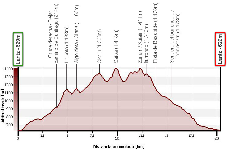
Distance: 20,4kms.
Cumulative difference in altitude: +/- 1.200m.
Timetable: about 7 hours. Walking time non-stop: 5h45min.
Water: There is a fountain in the square. On the way up to Okolin there is a spring. On the way down we cross several streams.
Difficulty: long route to which the accumulated difference in altitude between peak and peak is added.
Recommended equipment: boots or slippers, two walking sticks, GPS recommended for getting around the labyrinth of paths in the forest, canteen.
How to get there:
See in Google maps.
To get to Lantz from Pamplona, follow the N-121-A until kilometre 23, where there is a turning on the right that indicates Lantz.
Itinerary:
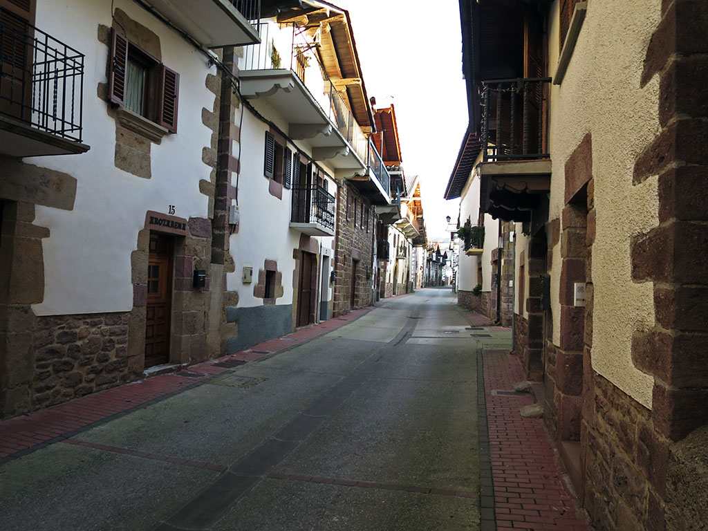
(0h00min; 0,0kms) Lantz - Plaza (629m). The route starts by the church of Santa Cruz, where you find some parking place for your car. You start by following the main street (de Santa Cruz) to the end of the village (0h03min).
Straight ahead is the path back to Lantz, and to the left, the one we have chosen for the ascent. The path is marked with yellow arrows in the opposite direction to the direction of the walk, as it is the Camino de Santiago de Baztán. They will accompany us for the first hour of the route. Shortly after leaving Lantz you take a junction to the right (0h07min) and another one just after (0h08min). The path soon leaves the meadows behind and enters a vast beech forest. At a crossroads (3,1kms; 0h46min) you take the path to the right, marked in yellow. This is followed by an uphill stretch before you reach the crossroads where you leave the Camino de Santiago for good, and head uphill to Loiketa.
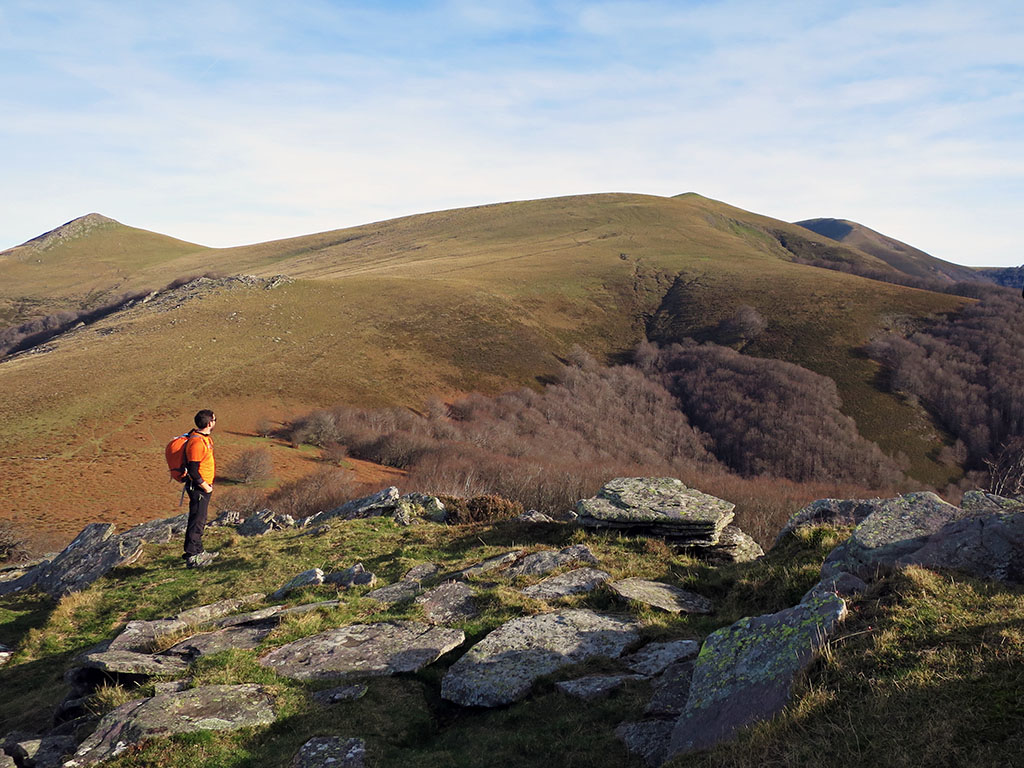
(1h00min; 3,8kms) Cross right. Leave the Camino de Santiago (914m). Take another junction to the right (1h02min), which ascends a steep path that gets even steeper at the end. In the meantime you ignore a path to the left. Almost at the top, the path fades away, but no matter, we are already on the ridge, close to our first peak of the day.
(1h15min; 4,8kms) Loiketa (1.138m).

From here the next peak is close by. The route continues in an obvious way passing by the pass of Loiketatako Lepoa and then along cattle trails until it reaches...
(1h40min; 5,9kms) Algorrieta / Oiana (1.160m).
The climb to Okolin will be somewhat more demanding. From here it looks like a gently rolling hill where cattle graze freely. A short descent to the next pass brings us to the base of Okolin, where we start the climb. In an area where the slope becomes gentler is the Cromlech de Saioa-Loiketa (6.8kms; 1h56min). The path, which is not very well marked, ascends following the cairns that separate the municipalities of Valle de Anue and Bertizarana. To the left of one of these cairns (7,3kms; 2h06min), you find a spring that we cannot be sure is drinkable. Shortly before the summit we come across the GR12 path (Ruta de Euskal Herria), which actually follows our route to the Sagardegui pass, but avoiding the ascent to Saioa.
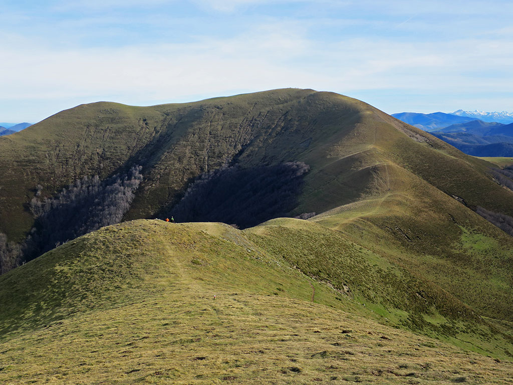
(2h25min; 8,2kms) Okolin (1.360m).
We are on the main axis of the Pyrenees, on the Cantabrian-Mediterranean divide. Our main objective is close, although in between we still have to descend to the Okolin pass (1,238m).

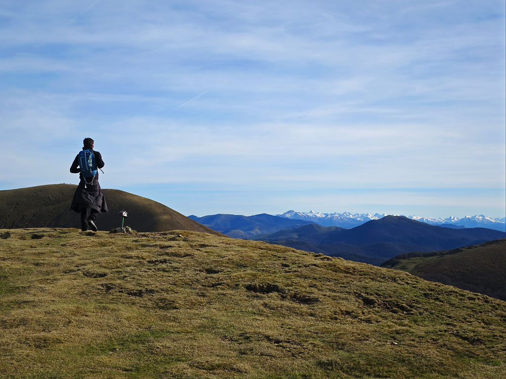
(3h05min; 9,9kms) Saioa (1.418m). Geodetic vertex.

The 360º panoramic view is fabulous. The views of the Pyrenees stand out, of which we can make out a number of peaks of over 2000m. The summit of Saioa is the highest point of this route and the halfway point. We start the descent down a steep grassy slope heading southeast, with our sights set on the Sagardegui pass (3h17min; 10.7kms; 1,239m). On the way we cross the GR12 again, which descends towards the Artesiaga pass. On this last long climb of the day you will pass by a chasm protected by a fence.
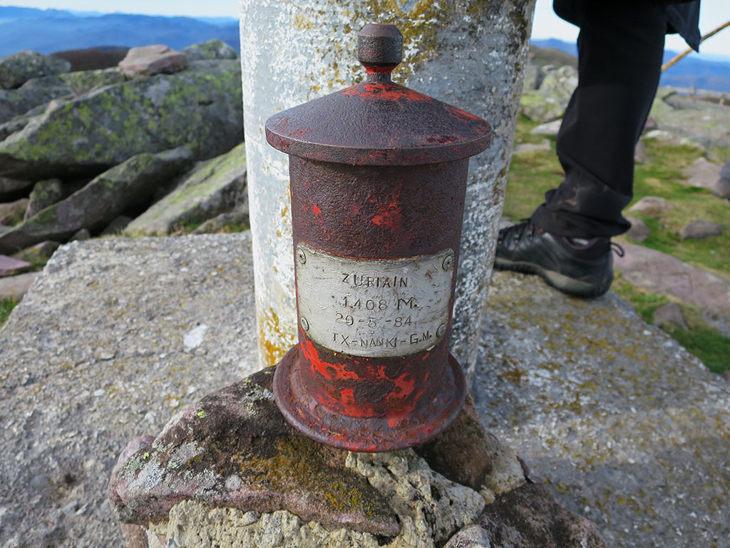
(3h45min; 12,3kms) Zuriain / Xuriain (1.411m), crowned with a geodesic vertex and a letterbox.
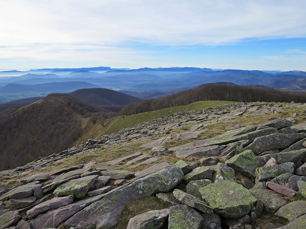
We start the descent along the beautiful ridge that descends to...
(3h55min; 12,9kms) Iturrondo (1.340m). A tack that we passed almost unnoticed.
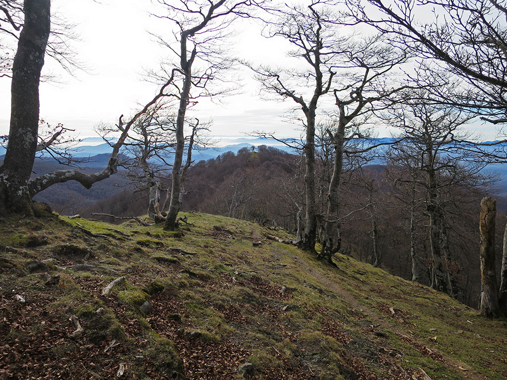
The path continues to lose altitude in search of the shelter of the forest.
(4h10min; 13,7kms) Basabide track (1.178m). When we get here we have several options. We can follow the track around (1,5kms), take a shortcut without a path to the left after half a kilometre, or leave the track at this point and look for a path that descends to the left (SE) and returns to the track in a horseshoe bend to the right (14,4kms; 4h20min). Once you reach this bend by either of the options, you look out for a wide dirt road that comes out of the inside of the bend, which is usually covered with leaves. Later, at the next junction (14.8kms; 4h24min), continue left on the main path and pay close attention when you reach a wide bend to the right (15.4kms; 4h28min), to find on your left a very faint path at the beginning that descends steeply downhill. Shortly after starting to descend, the path turns sharply right, slightly uphill, looking for the ideal place to cross a stream that we find with water.
(4h40min; 15,6kms) Txorrostarri ravine trail (970m). The path, although narrow, becomes more visible from here onwards. This part of the route is really beautiful. The path descends along the right bank of the Txorrostarri ravine, dodging numerous streams.
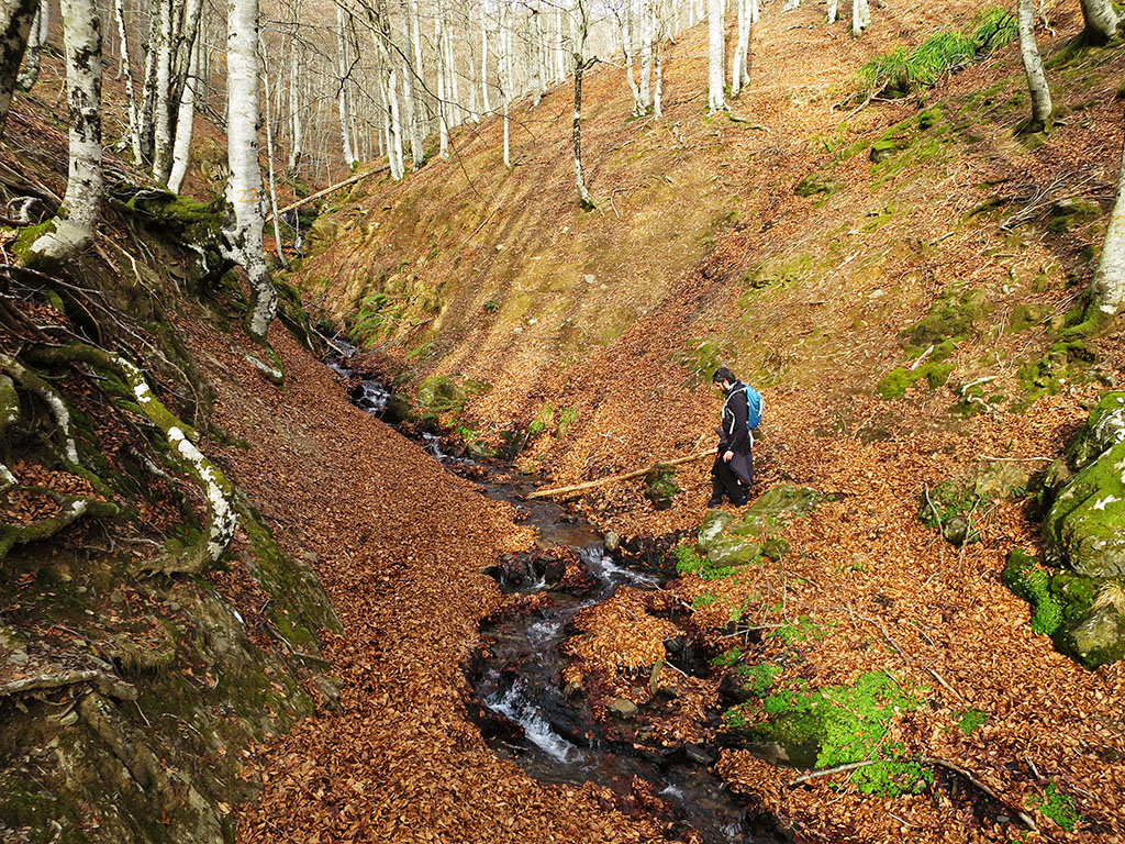
After a while we reach one of the many caves (17,6kms; 5h05min) in this area. It is said that the Basajaun lives in one of them. We look for it without luck and continue downhill. In 10 minutes we reach a bridge where the waters of another well-fed ravine meet. At Xinborneko Borda (5h25min) we join a track, then a junction to the right (5h32min) and we arrive at...
(5h45min; 20,4kms) Lantz - Plaza (629m).
Fastpacking is not about going faster. It's about going lighter.
If you come from classic trekking, this is the next step: learning to move with less weight,
more fluid and enjoying every kilometre more.
Join the Outsiders Newsletter and start discovering what lightness feels like.