Ascents and routes in Ordesa - Monte Perdido - Gavarnie
The highest limestone massif in Europe culminates at an altitude of 3,348 metres at Punta de Treserols / Monte Perdido.
You can go directly to the different sections: Day trips / Multi-day routes / Ascents / For experienced mountaineers / In the family
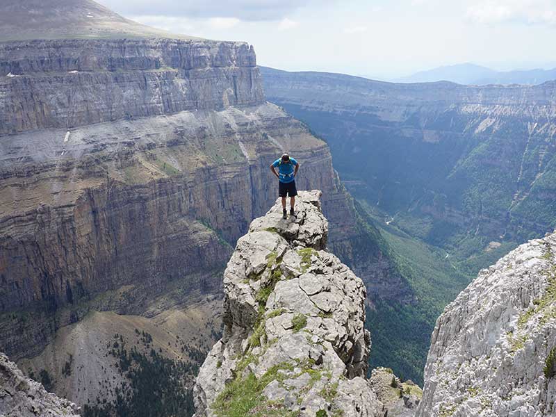
A massif crowned by steep peaks of more than three thousand metres (up to 27), eroded over millions of years in a sort of U-shaped valleys, through which water cascades in countless waterfalls and waterfalls of great beauty. The Pyrenees-Monte Perdido mountain landscape has been a World Heritage Site on both sides of the border since 1997. And this is how we want to describe some of the most interesting routes in this massif, without knowing its limits. Covering the whole area and the many surprises it holds for us, and visiting the great natural monuments: the great canyons on the Huesca side (the Ordesa Valley, the Añisclo Canyon and the Escuaín Gorge); the great glacial cirques on the French side (Gavarnie, Estaubé and Troumouse, the latter in the La Munía sector); and a whole succession of unparalleled three-thousand-metre peaks.
Day trips
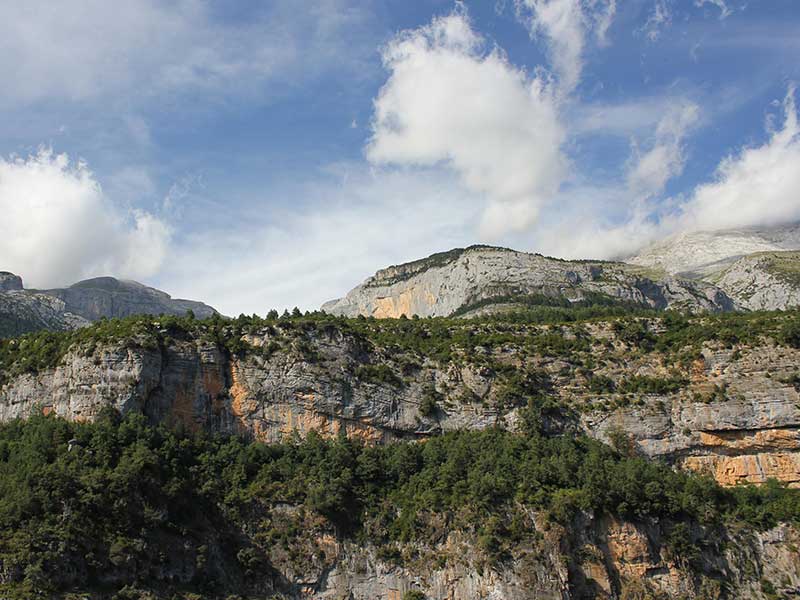
Cirque de Soaso and Cola de Caballo by the Pelay Girdle
SECTOR: Ordesa. ROUTE (Circular route): Ordesa Meadow - Hunters' Path - Pelay Girdle - Soaso Cirque - Ordesa Meadow. REVIEW7h (return trip), Difficult, 650m ascent. EPOCA RECOMMENDED: From June to October. ACCESS. The route starts in the Ordesa meadow, which can be reached by car from Torla or by the park bus in the summer months. TRACK (Click here)
This route offers one of the best panoramic views of the Ordesa Valley: the one that can be seen from the Faja de Pelay, a long terrace on the vertical wall of the Ordesa canyon.

- THE ROUTE. Starting from the end of the Meadow of Ordesa, we will cross the Arazas river over the bridge that crosses the Path of the Hunters. The path climbs steeply up to the viewpoint at Calcilarruego. Just before it links up with the path of the Pelay Girdlewhich hangs over the southernmost ledges of the valley. We conclude at the Soaso and Cola de Caballo circusto return along the path that descends the Ordesa Valley.
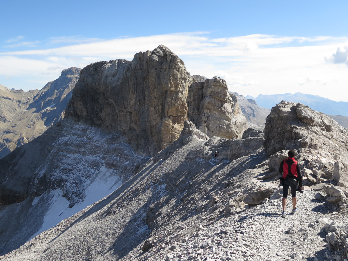
The Roland Gap
SECTORGavarnie. ROUTE (Round trip): Col des Tentes-Serradets-Brecha Rolando-Col des Tentes. REVIEW: 5h30′, Difficult, 628 m ascent, 11 km. EPOCA RECOMMENDED: From June to October. ACCESS. Col des Tentes, Gavarnie. TRACK (Click here)
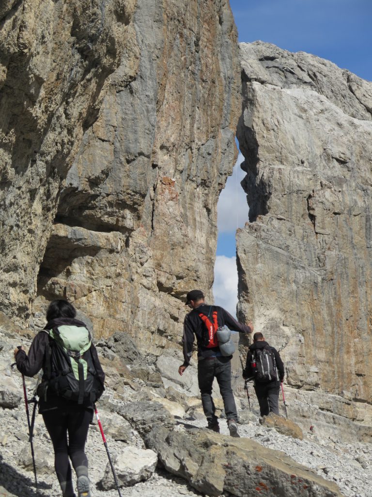
- It is a magical place nestled between the peaks of the Bazillac and the Punta dero Corral Ziego / The Hull. A deep gorge at an altitude of 2,807 metres, 100m high and 40m wide. A legendary place, surrounded by legends, which allows the passage between Spain and France. In the past, this pass was frequented by smugglers, today, however, it is crossed by hikers.

- THE ROUTE. From the col des Tentes (2207 m) (which can be reached by car from Gavarnie, or on foot to the Bujaruelo pass from Bujaruelo (3h)), we follow the horizontal path overlooking the Pouey Aspé valley, facing the strata of the Taillon-Gabietos mountain range. The path rises a little halfway up towards the Bujaruelo pass. We follow the path towards the Brecha de Rolando (signposts), for which we take on the Serradets pass and then the Refugio de la Brecha or Serradets hut. From here the slope becomes steeper (ice axe and crampons recommended all year round on the glacier) until we reach the Gap itself. We will descend along the same route.
Multi-day routes
(YOU MAY BE INTERESTED IN: High Route of the Lost. The CLASSIC route is a circular trekking around the massifs of the Monte Perdido and the Vignemale. The route runs along 8 shelters and can be done in several stages, 6 days is the most usual for the most classic route, although it is also possible to cover the whole of the 92-105 km with more than 6,000 metres of accumulated altitude gain in a single day - the record is just under 14 hours.TRACK, Click here.)
Tour of La Brecha de Rolando (3 days)
SECTOR: Bujaruelo, Gavarnie, Ordesa. ROUTE (Circular): Bujaruelo-Serradets–Roland Gap–Goriz-Bujaruelo. REVIEW3 days, 42 km, +2,425 m ascent, Difficult. EPOCA RECOMMENDED: From June to October. ACCESS. Bujaruelo. TRACK (Click here)
This high mountain itinerary in 3 stages will take you to discover some of the most spectacular natural sites in the Pyrenees: the Cirque de Gavarnie, the Roland Gap and the Ordesa Canyon.

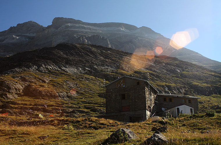
- Stage 1: from Bujaruelo Hut to Serradets Hut or Roland Gap Hut (4h15, 9 km, +1240 m) We cross the Bujaruelo pass, a historic route between Spain and France, until we reach the northern flanks of the Taillon massif before reaching the Roland Gap and the Serradets Hut. The more energetic could continue on to Goriz, the second of the stages we propose, but it is a fairly demanding route (more than 1500m of vertical drop).
- Stage 2: from Serradets Hut to Góriz Hut (3h30, 6.9km, +214 m)crossing the Rolando Gap. On the way to Góriz we will find the Sarrios Pass shortly after the Brecha (easy, equipped with a towrope) and, somewhat hidden but visible, the mouth of the Espluca Negra / Frozen Grotto of Marboré or Grotte Glacée of Casteret.
- Stage 3: from Góriz Hut to Bujaruelo Hut (8h, 24.6 km,+381). We descend the entire Ordesa Canyon, at the confluence with the river Ara (bridge of the Navarros) and go up the valley towards the refuge of Bujaruelo.
The return to Monte Perdido (3 days)
SECTORPineta, Gavarnie, Ordesa, Añisclo. ROUTE (Circular): Pineta-Tucarroya–Gavarnie-Roland Gap–Goriz-Pineta. REVIEW3 days, 49 km, +2,400 m ascent, Difficult. EPOCA RECOMMENDED: From June to October. ACCESS. Pineta. TRACK (Click here)
A high mountain route around the Monte Perdido massif that will allow us to contemplate some of the most spectacular attractions of this limestone massif, such as the Gavarnie Cirque, the Roland Gap and a glimpse of the north face of Monte Perdido from Marboré Lake.

- Stage 1: from Pineta Refuge to Espuguettes Refuge We will pass the Balcón de Pineta and the Tucarroya gap (16.5 km, +1,722 m ascent). This stage has the attraction of being able to contemplate the north face of Monte Perdido. A tough day with steep slopes to overcome.
- Stage 2: from the Espuguettes Hut to the Sarradets Hut. In this stage it will be the Cirque de Gavarnie that will overshadow the landscape until the end of the day, when we will come face to face with the Roland Gap.
- Stage 3: from Serradets Hut to Pineta Hutpassing through the faja de las Olas and the Añisclo pass.
GR11 -Pyrenean Path in Ordesa
This Gran Recorrido trail will allow you to cross the Ordesa and Monte Perdido National Park, from Bujaruelo a Góriz y Pineta. The path descends the valley of Bujaruelo through the narrow Gorge of the Navarros to enter the beautiful Ordesa and Monte Perdido National Park. Afterwards, the trail climbs up the beautiful Ordesa valley to reach the shelter of Góriz. The GR11 continues the next day towards Pineta descending to the Fuenblanca or crossing the Faja de las Olas. [Stage 16: Bujaruelo - Góriz / Stage 17: Góriz - Pineta (via the Fuenblaca) / Stage 17 (GR11.9): Góriz - Pineta (Faja de las Olas))]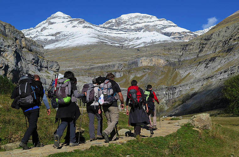
Ascents
Ascent to Monte Perdido / Punta de Treserols from Góriz
SECTOR: Ordesa. ROUTE (Round trip): Pradera-Góriz-Monte Perdido-Pradera. REVIEW2 days, 32 km, +2,055 m ascent, Difficult. ACCESS. Ordesa meadow, accessible from Torla-Ordesa. EPOCA RECOMMENDED: From June to October. TRACK (Click here)
It is the highest point in the National Park and the fourth highest in the Pyrenees at 3,348 metres (according to the current official height of the IGN). It is part of the Tres Sorores or Treserols massif, together with the Mallo de Marmorés / Cilindro de Marboré and Pico d'Añisclo.
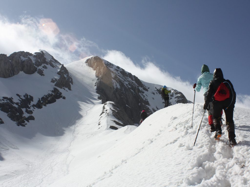
- THE ROUTE. Ascent to Monte Perdido from the Goriz refuge (it is usual to spend the night in the refuge and plan the ascent in two days). From the refuge, we will go up the Góriz ravine, gaining height, a flank to the left overcomes the drops in the mountain and looks for the water torrent, the succession of milestones will take us to Lago Helado (frozen lake). Ascend the section of The SpittoonThe descent to the summit (3h15m).

- On its north face you will be able to contemplate its two glaciers suspended on the Pineta valley. The north of Monte Perdido is a classic Pyrenean climb of the whole massif, for experienced climbers.
Ascent to Punda Negra / Tallón from the Col des Tentes
SECTORGavarnie. ROUTE (Round trip): Col des Tentes-Serradets-Brecha Roland-Tallon-Col des Tentes. REVIEW5h50 (ascent and descent), 16 km, +910 m ascent, Easy. ACCESS. Col des Tentesaccessible from Gavarnie. EPOCA RECOMMENDED: From June to October. TRACK (Click here)
Officially known as Punda Negra / Tallón, it is one of the 3,000 metre peaks considered to be the easiest. During the ascent we will pass through the legendary Roland Gap.

- THE ROUTE. From the Col des Tentes (parking place) we continue on foot to the pass of Bujaruelo (25min), at the crossroads we turn left towards the refuge of Serradets. The path climbs gently up to the base of the Cabietos and then the Tallón. We cross a rocky outcrop and its torrent, the path winds along the remains of the moraine. We reach the Sarradets pass (1h35 without stops) and the refuge. The slope becomes steep to ascend to the Roland Gap (just above the refuge), in an area where we will find snow or ice until well into the summer. Cross the Gap and turn right to undertake the final ascent along the southern flank of Bazillac, passing next to the Dedo and the false gap and gaining the summit of Punda Negra / Tallón.
For experienced mountaineers
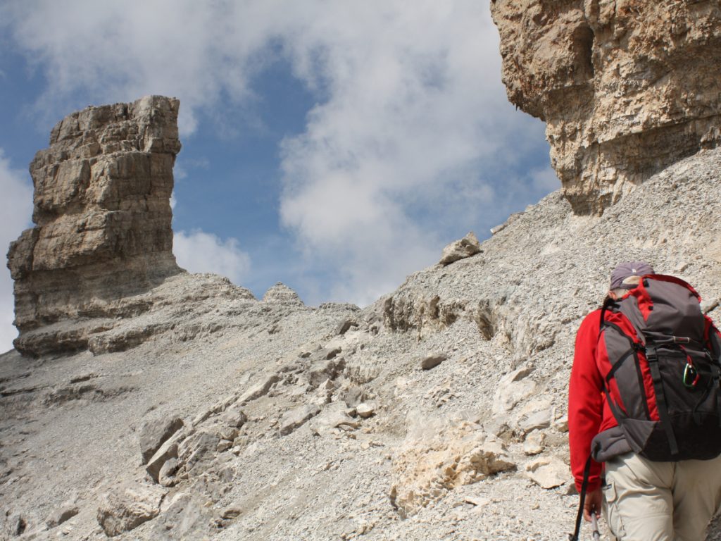
Circular of the Three Thousanders, Ordesa
SECTOR: Bujaruelo, Gavarnie, Ordesa. ROUTE (Circular): Bujaruelo-Tallón-Cabietos (3)-Brecha de Rolando-El Casco-Torre de Marboré-Punda dero Espaldador-Picos de la Cascada (previous name, 3 peaks)-Marboré-Cilindro de Marboré-Lago Helado-Monte Perdido-Repunta de las Neveras-Mallo de Tormosa-Añisclo-Punta de Tormosa-Punta deras Solas-Góriz-Bujaruelo. REVIEW: 4 days, 64 km, +4.500 m ascent, Very Difficult. ACCESS. Bujaruelo. TRACK (Click here)
This route is suitable for experienced and fit people. It will take us to chain the tremiles from Los Cabietos to Punta deras Solas.

We start from Bujaruelo, go up the pass and pass the Sarradets hut and cross the gap to go up to Tallón and Los Cabietos. We will descend and spend the night in the bivouacs of La Brecha (1st night). Another option is to go back down to the Sarradets Refuge. The following day we tackle El Casco, Torre de Marboré, Punda dero Espaldador, the three Picos de la Cascada (Punda dera Ula, Repunda deras Bruixas and Punda deras Crepas), Marboré and Cilindro de Marboré. The second bivouac is at Lago Helado (2nd night). The third day will take us to the summit of Monte Perdido, Cuello del Perdido, Repunta de las Neveras, Mallo de Tormosa, Añisclo, Punta de Tormosa and Punta deras Solas. We will finish the day in the Refugio de Góriz or in one of the nearby bivouacs (THIRD NIGHT). On the fourth day we went down to the Ordesa meadow and returned to Bujaruelo following the GR11.
The Flower Belt
SECTOR: Ordesa. ROUTE (Circular): Pradera-Virgen del Pilar-Clavijas de Cotatuero-Cotatuero waterfall-Faja de las Flores-Llanos de Salarons-Pradera. REVIEW: Difficult-Exposed, 17km, +980m elevation gain. ACCESS. The route starts in the Ordesa meadow, which can be reached from Torla by car or bus.
- YOU MAY BE INTERESTED IN: The Faja de las Flores in Ordesa, hanging over the abyss. This is one of the classic routes in Ordesa. The Faja de las Flores is one of the most incredible viewpoints in the Valley, offering visitors a beautiful and impressive panoramic view of the entire geological and natural scenery of the Park.
- The route is difficult, as we will have to overcome the pegs at the beginning and end of the gorge and the route has a drop of more than 1,000 metres. The Faja de las Flores itself is 3 kilometres long. TRACK (Click here)
In the family
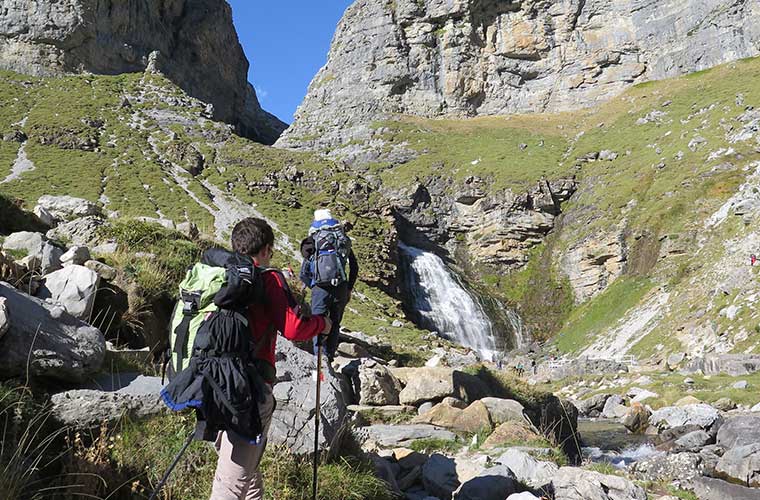
- ORDESA MEADOW. There is a beautiful forest behind the car park - La Pradera - with coniferous trees, mainly firs and beeches, where we can walk through a little piece of heaven, not forgetting the little bridge across the river Arazas. During autumn the slopes of the Ordesa Valley turn multicoloured, making it an ideal time to follow this itinerary. An easy hike that can be done with children, with a host of attractions along the way, which you can enjoy with the little ones at home - waterfalls, forest, nature in its purest form.
- COTATUERO CIRCUS. Another good option is to go up to the Cotatuero Circus and appreciate the 200m waterfall. The walk to the pegs takes approximately two hours and involves a 500 metre climb. To see the waterfall it is not necessary to go all the way to the pegs. We start this route in the Ordesa meadow, following the main path through the valley. The turning to the left towards the Cotatuero cirque is not long in coming. The path zigzags upwards through a forest of white fir trees until it reaches the cirque where the waterfall cascades down. You can return along the same path or by Racón o Canarellosby means of circular routes.
- ESCUAÍN GORGE. On this 2.5-kilometre, 1.5-hour route, you can enjoy the spectacular scenery of this gorge. In Escuaín you can look out over the viewpoints of O Castiello and the Yaga River Gorge before starting the excursion. It starts one kilometre from the village, with a descent along the Yaga River and moving along its course until it reaches the foot of a waterfall.