Pyrenees and mountains 📩
Here 🔥The High Route of the Lost
Quick guide TREKKING SEVERAL DAYS in the Pyrenees
with everything you need to know before undertaking a multi-stage circular route.
The High Route of the Lost is an attractive circular route in the Pyrenees, which runs through the highest limestone massif in Europe. A beautiful experience for all adventure lovers: freedom, challenges and spectacular nature; here we bring you a quick guide with the recommendations you should take into account to enjoy this trekking route.
What is the High Route of the Lost
This is a circular trekking route around the massifs of the Monte Perdido and the VignemaleThe route takes you through the Ordesa y Monte Perdido National Park, as well as through the French Pyrenees National Park in the central Pyrenees.
The route runs through 8 refuges and can be done in several stages, 6 days is the most usual for the most classic route, although it is also possible to cover the whole of the 92-105 km with more than 6,000 metres of accumulated altitude gain in a single day - the record is just under 14 hours.

The stages of the High Route of the Lost Ones
The tour mainly takes 5 days or 6 days.The route is generally anti-clockwise, with two optional ascents of the great massifs of the area. The route is generally done in an anti-clockwise direction, below is a proposed 6-day tour (classic route), starting from the Refugio de Bujaruelo, which is the most southerly of the whole route.
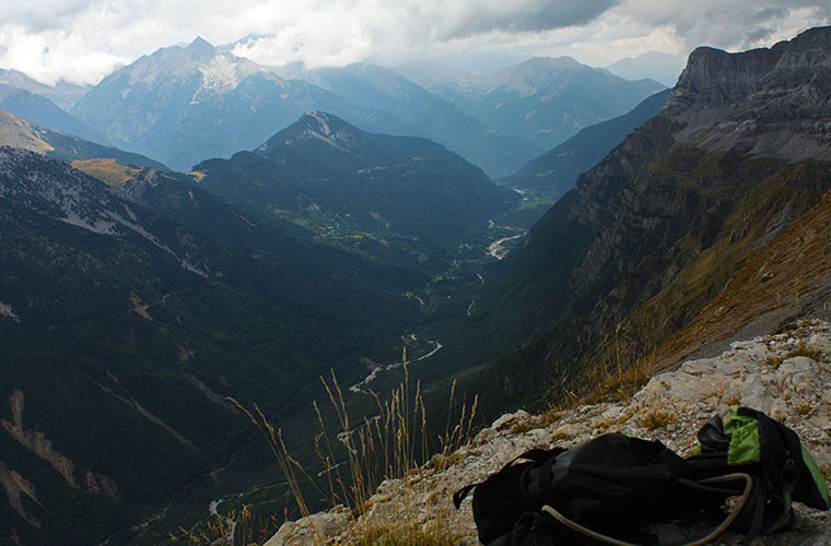
Stage 1 Bujaruelo - Góriz
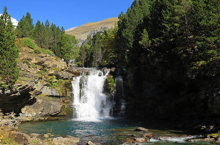
This is a total of almost 18 km of a beautiful trail between waterfalls and wooded areas of Ordesa. We will start the day walking downhill until we reach the Bridge of Los Navarrosto face the ascent to the Ordesa Meadow and go all over the Ordesa Canyon. After crossing the cirque of Soaso we will arrive at Góriz.
Stage 2 Góriz - Pineta
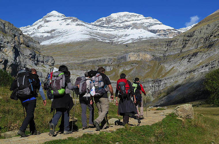
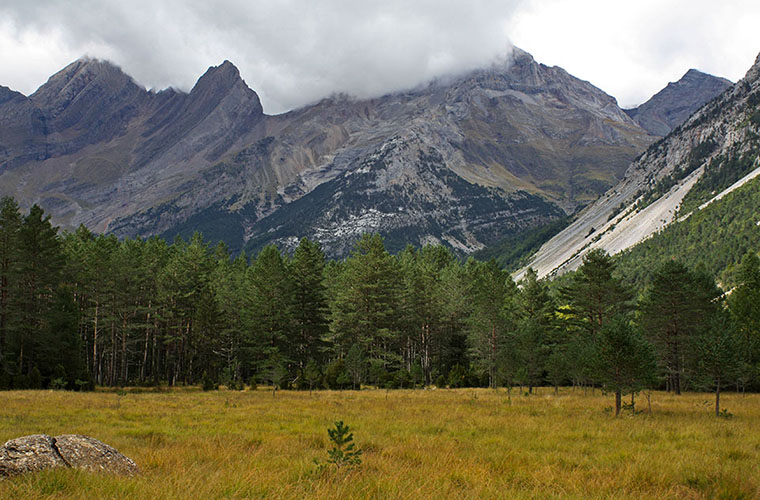
We highly recommend the optional ascent of the Monte PerdidoThis is the first great high mountain challenge, reaching an altitude of 3,355 metres, which is also the highest point on the route. Afterwards, by the same route, you will return to Góriz. The route continues to the east. The mountain scenery does not end, we pass through imposing canyons, such as that of Añisclo or ascents and crossings such as the Passage of the Waves -two alternatives of the route, where your resistance to vertigo will also be put to the test. Finally comes a long descent to the Pineta Refuge located in the valley of the same name. More than 1000 m of elevation gain that will put your knees to the test.
Stage 3 Pineta - Espuguettes
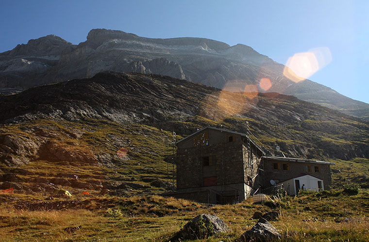
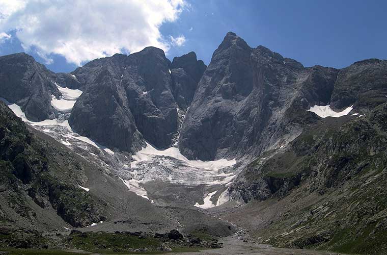
Of these 16.5 km, the first half is an ascent to the northern part of the majestic Monte Perdido glacierpassing by spectacular lakes such as the Ibon de MarboreThe second part of the route is a descent towards the Pyrenees, with its vivid blue colour contrasting with the rocky Pyrenean peaks. The second part of the route is a descent in the direction of Horquette d'Alans to subsequently reach the Shelter in Espuguettes. Those who prefer to do the stage in 5 days, even omit the rest in this refuge.
Stage 4 Espuguettes - Grange de Holle
We are in the French Pyrenees. We tackle most of it downhill, a short route of just under 10 km. One of the main attractions is the passage through the base of the impressive Cirque de Gavarnie. And shortly before reaching the refuge of Grange de Holle you can drink a well-deserved ice-cold beer in the picturesque village of Gavarnie.

Stage 5 Grange de Holle - Oulletes
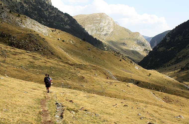
This stage begins with a splendid hike through the forest of Ossue Valleyto reach the intermediate shelter of Bayssellancewhich also marks the optional route of the ascent to the spectacular Vignemale -an extra day is definitely worth it if you still have enough energy left. We would return to Bayssellance to continue the route to OulletesThe route passes through breathtaking landscapes such as the glacier and the D'Ossoue valley.
Stage 6 Oulletes - Bujaruelo
To round off the High Route of the Lost Ones we have this high mountain stage, where snowy and rocky landscapes are common as soon as we get out of Oulleteswith an address at Collado de los MulosAlthough this last challenge is overcome, after 10 km of gentle descent, you will return to the Bujaruelo Hutwhere we can celebrate the culmination of this essential route for lovers of Pyrenean hiking.
What I need for the High Route of the Lost Ones
It considers this to be a demanding Pyrenean high mountain crossingTherefore, it will be important to have experience in this type of route from the outset; here are a series of recommendations, particularly for summerThis is the season in which the route is officially available and is the recommended time of year to do it.
A light backpack is useful, as the slopes are very important and this will facilitate your progress. You should carry basic elements such as sleeping bag - option to take a sleeping bag if sleeping in the shelters, which have blankets - water bottle, and sufficient food supplies. -You will be able to stock up at some refuges, and at all of them you will be able to stay overnight on a half-board basis.
As it is a mountain route, where the light intensity is very important, some of the routes are sunglasses with protection 4 at least they are useful, as well as sunscreen and a hat for better protection.
A couple of trekking poles are also practically essential. Depending on the season, it will be essential to also carry cramponsIt is not uncommon to find some snowy passes even in summer, and of course some of them are still snowy. trekking boots high-end waterproof flip-flops with strong soles that your feet are used to will also be important for covering the route. However, we also recommend a pair of flip-flops for those moments when you can relax your feet after the hard work of the day.
You may find some of the following useful thermal fibre for the cold, while a good waterproof as well as protecting you in rainy conditions, it is also useful in windy conditions.
A hood will also help to protect you from the sun and wind, although a hood is certainly a better option. first aid kit You can't miss it, and if you're not federated you can also take out insurance for the route - you'll be able to do the route with greater peace of mind.
READ ALSO:
Fastpacking is not about going faster. It's about going lighter.
If you come from classic trekking, this is the next step: learning to move with less weight,
more fluid and enjoying every kilometre more.
Join the Outsiders Newsletter and start discovering what lightness feels like.
I would like to know the dates that you plan to do this route during this coming month of July and August.
Hello Antonio!
I'm sorry to tell you, Travesía Pirenaica does not organise guided routes, we are just a digital magazine.
In any case, do some research on the internet, you will have no problem finding a company that offers this product.