Circular from Santa Cecilia along the "camí de l'Arrel" and down through the monastery of Montserrat.
Pyrenees and mountains 📩
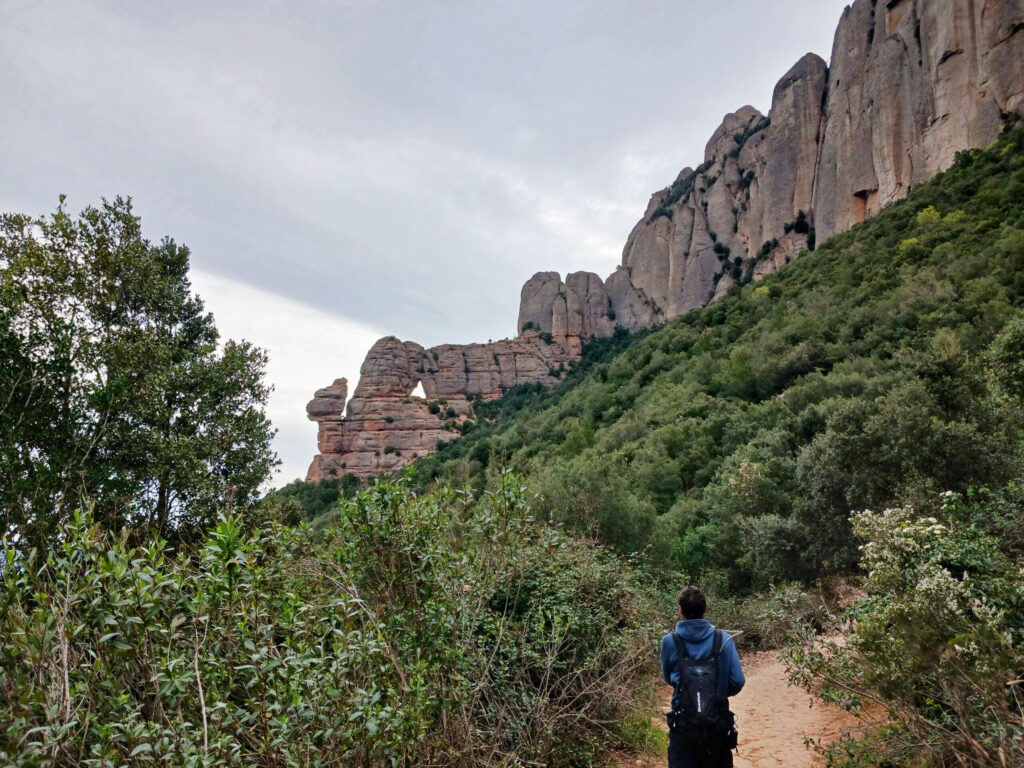
Here 🔥A very interesting way to get to the monastery of Montserrat is by the wooded camí de l'Arrel. On this circular route we will pass through the TebaidaThe route continues through the area of rocky spires above the monastery and then descends again through the camí dels DegotallsThis is a path with a lot of history that will link us with the return path at the base of the mountain.
Summary:
The "camí de l'Arrel"starts on the road next to the monastery of Santa Cecília. Progressively, it will make us gain altitude until we reach the area of the Tebaida. Here we will pass very close to several hermitages and we will be able to contemplate several rocky spires. We then descend to the monastery by the stairs and the Pas dels Francesos. Now all we have to do is look for the camí dels Degotalls which will lead us following the PR marks to our starting point.
Map:
Downloadable:
Technical specifications:
Distance: 9.7 km.
Cumulative difference in altitude: +/- 313 m.
Timetable: about 4.5 hours. Walking time non-stop: 3h30min.
Water: There are bars and a fountain in the monastery grounds.
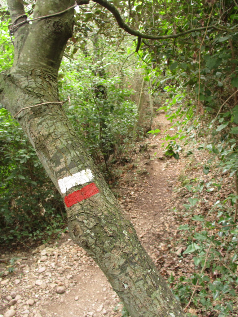
Difficulty: average. Well-defined and well-signposted paths.
Recommended equipment: comfortable clothing, canteensome food, sun protection, a baton for the climb, GPS...
Suggestions: you can combine the tour with a visit to the monastery of Montserrat or with one of these two circular proposals: Circular from the Monastery of Montserrat to Sant Jeroni and the Albarda Castellana o Circular from the monastery of Montserrat to the Miranda de Santa Magdalena, passing through Sant Joan and Sant Onofre.. If, on the other hand, you want to do something more modest, we suggest you: The "Creu de Sant Miquel" from the monastery of Montserrat.
How to get there?
See in Google Maps.
The starting point of this excursion is the Monastery of Santa Cecilialocated on the BP-1101 road, at km 5.4 (Marganell). Next to the monastery of Santa Cecilia, which functions as an art gallery, there is a free car park.
Itinerary:
(0h00min; 0,0 km) Santa Cecilia (624 m). This monastery, founded in the 10th century, is governed by the rule of Saint Benedict. Until the middle of the 20th century it was home to a community of Benedictine nuns, later it was used as a refuge for hikers and today it is an art centre.

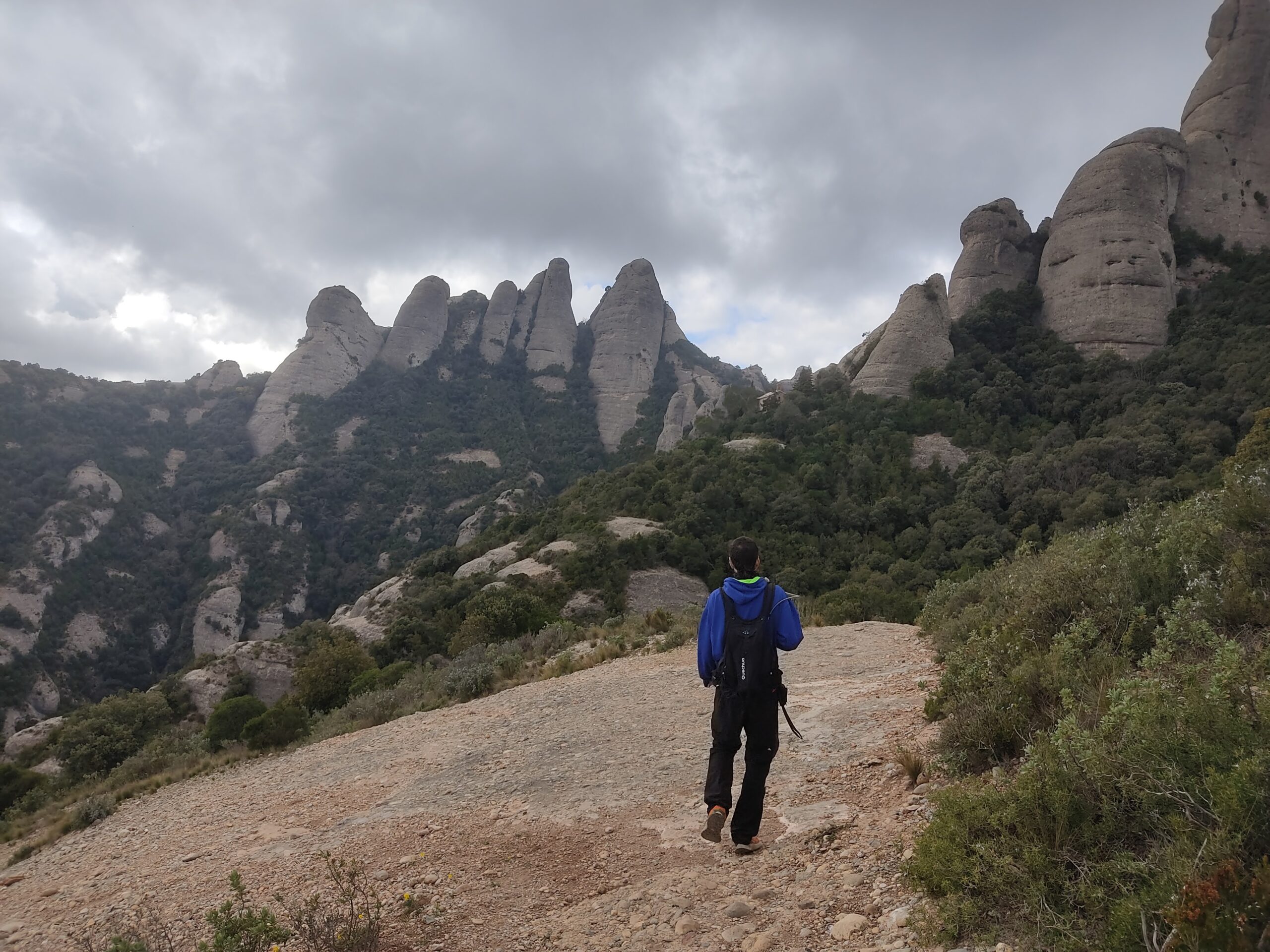
After walking a few metres along the road towards the Monastery of Montserrat (East), we will see a path that climbs up the mountain and links up with the "camí de l'Arrel". We follow the marks of the PR C-19 and the GR4 and 172 through shrubby vegetation such as steppe and heather, accompanied by the occasional pine tree. Up on the right we have the majestic Paret de l'Aeri, one of the first walls that climbers want to climb, with countless routes over 300 metres high. After 15 minutes we pass the Canal del Moro, the first of many.
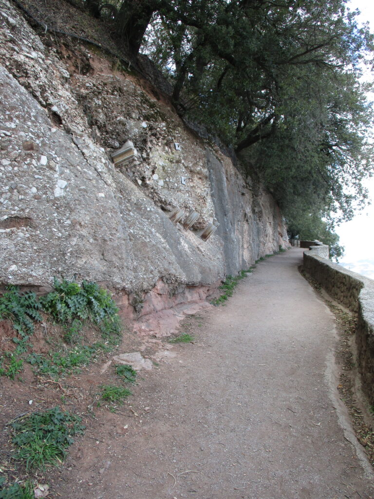
This historic path is spectacularly beautifully wooded, with a well-developed holm oak forest and some maple trees. After 0.8 km, below us, we see the monastery of Sant Benet, where the religious community that lived in Santa Cecilia moved to live.
The Camí de l'arrel
The name "camí de l'Arrel". (root road, in Spanish), refers to the road that leads from the monastery of Santa Cecilia to the "pla de la Trinitat. According to ancient cartography, it used to be slightly longer. The name comes from the "pas de l'ArrelThis is an area of passage between rocks that would be a challenge for the pack animals that climbed up to the monastery. It crosses several "canals" and will surprise us with its wooded exuberance.
(0h25min; 1.0 km) Canal Arínjols or "Avellaners". (891 m).
The confusing toponymy of the canals on the north face of Montserrat
The toponymy has been a source of confusion in the canals on the north face of Montserrat since the name "Canal dels Avellaners" was assigned to the canal that runs between the Serrat de les Onze and the Serrat dels Patriarques. From this point on, there were other errors and a transfer of place names between neighbouring canals that is still present in today's cartography. If you want to know more, on the website Tot Montserrat This confusion is well explained and the most correct names to use are proposed.
We find this "canal" on our right. These paths are cracks between needles and allow us to go to other paths or summits. This one in particular is very eroded by natural phenomena and wild goats that devour the vegetation. For some time it has been closed to protect the growing yew saplings, as the passage of hikers and the above phenomena endangered its viability.
Following the camí de l'Arrel, which now runs in the shadow of the Paret dels Diables (another of the great walls of Montserrat), cross the Cavall Bernat torrent (0h40min; 1,8km), go around the buttress that emerges from it and pass a detour that climbs to the right before reaching the...
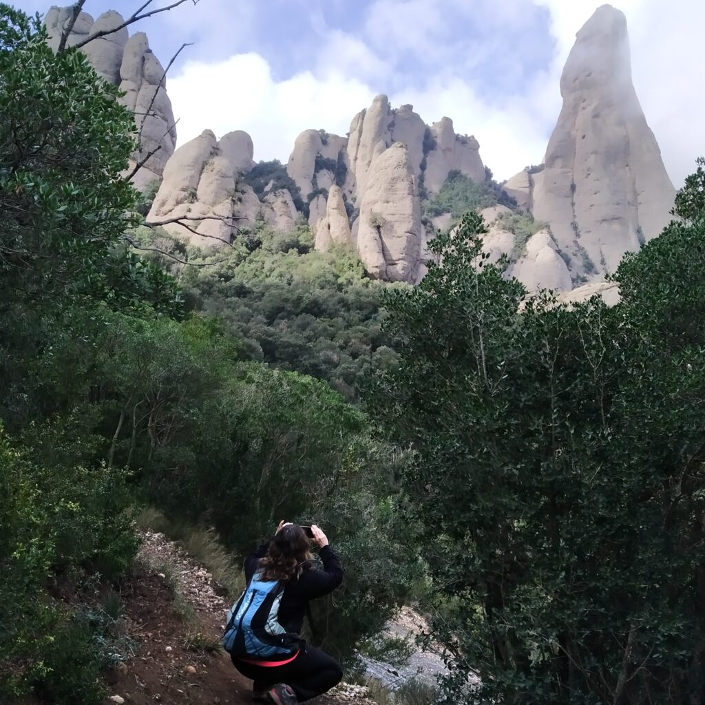
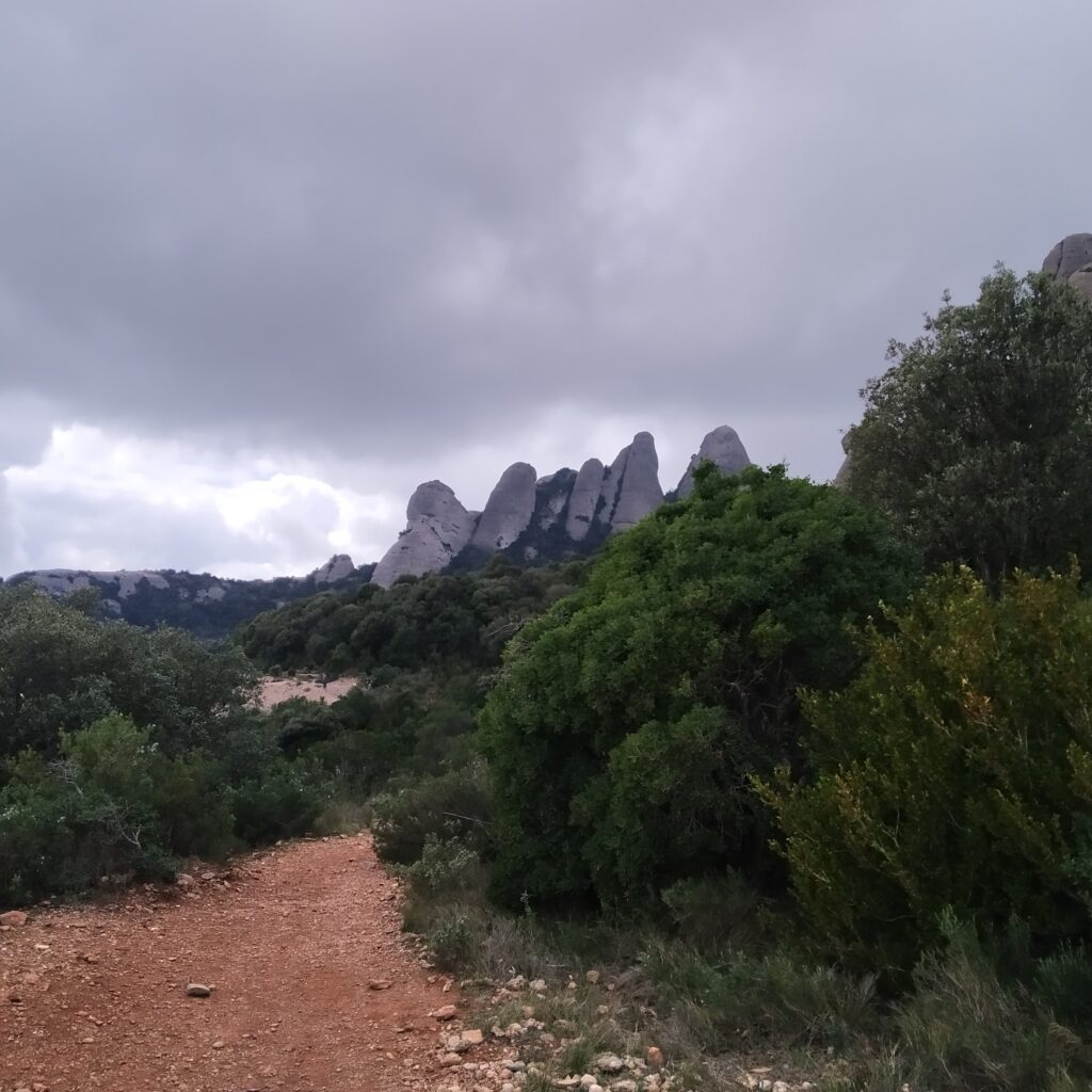
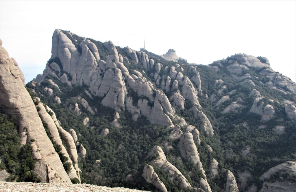
(0h50min; 2,2 km) Fork "Canal Cavall Bernat". (875 m). We pass under the access to this emblematic spire of Montserrat. We can see the large blocks at the beginning. A little later we can see it in all its splendour, together with other Montserrat spires.
(1h20min; 2,9 km) Fork "Canal Plana". (889 m). We leave it on our right and continue through the forest. A minute later we pass another fork, which we leave on our left, that of the Canal del Pou del Gat. If we wanted to do it downhill, we would have to take into account some technical rocky passages.
(1h40min; 3,8 km) Pla de la Trinitat (946 m). At this junction of paths we finish the "camí de l'arrel".
We continue following the GR markings in the direction of the monastery, a little further on we pass a "gate" in the path.
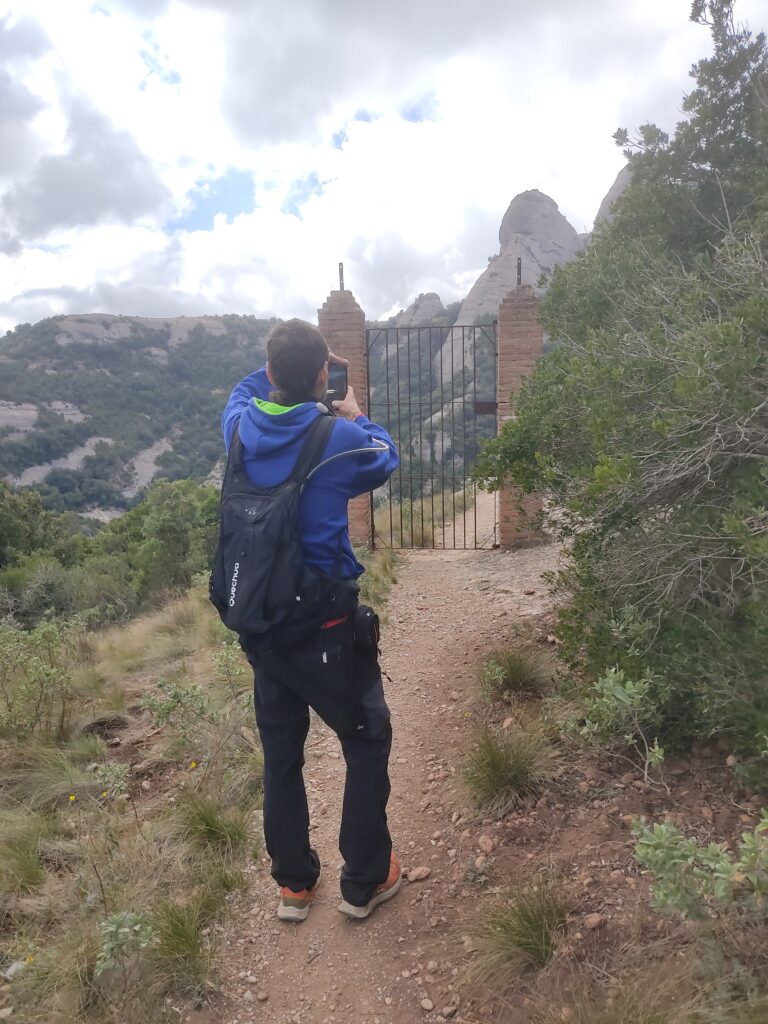
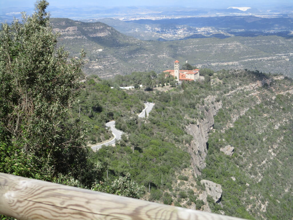
(1h55min; 4.4 km) Tebaida (935 m). This name appears in the first hiking guides and refers to the area of Sant Salvador. The path will allow us to contemplate the nearest rocky spires. On your right you leave the ascending access to the hermitage of Sant Benet. Go down a stepped section and you will see a viewpoint on your left.
We continue along the path.
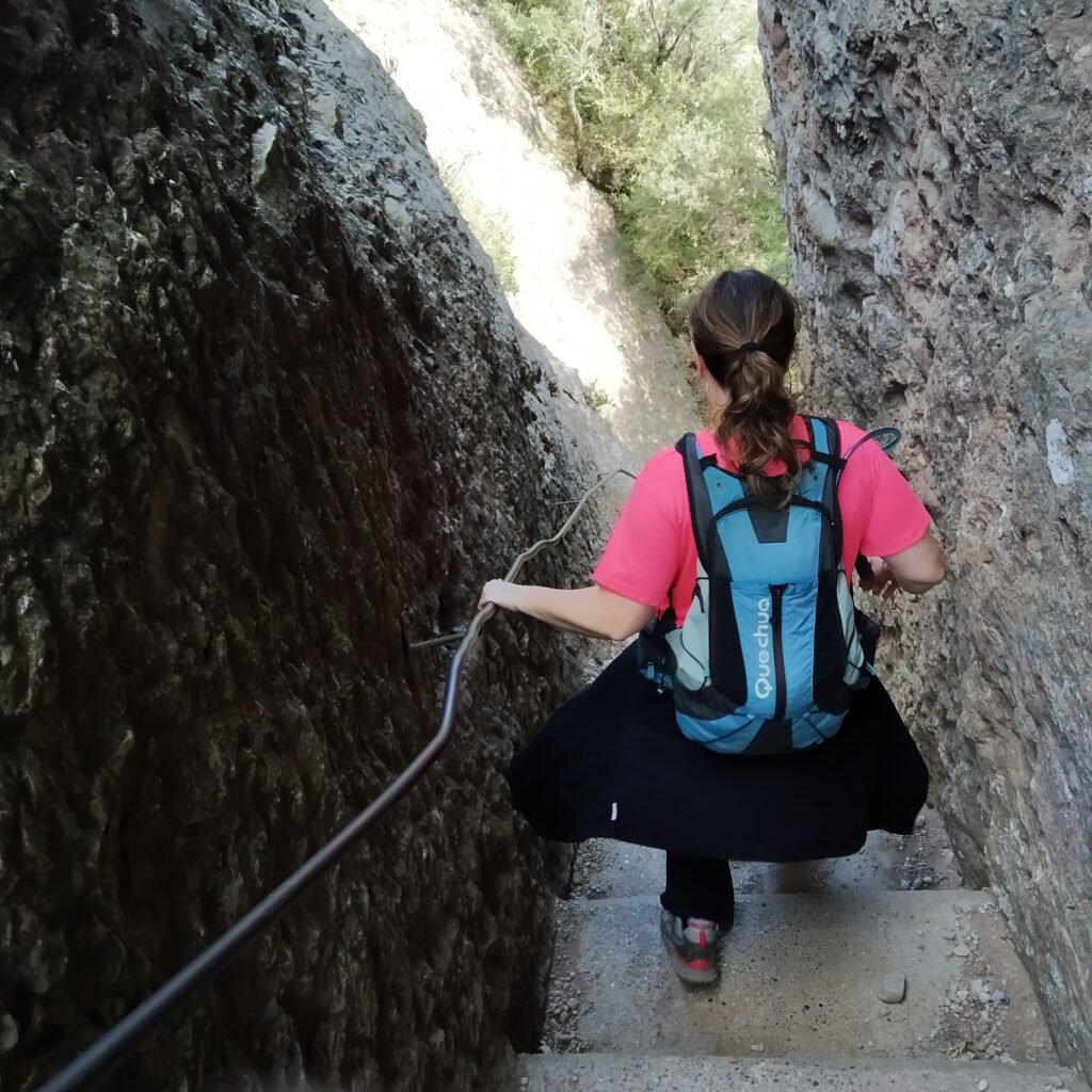
(2h05min; 4,7 km) "Plaça de Santa Anna" (895 m). Located in a rocky area, on our right we will have the hermitage of the same name. We go to the left up countless steps, which will take us over the famous "Pas dels Francesos". This is a staggered path, cut into the mountain, through which the French troops entered the massif during the War of Independence.
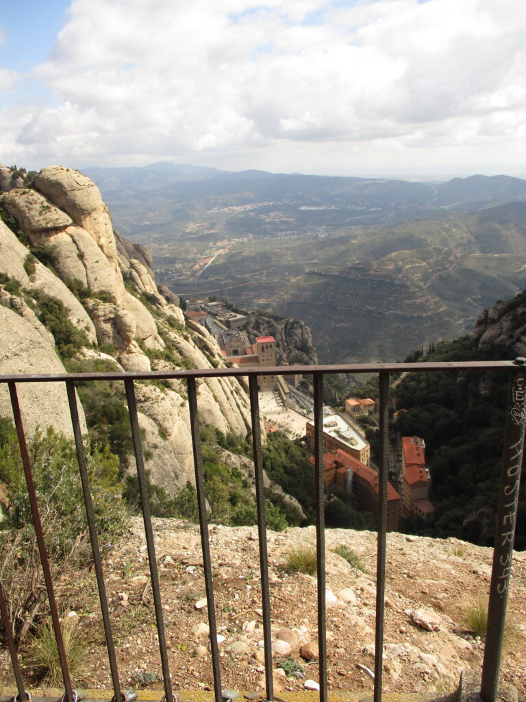
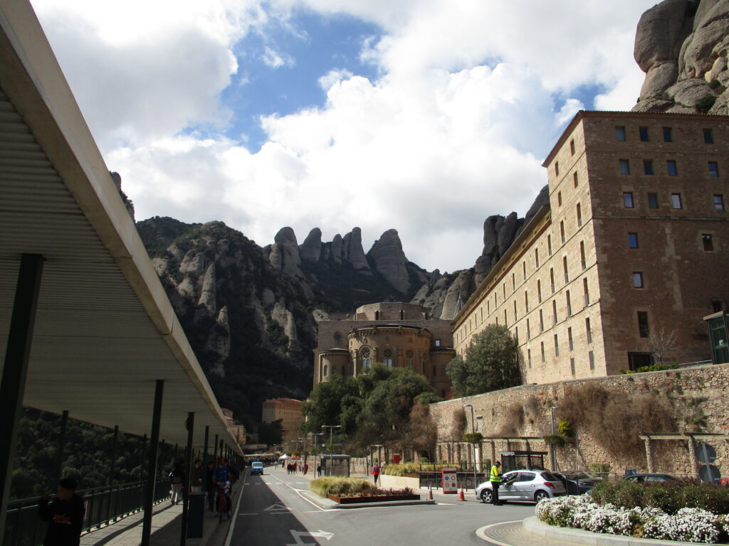
(2h25min; 5,5 km) Montserrat Monastery - Plaça de la Creu (724 m). We are in the sacred and most famous enclosure of Montserrat. After the usual visit, we continue downhill towards the car park.
(2h35min; 6,0 km) Camí dels Degotalls (718 m). We see the access on our left. If we want to go all the way to the end, we will add 10 minutes more to the route. If not, 150 metres before the end we take a descending path on the right.
The "Camí dels Degotalls"
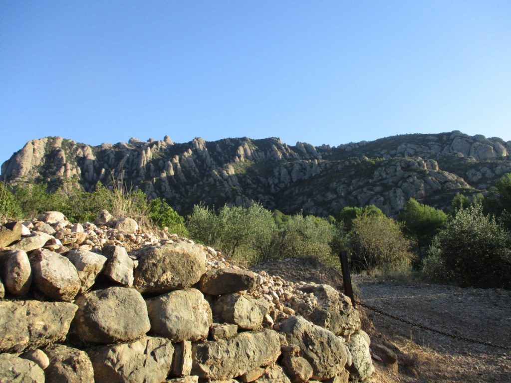
This is the start of the Way of Saint James from Montserrat. The name "Degotalls" refers to the "dripping" of water down the walls of the conglomerate that accompanies us on the route. The culminating point of this geological phenomenon is the "bauma" and the "Roca dels Degotalls" (Degotalls Rock). Located below the walls of "la Trinitat", parallel to the road but higher up. Its route, just over a kilometre long, allows us to relax between roundabouts, cypresses, yew trees and a mature holm oak wood. Forest birds take refuge in this shady environment. All along the route we can contemplate dedications to the Virgin Mary and monuments to famous Catalan personalities, such as Jacint Verdaguer, Joan Maragall and Pompeu Fabra.
(2h50min; 7,4 km) Downhill trail (722 m). We follow it until we reach the road.
(3h00min; 7,8 km) Road BP-1121 (659 m). We go to the left on the verge enabled for hiking, without worrying about cars.
(3h15min; 8,8 km) "Baixada dels Matxos" (Matxos Crossing) (643 m). We leave this path on the right. The name "matxos" in Catalan refers to the mules, which served as pack animals and used this winding road.
The road takes us through a tunnel.
(3h30min; 9,7 km) Santa Cecilia (624 m).
Nearby you may be interested in:
If you want to get to know the mountain of Montserrat and start with an impressive route, the ascent to Sant Jeroni (1,236m), the top of Montserrat, would be the recommended route. [3h30min; 11,7km; +/-760m].
Route through Montserrat from Collbató, on the southern slope of the massif [5h30min; 14,6km; +/-1.269m].
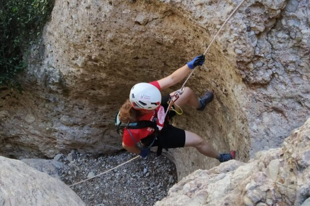
Dry canyon - Medium level - Total time: 5-6 h. Approach: 60′ approx. Descent: 2-3 h. Return: 40′.
Clockwise circular route to les Agulles and els Frares Encantats from Can Maçana. [3h20min; 7,5km; +/-470m].
Fastpacking is not about going faster. It's about going lighter.
If you come from classic trekking, this is the next step: learning to move with less weight,
more fluid and enjoying every kilometre more.
Join the Outsiders Newsletter and start discovering what lightness feels like.