ARP High Pyrenean Route
Embark on the ARP, the intermediate trans-Pyrenean route between the GR10 and the GR10. (northern slope) and the GR11 or Senda Pirenaica (Pyrenean Trail) (southern slope). Along the central axis, isolated and at a higher altitude. A real challenge.

Quick guide ARP - Pyrenean High Route
with everything you need to know before undertaking the High Pyrenean Route
With a subscription of 4 per month you will have access to exclusive benefits, including:
Special Edition Pyrenean Crossing


ARP Map - Pyrenean High Route
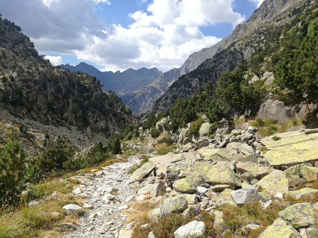
The High Pyrenean Route is a intermediate route between the GR10 (northern slope) and the GR11 or Senda Pirenaica (Pyrenean Path). (southern slope), which generally runs at a higher altitude, although it sometimes coincides with these.


It can be said that the Alta Ruta Pirenaica (ARP) is harder than the Senda Pirenaica (GR 11), considering not its route, but other difficulties, such as the route's signposting, access to facilities en route, etc.

ARP Stages - High Pyrenean Route
It is not a certified trail and is not marked on the ground, although it was marked with yellow paint and the route is usually shown on hiking maps. The ARP runs most of the time in French territory but more in the high mountains than the GR10. In the following table you have a layout of the Haute Route Pyrénéenne in 41 stages
|
Stage _______ 👉 . |
🕒 Timetable . |
↔️ Dist. (km) . |
📈📉 Desn. (m) . |
|---|---|---|---|
| . |
8h30min . |
27 . |
+1.400/ -1.200 . |
|
8h . |
27 . |
+1.000/ -1.000 . | |
| . |
11h |
33 . |
+1.750/ -1.000 . |
|
8h . |
25 . |
+1.000/ -1.100 . | |
| . |
5h |
15,5 . |
+1.100/ -600 . |
| . |
6h . |
18 . |
+1.200/ -1.200 . |
| . |
6h . |
18,5 . |
+1.200/ -800 . |
| . |
8h . |
21 . |
+1.100/ -1.300 . |
|
6h30min . |
15,5 . |
+1.200/ -700 | |
| . |
10h . |
28 . |
+1.550/ -1.600 . |
|
9h . |
21 . |
+1.800/ -1.500 . | |
| . |
8h . |
17 . |
+900/ -1.300 . |
|
7h . |
14 . |
+1.400/ -600 | |
|
8h |
20 . |
+1.400/ -1.500 . | |
| . |
8h . |
22 . |
+1.000/ -2.000 . |
| . |
5h . |
13,5 |
+1.400/ -500 . |
| . |
4h |
15 |
+220/ -1.470 |
| . |
8h . |
21 . |
+1.450/ -900 . |
| . |
5h . |
14 . |
+950/ -1.000 . |
| . |
6h . |
11,5 . |
+1.450/ -550 . |
|
6h . |
16 . |
+900/ -1.300 . | |
| . |
7h . |
16 . |
+1.050/ -1.600 . |
| . |
7h |
14 . |
+1.100/ -700 |
| . |
6h45min |
20 . |
+800/ -1.500 . |
| . |
7h45min . |
27 . |
+740/ -600 . |
| . |
9h30min . |
19 |
+1.400/ -1.450 . |
|
4h30min . |
11 . |
+1.450/ -550 . | |
| . |
7h |
17,5 . |
+750/ -1.800 |
| . |
7h30min |
13 . |
+1.750/ -350 . |
| . |
5h |
12,5 . |
+350/ -1.200 . |
| . |
8h . |
19 . |
+1.600/ -1.300 . |
| . |
6h . |
20 . |
+1.000/ -950 . |
| . |
7h . |
19 |
+1.350/ -1.250 . |
| . |
4h40min . |
18 . |
+170/ -550 . |
| . |
7h30min |
21 . |
+1.850/ -1.100 . |
| . |
7h . |
24 . |
+580/ -1.100 . |
| . |
9h . |
29 . |
+1.350/ -1.350 . |
| . |
5h . |
15 . |
-1.250 . |
| . |
6h . |
20,5 . |
+1.400/ -1000 . |
| . |
6h . |
22 . |
+850/ -550 . |
| . |
8h30 . |
29 . |
+1.400/ -2.300 . |


Frequently asked questions
ARP FAQs
All the questions you are asking yourself to prepare for the ARP - Alta Ruta Pirenaica


-
 Producto en ofertaGR 10 French tracks stagesEl precio original era: 15,00 €.5,70 €El precio actual es: 5,70 €.
 -
 Producto en ofertaGR 11 tracks stagesEl precio original era: 15,00 €.5,70 €El precio actual es: 5,70 €.