GR11 / Etapa 7: Ochagavía-Isaba
Este contenido es exclusivo para miembros.
¿Ya eres miembro del Club? Inicia sesión.

↔️ Distancia: 21,1 km
📈 Desnivel (+730 m), (-730 m) 📉
🕒 Tiempo: 5h25min (tiempo de marcha sin paradas)
⚠️ Dificultad: media-fácil. La mayor parte del recorrido es por pista. La única dificultad reseñable es la empinada bajada a Isaba que pondrá a prueba nuestras rodillas.
💧 Agua: no encontraremos fuentes hasta casi el final de la etapa.

El río Salazar se forma en Ochagavía por la confluencia del Anduña (foto) y Zatoya. 
Santuario de Muskilda 
El Pico de Orhi 
Últimas estribaciones del Pirineo navarro. Anie, Mesa de los Tres Reyes, Petrechema, Acherito, etc 
Balsa de Lakuaga 
Ateas de Belagua 
Nuestra Señora de Idoia 
Cerca de Isaba, en el camino de Idoia.
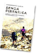
Guía rápida
GR 11
con todo lo que debes saber antes de acometer la Senda Pirenaica