GR 11 Pyrenean Path
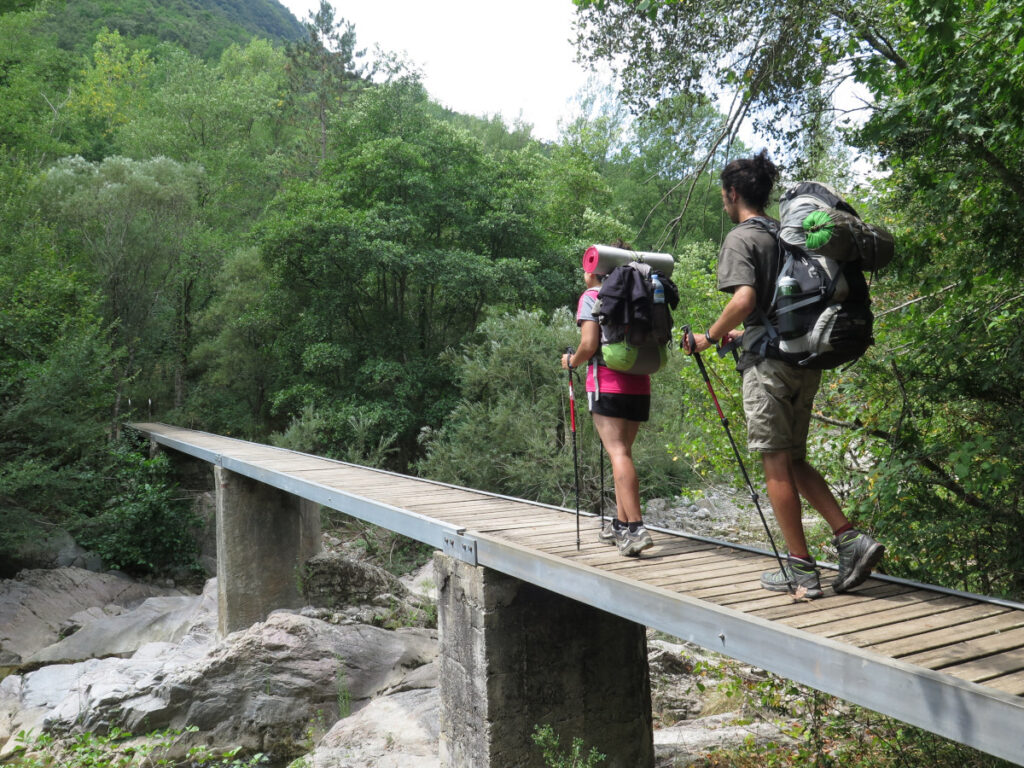
Embark on the GR11, the trans-Pyrenean route of more than 800 km that will challenge your limits and make you live a great adventure.

Quick guide GR 11
with everything you need to know before undertaking the Pyrenean Path
With a subscription of 5 per month you will have access to exclusive benefits, including:
GR11 Map - Pyrenean Path
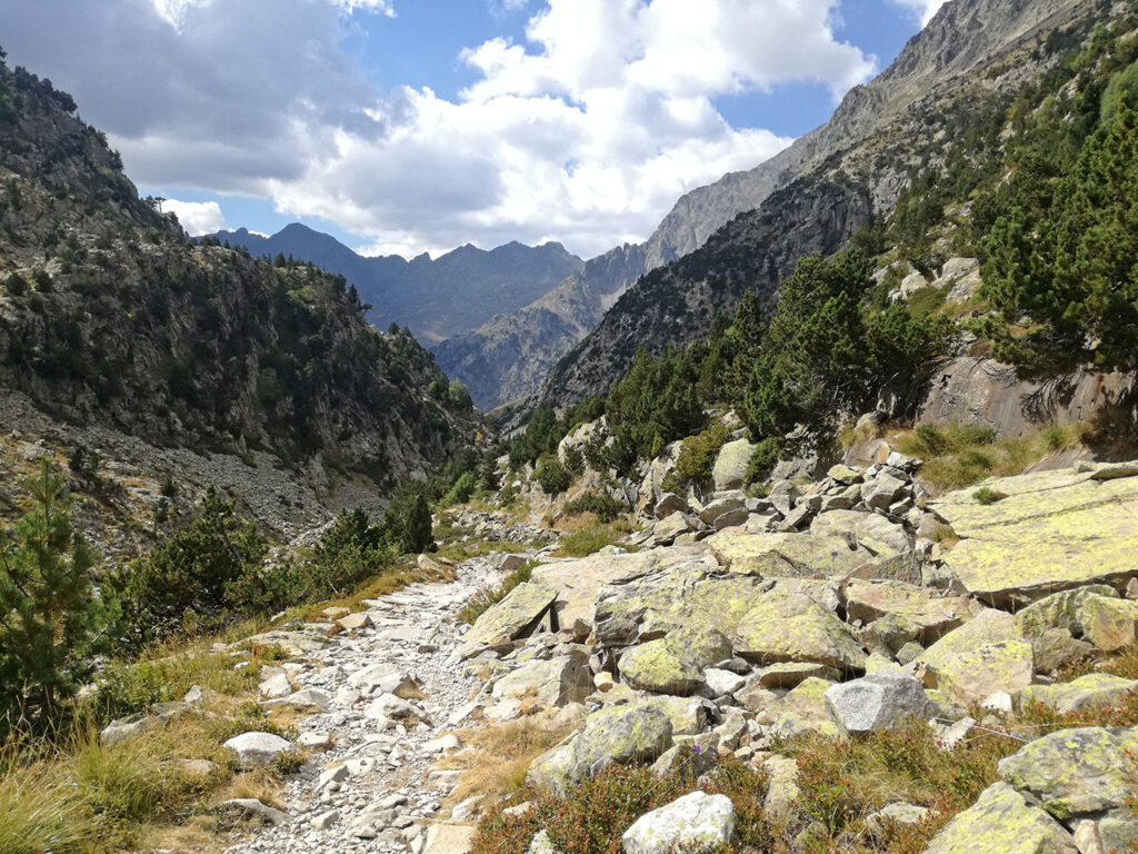
The Trans-Pyrenees Trans-Pyrenees long distance footpath of 800 kilometres, from sea to sea through the Pyrenees, from the Cantabrian Sea (Cape Higuer) to the Mediterranean Sea (Cape Creus).
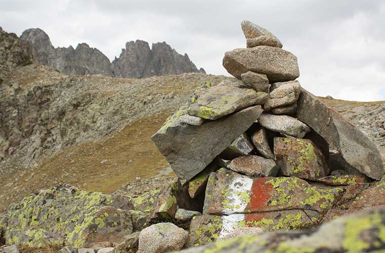
It is a route that is almost entirely signposted with white and red markings.
Stages of the GR11
Its stages generally run between villages, refuges or hostels, so the logistics of the trek are simple.
|
Stage _______ 👉 . |
🕒 Timetable |
↔️ Distance . |
📈📉 Unevenness . |
|---|---|---|---|
|
- . |
9,2 kms . |
- | |
| . |
7h55min . |
31,6 kms . |
+830/-790 |
| . |
8h15min |
29,6 kms . |
+1260/-1140 |
| . |
5h55min . |
18,9 kms . |
+1080/-350 . |
| . |
5h05min . |
17,5 kms . |
+720/-735 . |
|
4h45min . |
17,3 kms |
+595/-585 . | |
|
Stage 6: Villanueva de Aezkoa/Hiriberri - Ochagavía/Otsagabia . |
5h45min . |
20,6 kms . |
+780/-950 . |
| . |
5h25min . |
21,1 kms . |
+675/-625 . |
| . |
3h . |
11,2 kms |
+560/-80 . |
| . |
6h05min . |
18,6 kms . |
+1170/-780 . |
|
4h20min . |
13,7 kms . |
+635/-715 . | |
| . |
5h25min . |
16,3 kms . |
+1.045/-1.002 . |
|
7h05min . |
23,8 kms . |
+905/-1135 . | |
|
3h15min . |
11,2 kms . |
+902/-36 . | |
| . |
5h30min . |
13,9 kms . |
+745/-1.260 . |
|
7h20min . |
21 kms |
+1.100/-1.430 . | |
| . |
8h30min . |
24,6 kms . |
+1238/-381 |
| . |
7h40min |
13,4 kms . |
+943/-1.863 . |
|
5h-6h . |
18 kms . |
+880/-1025 . | |
| . |
6h15min . |
21,7 kms . |
+1580/-1000 . |
|
Stage 20: Refugio de Biados - Puente de San Jaime (San Jaime Bridge) . |
7h00min |
20.3 kms20.3 kms . |
+905/-1.362 |
| . |
5h40min . |
16,5 kms . |
+1500/-350 . |
| . |
3h50min . |
10,2 kms |
+205/-1.070 . |
| . |
4h45min |
12 kms . |
+900/-460 . |
| . |
4h . |
7,5 kms . |
+640/-510 . |
|
4h45min . |
12,5 kms . |
+580/-830 . | |
| . |
4h45min . |
17,4 kms . |
+240/-1200 . |
| . |
4h25min . |
11,6 kms . |
+1290/-980 . |
| . |
4h45min |
13,1 kms . |
+690/-865 . |
| . |
6h . |
14,7 kms . |
+1225/-1100 |
| . |
5h40min . |
15,4 kms . |
+1345/-80 |
| . |
6h25min . |
14,9 kms . |
+810/-1920 |
| . |
5h15min . |
15,1 kms . |
+1050/-1150 |
| . |
6h |
20,5 kms . |
+1350/-560 . |
| . |
4h . |
10,3 kms . |
+810/-740 . |
|
3h30min |
14 kms . |
+100/-1030 . | |
|
6h30min . |
25,3 kms . |
+1020/-1085 . | |
| . |
6h20min . |
16,9 kms . |
+1440/-750 . |
|
5h . |
11,6 kms . |
+1000/-720 . | |
|
6h40min . |
20 kms . |
+620/-1670 . | |
| . |
6h00min . |
23 kms . |
+735/-1200 . |
| . |
6h15min . |
19,3 kms . |
+760/-1275 . |
|
6h50min . |
26 kms . |
+860/-550 | |
| . |
6h20min |
25 kms . |
+830/-880 . |
| . |
7h30min . |
31 kms . |
+560/-890 . |
| . |
5h45min . |
21 kms . |
+760/-910 . |
|
3h50min |
15,3 kms . |
+470/-450 . |
Variants of the GR11
|
Stage _______ 👉 . |
🕒 Timetable . |
↔️ Distance . |
📈📉 Unevenness . |
|---|---|---|---|
|
7h45min . |
29,8 kms . |
+810/-720 . | |
| . |
8h35min . |
31,2 kms . |
+1200/-1080 . |
| . |
6h05min . |
17,7 kms . |
+1400/-950 . |
| . |
5h15min . |
14,3 kms . |
+530/-600 |
| . |
6h00min . |
17,9 kms . |
+1.050/-1.334 . |
|
4h00min . |
12,2 kms . |
+1090/-500 . | |
| . |
7h20min . |
22,1 kms . |
+1030/-1350 . |
|
Stage 12v (Former variant along the Canal de Izas): Canfranc-Estación - Sallent de Gállego . |
6h40min . |
22,7 kms |
+1115/-1025 . |
| . |
6h |
11,7 kms |
+548/-1.470 . |
| . |
4h40min |
10,6 kms . |
+1.150/-730 . |
|
7h30min . |
21,4 kms |
+856/-1.729 | |
|
Stage 21v (GR11.5): Bridge of San Jaime - Refuge of La Renclusa . |
5h15min . |
16,2 kms . |
+1.018/-145 . |
| . |
7h30min . |
11,3 kms . |
+1.117/-829 |


Frequently asked questions
FAQs GR11
All the questions you are asking yourself to prepare the Senda Pirenaica - GR11


-
 Producto en ofertaGR 10 French tracks stagesEl precio original era: 15,00 €.5,70 €El precio actual es: 5,70 €.
 -
 Producto en ofertaGR 11 tracks stages (v1.2 MAY 2026)El precio original era: 15,00 €.5,70 €El precio actual es: 5,70 €.