Free download! The quick guide containing everything you need to know before taking on the Pyrenees Trail-GR11
I want it now!
I want it now!
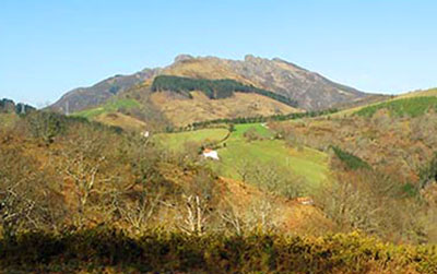
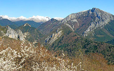
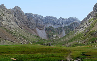
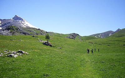
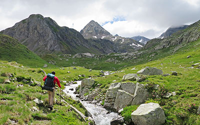
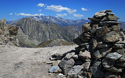
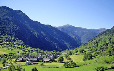
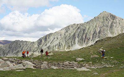
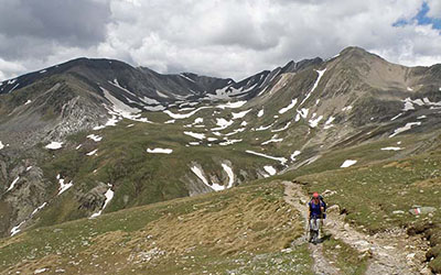
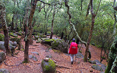
The Pyrenees range is something of a bastion, a natural frontier, which rises majestically along the northern edge of the Iberian Peninsula between Spain, Andorra and France, covering over 400 km from the Cantabrian Sea (Gulf of Biscay) in the west all the way to the Mediterranean Sea (Cape Creus) in the east.
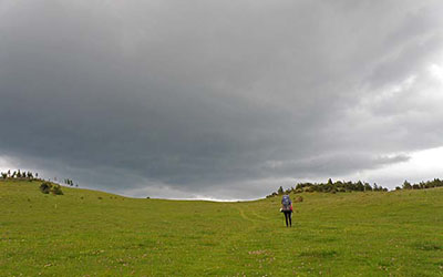
Its whimsical geological formations are home to a climate which will typically range from a gentle caress to exposure to the harshest
and bleakest of conditions. Its peaks, heights, impossible terrains, snow and ice preserve native forests, endangered and isolated creatures,
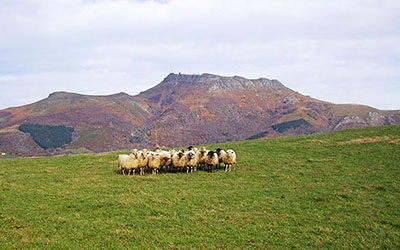
all manner of wildlife that have chosen this place as their last refuge. These mountains, their harsh climate, their terrain, have forged
centuries of culture, folklore, traditions and legends that have gradually grown in the shadow of the highlands, protected by the shelter
of the valley and the village, in the warmth of the hut and the farmstead. A love-hate relationship which has captivated romantic explorers,
scientists, dreamers or even the nobility; intrepid and visionary mountaineers, keen Pyreneists; people with a fighting spirit who would never
surrender to the severity of their beloved mountains.
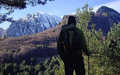
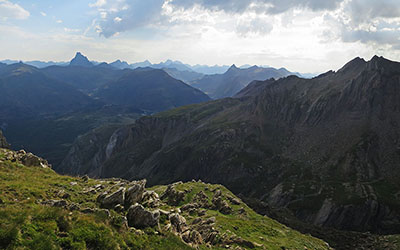
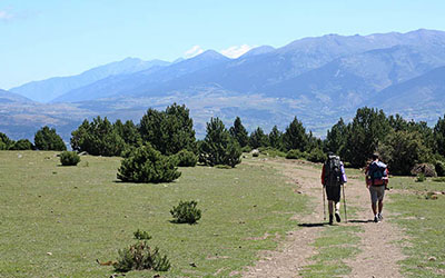
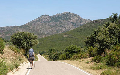
The Pyrenees Trail (GR 11) spans this natural frontier, and throughout this journey the hiker will become enthralled by the untamed
nature of this mountain range, absorbed by the culture of its peoples and fascinated by their stories and legends, but most importantly,
day by day and stage by stage, they will discover emotions, experiences and shared moments along the way and in the shelter of its mountain
huts.
The GR 11 is a Grand Route Trail which crosses the whole of the Pyrenees covering some 800 kilometres, from the Cantabrian Sea (Cape Higuer)
to the Mediterranena Sea (Cape Creus). The route is signposted practically in its entirety with red and white stripes. Each stage will
generally pass between villages, mountain huts or hostels, making the logistics for trekking much easier.
Time: -
Distance: 9.2 kms
Elevation: -
Anyone who wishes to begin the adventure of crossing the Pyrenees from the Cantabrian Sea, and decides to spend the night in Hondarribia or Irún, might consider the possibility of completing this prologue stage in the afternoon/evening, on the day of their arrival. Taking a quiet walk down to Cape Higuer, checking out the fishermen´s quarter in Hondarribia, or having a glass or two of beer in Irún’s old quarter are really worth the time.
Time: 7h55min
Distance: 31.6 kms
Elevation: +830/-790
First stage of the GR11 or Pyrenees Trail between Cabo de Higuer and Bera/Vera de Bidasoa. The main difficulty will be the distance, as well as finding your way across Hondarribia and Irún. Once you are out of the urban areas, the signposting of the route is excellent. The starting point for the GR11 is Cabo Higuer, it crosses Hondarribia and Irún, climbs up to San Marcial´s Chapel and heads towards Endara reservoir via the Col de Ursain. Later on, at the Amargun col, the GR forks into two paths. To the right the GR11.3 leads to Lesaka, and straight ahead we will walk on to Bera.
Time: 8h15min
Distance: 29.6 kms
Elevation: +1260/-1140
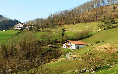
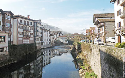
The Pyrenees Trail takes us through the green valleys of the Bidasoa and Baztán, crossing a landscape of farmsteads, known locally as “caseríos”, meadows and woodlands typical of this area of the Navarrese mountains. This is quite a long stage with considerable elevation. From Bera we head to Elizondo, passing Santa Bárbara, the Lizaieta pass, Xorilepo col —where it joins the variant GR11.3—, Elordi col, Esquisaroi col and finally Atxuela.
Time: 7h45min
Distance: 29.8 kms
Elevation: +810/-720
Variant GR11.3 of this first stage of the Pyrenees Trail. The route is similar to the Bera stage. It follows the same path for 27 km as far as Amargún col. At this point it forks right and drops southwards, ending in Lesaka.
Time: 8h35min
Distance: 31.2 kms
Elevation: +1200/-1080
The second part of variant GR11.3. In Lesaka the route descends in search of the River Bidasoa, before rising up steadily toward Xorilepo col —some 10km from Lesaka— where it rejoins the main route.
Time: 5h55min
Distance: 18.9 kms
Elevation: +1080/-350
We begin to climb, as we leave the farmsteads behind, to the grassy hilltops dotted with pigeon hunting posts, finally ending up in the Quinto Real hills, dominated by vast beech forests.
The stage is relatively short. There is no accommodation at the end of it, so we will need to have an alternative plan in place (some establishments in Eugui will provide a shuttle service to and from the Pass, or alternatively, we could keep walking to Sorogain). Between Elizondo and the Urkiaga Pass the GR11 passes the Jaimesaltsu barn, Urbillo col, Kinto barn, Buztamorro col and Zagua col.
Time: 5h05min
Distance: 17.5 kms
Elevation: +720/-735
From Urkiaga Pass to Burguete via the Aratún col, Sorogain and Mendiaundi.
We cross the Qunto Real lands, dominated by beech forests. The first part of the stage passes through this delightful woodland. Later, from Sorogain onwards, the beech trees give way to huge clearings of pasture land and the path climbs up to its highest point before dropping down into Burguete, a main stopping point on the Way to Santiago.
Time: 4h45min
Distance: 17.3 kms
Elevation: +595/-585
The fifth stage between Burguete/Auritz and Villanueva de Aezkoa/Hiriberri, passing Navala, Usateguieta col, Latxaga and Orbara.
As before, this stage is characterised by the forests that prevail in this part of the Navarrese Pyrenees. We leave behind both the Alduides massif and Quinto real, and we head into the Aezkoa valley, the western gateway to the famous Selva de Irati.
Time: 5h45min
Distance: 20.6 kms
Elevation: +780/-950
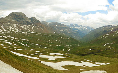
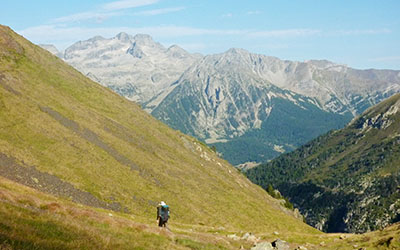
From Villanueva de Aezkoa/Hiriberri to Ochagavía crossing the Ollokiate Pass, the Tapla Pass, the highest point of Western Abodi, the Alforjas Pass and the Muskilda Basilica.
The GR11 climbs up to the Sierra de Berrendi and winds all the way along the hilltop ridge of the Sierra de Abodi as far as the Alforjas Pass. Below, on the north-facing slope lies the Selva de Irati, dominated by the ubiquitous Orhi peak, the first 2,000m-high mountain of the range from the west. Later, we take a long descent into Ochagavia, making an obligatory and worthwhile stop on the way to see the Muskilda Basilica.
Time: 5h25min
Distance: 21.1 kms
Elevation: +675/-625
The seventh stage between Ochagavía (Salazar valley) and Isaba (Roncal valley) via the Millingrate col.
The first half of this stage, which runs along a dirt track, is pretty leisurely. Below Mount Kakueta the landscape starts to open up, as peaks begin to appear, providing a stark contrast to what we have seen so far. Throughout the second half of the day´s walking, we will be putting our knees to the test as we take on the steep descent into Isaba.
Time: 3h
Distance: 11.2 kms
Elevation: +560/-80
This is a very short stage, and could almost be considered a rest day. In case of bad weather conditions, or if there is still snow in Ezcaurre, this would be the recommended option.
Time: 6h05min
Distance: 17.7 kms
Elevation: +1400/-950
Those who would like to reach an important summit might like to choose this alternative option. However, the steep slopes on the descent to Zuriza are dangerous in winter when the snow hardens. In summer, they shouldn’t pose a problem.
Time: 6h05min
Distance: 18.6 kms
Elevation: +1170/-780
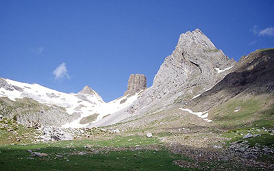
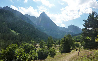
A delightful stage between the headlands of the Aragonese valleys of Ansó and Hecho. In the first part of today’s GR stage we climb up to Petraficha col, under the stoney gaze of the Sierra de los Alanos. We then head down towards the valley of the Aragón-Subordan —the views here are breathtaking: Selva de Oza, Castillo de Acher, Ansabere, etc— and to top it all, we will conclude our day’s walking in the Aguas Tuertas valley, one of the most beautiful in all the Pyrenees, where there is a small cabin to spend the night.
Time: 4h20min
Distance: 13.7 kms
Elevation: +635/-715
The variant GR11.1 via Estribiella is a good option, particularly for those looking for a comfortable end of stage. This variant splits from the one going to Aguas Tuertas on the plains of Taxeras, heading instead up the Mazandú ravine – at the foot of the rocky outcrop of the Alano mountain chain - to Estribiella col. After that, it heads down into Oza forest, where it converges with a variant of the Camino de Santiago, and continues downstream, following the ever narrowing course of the river Aragón-Subordán which reaches its narrowest point at the Boca del Infierno.
Time: 5h25min
Distance: 16.3 kms
Elevation: +1.045/-1.002
Despite the modest height of the mountains and cols the route passes through, we can still consider this as one of the traverse’s high-mountain stages. It is also one of the most beautiful stages, passing such places as the Aguas Tuertas valley, the Ibón de Estanés lake or the wild forest of Sansanet.

Time: 5h15min
Distance: 14.3 kms
Elevation: +530/-600
Despite the modest height of the mountains and cols the route passes through, we can still consider this as one of the traverse’s high-mountain stages. It is also one of the most beautiful stages, passing such places as the Aguas Tuertas valley, the Ibón de Estanés lake or the wild forest of Sansanet.
Time: 7h05min
Distance: 23.8 kms
Elevation: +905/-1135
A direct stage between Candanchú and Sallent de Gallego via Canal Roya, and the Anayet and Formigal lakes.
The GR skirts Mount Anayet. This mountain, just like its neighbour the Midi D'Ossau, owes its origins to volcanic phenomena which occurred after the Hercynian orogeny mountain-forming event and prior to the Alpine orogeny which gave rise to the Pyrenean range as we know it. Consequently, in 2007 this area was declared a Place of Geological Interest.
Time: 6h00min
Distance: 17.9 kms
Elevation: +1050/-1334
The variant GR11.1 via Estribiella is a good option, particularly for those looking for a comfortable end of stage. This variant splits from the one going to Aguas Tuertas on the plains of Taxeras, heading instead up the Mazandú ravine – at the foot of the rocky outcrop of the Alano mountain chain - to Estribiella col. After that, it heads down into Oza forest, where it converges with a variant of the Camino de Santiago, and continues downstream, following the ever narrowing course of the river Aragón-Subordán which reaches its narrowest point at the Boca del Infierno.
Time: 4h00min
Distance: 12.2 kms
Elevation: +1090/-500
The first of two stages of the variant GR11.1 which takes a southerly course from Selva de Oza To Lizara via Santa Ana Bridge, Gabardito hostel, Plan de Dios te Salve and the Foratón gap.
Time: 7h20min
Distance: 22.1 kms
Elevation: +1030/-1350
The second of two stages of the variant GR11.1, which joins Lizara with Canfranc Station in the valley of the Aragón river. Over the course of this stage we will pass two cols above 2,000m, el Bozo and la Magdalena, and we will take in some spectacular views such as those we will encounter in the Riguelo valley or the views from the Magdalena col.
Time: 6h40min
Distance: 22.7 kms
Elevation: +1115/-1025
A pleasant variant across the Izas Canal, featuring the outstanding Punta Escarra or the fabulous north face of the Pala de Ip, an area of real adventure in winter for top mountaineers.
This variant is the most logical course to follow for those who have opted for the GR11.1 variant via Lizara and the Selva de Oza. Nevertheless, this is a “declassified” stretch of the walk. Waypoint markings disappear at some points along the climb to the Collado de Izas from Canfranc and are practically non-existent towards Formigal.
Time: 3h30min
Distance: 11.2 kms
Elevation: +902/-36
A short stage in which the GR11 enters into the Central Pyrenees. The Pyrenees Trail rises up through woodland as far as La Sarra reservoir, at which point the valley narrows. The trail heads up Aguas Limpias ravine, with Arriel peak (2,824) as its backdrop, taking in such spectacular views as towards Paso del Onso.
Time: 5h00min
Distance: 13.9 kms
Elevation: +735/-1251
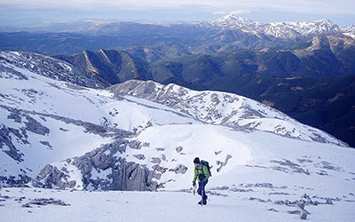
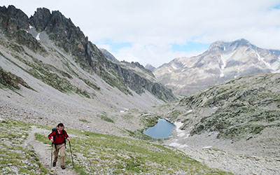
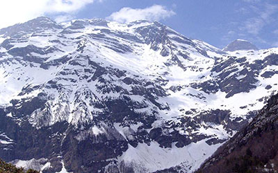
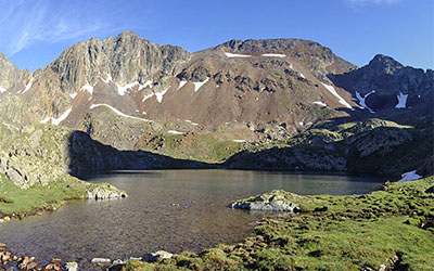
A high mountain stage between Respomuso auberge and Panticosa spa, crossing Tebarray col and the mountain lakes of Bachimaña. One of the stellar days of the route, taking in high mountain vistas, mountain lakes, 3,000-metre peaks and a 2,800m pass where snow is present practically year-round.
Time: 7h
Distance: 20 kms
Elevation: +910/-1210
A great day’s walking between Panticosa Spa and San Nicolas de Bujaruelo. The day commences with an exhausting climb out of the deep valley dominated by peaks of 3,000m in which the spa is nestled. On the other side of the Brazato col, the tranquil valley of Ara awaits us, followed by the impressive Vignemale massif, the scene of great exploits, stories of noblemen and refuge of the last glacial language that still survives in the Pyrenees.
Time: 6h
Distance: 21 kms
Elevation: +1180/-330
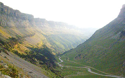
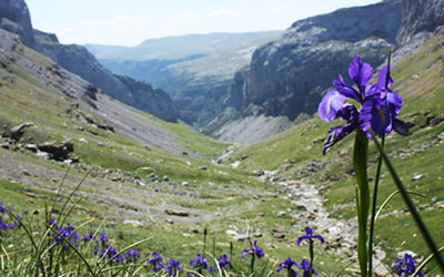
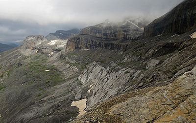
A stage between Bujaruelo and Góriz mountain hostel which crosses, in its entirety, what is likely to be the best-known valley in the Pyrenees, the Ordesa valley, ending up at the foot of Mount Perdido, one of the great colossus of the mountain range.
Time: 7h40min
Distance: 13.4 kms
Elevation: +943/-1863
In the National Park of Ordesa y Monte Perdido, nature can be expressed using only superlatives. The Ordesa valley, the canyon of Añisclo, the Monte Perdido massif or the impressive U-valley in Pineta are some of the sites you will get to discover as this stage unfolds.
Time: 6h
Distance: 11.7 kms
Elevation: +548/-1470
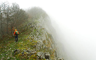
The route you follow along the variant GR11.9 via the Faja de las Olas is simply spectacular. Between the cols of Arrablo and Añisclo, the path wends its way up along a terrace forged along the wall of the Punta de las Olas. This route saves both in time and elevation if we compare it to the main route via Fuenblanca. There are, however, stretches of this path that are exposed, so it is only to be recommended in fair-weather conditions by experienced mountaineers.
Time: 7h
Distance: 20.4 kms
Elevation: +1060/-1150
From Pineta to Parzán passing the Llanos de La Larri, the Coronetas col and the village of Chisagües.
We leave behind the Mount Perdido massif, which bids farewell in a blaze of glory, as it reveals its imposing north face, plummeting 2,000m down to Pineta and its hanging glacier.
Time: 6h15min
Distance: 21.7 kms
Elevation: +1580/-1000
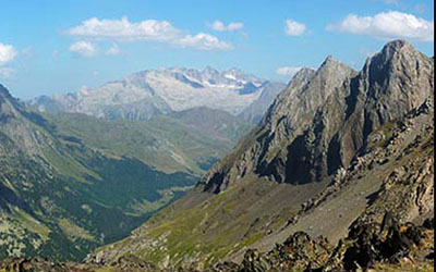
Despite the significant elevation gain to take into account on this stage, more than 1,500m up to Urdiceto col, most of the time our ascent along a dirt track will be bearable. The second part, following a path, is more enjoyable, and on the horizon we can make out a number of peaks over 3,000m, with Posets standing tall above the rest.
Time: 7h00min
Distance: 20.5 kms
Elevation: +905/-1362
From Biados to Puente de San Jaime via Añes Cruces and the Chistau pass.
A simple stage thanks to the distance and elevation, even though most of it remains above 2,000m, passing on both sides mountains that easily exceed 3,000m.
Time: 4h40min
Distance: 10.6 kms
Elevation: +1150/-730
The original variant following the south face of Posets. As this is not a particularly demanding stage in terms of elevation and time, many mountaineers opt to climb Forqueta (3,011m), a three-thousand-metre mountain that presents little difficulty and which can be accessed in half an hour from Forqueta col (2,860m).
This is an enjoyable stage, full of variety. The first part leads you through pine forest, then open fields and finally boulders and rocky terrain on the ascent to the col. On the other side Llardaneta lake awaits. The rest of the descent follows reasonably comfortable terrain down to the auberge.
Time: 7h30min
Distance: 21.4 kms
Elevation: +856/-1729
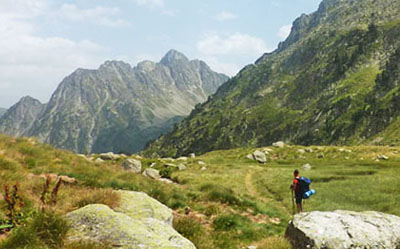
Ángel Orús auberge is a busy place, frequented by those looking to climb Posets (3,369m), the second-highest peak in the Pyrenees. The GR11 soon diverges from the path that takes climbers up to Posets and skirts it to the east, along a much quieter route. Lakes are dotted around the higher ground, while in the distance Aneto emerges with its own posse of three-thousand-metre climbers. Below, Agulla de Perramó stands defiantly. The image of the needle taken from the area around Batisielles lake, is one of the most popular snapshots. The route now heads into the pine forest in search of Benasque valley, at the foothills of the Maladeta massif.
Time: 5h40min
Distance: 16.5 kms
Elevation: +1500/-350
An easy stage due to the distance and elevation, and thanks to the dirt tracks that traverse the valley of Vallibierna. This is a transitional stage between the two regions that contain the highest peaks of the mountain chain. We leave behind the Posets and Perdiguero massifs and we head into the Maladeta massif and Mount Aneto under the watchful eye of Pico Vallibierna.
Time: 5h15min
Distance: 16.2 kms
Elevation: +1018/-145
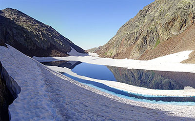
The variant GR11.5 skirts the Maladeta massif on the north side. The Pyrenees Trail follows the course of the river Ésera upstream as far as the Hospital plains, known as Plan d'Estan and continues towards Forau d'Aigualluts and Renclusa auberge. In times gone by these green meadows were occupied by a thick icy layer. Today, some ice persists, cornered into the highest part of the massif, like a relic of the ice age.
Time: 7h30min
Distance: 11.3 kms
Elevation: +1117/-829
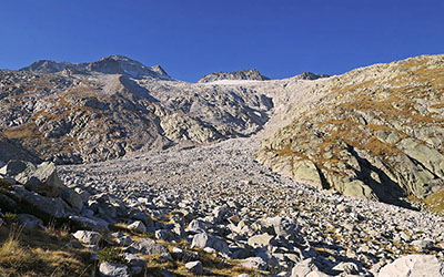
In this second stage of the variant GR11.5 you reach the other side by continuing to skirt the north face of the Maladeta massif. This is a high-mountain stage. Vegetation almost completely disappears. Making progress over the chaos of boulders becomes rather complicated and you will also have to cross a 2,809m pass, which is covered with snow all year round. As a reward, the stage regales us with some magnificent views over the monarch and his court. In no other stage can you see so many 3,000-metre peaks in such close proximity.
Time: 3h50min
Distance: 10.2 kms
Elevation: +205/-1070
From Coronas Bridge Hostel to Conangles Hostel passing the Ballibiena high lakes and col, Riueno col, Anglios lake and Salenques valley.
This is a tough stage in which we will have to climb up one col above 2,700m and another over 2,500m. We are in the land of high mountains, boulders and unstable scree slopes…The beauty of the landscape, the mountain lakes and the solitude that pervades more than compensate for the effort.
Time: 4h45min
Distance: 12 kms
Elevation: +900/-460
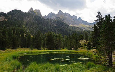
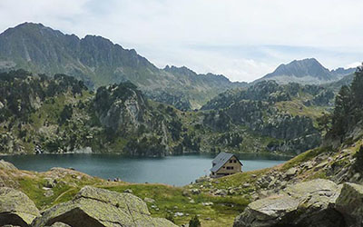
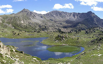
From Conangles to Restanca via the Rius pass and Rius valley. The Catalonian Pyrenees welcome us in the grandest style. In just two hours we go from the fabulous fir tree forests that grow alongside the busy road that links Vielha to the península, to finding ourselves deep in the heart of Aigüestortes i Sant Maurici, the greatest spectacle of glacial lakes, known here as “estanys” in Catalan or “estanhs” in Aranese, in the whole of the Pyrenees.
Time: 4h
Distance: 7.5 kms
Elevation: +640/-510
This is one to pencil in, as it is one of the most noteworthy days of the whole traverse. The stage is short, one that invites us to stop, relax, take photos and get our feet wet in one of the lakes we encounter along the way. We also have the opportunity to climb to the top of the Montardo mountain.
Time: 4h45min
Distance: 12.5 kms
Elevation: +580/-830
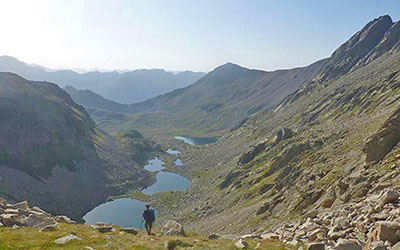
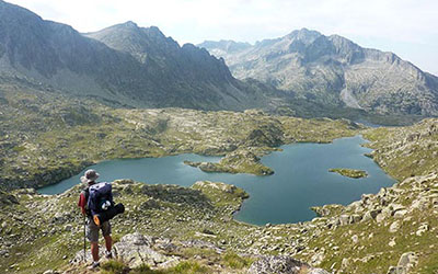
There is little doubting we are still in Aigüestortes. The glacial lakes come in quick succession; Long, Redon, Obago... there are up to 48 in the Colomers cirque. The only major obstacle of the day will be the Ratera Pass. The reward reserved for the end of the day far outshines the effort involved as we reach the Estany de Sant Maurici below the overwhelming hulk of Els Encantats.
Time: 4h45min
Distance: 17.4 kms
Elevation: +240/-1200
From the Ernest Mallafré Hostel to La Guingueta via Espot, Estaís and Jou.
We leave the Aigüestortes i Sant Maurici National Park behind under the watchful eyes of Els Encantats and we make our way down towards the valley of Aneu, in the Pallars Sobirá district, best known to many for the white waters of the Noguera Pallaresa.
Time: 4h25min
Distance: 11.6 kms
Elevation: +1290/-980
From Guingueta d'Aneau to Estaon via Dorve and the Montcaubo col.
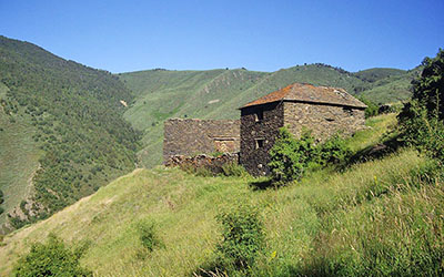
The GR11 route veers away from the main direction of the chain, further to the south, off the beaten path and away from the tourists, as it shows us its less visible side, that of so many villages and barns that have been left abandoned in these districts.
Time: 4h45min
Distance: 13.1 kms
Elevation: +690/-865
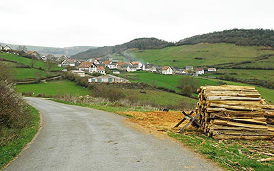
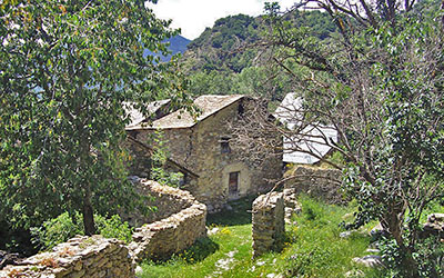
Just as with the previous stage, our route furrows a solitary path. The landscape is more civilized and less rugged, while revealing places that at one time would have been brimming with life, like the Nibrós barns which today are merely a cluster of ruins that watch the world pass it by; a reminder of peoples’ lives in this valley in days gone by.
Time: 6h
Distance: 17.1 kms
Elevation: +1225/-1100
From Tavascan to Àreu passing Boldís Sobirá, the Tudela Col and the Costuix barns.
This is the last of the transitional stages before arriving at Vall Ferrera, at the foothills of the emblematic Pica d'Estats, last of the Pyrenean massifs to rise above 3,000m.
Time: 5h40min
Distance: 15.4 kms
Elevation: +1345/-80
This is one of the great stages, and is quite demanding due to the elevation gain involved. It begins by climbing the Vall Ferrera, sharing the same route that heads towards the Pica d'Estats. Shortly before reaching the Pla de Boet, the routes go their different ways, and our route leads upwards, passing mountain streams, lakes and high-mountain meadows, which give way to a much rockier terrain the higher we climb.
Time: 6h25min
Distance: 14.9 kms
Elevation: +810/-1920
A high-mountain stage, with a considerable descent, but featuring a couple of rather demanding climbs.
We enter the Principality via the Port de Baiau. The views here are spectacular, and we are soon welcomed by the Pic de Comapedrosa, Andorra’s highest peak. From this point, a long descent to Arinsal awaits, although before we can finish the stage and reach Arans, we must first get over the Col de Les Cases.

Time: 5h15min
Distance: 15.1 kms
Elevation: +1050/-1150
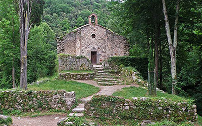
A quiet day’s walking between Arans and Encamp with the only difficulty being the Coll de Ordino and the steep drop down to Encamp. Other than that, we will be following paths, crossing vast pine forests and never far from some village or road. Almost at the end of the stage, it is worth stopping for a moment to visit the Sant Romà de les Bons chapel.
Time: 6h
Distance: 20.5 kms
Elevation: +1350/-560
We sef off from Emcamp in search of the Madriu valley. Here, the landscape is stunning, as our path climbs up alongside a torrent of raging water, boxed in between enormous mountains, and along some stretches it takes the same course as other routes such as the GR7 and the GRP. Towards the end, the valley widens and to our delight a cluster of lakes occupies each of the depressions.
Time: 4h
Distance: 10.3 kms
Elevation: +810/-740
We leave Andorra behind and head into Cerdanya, never dropping below 2,000m. On the Vallcivera cols and the Engorgs pass, it feels as though we could almost touch the sky.
Time: 3h30min
Distance: 14 kms
Elevation: +100/-1030
A day of transition from the group of mountains around Malniu, culminating with the Puig Pedros (2,911m), and those awaiting us on the following days around Nuria, culminating with the Puigmal (2,913m).
The Pyrenees Trail drops down into the enormous depression of Cerdanya — a wide valley that rises up 1,000m above sea level, forged by the River Segre from east to west — to finish in its main town of Puigcerdà.
Time: 6h30min
Distance: 25.3 kms
Elevation: +1020/-1085
A long stage between Puigcerdà and Planoles passing Vilallovent, the Marcer col, the Creu de Meians col and Dòrria.
This is a tough stage, due to the distance and elevation involved. Nonetheless, throughout the day we will take in some fabulous views on all sides.
Time: 6h20min
Distance: 16.9 kms
Elevation: +1440/-750
A tough day’s walking which heralds a return to the Pyrenees at their most rugged. The stage could be divided into two; in the first part, we make our way up to the Collet de les Barranques through woodland, under the watchful eye of the Puigmal (2,913m), and then drop down to Queralbs, a lively little village with the typical beauty of rural Pyrenees. The second part of our walk climbs up through the narrow valley of Nuria, alongside the famous rack-and-pinion railway line that runs to the Basilica, which has become an important pilgrim destination.
Time: 5h
Distance: 11.6 kms
Elevation: +1000/-720
A short stage between Nuria and Ulldeter, providing a last taste of high-mountain terrain. We will climb up to 2,800m at the Noucreus col, and without losing height, we will walk along the ridge, a row of high points that make up the headwaters of the River Freser. Further ahead, we will head into the Ter river basin, the most voluminous of all Catalonian rivers.
Time: 6h40min
Distance: 20 kms
Elevation: +620/-1670
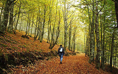
The long descent into Setcases, in conjunction with the previous stage, seems to confirm that we are definitively leaving behind the rugged peaks of the Eastern Pyrenees. From here on in, although the landscape is shaped much more by the human hand, and is influenced much more by the Mediterranean, it doesn’t mean it is any less beautiful. The Alta Garrotxa, a wild land which hides a real natural treasure within it, awaits.
Time: 6h00min
Distance: 23 kms
Elevation: +735/-1200
The route of this stage enables us to discover a land covered with vast areas of forest, picturesque villages and abandoned farmsteads. We are in the heart of the Alta Garrotxa.
Time: 6h15min
Distance: 19.3 kms
Elevation: +760/-1275
A delightful stage between Talaixà and Albanyà, which will take us deep into the heart of the Alta Garrotxa, passing the romanesque chapel of Sant Aniol, amid a rough landscape with dense Mediterranean woodland, before reaching the Alt Empordà.
Time: 6h50min
Distance: 26 kms
Elevation: +860/-550
A demanding, essentially Mediterranean, day’s walking, with dense woodland teeming with evergreen oaks and cork oaks, and dotted with Catalonian “masía” farmsteads. At the top of some hills you can make out the sea. The last stretch passes through areas brimming with history; Mina Canta, La Vajol... and follows paths that in their day were used by thousands of exiles during the Spanish Civil War. Men of such status as Lluís Companys, Manuel Azaña or José Manuel Aguirre walked these paths.
Time: 6h20min
Distance: 25 kms
Elevation: +830/-880
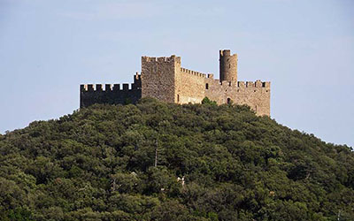
La Jonquera has been a crossing point since time immemorial, going all the way back to Roman times, when it served as the major point of access between the peninsula and Rome; in Gaul it was known as the Via Domitia and in Hispania it was known as the Via Augusta.
History is a fundamental element of this stage, which makes its presence felt in places such as Requesens Castle, the lime furnaces or the megalithic remains that are in abundance throughout this area.
Time: 7h30min
Distance: 31 kms
Elevation: +560/-890
This is a stage with a very Mediterranean flavour. We are in the Empordà region, between the Costa Brava and the Pyrenees, and it can reach blistering temperatures here in summertime. Close to Requesens there is an abundance of evergreen oaks, although in the uplands, in shadier terrain, a few beech trees persist. These are the eastermost examples in the Pyrenees chain. Scrubland later takes over as shade becomes harder to come by and, just like an oasis, the monastery of Sant Quirze de Colera appears out of nowhere. The stage ends in Vilamaniscle, in one of Catalonia’s vineyards par excellence.
Time: 5h15min
Distance: 21 kms
Elevation: +760/-910
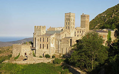
Although the GR11 reaches the Mediterranean in Llançà, the Pyrenees extend a little further, to Cap de Creus. This stage, which hints at the trail drawing to a close, still reserves a few places that can be considered jewels in the history of this land, such as the monastery at Sant Pere de Rodes or the tiny village of Selva de Mar, hidden in the hills to ensure protection from the constant attacks from pirates.
Time: 3h50min
Distance: 15.3 kms
Elevation: +470/-450
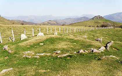
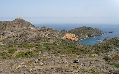
Within the peninsula of Cap de Creus lies a strange beauty; inland it is rugged, while the coastline is jagged, harsh and wild: The Tramuntana has had much to do with the shaping of this landscape. Besides all this, we find ourselves in an area rich in history; here we can witness one of the major groups of megaliths in Catalonia.
Any hiker who is walking the GR11 will realise what a moving place this is, whether it be the beginning or the end of this great adventure. Nothing else lies beyond the lighthouse, just a rocky point lashed by the winds that drive into the Mediterranean Sea at the easternmost point of the Iberian peninsula.