Download the track


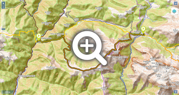
Stage 8 (GR11.4): Isaba - Zuriza (via Ezkaurre)
Alternative - Main Route: Isaba - Zuriza (via Belabarze)


Distance/elevation: 17,7 km / (+1.405),(-950)
Time: 6h05min (walking time without stops).

Difficulty: Hard, not recommended in winter – crampons required in the descent/ascent to Zuriza

Route/Itinerary:

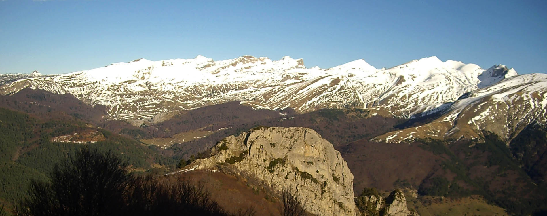
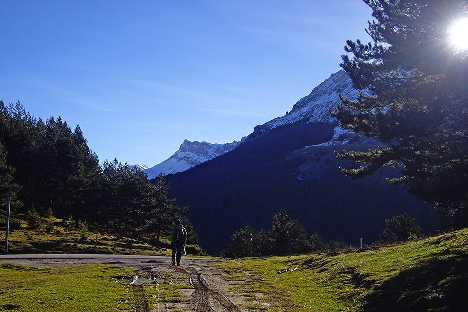
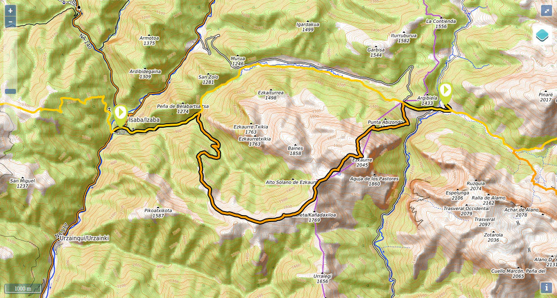
(0h0min; 0kms) Isaba (790m). On the NA-137 road that crosses Isaba, walk down a cobbled street on the right, at the end of a kind of park/viewing platform with benches and a phone booth. The Pyrenees trail leaves the last houses behind and drops down towards Belabarze ravine before coming to a track coming from Isaba. The landscape is overshadowed by the rocky outcrop of Ezkaurre Txikia. Keep walking ahead along the track.

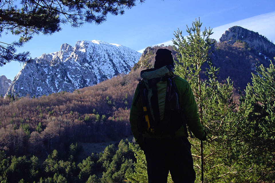
(0h35min; 2.4kms) Ateas de Belabarze Pass (860m). The track divides, as does the GR. One option is straight ahead through Ateas pass via Belabarze Valley. To the right, as we are about to explain, you have the variant GR11.4 which climbs to Ezkaurre. The GR11.4 continues through Berroeta ravine until it emerges from it and takes on, to the south, the steep slopes of Mendikosanz. Once you reach the top, in open terrain, follow the ridge and to the north skirt round Itoleta or Punta del Trozo (1769m) and leave Alto Solano de Ezkaurre (1712m) on your left before reaching...

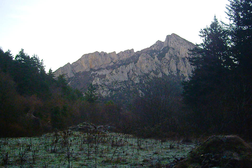
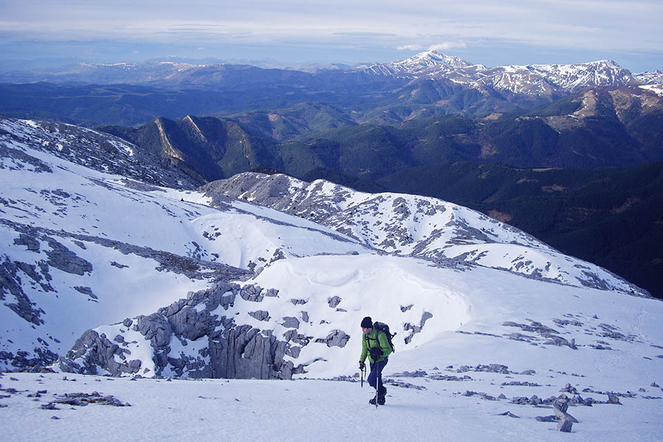
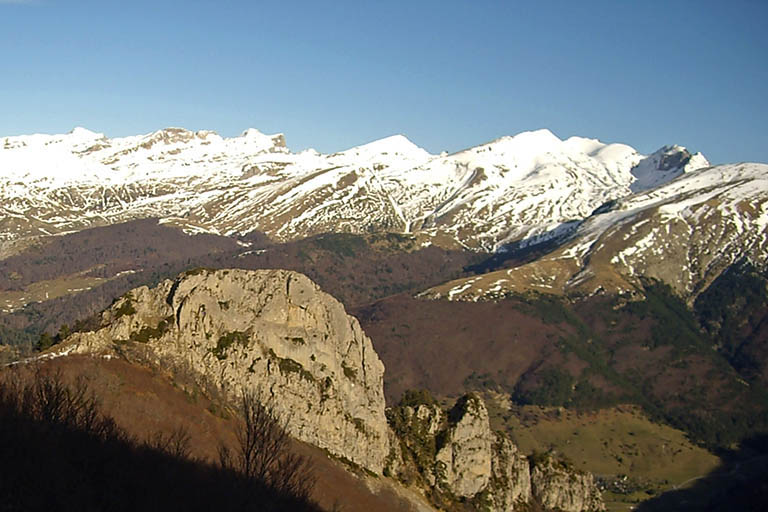
(3h20min; 11.2kms) Ezkaurre Lake (1.675m), below the rocky outcrop. You reach the summit ridge by following the narrow channel between scree and boulders. At the top, keep right (east) and reach the nearby summit of...

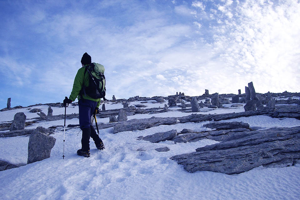
(4h25min; 12.6kms) Ezkaurre (2.050m). The GR11 drops down towards Abizondo col (1641m), via the north face (difficult in wintry conditions, crampons required). Beyond the col, the path enters the beech forest – the steep slopes give you no respite – and you will soon reach...

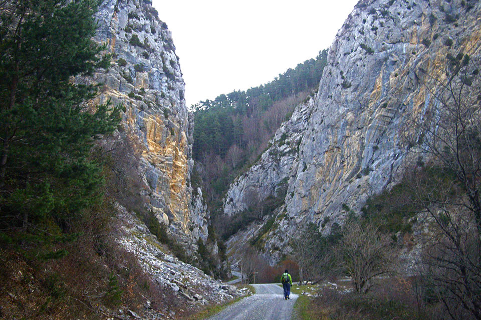
(5h45min; 16.1kms) Argibiela col or Navarros Pass (1.290m), where you will meet the road that joins Isaba and Zuriza, as well as the GR11 (por Belabare). You are leaving Navarra and entering Aragón. A gentle downhill walk with your eyes on the road leads you effortlessly to the end of your stage at...

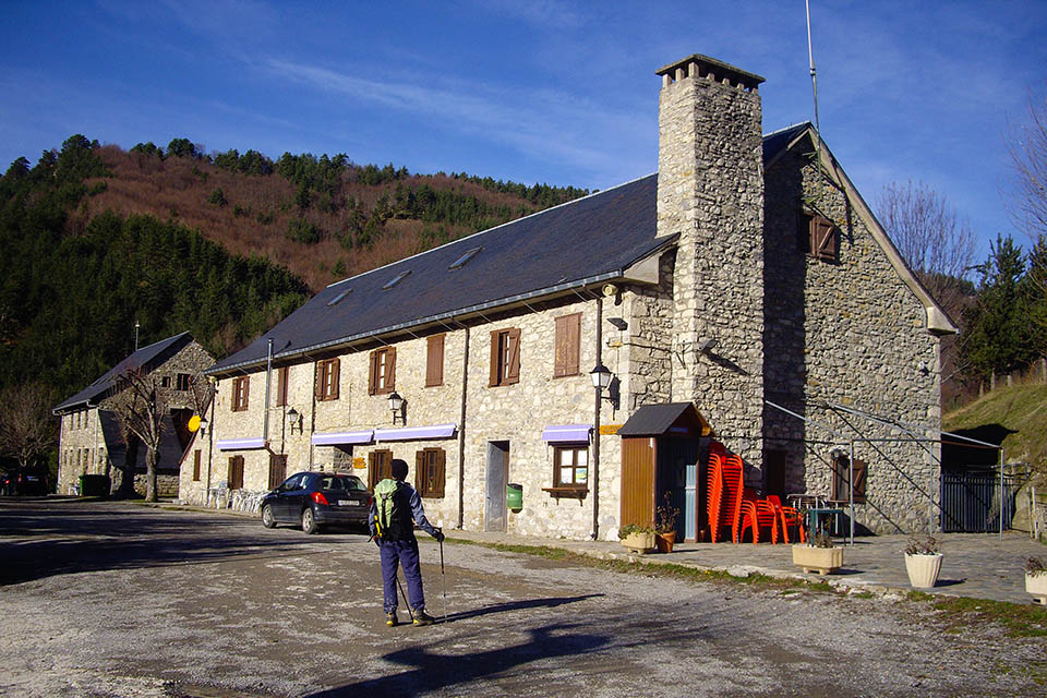
(6h05min; 17,7 kms) Zuriza Campsite (1.220m).

Where to sleep?

In Isaba there is a choice of accommodation. We recommend SNO Isaba (+34 948 37 00 77; reservas@snoisaba.com) and for groups Albergue Oxanea (+34 948 893 153 / 609 447 726; info@albergueoxanea.com;), (5-9 rooms, restaurant and kitchen).

In Zuriza there is the Zuriza Campsite-Auberge (/). Below the campsite there is an open shelter (2 floors, reasonable condition).

Other services:

In Isaba you will find a supermarket, an ATM machine and several bars and restaurants.

Zuriza Campsite has a bar-restaurant as well as a store.

Maps:

- Alpina: Valles de Belagua y Roncal (Scale: 1/25.000).
- SUA edizioak: Belagua y Zuriza (Scale: 1/25.000).

Transport:

There are buses running from Pamplona to Isaba, with La Tafallesa () bus company.

To get to Zuriza from Ansó you can get a taxi, based centrally in Jaca ().

To get to Ansó, there are buses from Jaca, via Hecho and Siresa ().


Perfil de la etapa

Stages - GR11

- Prologue: Cabo Higuer - Hondarribia - Irun
- Stage 1: Cabo Higuer - Bera
- Stage 1v (GR 11.3): Cabo Higuer - Lesaka
- Stage 2: Bera - Elizondo
- Stage 2v (GR 11.3): Lesaka - Elizondo
- Stage 3: Elizondo - Pto de Urkiaga
- Stage 4: Puerto de Urkiaga - Burguete
- Stage 5: Burguete/Auritz - Villanueva de Aezcoa/Hiriberri
Stage 6: Villanueva de Aezcoa/Hiriberri - Ochagavia
Stage 7: Ochagavia - Isaba
Stage 8: Isaba - Zuriza (via Belabarce)
Stage 8v (GR 11.4): Isaba - Zuriza (via Ezkaurre)
Stage 9: Zuriza - Aguas Tuertas
Stage 10: Aguas Tuertas - Lizara
Stage 10 (discontinued): Aguas Tuertas - Candanchú
Stage 11: Lizara - Candanchú
Stage 12: Candanchú - Sallent de Gallego
Stage 9v (GR 11.1): Zuriza - Puente de Santa Ana
Stage 10v (GR 11.1): Puente de Santa Ana - Lizara
Stage 11v (GR 11.1): Lizara - Canfranc Estación
Stage 12v: Canfranc Estación - Sallent de Gallego (via C.Izas)
Stage 13: Sallent de Gallego - Refugio de Respomuso
Stage 14: Refugio de Respomuso - Balneario de Panticosa
Shortcut: The pipeline path from Bachimaña to Brazato
Stage 15: Balneario de Panticosa - San Nicolas de Bujaruelo
Stage 16: San Nicolas de Bujaruelo - Refugio de Goriz
Stage 17: Refugio de Goriz - Circo de Pineta (Fuenblanca)
Stage 17v (GR11.9): Refugio de Goriz - Circo de Pineta (Faja de las Olas)
Stage 18: Circo de Pineta - Parzán
Stage 19: Parzán - Biadós
Stage 20: Biadós - Puente de San Jaime
Stage 20v (GR 11.2): Biadós - Ref. Ángel Orús
Stage 21v (GR 11.2): Ref. Ángel Orús - Puente de San Jaime
Stage 21: Puente de San Jaime - Refugio de Cap de Llauset
Stage 21v (GR 11.5): Puente de San Jaime - Refugio de la Renclusa
Stage 22v (GR 11.5): Refugio de la Renclusa - Refugio de Cap de Llauset
Stage 22: Ref. Cap de LLauset - Conangles
Stage 23: Conangles - La Restanca
Stage 24v (GR11.18): La Restanca - Colomers
Stage 25: Colomers - Ernest Mallafré
Stage 26: Ernest Mallafré - La Guingueta
Stage 27: La Guingueta - Estaón
Stage 28: Estaón - Tavascán
Stage 29: Tavascán - Areu
Stage 30: Areu - Baiau
Stage 31: Baiau - Arans
Stage 32: Arans - Encamp
Stage 33: Encamp - Ref. l'Illa
Stage 34: Ref. l'Illa - Malniu
Stage 35: Malniu - Puigcerdá
Stage 36: Puigcerdá - Planoles
Stage 37: Planoles - Santuario de Nuria
Stage 38: Santuario de Nuria - Refugio de Ulldeter
Stage 39: Refugio de Ulldeter - Molló
Stage 40: Molló - Talaixà
Stage 41: Talaixà - Albanyà
Stage 42: Albanyà - La Vajol
Stage 43: La Vajol - Requessens
Stage 44: Requessens - Vilamaniscle
Stage 45: Vilamaniscle - El Port de la Selva
Stage 46: El Port de la Selva - Cap de Creus

Selección: GPS de montaña
eTrex Touch 35
eTrex 30x
eTrex 20x


Map of the stage