Stage 9v (GR11.1): Zuriza - Puente de Santa Ana
Difficulty: the descent from Estriviella col towards Oza is steep. A section with towlines involves no difficulty. The route is well waymarked.
Water: throughout the stage you will find a number of drinking fountains and streams to fill up with water. The main ones are indicated in the description.
Notes/suggestions: The stage description ends at Puente de Santa Ana, where several options for spending the night are available. See the section “Where to sleep”. As an alternative to this stage, you could follow the route of the Senda Camille (Zuriza - Paso de Taxeras or Txandalan - Collado de Lenito Baxo - Puente de Santa Ana).
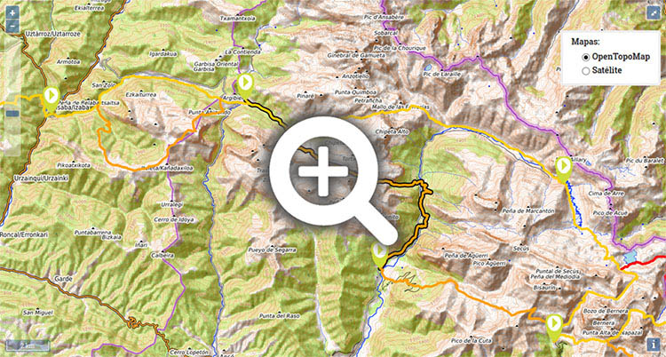
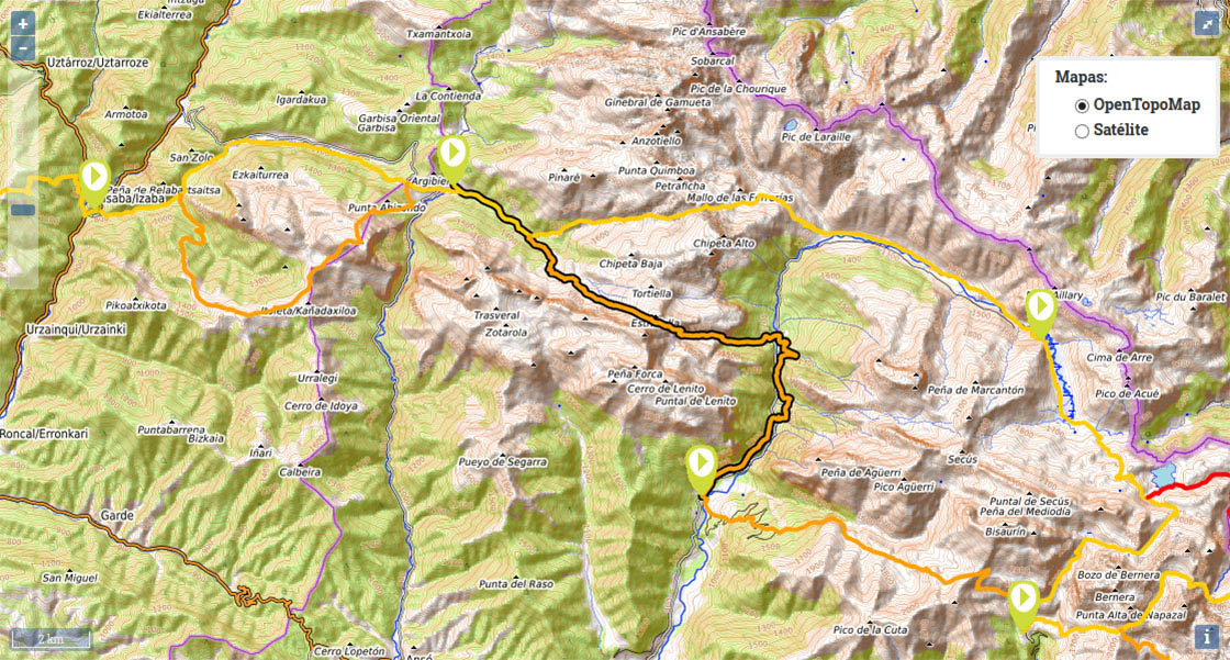
(0h0min; 0kms) Zuriza (1.223m). Take the track that begins just below the campsite on a horse-shoe bend (GR11 panel), towards Petraficha ravine. To the left are the slopes of Quimboa, and to the rights lies Ruzquia Peak (2074m). The elongated Sierra de Alano, which bears an uncanny resemblance to the Dolomites, begins here. The uphill climb along the track to Taxeras car park is gentle, and along the way you pass a couple of small streams and a drinking fountain where you can fill up with water.
(0h30min; 2.8kms) Llano de Tacheras/Taxeras (1.283m). Just before reaching the car park, on the left, rises the GR11 via Petraficha col (GR11 panel). You continue along the variant GR11.1, crossing the river via the passage for vehicle, and just after it, take the path on the left (drinking fountain on the left, by the river) that climbs up, often taking short-cuts, to the Zucaca farms. From now on you follow the track as far as it goes (15min from the farms, you pass a couple of sparse streams).
(1h15min; 4.6kms) End of the track (1.560m). At this point, just opposite, on the other side of the river there is a small free refuge (Mazandú, 5-6 people, not in great condition). The path continues along the slopes of the Sierra de Alano crossing a number of dry river courses, it crosses Mazandú ravine and climbs up on the right-hand side. The ravine soon dries up and 1km ahead, on the other side, you see the last stream before reaching the col where you can fill up with water at the end of the summer.
(2h35min; 7.1kms) Cuello de Estribiella (2.000m). The path descends relentlessly towards Estribiella ravine to the point where, at around 1800m altitude, a towline has been affixed along with a few spikes to aid scrambling down a short section (no difficulty).
(3h20min; 8.3kms) Estribiella Ravine – Crossroads to Peña Forca (1.635m). Water is available here. The path follows the course of the river downstream on the left-hand side, through gentle terrain, following paths used by livestock, until you enter the beech forest, where the path gets steeper again.
(4h15min; 11,2 kms) Puente de Oza (1.125m). There are a number of buildings next to the car park. If you follow the road to the right for about 100m you will come to the free refuge of Oza (free, good condition). You cross the bridge, and on the left next to the river, there is a drinking fountain and further ahead, a bar and campsite. You take a path on the right as soon as you pass over the bridge (GR11 panel) and continue past a zip wire park in the trees. To begin with, the waymarks coincide with the climb to Castillo d'Acher (2390m) and also the variant of the Camino de Santiago (GR 65.3.3), which you will follow to the end of the stage. The path passes through a spectacular beech and silver fir forest, winds through the Espata ravine (Palanca de Espata bridge) and drops down as far as Puente d'Isil, a small walkway that leads to the road, 2km from Oza bridge. You can either walk along the road or follow the path to the abandoned camp at San Juan de Dios, at which point you cross a walkway (Puen de lo Sacadero) to join the road.
(5h10min; 14,6 kms) Puen de lo Sacadero - San Juan de Dios Camp (1.055m). By the road you will find a forest refuge (free, not in great condition). Again, you can choose to follow the road – not a bad idea, as there are great views over the la Boca del Infierno ravine – or take the path that climbs up the right-hand side (the ancient Roman road Caesaraugusta-Beneharnum), until you reach a defensive tower known as Castillo Viejo or Castiello Biello. Leaving the tower behind you, the path heads down through beech woodland (take the left-hand fork, steep slope) then rejoins the road. You follow it for a few metres to the crossroads, where to the left you are directed to the Bisaltico cottage and campsite, close to Puente de Santa Ana.
(6h00min; 17,7 kms) Crossroads - Puente de Santa Ana (944m).
In Zuriza there is theZuriza Campsite-Auberge (/) . Below the campsite there is an open shelter (2 floors, reasonable condition).
During the stage, at the end of Taxeras track, on the other side of Mazandú ravine lies the free refuge of Mazandú (5-6 people, fireplace, not in great condition). Close to Oza bridge, further up, you have Camping Selva de Oza (with a mini-store) and 100m down the road, there is the free refuge of Oza (refurbished in 2013, with floor space for up to 18 people). On the side of the Oza road, by the San Juan de Dios camp, you will see a forest refuge (not in great condition).
At the end of the stage, 300m down the Hecho valley road towards Siresa: Hotel Uson. Also, in Hecho and Siresa you will find a wide choice of accommodation. In Siresa: Hotel Castillo d'Acher. In Hecho: Hotel Lo Foraton and Hotel de la Val.
Other services:The campsite in Zuriza has a store. In Siresa there is the odd bar and shop. In Hecho you have a little of everything: 2 ATM machines close to the town hall square, a sports shop, a post office, a supermarket and even a Wi-Fi hotspot in the library.
Maps:
- Alpina:
Valles de Ansó y Echo
(Scale: 1/25.000).
- Prames:
Valles occidentales - Ansó y Echo
(Scale: 1/25.000).
The only way to get to Zuriza or Selva de Oza is by taxi. Taxis are bases centrally in Jaca () . To get to Ansó, Echo and Siresa from Jaca, Autobuses Escartín ().


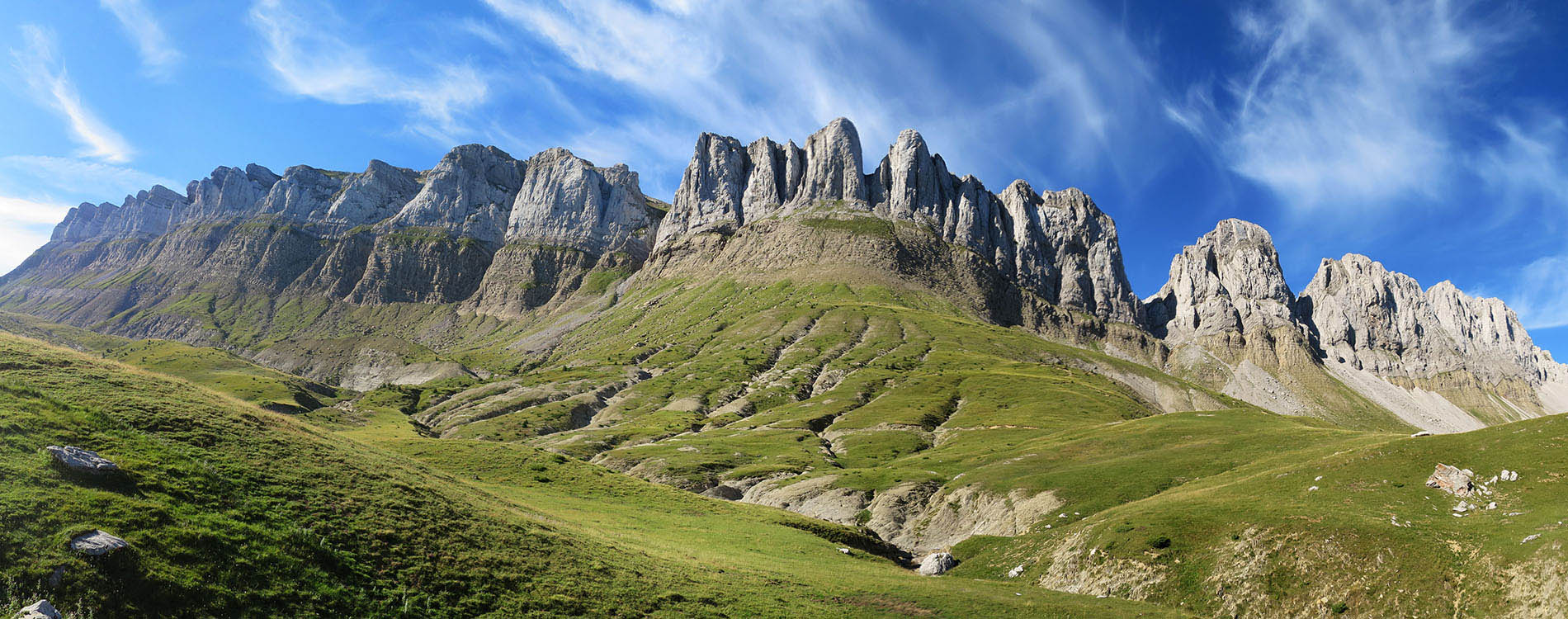
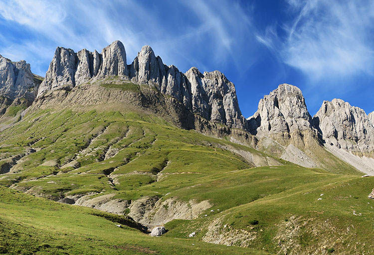
Atajos en la pista de Tacheras


Al fondo destacan el Castillo d'Acher y el Bisaurín

Paso equipado con sirga bajando del cuello de Estribiella


Abetos blancos en el valle de Oza