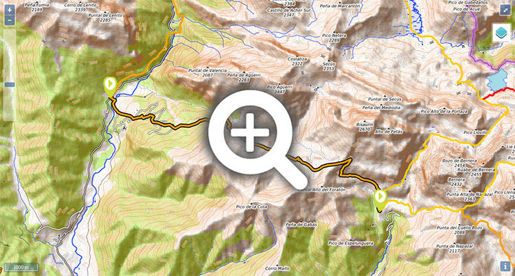
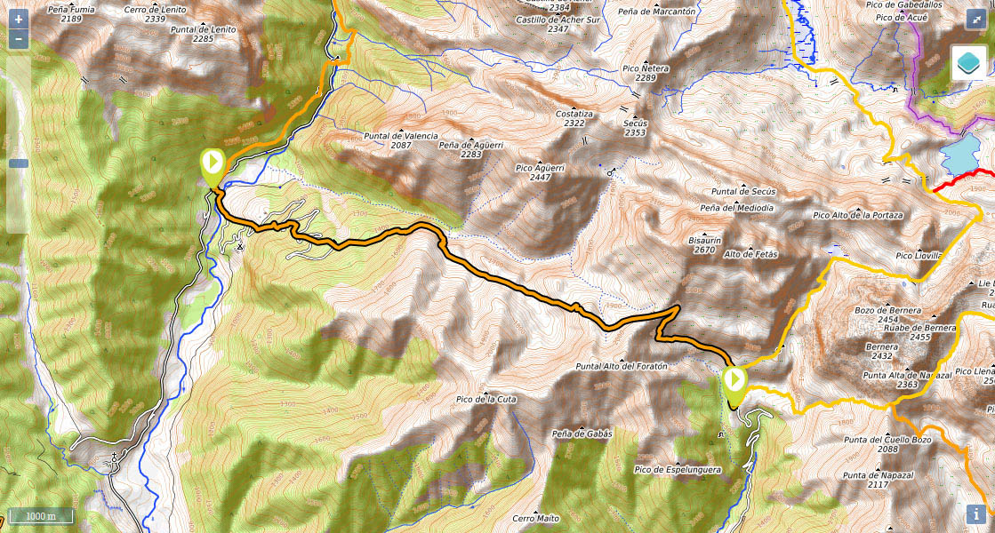
Stage 10v (GR11.1): Puente de Santa Ana - Lizara
(0h0min; 0kms) Puente de Santa Ana (925m). On the valle de Oza road, take the turning that is signposted to Gabardito and Bisaltico auberge. After crossing the river (Santa Ana bridge) keep on the narrow road for another 5mins then take a path on the left that heads uphill through the woods. This is a straight ascent, offering little respite. You will cross over the road several times on your way up, until you reach...
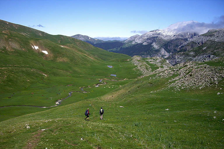
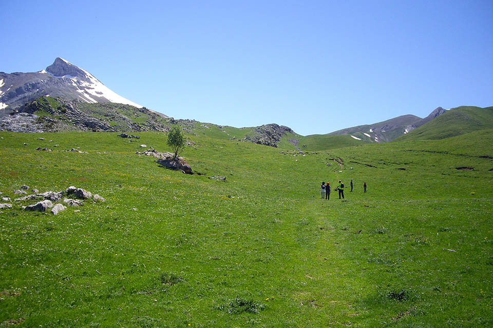
(0h55min; 2.8kms) Gabardito auberge (1.370m), standing on a great plain with magnificent views towards Lenito peak. Drinking fountain. Once you have left if behind you, the track heads back into the pine and beech forest and becomes a path. Rising up the right-hand side of Agüerri ravine, the path gets closer to the rocks, passing an enormous gendarme pinnacle known as "Puntal de los Porquez". Soon afterwards you ignore a path leading to the bottom of the valley, and zigzag uphill over a rocky step, rising steadily, until the woodland gradually gives way to pastureland.
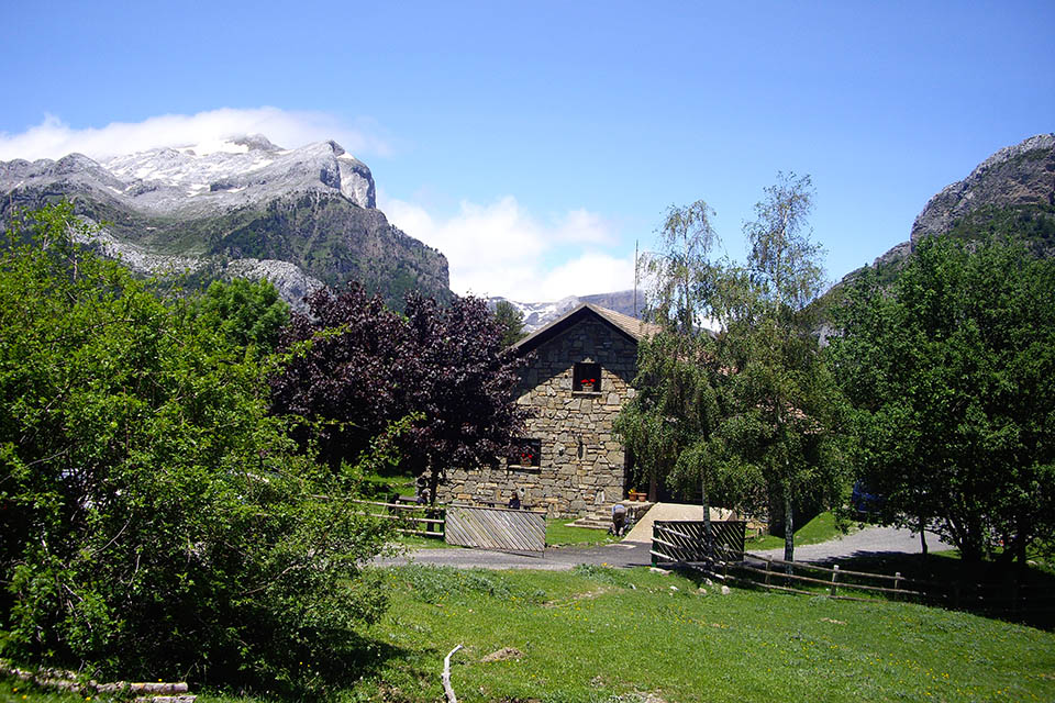
(1h55min; 5.5kms) Plan de Dios te Salve (1.650m). On your left you will see the Dios Te Salve refuge (in OK condition) and later on, on the way to Plan d’Aniz, a refuge with the same name. The GR11.1 climbs up across fields to the...
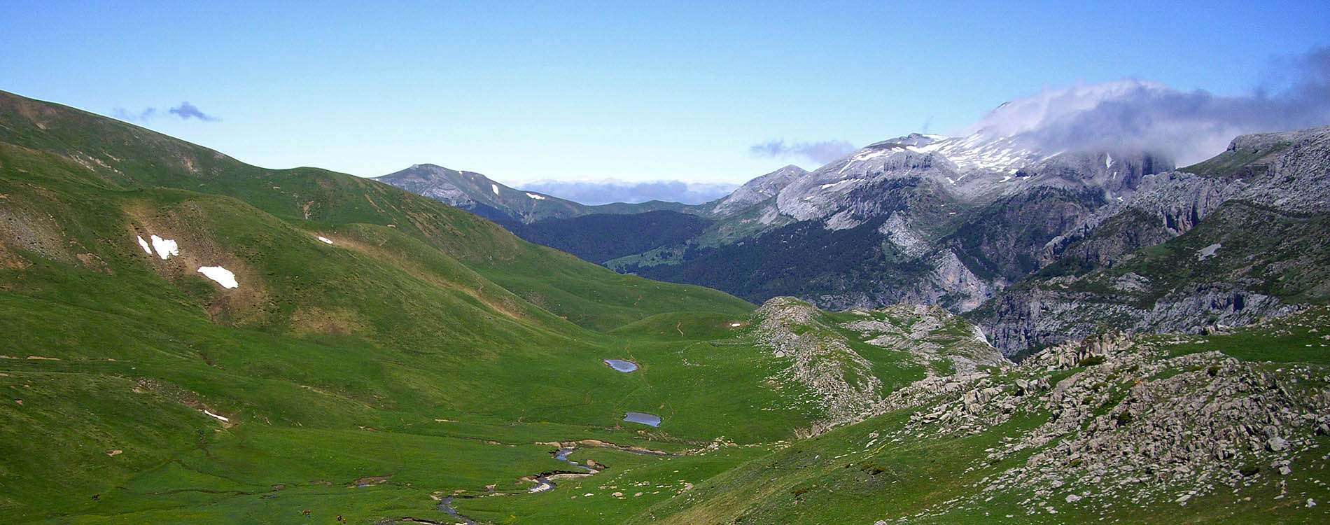
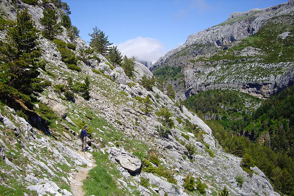
(3h10min; 9kms) Cuello de lo Foratón (2.032m). This col lies at the foot of Bisaurín itself (2670m) (for those brave souls in search of a complete day’s walking). The path zigzags down the last descent from the col then follows much gentler terrain. Walking through open countryside, you cross the odd stream and almost at the end, you pass the Fuenfría drinking fountain.
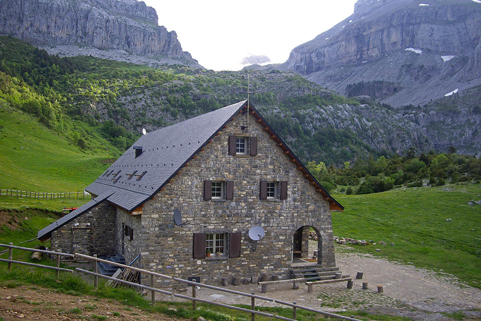
(4h00min; 12,2 kms) Refugio de Lizara (1.540m).
At the beginning of the stage, 300m down the Hecho valley road towards Siresa: Hotel Uson. Also, in Hecho and Siresa you will find a wide choice of accommodation. In Siresa: Hotel Castillo d'Acher. In Hecho: Hotel Lo Foraton and Hotel de la Val.
During the stage, Refugio de Gabardito (/) (staffed, 3kms; 1h; 450m climb). Before Cuello de lo Foratón: Dios Te Salve refuge (free, in OK condition, 5-6 places) and Plan d’Aniz refuge (free, in OK condition, 4-5 places). On the other side of the col (Lizara side), Fetás refuge (free, in OK condition, 2-3 places).
At the end of the stage, Refugio de Lizara (/) (staffed, half and full-board, with bar; accessible by road).
Other services:In Siresa there is the odd bar and shop. In Hecho you have a little of everything: 2 ATM machines close to the town hall square, a sports shop, a post office, a supermarket and even a Wi-Fi hotspot in the library.
Transport:To get to Siresa from Jaca, Autobuses Escartín (). You can reach Lizara auberge by car.

Detrás el Puntal de Lenito.
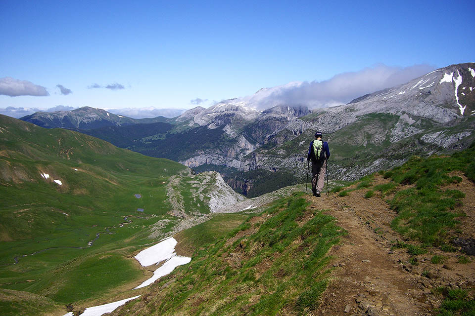
Por encima del barranco de Agüerri
En el Plan de Dios Te Salve. A la izquierda, nevado, el Bisaurín.
Abajo el Plan de Aniz y el Plan de Dios Te Salve.
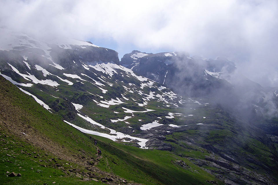
Laderas del Bisaurín y macizo de Bernera
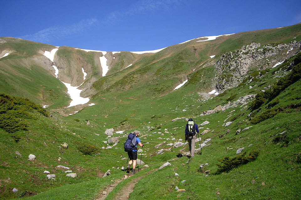
Cuello de lo Foratón desde el barranco de Espelungueta