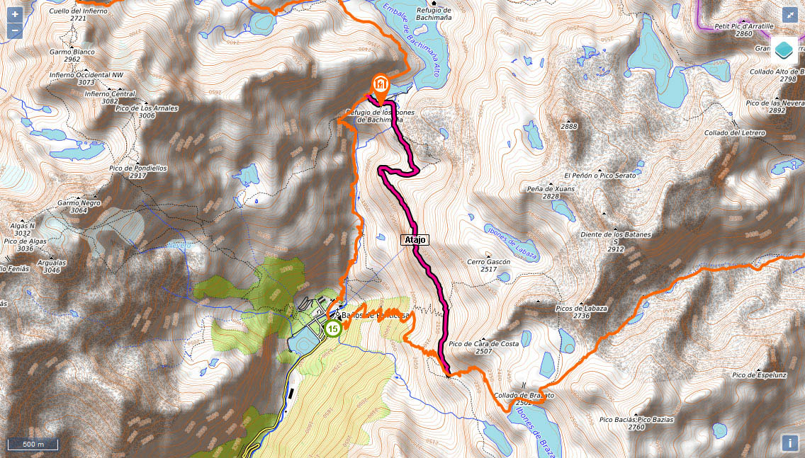
Shortcut: The pipeline path from Bachimaña to Brazato

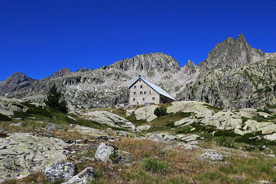
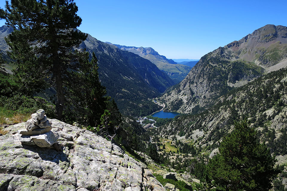
(0h0min;0km) Bachimaña Bajo reservoir dam (2,172m). In 3 minutes you reach the Ibones de Bachimaña auberge. A clearly-marked path leads you down to the banks of the reservoir. You will take another one on the right that heads down towards a boggy area. You pass a shelter in poor condition – some 50 metres to the left – and continue in a southerly direction, following the valley that is hidden behind the shelter. Upon reaching a kind of wall or raised pipeline over the river, you take a path on the left. You head to the top of a brow where a pine tree stands proud, and descend with care as you cross huge sections of granite slip rock.
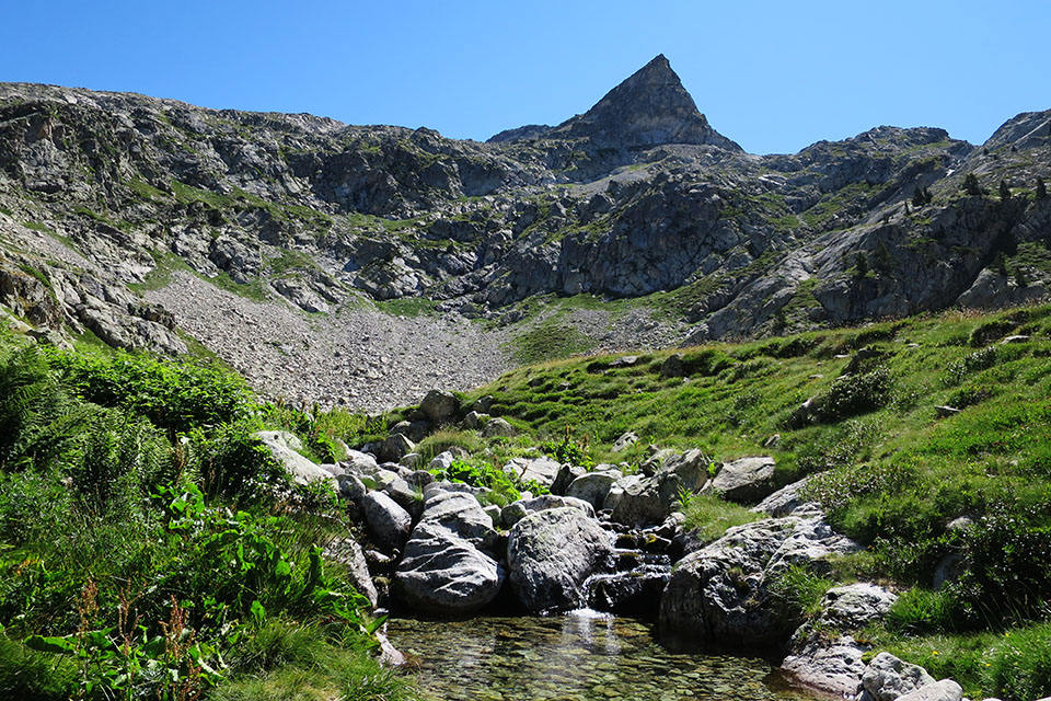
(0h25min; 1.0kms) Barranco de Labaza (2,360m). You cross the stream coming from the Labaza lakes. The path drops to the west until it leaves the buttress behind. Once round it, take a path marked with cairns up to the left. During the climb, the vistas towards Argualas (3,046m), Garmo Negro (3,051) or los Picos del Infierno (3,082m) are truly magnificent. You head over a kind of mini pass beyond which, after a short drop, is to be found the...
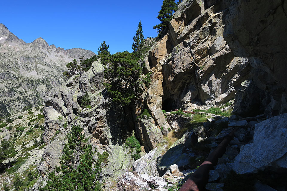
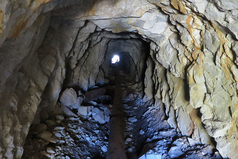
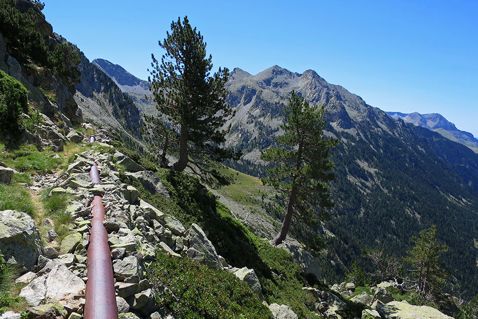
(1h05min; 2.6kms) Pipeline (2,400m). Follow alongside it until you join the GR11. Along the way you walk through a couple of tunnels where a torch is not required, as the longest one is just 30 metres long.
(1h35min; 4.0kms) Enlace GR11 (2,200m). Stage 15: Balneario de Panticosa - Bujaruelo.
See: Stage 14: Ref. Respomuso - Balneario de Panticosa and Stage 15: Balneario de Panticosa - Bujaruelo
Maps:
Alpina:
Valle de Tena
(Scale: 1/25,000) and
Valle de Tena
(Scale: 1/40,000)
SUA:
Balaitús-Vignemale
(Scale: 1/25,000)
Prames:
Valle de Tena
(Scale: 1/25,000)
Editorial Pirineo:
Valle de Tena
(Scale: 1/40,000)


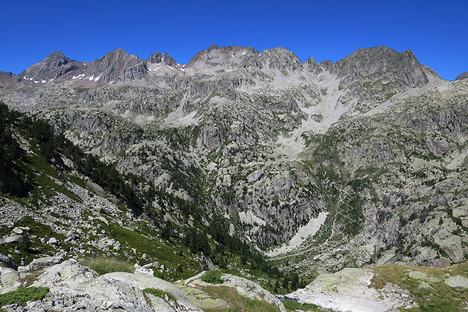
La cuesta del Fraile bajo los picos de Argualas, Garmo Negro, Pondiellos y Picos del Infierno entre otros.
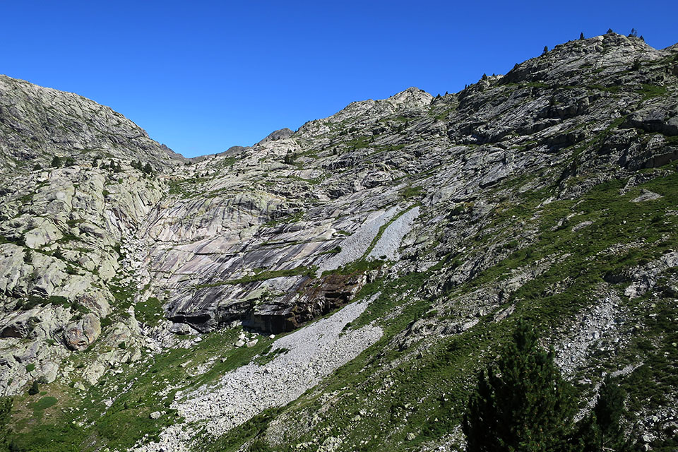
El sendero discurre por encima de estas lanchas graníticas.
En la tubería. Detrás la Punta Foratula.